You’ll find Port Leon’s ghost town site three miles south of St. Marks within the St. Marks National Wildlife Refuge, accessible via the 3.5-mile Port Leon Access Road after paying a $5 vehicle fee. The paved Historic Railroad Trail follows the 1837 corridor that once carried cotton bales to the doomed port, where weathered pilings and interpretive markers now chronicle the settlement’s complete erasure by the 1843 hurricane and preceding yellow fever outbreak that claimed 139 lives—though exploring further reveals the haunting maritime history behind Florida’s vanished coastal empire.
Key Takeaways
- Pay the $5 vehicle fee at the honor station near the Visitor Center to access Port Leon within St. Marks National Wildlife Refuge.
- Follow the 3.5-mile Port Leon Access Road eastward to reach the ghost town site two miles below the river merge.
- Hike the paved Historic Railroad Trail from the trailhead at 1255 Lighthouse Road to explore the 1837 railroad corridor.
- Visit interpretive markers at 620 Port Leon Drive to learn about the 1843 hurricane and yellow fever outbreak devastation.
- Expect primitive conditions with no remaining buildings, only weathered pilings, disturbed lands, and historical markers at the site.
The Rise and Fall of a Forgotten Florida Port City
When Richard Keith Call envisioned Port Leon in 1837, he saw more than just another coastal settlement—he saw the future of Florida’s cotton empire. As territorial governor and railroad president, he strategically positioned this port three miles south of St. Marks, extending rail lines across the river to capture lucrative shipping routes.
What Remains at the Port Leon Site Today
You’ll find the most tangible connection to Port Leon along the old railroad bed, now integrated into the Florida National Scenic Trail and the Tallahassee-St. Marks Historic Railroad State Trail. These pathways lead you through what was once the town’s commercial heart, though the forest has long since reclaimed the disturbed lands where buildings stood.
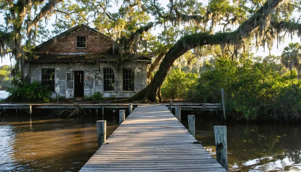
At the water’s edge, weathered pilings thrust up from the St. Marks River—remnants of the Federal Dock and wharves that once bustled with cotton-laden ships bound for distant ports.
Historic Railroad Trail Access
The railroad corridor that once connected Tallahassee to the ill-fated Port Leon has survived as a 20-mile recreational trail, offering modern visitors a tangible link to Florida’s antebellum transportation network. You’ll find the trailhead north of the St. Marks National Wildlife Refuge Visitor Center at 1255 Lighthouse Road, where historic railroad preservation efforts have protected this 1837 transportation route.
The Florida Department of Transportation acquired the corridor in 1984, following the Seaboard System‘s abandonment filing with the Interstate Commerce Commission. This recreational trail management strategy transformed obsolete infrastructure into accessible wilderness exploration.
The original earthworks remain visible throughout the refuge, marking where mule-powered cars once hauled cotton shipments before steel rails and locomotives modernized operations in 1856. You’re walking the same path that fueled Port Leon’s brief commercial ambitions.
Refuge Structures and Pilings
Scattered pylons along the St. Marks River shoreline mark where Port Leon’s commerce once thrived. You’ll discover rubble near former dock areas and pilings that indicate warehouse and tavern locations. The original refuge headquarters, constructed through Civilian Conservation Corps activities on the actual town site, has vanished into the coastal environment. Officials chose this remote location specifically because interior roads didn’t exist, requiring boat patrols instead.
What you can still identify:
- Railroad bridge center post that survived decades after the 1843 hurricane
- Rebuilt docks near the original Port Leon landing sites
- Disturbed archaeological lands encompassing the former headquarters complex
The railroad bridge remnants, featuring Town lattice design, were pushed upriver by the devastating storm. These fragmentary remains offer tangible connections to Port Leon’s brief but intense maritime history.
Getting to Port Leon Within St. Marks National Wildlife Refuge
Accessing Port Leon’s ghostly remains requires traversing through St. Marks National Wildlife Refuge‘s controlled network. You’ll pay $5 per vehicle at the honor station near the Visitor Center at 1255 Lighthouse Road, where the 3.5-mile Port Leon Access Road begins.
This route cuts eastward to the town site, positioned two miles below where the Wakulla and St. Marks Rivers merge. The 1837 settlement, obliterated by 1841’s yellow fever outbreak and hurricane, now serves as a haunting reminder of coastal vulnerability.
Trail conditions vary seasonally—expect primitive paths rather than maintained walkways. While boat ramp access exists at nearby Aucilla River, reaching Port Leon demands vehicle passage through refuge lands, where gates close after dark and nature reclaims civilization’s failed foothold.
Hiking the Historic Railroad Trail Through the Ghost Town
You’ll walk the same railroad bed that once carried Confederate troops and cotton bales, now transformed into Florida’s first rail-trail. The paved path follows the 1837 corridor southward through longleaf pines and coquina outcrops, its historical markers chronicling the Tallahassee-St. Marks Railroad’s 147-year operation and Port Leon’s hurricane erasure.
At the southern terminus near 620 Port Leon Drive, you’ll find interpretive signage marking where the ghost town vanished beneath the 1843 storm surge.
Trail Access and Routes
The historic railroad trail to Port Leon begins at multiple access points throughout the Saint Marks National Wildlife Refuge, with the primary trailhead located north of the refuge’s visitor center at 1255 Lighthouse Road in St. Marks. You’ll pay $5 per vehicle to enter, or access the trail free from Goose Pasture Road, 1.1 miles west of Powell Hammock Grade intersection.
Trail conditions remain largely flat and dry through pine flatwoods and hardwood hammocks, following old Aucilla Tram Road beds. At 0.8 miles, orange blazes guide you through the refuge gate, maintaining visibility for over two miles through pine-and-palmetto corridors.
Key navigational markers include:
- 3.1-mile junction featuring primitive campsite and blue-blazed spur to Port Leon townsite
- Wildlife encounters with white-tailed deer, wild turkeys, and red-cockaded woodpeckers near the 5-kilometer mark
- Historic wharf remnants marking the ghost town’s waterfront location
Historic Railroad Bed Features
As you follow the orange blazes deeper into the refuge, weathered indentations beneath the modern asphalt reveal where wooden cross-ties once anchored Florida’s pioneering railroad. These trail features mark America’s first Congressional Land Grant railroad, constructed by enslaved laborers in the 1830s to liberate cotton from inland plantations to Gulf ports.
The 16-mile corridor initially carried mule-drawn carriages before steam locomotives thundered through, transporting Confederate supplies during the pivotal 1865 Battle of Natural Bridge. Transportation history literally unfolds beneath your feet—iron rails that once connected Tallahassee’s commerce to international markets now guide cyclists and hikers through towering longleaf pines.
Park benches positioned along the paved surface invite contemplation of this route’s 150-year operational legacy, from rudimentary wooden tracks to Florida’s longest-running railroad.
Ghost Town Site Markers
Standing at St. Marks, you’ll find interpretive marker features that anchor Port Leon’s memory two miles south across the river. The historical site signage chronicles a ghost town’s brief existence from 1838 to 1843, when hurricane waters erased civilization in a single day.
The marker reveals what you’ll discover:
- Lattice bridge remains swept upriver by the 10-foot tidal surge that destroyed every dwelling
- Railroad bed traces where the Tallahassee-St. Marks line once terminated at this cotton shipping rival
- Mound Trail indicators showing the 1843 flood’s high-water mark among old dikes and pilings
You’ll find no cemetery markers, no house foundations—just disturbed lands within St. Marks National Wildlife Refuge where 139 yellow fever victims preceded the hurricane’s final devastation.
The Yellow Fever Epidemic That Devastated the Settlement
During summer 1841, yellow fever descended upon Port Leon with virulent fury, spreading from a fruit vessel that had arrived in nearby St. Joseph from the West Indies. The disease ravaged your settlement simultaneously with outbreaks in Apalachicola, St. Marks, and Tallahassee, claiming prominent citizens including Col. John B. Collins, former postmaster Isham G. Searcy, and merchant James Moore. The entire Wellford family perished.
The epidemic’s lasting impact proved catastrophic—St. Joseph’s population plummeted from nearly 4,000 to under 400 by year’s end. Port Leon, struck during its incorporation year at peak prosperity with several hundred residents and numerous businesses, never recovered. Community grief and recovery became impossible when the 1843 hurricane delivered the final blow, ultimately driving survivors inland to Newport.
The Catastrophic 1843 Hurricane That Ended Port Leon

Just months after Port Leon became the county seat on March 11, 1843, residents awakened on September 13th to strong winds whipping through their prosperous settlement of nearly 450 souls. An afternoon lull deceived survivors into false security before midnight’s 10-foot storm surge roared up the St. Marks River, obliterating everything in its path.
A deceptive afternoon calm lured Port Leon’s survivors into deadly complacency before midnight’s devastating surge destroyed their entire world.
The hurricane’s fury left catastrophic devastation:
- Every dwelling swept away, railroad bridge relocated upriver by surge force
- Fourteen deaths total: one resident and thirteen at the nearby lighthouse
- Town reduced to uninhabitable wasteland, now disturbed lands within St. Marks Wildlife Refuge
Survivors abandoned Port Leon entirely, relocating inland to Newport. Where 30,000-40,000 cotton bales once shipped annually, native flora and seasonal wildlife now reclaim the low-lying grounds mere feet above sea level.
Best Time to Visit and What to Bring
While Port Leon’s ruins remain accessible year-round within the St. Marks National Wildlife Refuge, you’ll find ideal exploration windows during spring and fall shoulder seasons. March through April and September through October offer mild temperatures perfect for the 3-mile trail hike without summer’s oppressive humidity or winter’s chill.
These periods align with the best times for water activities—warm Gulf waters for paddling across the river crossing while avoiding peak hurricane season.
Your ideal packing recommendations include sturdy walking shoes for traversing overgrown townsite remnants, insect repellent against marsh mosquitoes, and rain gear since afternoon thunderstorms arrive unexpectedly. Layer clothing for variable coastal conditions.
Winter visitors encounter solitude and prime oyster season, though you’ll need warmer layers for shoreline exploration. Regardless of season, arrange boat access beforehand—Port Leon’s watery grave demands respect.
Nearby Historic Sites and Attractions in Wakulla County

Beyond Port Leon’s waterlogged foundations, Wakulla County preserves an archaeological tapestry where Spanish conquistadors, Creek warriors, and antebellum merchants left their marks across three centuries.
San Marcos de Apalache Historic State Park guards the confluence where Narváez first sighted European civilization’s foothold in 1528. The fort’s crumbling bastions reveal Spanish, British, and American occupations, with preserved native american artifacts spanning 12,000 years displayed in its museum.
Navigate these heritage corridors:
- St. Marks Lighthouse (1831-1837) commands the historic navigation channel through Apalachee Bay, its beacon still guiding vessels through waters that claimed Port Leon
- Wakulla Springs conceals mastodon bones and pre-Columbian settlements beneath crystal depths
- Old Wakulla County Courthouse documents frontier justice in Crawfordville’s architectural monument
Each site illuminates Port Leon’s context within Florida’s untamed coastal legacy.
Frequently Asked Questions
Are There Any Guided Tours Available of the Port Leon Ghost Town Site?
No walking tours available specifically target Port Leon’s ghost town site. You’ll find self-guided exploration options through the St. Marks National Wildlife Refuge, where you can freely discover artifacts and disturbed lands marking this vanished settlement’s location.
Can You Camp Overnight at the Port Leon Location Within the Refuge?
Your wild spirit must wander elsewhere—Port Leon offers no primitive camping options for ghost town explorers. As a non-through hiker, you’ll need nearby camping alternatives outside the refuge to pursue your overnight adventures freely.
Is There an Entrance Fee to Access St. Marks National Wildlife Refuge?
Yes, you’ll pay entrance fees at St. Marks National Wildlife Refuge—$5 per vehicle or $1 for pedestrians. However, accessibility for visitors improves with national passes, which waive these costs, letting you explore freely across 80,000 protected acres.
Are Dogs Allowed on the Trails Through the Port Leon Area?
Dogs are allowed on Port Leon Road through the refuge when leashed. You’ll find this three-mile stretch safely accommodates leashed pets, though you’re responsible for pet waste disposal. Most other refuge trails remain off-limits to protect wildlife.
What Wildlife Might I Encounter While Visiting the Port Leon Site?
You’ll encounter possible bird species like pelicans, herons, and eagles soaring overhead, while native plant life shelters raccoons, bobcats, and marsh rabbits. Alligators bask near wetlands, and gopher tortoises roam sandy trails throughout this historic coastal wilderness.