Plan your Port Wine ghost town adventure for spring (April-May) or fall (September-November) when temperatures hover between 50-80°F and roads remain passable. You’ll find this 1850s hydraulic mining settlement 10 miles northwest of Downieville via Port Wine Ridge Road—accessible by standard 2WD vehicles, though expect unpaved forest routes. Explore overgrown stone foundations, remnants of the original flume system, and the restored cemetery where infant graves tell poignant frontier stories. The surrounding article reveals additional nearby Sierra County ghost towns and essential photography tips for capturing this atmospheric Gold Rush relic.
Key Takeaways
- Port Wine is located 10 miles northwest of Downieville in Sierra County, accessible via unpaved Port Wine Ridge Road.
- Visit during spring (April-May) or fall (September-November) for optimal weather conditions and reliable road access.
- Standard 2WD vehicles can reach the site, though expect unpaved forest roads and potential seasonal access challenges.
- Explore overgrown stone foundations, preserved ruins with hand-chiseled craftsmanship, restored cemetery, and remnants of flume systems.
- Witness dramatic hydraulic mining scars, exposed hillsides, and engineered waterways that transformed the landscape in the 1850s.
The Rich History of Port Wine’s Mining Legacy
The discovery of Port Wine in early 1850 emerged from an unusual moment in California’s Gold Rush history—prospectors stumbled upon a keg of port wine concealed in the bushes, and the name stuck. Located 10 miles northwest of Downieville in Sierra County, this camp thrived on placer deposits before surface mining declined by 1851.
Hydraulic mining impacts transformed the landscape afterward, literally consuming the hill where part of town once rested. You’ll find geological diversity in the Port Wine channel’s quartz-rich gravels, overlaid with pipe clay and andesite, cutting through slate, quartzite, and amphibolite bedrock.
Operations like the American Hydraulic Mine and Canada Drift sustained this remote outpost through decades of intermittent prospecting, serving miners from neighboring camps until hydraulic devastation erased its physical presence.
What to Expect at the Port Wine Ghost Town Site
Very little physical evidence greets visitors who make the journey to Port Wine’s remote townsite today. You’ll find overgrown stone foundations scattered throughout the forest, though identifying specific structures proves challenging.
The remnants of buildings that once housed a thriving community have largely disappeared—most significantly the Wells Fargo structure, which stood intact until heavy snow collapsed its roof during the 1970s. Along the hillside west of town, you can still trace sections of the original flume system.
One remarkably preserved stone ruin showcases hand-chiseled craftsmanship with iron door remnants still visible. While artifacts uncovered during excavations remain minimal, the restored cemetery tells Port Wine’s most poignant story, where infant graves and family plots mark the settlement’s vanished population.
Best Time to Visit Port Wine
Planning ahead pays dividends when you’re mapping out your Port Wine expedition, as this high-elevation ghost town sits at over 8,000 feet where weather patterns shift without warning. Spring and fall deliver ideal conditions—shoulder season temperatures range from 50-80°F daytime highs with comfortable exploration windows, while shoulder season crowds remain sparse compared to summer’s packed parking areas.
You’ll find April through May particularly rewarding when wildflowers blanket the landscape and roads stay accessible. September through early November offers equally stellar touring conditions with dry trails and clear skies dominating forecasts. Winter’s snow and rain disrupt access roughly 25% of the time, limiting your freedom to roam.
Summer provides extended daylight hours, though prepare for intense UV exposure and increased visitor traffic at this remote California relic.
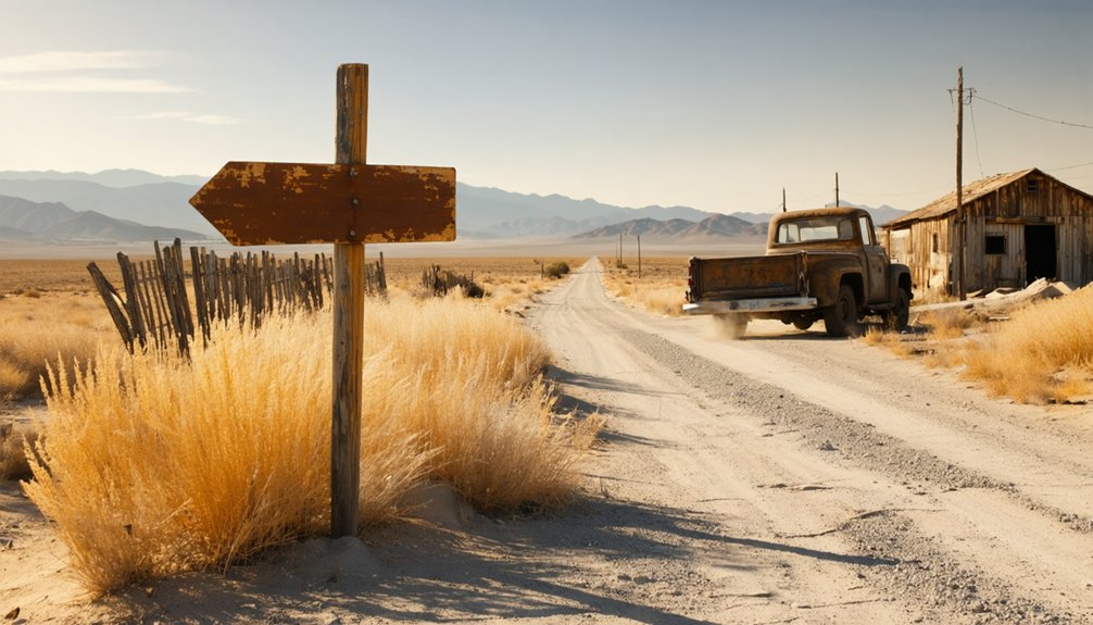
Getting There: Location and Road Conditions
You’ll find Port Wine nestled in northwestern Sierra County at 39° 39′ 37” North, 120° 56′ 52” West, roughly 10 miles northwest of Downieville near the Plumas County line. Port Wine Ridge Road serves as your primary artery, linking the ghost towns of Grass Flat and Howland Flat through territory scarred by nineteenth-century hydraulic mining operations.
While nearby Scales remains accessible via 2WD vehicle, expect unpaved forest roads and OHV trails typical of this remote Plumas National Forest region where prospectors once carved routes to now-abandoned diggings.
Directions From Nearby Towns
From Downieville, the nearest substantial town approximately 10 miles southeast, you’ll need to navigate a network of mountain roads that wind through the remote “Over North” territory of northwestern Sierra County. These driving directions lead you through terrain where jurisdictional boundaries once shifted between Plumas and Sierra counties.
Your route passes these nearby landmarks:
- La Porte district – adjoining Port Wine’s northwest boundary, serving as your primary navigational reference
- Poverty Hill district – immediately southwest, marking the exchange into Port Wine’s territory
- Poker Flat-Howland Flat district – positioned northeast along the channel system
- Historic diggings – Grass Flat, Queen City, and St. Louis mark the mining district’s boundaries
The 2-wheel-drive roads alternate between gravel, dirt, and rock surfaces as you approach coordinates 39.6604487°N, -120.9485634°W.
Vehicle Requirements and Accessibility
Standard passenger vehicles with 2-wheel-drive capability can reach Port Wine’s remaining foundations and cemetery, though the journey demands respect for Sierra County’s unforgiving mountain terrain. You won’t need 4WD like other remote Sierra sites, but seasonal access challenges dictate your planning. Heavy snowpack buries roads from October through June, making July-September your ideal window. Winter’s weight collapses historic structures and closes mountain passages entirely.
Your packing list recommendations should include sturdy boots for traversing hydraulic pits and overgrown foundations. The gravel roads alongside flume remnants grow rough near mining scars where hydraulicking reshaped entire hillsides. Spring melt creates muddy conditions; autumn brings unpredictable storms. Summer’s reliability lets you explore freely—the maintained paths to both townsite and graveyard open without restriction when snow releases its grip on these forgotten streets.
Exploring the Remnants of Hydraulic Mining
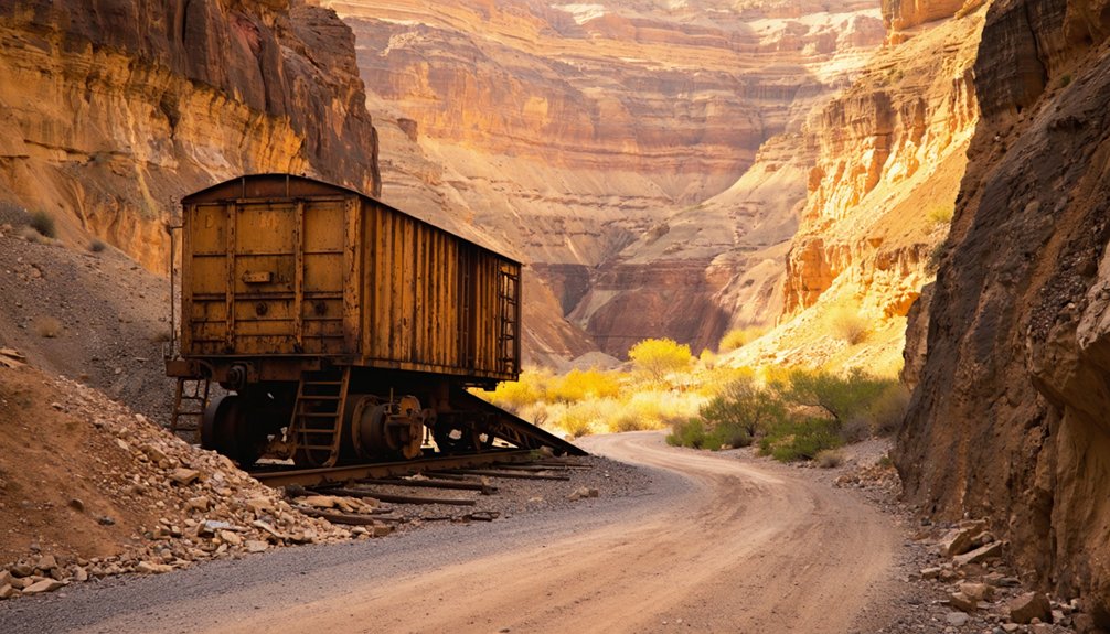
The scars of hydraulic mining still rake across Port Wine’s landscape nearly 140 years after Judge Lorenzo Sawyer‘s landmark decision silenced the monitors on January 7, 1884. You’ll discover where man-made canyons literally consumed portions of the town, revealing the bedrock of slate, quartzite, and greenstone beneath.
Hydraulic monitors carved deep wounds into Port Wine’s hills, exposing ancient bedrock that remains visible 140 years after operations ceased.
As you explore, you’ll encounter:
- Exposed hillsides where Anthony Chabot’s monitors blasted away millions of tons of earth
- Foundation remnants marking where homes once stood before hydraulicking leveled the terrain
- Gravel deposits from the Port Wine channel, still bearing quartz-rich traces
- Engineered waterways that diverted rivers through wooden flumes
Port Wine’s natural beauty now reclaims these industrial wounds, though preservation efforts remain minimal in this remote Sierra County location.
The Kleckner Brothers Store and Other Preserved Structures
Among Port Wine’s weathered remnants, Abraham and Amandes Kleckner’s general store stands as the settlement’s most enduring witness to Sierra County’s mercantile past. You’ll find this structure holding up remarkably well despite hydraulic mining’s devastating erosion of the surrounding hillside.
The brothers’ store operations served gold miners from La Porte, Howland Flat, and Poker Flat throughout the 1850s-1890s, stocking everything from whiskey and tobacco to bacon, beans, and mining hardware.
Customer interactions documented in their 1892-1895 ledger reveal miners like David Corbett and Amos Dubuque purchasing supplies between shifts at nearby operations.
Today, you can still photograph the store’s remains—visible since the 1930s—alongside scattered foundations and hydraulic mining gear. It’s tangible proof of commerce that once sustained these independent prospectors chasing California gold.
Port Wine Cemetery: a Window Into the Past

You’ll find Port Wine Cemetery clinging to a hillside above the eroded town site, where 43 documented graves mark the final resting places of miners who succumbed to accidents, disease, and violence during the 1850s hydraulic mining boom. The scattered headstones and memorial records preserved on Find a Grave offer rare glimpses into a multi-ethnic workforce’s mortality, as most physical evidence was washed away by the very mining operations that drew these men to the Sierra Nevada.
Standing among the weathered markers today, you’re witnessing one of Sierra County’s most tangible connections to Gold Rush-era lives cut short by the hazardous pursuit of fortune.
Notable Graves and Headstones
Weathered by time and scarred by forest fires, Port Wine Cemetery stands as a solemn archive of the hydraulic mining era, its 43 documented graves telling stories of hardship and perseverance in Sierra County’s gold country. The headstone inscriptions reveal remarkably detailed burial locations, with markers specifying deaths at “Slate Creek Bridge” and Port Wine itself.
You’ll discover these notable graves:
- William Bevan (aged 51, died November 1867) and his sister Ann Bevan Turner (aged 79, died May 1900), both from Slate Creek Bridge
- Jonathan Iseman, miner connected to Port Wine’s historic Iseman building (died 1886)
- Lawrence family members, including mine operators David and Edward from Queen City
- Agnes Lawrence, who bore six children in Port Wine’s harsh mining camps
These pioneers’ names and dates preserve authentic glimpses into California’s untamed frontier.
Cemetery Preservation and Condition
Beyond these pioneer markers lies an ongoing battle against time and nature. You’ll find 60% of original headstones still standing, though winter frost heave shifts graves annually and wildfires have scorched 15% of wooden elements since 2018. Volunteers cleared invasive vegetation throughout the 1990s, but blackberry bushes persistently reclaim 30% of the site each year.
Modern restoration methods now include laser scanning for 3D preservation models and drone surveys planned for 2026. A 2024 grant secured $50,000 for granite reinforcements, yet state funding challenges leave 25 markers awaiting repair.
The Sierra Nevada Conservancy partnership targets full stabilization by 2030, while community caretakers maintain individual sections. You’re witnessing history’s fragile persistence—accessible via dirt road, this Gold Rush relic demands constant vigilance against erosion and encroaching wilderness.
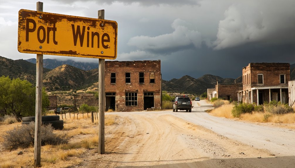
Combining Your Trip With Nearby Sierra County Ghost Towns
Since Port Wine sits amid one of California’s richest concentrations of 19th-century mining settlements, you can craft a multi-day itinerary that captures the full scope of Sierra County’s ghost town heritage. This clustered ghost town exploration lets you chase mining history legacies across mountain roads without backtracking.
As you venture beyond the main routes, consider the unique thrill of ghost town adventures in Cuttens, where remnants of the past echo through the silence. Each abandoned structure and weathered artifact tells a story of a vibrant community that once thrived in these rugged hills. Embrace the spirit of adventure as you uncover the mysteries hidden within these forgotten corners of history.
Essential Sierra County stops include:
- Downieville – The county’s premier gold rush hub with intact historical structures
- Sierra City – Featuring mining infrastructure remnants from the 1850s boom
- Alleghany – An active mining district preserving authentic frontier character
- Poker Flat – Remote settlement offering solitary exploration opportunities
Beverly, Eureka, Morristown, and Scales round out your options. You’ll traverse High Sierra backroads connecting these sites, where freedom means discovering California’s authentic past without crowds or commercialization.
Photography Opportunities and Safety Tips
Port Wine’s decaying structures and mining remnants offer photographers the same haunting compositions that captured the attention of documentarians in 1972 and again in 2010, when comparative images revealed the accelerating deterioration of hydraulic mining infrastructure. You’ll find atmospheric photography settings throughout the jail, saloon, school, church, and hotel—frame wide shots of building exteriors and capture dirt streets with colorful graffiti reminiscent of Salton Sea ghost towns.
Capturing unique details requires exploring cemetery stone markers, window reflections, and door hardware in low light with your tripod. Pioneer Mine and Gardner’s Point pits demand sequence panning to convey scale.
Travel Port Wine Ridge Road via Queen City junction, but announce yourself to caretakers and never explore alone—the terrain’s rugged, structures unstable, and visitors shouldn’t linger.
Frequently Asked Questions
Are There Any Facilities or Services Available at the Port Wine Site?
No facilities exist at Port Wine today—you’ll find no restroom facilities or food availability in this isolated ghost town. The ruins stand alone among forest remnants, so you’ll need to prepare thoroughly before venturing into this remote historical site.
Do I Need a Permit to Visit the Ghost Town?
You’re free as a bird to explore Port Wine without permits for casual visits. However, check local regulations beforehand regarding parking restrictions and property boundaries. Standard sightseeing requires no special authorization—just respect the historic site’s preservation.
Can I Camp Overnight Near Port Wine?
You’ll find overnight camping at nearby Calico Ghost Town Regional Park, featuring 265 sites with full campground amenities. The park offers recreational activities like OHV trails and evening programs, letting you explore California’s mining heritage at your own pace.
Are There Guided Tours Available for Port Wine Ghost Town?
You won’t find walking tours available at Port Wine itself—it’s too remote and abandoned. However, you’ll discover self-guided exploration options freely accessible, letting you independently roam this 1850s Sierra County settlement at your own adventurous pace.
What Should I Bring for a Day Visit?
Bring comfortable walking shoes for traversing foundations and mining remnants, plus snacks and water since there aren’t facilities. You’ll want layers for mountain weather, a hat for sun protection, and your camera to capture this vanished Sierra County settlement.


