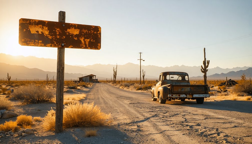
You’ll find Prado’s ghost town submerged beneath 1,200 acres of water behind the dam where the Santa Ana River once nurtured a thriving settlement. Head to the SR 71/91 interchange near Corona, where you can walk the 2,280-foot crest and imagine 7,000 acres of farms and dairies that vanished after 1938’s devastating floods. While you can’t explore the underwater ruins, the 664-foot bicentennial mural nearby stands as a vivid roadside monument, and beneath these waters lie Mexican immigrant artifacts waiting to reveal their stories.
Key Takeaways
- Prado’s historical settlement lies beneath Prado Dam near the SR 71/91 interchange along the Santa Ana River.
- The 1938 flood destroyed the working town, and archeologists later discovered Mexican immigrant artifacts from 1840-1890.
- Access the 2,280-foot dam crest and explore trails upstream into the flooded landscape where the community once thrived.
- View the restored 664-foot Bicentennial Mural, a 1976 landmark painted by Corona High School students near the site.
- Unlike active ghost towns, Prado is submerged; artifacts documenting its vibrant pottery and agricultural heritage are preserved archaeologically.
The Lost Settlement: Prado’s Story From Meadow to Reservoir
The meadow stretched wide and green when settlers first arrived in 1860, a natural grazing land where cattle moved through tall grass and the Santa Ana River traced its unpredictable path through the valley floor. You’d have found a working town here—Prado, they called it—where the Santa Fe railroad brought commerce and connection.
Where grass once fed cattle and rails brought prosperity, the meadow promised permanence that floods and dams would soon deny.
Seven thousand acres supported long term agricultural uses: farms, dairies, families carving independence from the land.
Then 1938’s floodwaters demolished everything.
Community resilience in disaster meant rebuilding, but the Army Corps of Engineers had different plans. By 1941, Prado Dam rose where the town once stood. Residents scattered to Corona and Norco, carrying memories of a settlement the reservoir would swallow. The meadow became an impoundment exceeding 10,000 acres—your freedom to stay erased by necessity’s cold calculus.
What Remains: Archaeological Discoveries Beneath the Dam
Beneath sediment layers that have accumulated since 1941, archaeologists unearthed fragments of lives the flood couldn’t entirely erase. Near two pottery kilns, they discovered preserved Mexican immigrant artifacts that tell stories of craftsmanship and resilience—ceramic frog figurines, an intact donkey, a man riding an ox. These treasures survived decades underground, offering insights into pre dam community life spanning 1840 to 1890.
Seven sites across Prado Basin revealed where Mexican potters once shaped clay and built their world. Though investigators deemed the discoveries non-significant for halting the Corps of Engineers’ 28-foot dam expansion, archeologists partnered with survivors to document what matters most: a vibrant historical record ensuring this vanished community’s legacy endures. You’re witnessing immigrant heritage reclaimed from oblivion.
Straddling the border between Riverside and San Bernardino Counties, Prado Dam rises from the Santa Ana River where the Chino Valley Freeway (SR 71) and Riverside Freeway (SR 91) converge in a sprawl of asphalt and concrete. You’ll find this 162-foot earth-fill barrier just west of Corona’s center, positioned at the river’s natural constriction point. The coordinates 33.8902°N, 117.6408°W will guide you directly to the basin’s edge.
Essential Navigation Details:
- Access the dam’s 2,280-foot crest via connector roads from the SR 71/91 interchange
- Park near the spillway for scenic panoramic views stretching across 6,600 acres
- Explore geological formations at spillway where ancient sediments tell millennium-old stories
- Monitor elevation changes from the 477-foot gage to the 548-foot basin
- Follow Santa Ana River trails upstream into Prado’s flooded ghost landscape
The Bicentennial Mural: A Roadside Monument to Remember
As you cruise eastbound on the 91 Freeway toward Corona, a colossal splash of red, white, and blue commands your attention from the north-facing slope of Prado Dam. This 664-foot-wide tribute to America’s bicentennial spans 150 feet vertically, showcasing a Liberty Bell silhouette and the declaration “200 YEARS OF FREEDOM” across its weathered face.
What thirty Corona High School students painted in 1976 has become the Inland Empire’s gateway sentinel. Despite decades of graffiti and deterioration that nearly erased the original design vision, the community refused to let this roadside monument fade. Through $2.65 million in funding and local artist contributions, the mural returned to its former glory in 2023—500 gallons of non-toxic paint restoring the vibrant patriotic spirit that welcomed travelers for nearly fifty years.
Making the Most of Your Visit: What to See and Do
Your journey past the bicentennial mural leads you deeper into a landscape where history isn’t preserved behind glass—it’s waiting for you to walk its dusty streets and peer into its shadowed mine shafts. Calico Ghost Town delivers immersive historical experiences through authentic 1880s silver mines and the Lucy Lane Museum’s frontier artifacts. You’ll discover outdoor adventures woven seamlessly into California’s Silver Rush heritage.
Essential Experiences:
- Descend into Maggie Mine’s 1882 glory hole where silver seekers struck fortune
- Browse nine distinctive shops from fossils to handcrafted leather goods
- Explore designated trails for hiking, mountain biking, and off-roading
- Photograph Mystery Shack’s optical illusions capturing the Old West’s quirky spirit
- Sample authentic western fare between historical explorations
Every corner invites you to step beyond observation into participation, where freedom means choosing your own adventure through genuine frontier territory.
Frequently Asked Questions
Are There Any Safety Concerns When Visiting the Prado Dam Area?
You’ll find the dam itself safe to visit, though you should watch for potential hazardous terrain near the spillway and respect restricted access areas. Always check weather forecasts beforehand, as the reservoir fills rapidly during storms.
What Is the Best Time of Year to Visit Prado?
Ironically, Prado’s “ghost town history” thrives most when you’d least expect—during scorching summer months when seasonal weather patterns drive crowds away. You’ll experience authentic solitude exploring sun-baked ruins, feeling the desert’s raw, untamed spirit without tourist interference.
Are There Nearby Accommodations for Overnight Stays Near Prado Dam?
You’ll find excellent nearby lodging options around Prado Dam, from full-hookup campsites to cozy vacation rentals. After exploring recreational activities nearby, unwind in comfortable hotels or pitch your tent under star-filled skies—total freedom awaits.
Can Visitors Access the Actual Dam Structure or Reservoir Basin?
“Look but don’t touch” applies here. You can’t access the dam structure itself due to structural integrity concerns. The reservoir basin remains off-limits during impoundments when reservoir conditions become hazardous, prioritizing flood control over recreational freedom.
Are There Guided Tours Available at the Prado Dam Site?
Guided tours aren’t offered at Prado Dam itself, leaving you to explore independently. You’ll find photography opportunities limited due to security restrictions, though the surrounding wetlands and regional park offer unrestricted views where you can roam freely.


