
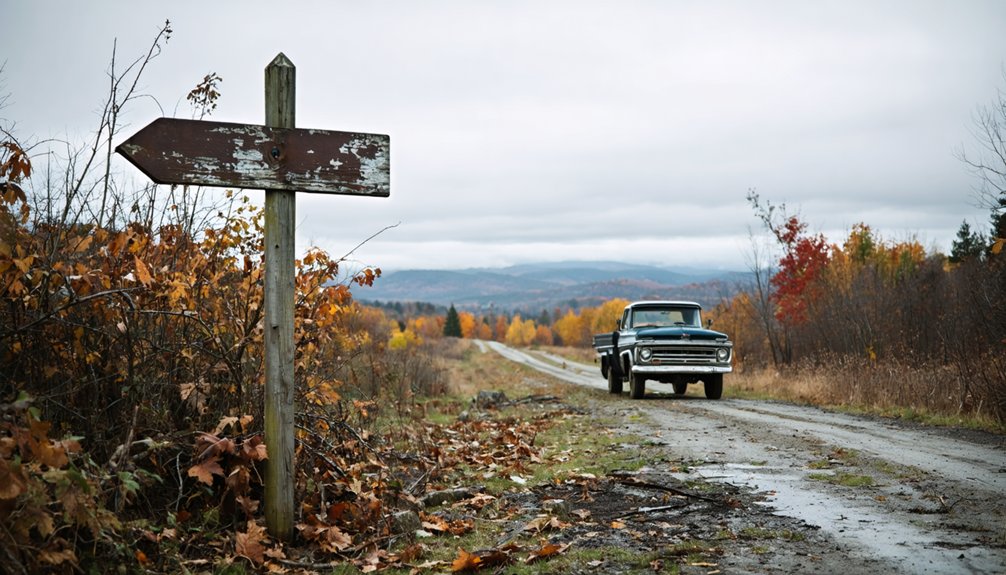
Prindle Corners doesn’t actually exist as a documented Vermont ghost town, but you can explore authentic abandoned settlements nearby. Visit Glastenbury’s eerie ruins in the “Bennington Triangle,” hike to Ricker Basin’s flood-submerged mill foundations, or discover Greenbank’s Hollow where fire destroyed the only bridge out. Start your journey at Chimney Point Interpretive Center to understand Vermont’s settlement patterns, then map a route through Tyson Furnace and Vershire’s Copperfield mining town. The stories behind these vanished communities reveal surprising truths about frontier life.
Key Takeaways
- Prindle Corners has no confirmed historical records as a real ghost town; it appears to be misidentified history.
- Visit documented nearby ghost towns: Glastenbury, Greenbank’s Hollow, Tyson Furnace, and Ricker Basin instead.
- These authentic sites feature abandoned boarding houses, mill ruins, quarries, and cemeteries from Vermont’s industrial past.
- Charlotte War Memorial Museum provides documented local history and context for the region’s settlement patterns.
- Chimney Point Interpretive Center offers 9,000 years of history including a restored 1785 tavern and archaeological exhibits.
The Mystery Behind Prindle Corners: Separating Fact From Fiction
When you search online for “Prindle Corners, Vermont,” you’ll find scattered references to a mysterious ghost town tucked somewhere in Charlotte’s rolling hills. But primary source analysis reveals a different story—no historical records actually confirm Prindle Corners as a formal place name or abandoned settlement.
The Prindle family settled Charlotte’s northeastern section in the 1790s, establishing tanneries and farms that integrated into the community. Through local folklore examination, you’ll discover that Charlotte’s population declined gradually from its 1810 peak, not through sudden abandonment. The family relocated to nearby Monkton and congregated at Baptist Four Corners, remaining active residents rather than fleeing pioneers.
What’s labeled a “ghost town” appears to be misidentified history, blending Charlotte’s authentic past with romantic speculation. Charlotte’s actual geography features a range of low mountains dividing the town into two nearly equal parts, with Mount Philo, Pease Mountain, and Mutton Hill marking the highest elevations where early settlers would have established their homesteads. Today, you can explore Charlotte’s documented history at the Charlotte War Memorial Museum, which houses an outstanding collection of local artifacts and materials available for tours.
Understanding Vermont’s Lost Settlement Pattern
While Prindle Corners may exist only in folklore, Vermont’s landscape holds genuine abandoned settlements with documented histories of rise and fall. You’ll discover that early colonial settlement patterns reveal cycles of boom and bust across the state.
French habitants pioneered permanent frontier agriculture along Lake Champlain’s shores in 1740, building stone windmills and fruit gardens before British forces torched everything in 1759. The settlement at Chimney Point grew to about 150 people living in 40 houses on both sides of the lake by 1754. Today, you can explore standing stone chimneys and cellar holes marking these vanished communities.
Vermont’s ghost towns emerged from iron furnaces, logging camps, and short-lived mining rushes like Plymouth Five Corners’ four-year gold fever. The Vershire Copper Mine, known to rockhounds as Copperfield in Orange County, operated actively during the 1880s before leaving behind stone walls and smelter ruins. From Addison County’s Fort de Pieux to Bennington’s abandoned charcoal towns on the Appalachian Trail, these sites offer tangible connections to Vermont’s forgotten frontier past.
Documented Ghost Towns Near the Prindle Corners Region
Since Prindle Corners exists only in legend, serious ghost town hunters can redirect their explorations to five documented abandoned settlements scattered across Vermont’s southern and central regions.
Exploring the history of Prindle Corners ghost town can spark curiosity about the lives once lived there. Many adventurers find that the remnants of other ghost towns tell vivid stories of the past, each with its own unique character and mystery. Discovering these abandoned places not only enriches your understanding of local history but also connects you with the whispers of time.
Verified Ghost Towns Worth Visiting:
- Glastenbury – Explore abandoned boarding houses at South Glastenbury’s “forks,” where 12 brick kilns once powered a rough charcoal community now infamous as the “Bennington Triangle.”
- Greenbank’s Hollow – Discover ruins where Vermont Valley Woolen Mill’s catastrophic fire illuminated Saint Johnsbury five miles away, destroying the only bridge access. A restored covered bridge now offers access to the preserved historic park.
- Tyson Furnace – Investigate forgotten quarry sites in Black River Valley, where Isaac Tyson’s 1835 iron empire left industrial remnants.
- Ricker Basin – Hike through Little River State Park to find mill foundations and a haunting family cemetery submerged by the 1927 flood. These sites reveal the challenges faced by Vermont’s rural farming communities throughout the state’s agricultural history.
What Caused Vermont Communities to Vanish
Vermont’s ghost towns met their demise through a brutal combination of economic collapse and environmental catastrophe that left once-thriving settlements as hollow shells.
You’ll find communities destroyed by economic restructuring—iron furnaces idled hundreds of workers, logging operations stripped forests bare by 1937, and gold rushes fizzled within four years.
Environmental disruption delivered knockout blows: the 1898 flooding obliterated Glastenbury’s railroad tracks, ending resort dreams overnight and washing away trolley lines to South Glastenbury’s casino. The harsh conditions included poor rocky soil that made farming nearly impossible. Infrastructure bypassed entire settlements when new roads cut different paths. The state took the unprecedented step of disincorporating Glastenbury and nearby Somerset when their populations dwindled to just a handful of residents.
Exploring Caledonia Spring House and Chimney Point
You’ll find the Judge David Hibbard Homestead’s Spring House standing as a preserved glimpse into 1814 Vermont agricultural life, where Federal-style architecture meets practical farmstead design.
Just beyond Caledonia County’s historic structures, the Chimney Point Interpretive Center offers context for understanding how architectural details—like strategically placed brick chimneys and hand-carved trim—defined northern Vermont’s early settlements.
These sites transform abstract history into tangible exploration, connecting vanished communities to the buildings and cellar holes that outlasted them. The homestead’s main block features an elaborate Federal entrance surround topped by a Doric cornice with mutules, showcasing the refined craftsmanship that distinguished early 19th-century construction along the Connecticut River. Early builders utilized Vermont materials such as limestone, marble, and locally produced brick, adapting national architectural types to the state’s resources and climate.
Historic Cellar Holes Exploration
When you arrive at the site where the Caledonia Spring House once dominated Wheelock’s village center, you’ll find only subtle depressions in the earth marking where the brick hotel stood until 1994. These cellar holes reveal Vermont’s rural architecture evolution from primitive log structures to sophisticated frame buildings. You’re walking through layers of historic village infrastructure that transformed Wheelock from wilderness to waystation along the Boston mail route.
What You’ll Discover:
- Stone foundation remnants showing Federal-era construction techniques with solid wood planks
- Spring house depressions where sulfur water flowed for medicinal purposes
- Connected barn foundations displaying New England’s continuous L-formation architecture
- Brick chimney bases positioned on back slopes, characteristic of 1830s construction
Each depression tells stories of settlers seeking freedom and prosperity in Vermont’s frontier landscape.
Chimney Point Interpretive Center
Standing on Lake Champlain’s eastern shore, the Chimney Point Interpretive Center commands a strategic position that’s witnessed 9,000 years of human history unfold across its grounds. You’ll discover three distinct cultural narratives here—from prehistoric Native American archaeology spanning millennia to French fortifications built in 1731, then Revolutionary War battlegrounds where American and British forces clashed.
The restored 1785 tavern, where Jefferson and Madison once gathered, showcases exceptional historic building restoration with Vermont’s most intact early tap room. Archaeological exhibits display artifacts unearthed during the Lake Champlain Bridge reconstruction, while workshops teach traditional Native American skills like atlatl throwing and flint knapping.
Open Memorial Day through Columbus Day, this interpretive center connects you with authentic stories of occupation, resistance, and survival across centuries of contested territory.
Plymouth Five Corners: Gold Rush Dreams Gone Cold
While California’s 1849 gold rush captured the nation’s imagination, Vermont quietly experienced its own glittering fever just six years later when William Hankerson—a returned forty-niner who knew what to look for—discovered gold in Plymouth’s rocky streams. By 1858, this remote crossroads exploded into Plymouth Five Corners, where rapid urbanization impacts transformed wilderness into bustling commerce.
You’ll find remnants of dreams that built:
- Hotel Carlisle (1858) – Lewis S. Carlisle’s lodging house served fortune-seekers enduring miners’ hard living conditions
- Rooks Mine shaft (1882) – Vermont’s deepest hard rock operation, now a dangerous flooded cavity
- Wooden sluice box sites along Buffalo Brook where $7,000 worth of gold once glittered
- Abandoned mill foundations where over 100 workers once crushed quartz
The Civil War emptied these claims, leaving ghostly infrastructure behind.
West Castleton’s Slate Quarry Legacy
The abandoned quarries of West Castleton tell a harsher story than Plymouth’s golden dreams—one written in immigrant blood and broken slate. Founded in 1852, the West Castleton Railroad and Slate Company controlled everything: housing near Screwdriver Pond, food, even transportation for its primarily Irish, Italian, and Welsh workforce.
Workers earned under $2 for ten-hour days, dying regularly from collapsing rock. The immigrant community life centered around company-built homes and West Castleton Public School No. 9.
You’ll find remnants of slate quarrying techniques that wasted 85% of extracted material through dangerous blasting and manual labor.
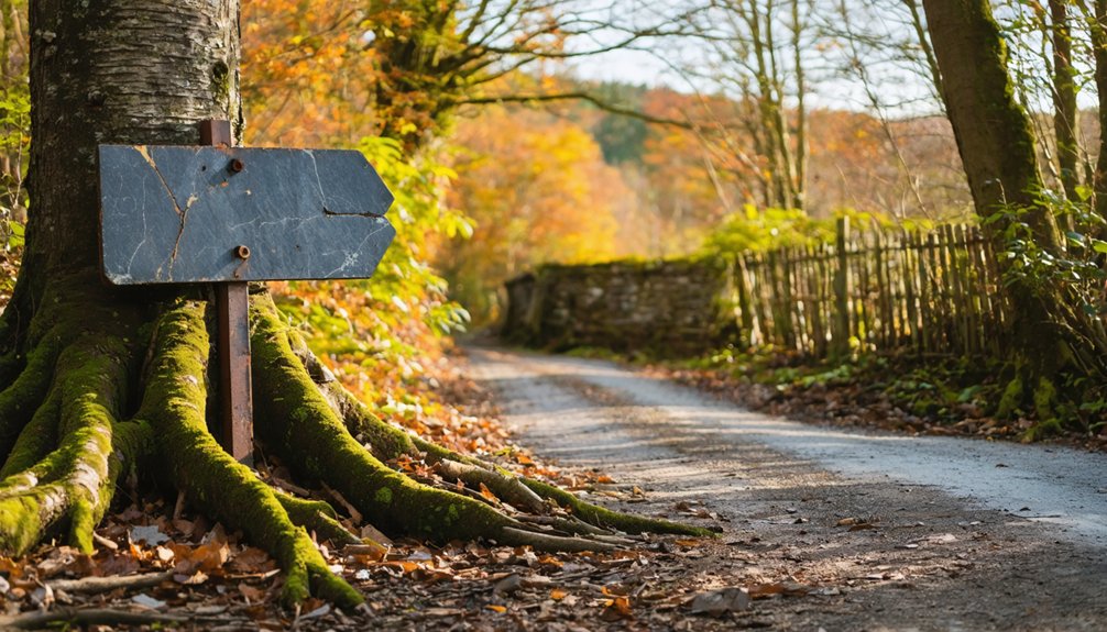
Mapping Your Route Through Vermont’s Abandoned Sites
Your journey through Vermont’s forgotten settlements requires strategic planning across rural highways and unmarked back roads that wind through the Green Mountains. You’ll navigate distances ranging from 15 to 60 miles between sites like Glastenbury and Somerset, where deteriorating logging trails replace conventional parking areas.
Understanding these essential routes, calculating realistic travel times on unpaved roads, and locating trailhead access points will transform your ghost town expedition from a vague adventure into a deliberate exploration of Vermont’s abandoned past. Exploring historical sites around Cedar Beach allows you to immerse yourself in the stories of the area, enriching your understanding of its heritage. Each landmark offers a glimpse into the past, inviting visitors to reflect on the lives once lived there. As you navigate the region, you’ll uncover hidden gems that showcase the unique history and culture of this beautiful locale.
Essential Highway Routes Explained
Planning your journey to Vermont’s forgotten settlements requires traversing a network of rural highways and backroads that wind through the Green Mountains’ most secluded valleys. You’ll navigate routes where civilization fades into wilderness, discovering unmarked trailheads and abandoned bridges that once connected thriving communities.
Key Highway Considerations:
- State Route 100 – Vermont’s main spine road provides access to numerous ghost town turnoffs through central valleys
- Secondary Forest Roads – Unpaved logging routes lead directly to isolated settlement remnants
- Seasonal Accessibility – Many backroads close November through April due to snow accumulation
- Navigation Tools – GPS signals weaken considerably; carry detailed topographic maps and compass
Your route demands flexibility and self-reliance. These highways don’t cater to conventional travelers—they reward those seeking authentic exploration beyond marked tourist destinations.
Distance Between Ghost Towns
Scattered across Vermont’s northeastern highlands, abandoned settlements form a constellation of forgotten places separated by miles of wilderness and winding mountain roads. Planning your ghost town exploration requires realistic route mapping since these sites don’t conveniently cluster together.
You’ll find Prindle Corners isolated in Vermont’s backcountry, while other abandoned communities like Glastenbury and Somerset sprawl across the southern Green Mountains—roughly 100 miles apart. Travel logistics become challenging when paved roads give way to overgrown trails and forgotten paths.
Most ghost towns lack precise coordinates or marked access points, demanding flexibility in your itinerary. Between destinations, you’ll traverse remote forestland where cell service disappears and navigation relies on topographic maps. Budget extra time for exploration and detours; these abandoned places reward those who embrace uncertainty over rigid schedules.
Trail Access and Parking
Reaching these remote locations demands more than knowing distances—you’ll need to locate trailheads that time and nature have worked to erase. Vermont’s abandoned settlements require careful preparation, as infrastructure that once supported thriving communities has long since vanished.
When planning your exploration:
- Research Historical Access Points – Old logging roads and forgotten paths often lead to ghost town sites, though trail signage and markings are typically nonexistent
- Scout Shoulder Areas – On site parking availability is limited; you’ll usually find narrow pull-offs along rural routes rather than designated lots
- Download Offline Maps – Cell service disappears in Vermont’s backcountry
- Contact Local Historical Societies – They possess invaluable knowledge about current access conditions and private property boundaries that modern maps won’t reveal
What You’ll Find at the Ruins Today
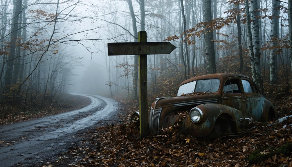
Deep within the Green Mountain National Forest‘s 400,000 acres, the ruins of Prindle Corners lie ten air miles northeast of Bennington along the Appalachian Trail. You’ll discover weathered stone foundations from old sawmills, crumbling cellar holes, and scattered rubble where charcoal operations once thrived.
A decrepit footbridge still spans a brook, while dense forest reclaims what flooding and abandonment left behind in the 1930s.
Visitor activities here blend historical exploration with wilderness adventure, though many hikers report disorientation and sensations of unseen presences. These mysterious occurrences add to the eerie atmosphere created by decades of isolation and natural decay.
There’s no restoration effort—just raw, untouched remnants slowly surrendering to the mountain. You’re free to explore these haunting foundations at your own risk.
The Bennington Triangle and Other Dark Legends
Between 1945 and 1950, five people vanished without a trace in the wilderness surrounding Glastenbury Mountain, spawning one of New England’s most enduring mysteries. Writer Joseph Citro coined the term “Bennington Triangle” in 1992, connecting these unexplained disappearances to supernatural phenomena that locals had whispered about for generations.
The most haunting cases include:
- Paula Welden – An 18-year-old Bennington College student who disappeared on the Long Trail in 1946
- Middie Rivers – A 74-year-old experienced guide whose only trace was a handkerchief
- Paul Jepson – A three-year-old who vanished from his family’s farmhouse
- Frieda Langer and Frances Christman – Both disappeared within days of each other in 1950
You’ll find these ghost towns now unincorporated, their secrets preserved in Vermont’s dense forests.
Frequently Asked Questions
What Permits or Permissions Are Needed to Explore Vermont Ghost Town Sites?
You’ll need written private landowner permission before exploring most ghost town sites, since they’re typically on private property. Follow historical society guidelines and respect boundaries—freedom comes with responsibility when you’re wandering Vermont’s abandoned places.
Are There Guided Tours Available for Vermont’s Abandoned Settlement Locations?
You won’t find organized excursions specifically for Vermont’s abandoned settlements like Prindle Corners. These forgotten places remain off the beaten path, accessible only through self-guided tours you’ll craft yourself, traversing overgrown trails toward history’s whispers.
What Safety Equipment Should I Bring When Exploring Cellar Holes and Ruins?
You’ll need sturdy boots, cut-resistant gloves, and a hard hat for protection. Bring hand-held lights with backup batteries, reflective safety gear for visibility, dust masks for airborne particles, and a thorough/detailed/extensive first aid kit for emergencies.
Can I Camp Overnight Near Any of These Ghost Town Locations?
You can camp at Somerset’s free national forest campground near ghost towns, though it offers minimal camping amenities nearby. Respect private property considerations around grandfathered Glastenbury camps, and always stick to marked trails for safe, legal exploration.
What’s the Best Season to Visit Vermont’s Abandoned Sites for Accessibility?
Fall’s your best bet for exploring abandoned sites—you’ll enjoy ideal trail conditions, stunning scenic beauty through colorful foliage, and comfortable temperatures. The season’s atmosphere perfectly complements local folklore while giving you maximum freedom to roam Vermont’s forgotten places safely.
References
- http://freepages.rootsweb.com/~gtusa/history/usa/vt.htm
- https://vermontcountry.com/2022/09/18/ghost-town/
- https://www.youtube.com/watch?v=m8FRx55xICM
- https://suncommunitynews.com/news/77959/rutland-countys-ghost-town-is-largely-forgotten/
- https://www.vermonter.com/ghost-haunting-northeast-kingdom-vermont/
- https://www.youtube.com/watch?v=ScW-H7A8yL8
- https://substack.com/home/post/p-149874056
- https://en.wikipedia.org/wiki/List_of_ghost_towns_in_Vermont
- https://sites.rootsweb.com/~vermont/ChittendenCharlotte.html
- https://charlottevthistory.org/museum.html


