You’ll find Ray’s ghost town coordinates at 33.18333°N, 110.99750°W in Pinal County, accessible via Arizona State Route 177 from Kearny, just 4.5 miles northwest. Don’t expect traditional ruins—the original settlements of Ray, Sonora, and Barcelona disappeared entirely into Kennecott’s massive open-pit mine by 1965. What survives is the remarkably intact cemetery with over 100 weathered headstones and scattered mining equipment near active operations. Bring a high-clearance vehicle, respect mine boundaries, and prepare for zero cell service in this remote copper country where one town literally consumed three others.
Key Takeaways
- Ray’s location is 33.18333°N, 110.99750°W in Pinal County, accessible via Arizona State Route 177 from Kearny, 4.5 miles southeast.
- High-clearance vehicles are preferred for unmarked access routes, especially during monsoon season, though standard vehicles handle public roads.
- Main attractions include a weathered cemetery with 100+ headstones, scattered stone ruins, collapsed headframes, and rusting ore cars.
- Respect active mine boundaries surrounding the site, expect no cell service, and prepare for remote desert conditions.
- Most original structures were consumed by open-pit expansion by 1965, leaving limited but historically significant remnants to explore.
The Rise and Fall of a Copper Mining Town
British investors stumbled upon opportunity in the Arizona desert when they organized the Ray Copper Mines Company in 1899. You’ll discover that Ray transformed from a dusty prospect into a groundbreaking operation—the world’s first copper mine producing 8,000+ tons daily through innovative caving methods under Louis S. Cates’ leadership.
The town’s golden era exploded after Ray Consolidated Copper Company took control in 1907, eventually landing in Kennecott‘s hands by 1910. Picture the bustling activity: smelter operations at nearby Hayden processing ore across 2,145 acres of mining lands, private railroads hauling copper, workers building a community in harsh terrain.
What Made Ray a Thriving Company Town
Ray’s success story began with geography—copper-rich mountains met accessible desert terrain just 60 miles southeast of Phoenix. You’ll find that Arizona Hercules Copper Company didn’t just dig mines in 1909—they built an entire world.
The company’s corporate control of housing shaped everything. They segregated workers into Ray, Sonora, and Barcelona, controlling where you’d live based on ethnicity. Yet this diverse immigrant workforce—Mexicans, Spaniards, Anglo-Irish miners, and Lebanese merchants—created unexpected dynamism. By World War I, 5,000 people called these connected towns home.
Two banks, a newspaper, and thriving general stores proved Ray wasn’t just surviving—it was prospering. When the Hayden smelter fired up in 1912, seventeen miles away, the mining-to-refining pipeline was complete. Freedom meant steady paychecks, even under Guggenheim’s watchful eye.
From Underground Operations to Open-Pit Mining
Long before Kennecott’s massive pit swallowed the landscape, silver prospectors organized the Ray Mining District in 1873, squinting at mountainsides that held secrets they couldn’t yet decode. You’d find copper lurking beneath those hills, but accessibility challenges kept it locked away until the Ray Copper Company started underground operations in 1883.
By 1911, large-scale mining descended seven levels—714 feet into darkness. Shifting ownership dynamics brought Nevada Consolidated, then Kennecott in 1933.
Smelting advancements arrived when ASARCO built Hayden’s facility in 1912, processing ore from seventeen miles away.
Everything changed when Daniel C. Jackling recognized what low-grade disseminated deposits meant: open-pit economics. By 1955, Kennecott abandoned the underground entirely. The towns of Ray, Sonora, and Barcelona disappeared into the expanding pit by 1965, their 2,712 residents scattered to Kearny.
Getting There: Location and Access Requirements
You’ll find Ray at coordinates 33.18333°N 110.99750°W in Pinal County, perched at 2,123 feet elevation where the high desert meets massive copper operations.
Your best approach is from Kearny, just 4.5 miles southeast—the town built in 1958 to house residents displaced when the expanding Ray Mine swallowed the original settlement.
Most standard vehicles can handle the public roads leading to viewable areas, though you’ll need to respect active mine boundaries where ASARCO’s operations continue eating into the landscape.
Geographic Location and Coordinates
Tucked into the rugged terrain of Pinal County, Arizona, this ghost town sits at coordinates 33.18339° N, 110.99761° W—a location that’s now more memory than destination. You’ll find Ray submerged beneath the copper-rich waters at the north end of Ray Mine, 2,123 feet above sea level. The mining camp ruins rest where local geology revealed massive copper deposits that justified drowning an entire town.
Your GPS coordinates lead to what was once a thriving community, now claimed by open-pit operations. You can approach from Kelvin, five miles south near the Gila River, or through Ray Junction six miles away. The old Copper Basin Railway route once connected this remote outpost to civilization—now you’ll navigate backroads through a landscape dotted with 37,253 nearby mines across Pinal County’s sprawling mineral district.
Vehicle Requirements for Access
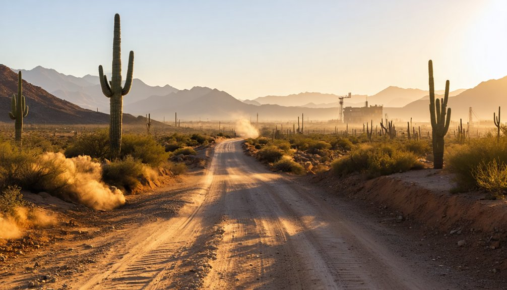
Most ghost town expeditions begin optimistically—until your sedan bottoms out on a hidden rock you should’ve seen coming. Ray’s dirt roads demand respect, though they’re surprisingly forgiving when approached right.
As you navigate the rugged terrain, you realize that to truly appreciate the rich history of the state, you must explore ghost towns in Arizona. Each stop reveals remnants of a bygone era, where stories linger in the crumbling walls and dusty streets. With every turn, the ghosts of the past beckon, inviting you to uncover the tales hidden behind the silence.
Vehicle clearance requirements matter here. Standard sedans work fine during dry conditions—a Ford Fusion proved this—but you’ll need experience reading desert roads. Vehicle four wheel drive considerations become critical during monsoon season when washes fill fast.
Your best approach:
- High-clearance vehicles handle rock patches and water crossings confidently
- Two-wheel-drive works in late spring through early fall with careful navigation
- Low-clearance sedans succeed with slow rolling over rough sections
- Four-wheel-drive preferred during rainy seasons or after storms
- Skip monsoons entirely—water crossings aren’t worth the gamble
Time your visit right, drive deliberately, and Ray remains accessible without requiring a lifted truck.
Nearest Highway Routes
Arizona State Route 177 delivers you closest to Ray’s ruins**, cutting through mineral-rich desert 4.5 miles southeast of the ghost town. You’ll navigate from Kearny, where highway signage guides you toward Ray Junction**—your jumping-off point into mining history. Don’t expect clear markers once you veer off SR 177; unmarked access routes characterize this territory, demanding sharp observation and perhaps downloaded GPS coordinates (33°11′00″N, 110°59′51″W).
The highway itself connects Florence, 24.6 miles southwest, to Superior in the north, threading through copper country where roadways once served industrial necessity rather than recreational convenience. You’re traveling paths that miners and railway workers carved through unforgiving terrain. Keep your odometer calibrated—distances between Kelvin, Riverside, and Ray Junction blur together when desert landmarks repeat themselves endlessly.
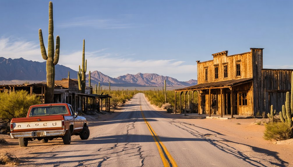
What Remains at the Ray Town Site Today
You’ll find scattered stone ruins and adobe remnants where Ray’s 4,000 residents once lived, though the massive open-pit crater—over 1,000 feet deep—has swallowed most of the original town.
The weathered cemetery with 100+ headstones remains remarkably intact on the hillside, while collapsed headframes and rusting ore cars mark the mining operations that once produced 300 million pounds of copper.
Be prepared to navigate dirt roads off Highway 177 and respect the fenced active mining areas that still restrict the eastern sections of this National Historic District.
Vandalized Structures Still Stand
Unlike most Arizona ghost towns where crumbling walls and weathered facades await exploration, Ray offers nothing but absence. You won’t find vandalized buildings tagged with graffiti or untouched remains hiding forgotten stories. The town site disappeared entirely beneath GRUPO-ASARCO’s open pit mine—every structure, street, and artifact consumed by industrial excavation.
What you’ll encounter instead:
- Active mining operations where Ray, Sonora, and Barcelona once stood
- Zero physical access to the buried town sites due to ongoing extraction
- No interpretive markers or visitor facilities at the location
- Complete absence of the residential buildings that housed workers from 1909-1965
- Historical records only—your sole window into this vanished community
The mine didn’t preserve Ray’s past; it erased it entirely, leaving only documents and memories.
Remote Access Required
Off highway exploration challenges intensify with zero cell service, demanding you load offline maps and pack satellite communicators. No shuttles run here; you’re entirely self-reliant.
Summer temperatures exceeding 100°F make adequate water supplies non-negotiable. The Bureau of Land Management permits day use only, so plan accordingly.
This remoteness preserves Ray’s scattered foundations and rusted machinery from casual tourists, rewarding those willing to embrace genuine wilderness isolation.
Active Mining Surroundings
- Industrial-scale pit operations where Ray’s business district stood before 1963 demolition
- Active mineral processing facilities replacing neighborhoods that housed 5,000 residents
- Security restrictions preventing close access to historic town locations
- Operational equipment working 24/7 extracting ore from former community grounds
- Viewpoints offering perspective on the pit’s overwhelming scale and transformation
The Story Behind Kearny’s Creation
When Kennecott Copper Company‘s open-pit mine demanded more space in the mid-1950s, three entire communities stood in its way. Ray, Sonora, and Barcelona were demolished to accommodate copper production expansion.
From this industrial upheaval, Kearny emerged in 1958 as a planned community for displaced mining families.
The town’s namesake would’ve found this transformation ironic. General Stephen Watts Kearny‘s initial impressions in 1846 labeled this area “hostile and uninhabitable” when he camped near the Gila River. Yet long before his dismissive assessment, early Apache presence thrived here until 1872.
You’ll find Kearny represents America’s untamed spirit—where necessity trumped planning, and communities rebuilt themselves rather than surrender. That bronze plaque from 1962 commemorates one man’s passage, but the town itself honors everyone who refused to leave.
Active Mining in the Ray District
The Ray Mine stretches across 7,824 hectares of Pinal County desert, where 250,000 tons of copper ore move through its processing system daily. You’ll witness one of America’s largest copper operations in action, with two massive open pits—Pearl Handle and West—carving deep into porphyry deposits that’ve yielded ore since 1911.
ASARCO’s operation maintains compliance with environmental regulations while shipping cathode copper to refineries nationwide.
What Makes Ray’s Modern Mining Operation Notable:
- Scale: Processing facilities handle over 40 million tonnes annually through concentrator and SX-EW systems
- Reserves: 835.7 million tonnes of proven copper ore remain underground
- Infrastructure: Copper Basin Railroad connects mine to Hayden Smelter 18 miles east
- Innovation: New slag concentrate operations launched in 2023
- Community engagement initiatives: Programs support nearby Kearny and Kelvin residents
Frequently Asked Questions
What Safety Precautions Should Visitors Take When Exploring the Ray Ghost Town?
Watch for unstable structures and avoid entering unsafe buildings at Ray. You’ll want to assess crumbling walls from outside, pack plenty of water for the desert heat, and never explore alone—freedom means staying smart and safe.
Are There Any Guided Tours Available for the Ray Mining District?
Picture yourself discovering copper’s secrets firsthand! You’ll find professional guides leading ticketed mine tours at ASARCO’s Mineral Discovery Center, plus free self-guided tours through indoor exhibits. Both options let you explore Ray’s mining heritage independently.
What’s the Best Time of Year to Visit Ray, Arizona?
Visit Ray during fall or spring when seasonal weather patterns offer perfect exploring conditions. You’ll avoid summer’s brutal heat and monsoons while enjoying comfortable temperatures. Check local event schedules beforehand, though Ray’s remote location means fewer crowds year-round.
Can Visitors Legally Collect Artifacts or Souvenirs From the Ghost Town?
Tempted by old relics? Don’t collect artifacts—it’s illegal. The legality of collecting artifacts is clear: you’ll face hefty fines and arrest. Ray’s potential archaeological significance means everything stays put, preserving Arizona’s heritage for future adventurers like yourself.
Are There Camping or Lodging Options Near the Ray Town Site?
You won’t find primitive campsites or facilities directly at Ray’s abandoned buildings. You’ll need to camp elsewhere, as the town site lacks designated areas. Consider nearby Boyce Thompson Arboretum’s campground or dispersed camping on surrounding BLM land for your adventure.


