You’ll find Reeder off Macoupin County‘s grid-pattern gravel roads near Carlinville, accessible via Interstate 55 and Illinois Route 4. This weathered coal mining settlement features original wooden structures from its early 20th-century peak, though subsided ground from 80-foot-deep underground extraction creates persistent hazards. Before visiting, consult historical mine maps and avoid unreinforced pathways where settling continues. Combine your trip with nearby ghost towns like Eagerville, Sawyerville, and completely vanished Rienzi. The following sections outline ideal routes, seasonal timing, essential safety equipment, and the mining economics that transformed this landscape.
Key Takeaways
- Access Reeder via Interstate 55 with connections to Illinois Routes 4, 16, 111, and 267 in rural Macoupin County near Carlinville.
- Explore weathered wooden structures and early 20th-century mining settlement buildings, some inhabited and others abandoned, along Reeder Lane.
- Check historical mine maps before visiting to identify subsidence hazards, ground depressions, and unstable terrain from underground coal extraction.
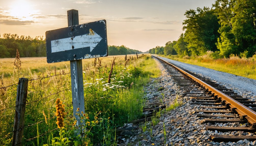
- Plan visits during favorable weather, as seasonal conditions affect gravel roads and remote access, especially during spring thaw periods.
- Use township cemeteries and the Womac historical site as wayfinding landmarks when navigating unmarked settlement areas and grid-pattern county roads.
Discovering Reeder’s Place in Illinois Mining History
When French explorers Louis Joliet and Jacques Marquette noted coal deposits along the Illinois River near Utica in 1673, they couldn’t have imagined the industrial transformation their observation would eventually spark. By 1810, William Boone launched commercial operations along Big Muddy River, floating coal to New Orleans markets.
You’ll find Illinois mining innovation accelerated dramatically—from Belleville’s first underground mine in 1848 to 7,400 individual mines spanning 76 counties. Early operations employed the room and pillar method, leaving support pillars while extracting coal. Modern longwall mining represents sustainable mining practices, recovering 85% versus the earlier 60% extraction rate.
This evolution created entire communities like Braidwood, which peaked at 8,000 residents during the mid-1870s boom, transforming Illinois into an industrial powerhouse.
Getting to Reeder in Macoupin County
Your journey to Reeder begins in Macoupin County, established January 17, 1829, from Greene and Madison Counties—a region positioned strategically between St. Louis and Springfield at coordinates 39°16′N 89°55′W. Interstate 55 provides your primary north-south access route, while Illinois Routes 4, 16, 111, and 267 offer additional connectivity through this central Illinois territory.
Navigate to Carlinville, the county seat, then locate Reeder Lane addresses at 17500 and 17510 (Carlinville, IL 62626). The nearby Womac historical site (GPS 39.2902257, -89.789152) serves as a reference point.
When accessing Reeder property, you’ll encounter agricultural terrain with substantial lot sizes—3,484,800 square feet and 95 acres documented. Parking accommodations near site remain limited given the rural classification, so prepare for roadside positioning along this remote agricultural corridor.
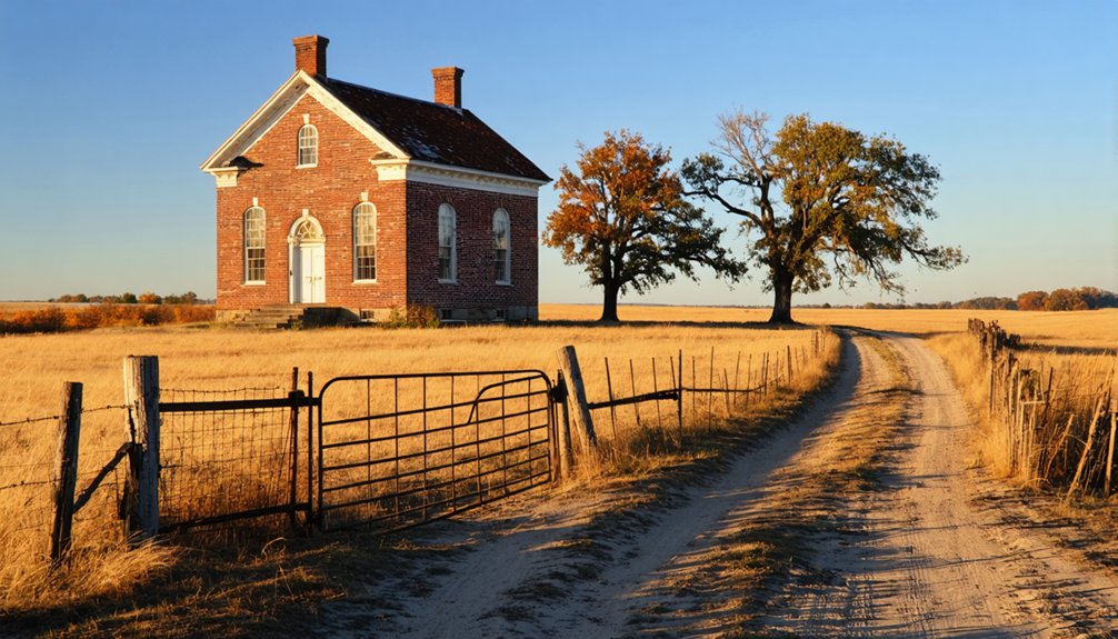
What Remains of the Wooden Mining Town
When you arrive in modern-day Reeders, you’ll find scarce physical evidence of the wooden shacks that once lined the railway near the Unionville mine operations.
The subsided mining ground beneath your feet—spanning 930 acres with an average depth of 80 feet—creates uneven terrain where the Vermillion Coal Company‘s massive extraction removed approximately 5,000,000 tons of material.
Main Street’s famed fluorspar paving, once dubbed the “million dollar Main Street” after lead miners discarded the mineral for road construction, has long since disappeared beneath subsequent development.
Visible Structural Evidence Today
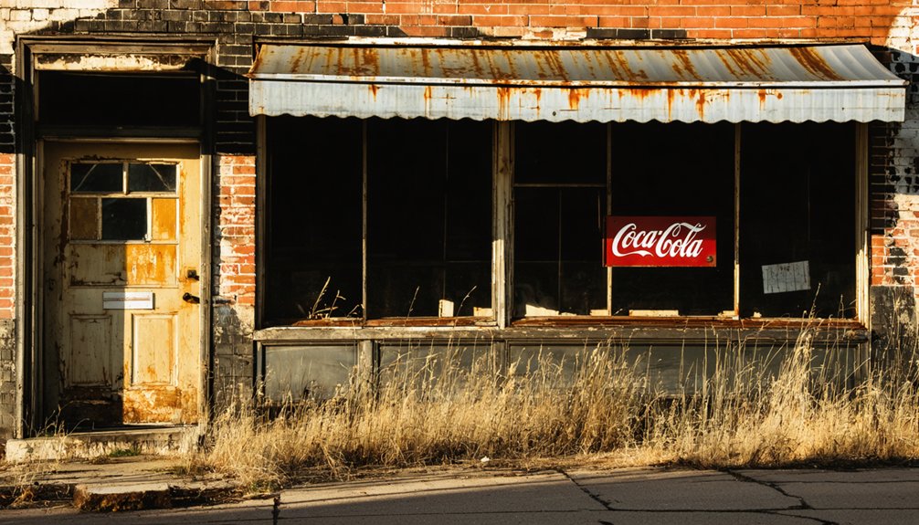
Reeders retains tangible evidence of its mining-era infrastructure through a scattered collection of weathered wooden structures that mark its original footprint. You’ll find both commercial and residential buildings occupying their original locations, displaying architectural styles characteristic of early 20th-century mining settlements. The wooden storefronts and frame homes demonstrate period construction techniques while simultaneously revealing material vulnerabilities inherent to their composition.
Decades of Midwestern weather exposure have compromised structural integrity across the townsite. You’ll observe advanced deterioration in roofing materials, uneven foundation settlement from subsidence, and significant weathering of exposed surfaces. The commercial district’s layout remains identifiable despite this degradation. Some residences still house occupants, creating an unusual juxtaposition of inhabited and abandoned properties. No formal preservation efforts currently protect these structures, leaving their long-term survival uncertain.
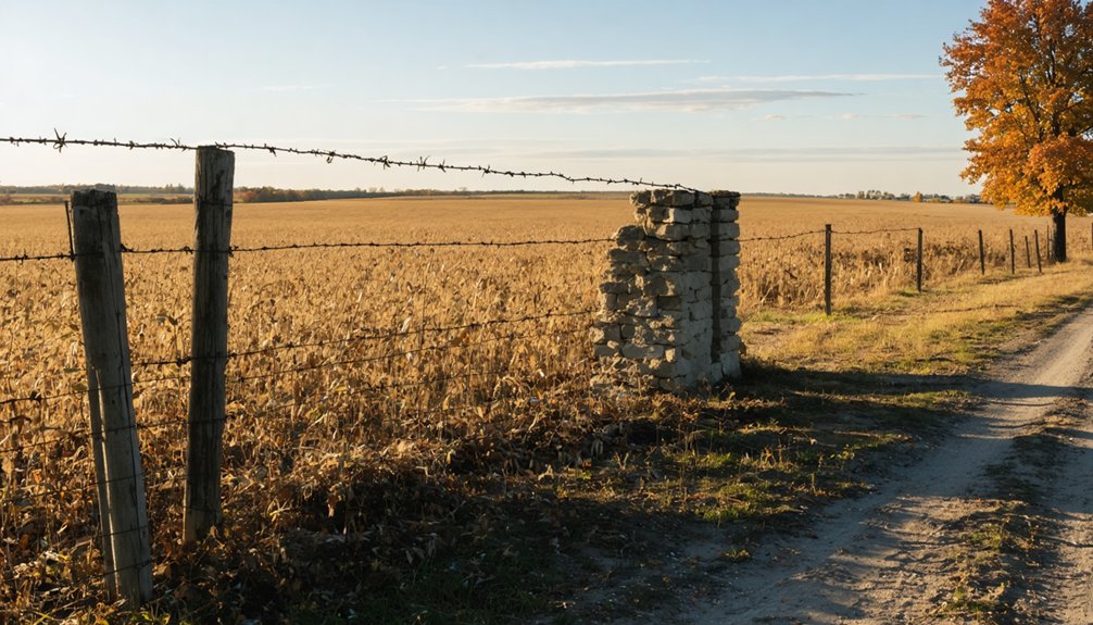
Underground coal extraction beneath Reeders created persistent ground stability hazards that complicate modern exploration of the townsite. You’ll encounter depressions and surface cracks where abandoned mine voids destabilized the terrain—common signatures of collapsed 19th-century operations.
The mining settlement infrastructure has largely vanished, though subsided areas mark where wooden structures once stood. Check historical mine maps from Will and Grundy counties before traversing into low-lying zones indicating potential sinkholes.
Avoid unreinforced pathways where ground settling continues decades after operations ceased. Travel with companions when surveying unmonitored areas, as safety hazards present include sudden terrain shifts and concealed voids.
The lack of state highway access to this agricultural ghost town means you’re maneuvering uneven ground with minimal emergency support—plan accordingly for this freedom-seeking expedition.
Understanding the Coal Boom That Built Reeder
Long before Reeders emerged as a coal town, Illinois’s rich mineral deposits had already attracted attention from the earliest European explorers. French explorers Joliet and Père Marquette documented coal seams along the Illinois River in 1673, centuries before commercial operations transformed the landscape.
Illinois’s coal wealth captivated European explorers centuries before mining towns like Reeders would rise from the prairie landscape.
By 1810, William Boone established the state’s first commercial mine along Big Muddy River, flatboating coal to New Orleans markets.
The coal powered transportation network accelerated dramatically when railroads tested Du Quoin bituminous coal in the 1850s, becoming the industry’s largest consumers. Northern Illinois experienced its boom in 1864, with Braidwood swelling to 8,000 residents.
The working class immigrant impact defined these mining communities—Italian, Austrian, Croatian, and Polish families arrived between 1890-1922, establishing the demographic foundation that would shape Reeders’s eventual development.
Why Reeder Became a Ghost Town
The same forces that propelled Reeders into existence ultimately orchestrated its demise. When mine explosions rocked the community in 1912, the subsequent shutdown severed Reeder’s economic lifeline.
You’ll find that coal mining’s collapse triggered cascading failures—industries that depended on the mines couldn’t survive independently. The abandoned hopes of miners and merchants alike scattered across Illinois as families sought opportunities elsewhere.
Economic hardships intensified when railroads, which had delivered both coal and prosperity, declined in prominence. Without the steady flow of mine workers’ wages, local businesses faltered and storefronts emptied.
Exploring Nearby Macoupin County Ghost Towns
You’ll find Schoper’s oil boom remnants along County Road 14, where Standard Oil’s 1918 investment of $1 million created a town that vanished within decades.
The route connects to coal mining sites at Anderson and McVey, accessible via Highway 4 through former extraction zones that powered the region’s economy.
Prairie settlement roads lead to Miles Station (Providence) and Barr, where original wagon paths still mark boundaries of these deserted communities.
Route Through Schoper Ruins
When Standard Oil of Indiana acquired Thomas Schoper’s 500-acre farm in 1918, they transformed pastoral Macoupin County into an industrial mining operation that would vanish within seven years. You’ll find remnants of this ghost town eight miles from Carlinville, accessible via rural roads near the Chicago and Alton railroad corridor.
The seven-foot coal seam prompted construction of Berry and Schoper mines, complete with mining infrastructure including a powerhouse beside the seven-acre Schoper Lake. Community structures emerged rapidly: twelve Sears Modern homes (Whitehall, Gladstone, and Warrenton models) housed supervisors, while boarding houses sheltered miners. A 12-bay garage served the residential complex.
Coal Mining Heritage Sites
Beyond Schoper’s vanished structures, Macoupin County’s landscape conceals dozens of abandoned mining settlements that once thrived during the region’s 1870-1920 coal boom. You’ll find remnants of early settlement patterns in Eagerville, Sawyerville, and Benld—towns built around Superior Coal Company’s four major tipples after 1898.
Changing mining technology transformed operations like Shoal Creek Mine No. 1, which shifted from 15% to 85% machine-mined between 1906-1910, employing 433 workers at its peak. East Gillespie’s Little Dog Mine stands out among typically numbered operations, while the Bunker Hill Mine produced 228,053 tons before closing in 1893.
Today’s single operational mine contrasts sharply with the 7,400 that once dotted Illinois, leaving you free to explore these industrial ruins.
Prairie Settlement Road Access
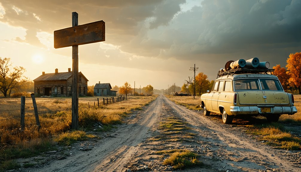
Although Reeders itself has left minimal physical traces in the historical record, accessing Macoupin County’s dispersed prairie settlements requires traversing a patchwork of county roads that follow 19th-century section line surveying patterns.
You’ll need personal transportation since public transportation access remains virtually nonexistent in these rural areas. The prairie settlement landscape reflects its agriculture production heritage through:
- Grid-pattern gravel roads spaced at one-mile intervals following original land surveys
- Unmarked settlement sites accessible only via maintained county thoroughfares
- Seasonal road conditions affecting remote ghost town exploration during spring thaw
- Historical wagon trails occasionally visible alongside modern farm-to-market routes
- Township cemeteries serving as primary wayfinding landmarks for vanished communities
Modern exploration demands detailed county maps, GPS coordinates, and landowner awareness, as many historical sites now occupy active agricultural properties.
Safety Considerations for Undermined Land
Undermined land presents documented hazards that transformed from active mining risks into persistent public safety threats. You’ll encounter subsidence from undermining through fault reactivation, ground collapse, and fissure formation in areas where extraction compromised geological stability.
The abandoned mine collapse risks you face include shaft falls when ground disappears under weight or vibrations, cave-ins from deteriorated wooden and metal supports, and highwall failures that bury or plunge visitors. Between 2000-2013, these conditions caused 381 deaths and 152 injuries at abandoned sites. What appeared safe one season becomes deadly the next as structural deterioration accelerates.
You’re traversing terrain where 27,520 ground control accidents produced 122 fatalities and 65 permanent disabilities from 2000-2021. Stay on marked trails and avoid mine openings, highwalls, and unguarded pits.
Combining Reeder With Sangamon County Sites

After traversing the physical hazards of undermined terrain, you’ll maximize your ghost town exploration by linking Reeder’s with Sangamon County’s vanished settlements in a single route. The historical significance of Reeder merges with Sangamon’s railroad and mining casualties across central Illinois highways connecting both counties.
Your combined route includes:
- Reeder’s south of Hettick – completely vanished mining settlement without structures
- Rienzi near Lake Sangchris – abandoned 1851, schoolhouse survived until 1948
- Jamestown (Jimtown) – local community connections to James Frazier Reed of Donner Party fame
- Howlett coal seams – originally drilled for oil before becoming Riverton
- Paper town Westminster – three lots sold but never developed
You’ll traverse rural paths linking these railroad-bypassed villages that lost infrastructure battles. Total distance spans mining ghost clusters where resource depletion ended settlements.
Essential Supplies for Your Central Illinois Ghost Town Adventure
Successfully traversing central Illinois’s abandoned settlements requires specific equipment tailored to the region’s unique hazards—undermined coal seams, overgrown structures, and remote locations with limited cellular service. Your pack should contain sturdy boots for maneuvering uneven terrain at sites like Pillsbury Mill, flashlights for exploring gutted factories, and first-aid supplies for handling scrapes from debris. GPS devices prove essential where historic preservation efforts haven’t maintained roadways, while paper maps detail Route 66’s dual southern Illinois alignments.
Cameras document massive grain silos before they collapse, and drones survey church ruins from safe distances. Don’t overlook survival essentials: water bottles, non-perishable snacks, and portable chargers maintain your autonomy in remote prairie ghost towns. Gloves protect against torn railings where sustainable mining practices never materialized, leaving hazardous industrial remnants.
Frequently Asked Questions
Are There Guided Tours Available for Reeder Ghost Town Visits?
No professional tour guides operate at Reeders Ghost Town currently. You’ll need to plan self-guided tours independently, exploring this forgotten Southern Illinois site on your own terms without commercial restrictions or scheduled group visits limiting your experience.
Can I Camp Overnight Near Reeder or Other Macoupin Ghost Towns?
You’ll find limited primitive camping sites near Macoupin County ghost towns. Contact the Macoupin County Historical Society recommendations for private landowner permissions and approved locations. Most explorers camp at established state parks within driving distance of Reeder.
What Is the Best Season to Visit Central Illinois Ghost Towns?
Fall paints the perfect backdrop—you’ll find autumn foliage frames abandoned buildings beautifully while mild temperatures let you explore freely. The serene atmosphere intensifies during October when fewer crowds roam and daylight hours provide safe access to remote historical sites.
Do I Need Special Permits to Explore Reeder’s Remaining Structures?
You won’t need IDNR permits for passive exploration, but you’ll face private property concerns requiring landowner permission. Always follow historical preservation guidelines when photographing structures, and verify current ownership before accessing Reeder’s remaining buildings.
Are There Restaurants or Gas Stations Near Reeder for Road Trippers?
You’ll find the cupboard pretty bare near Reeders—this forgotten settlement lacks nearby services. For basic amenities available, you’ll need to backtrack to larger towns where small local diners and gas stations serve travelers exploring Illinois’s abandoned corners.