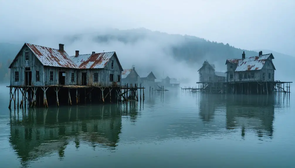
You’ll discover Tennessee’s most haunting attraction beneath Watts Bar Lake’s surface, where the 19th-century mineral springs resort of Rhea Springs has rested since 1942. Launch your kayak at dawn from Rhea Springs Recreation Area during fall months when lower water levels reveal foundations of seventeen houses, the grand hotel, and marble columns 80 feet down. The rusty water tower still pierces the waterline as a ghostly sentinel, and your journey can extend to nearby submerged communities like Loyston under Norris Lake for a complete exploration of TVA’s buried history.
Key Takeaways
- Launch from Rhea Springs Recreation Area at dawn for calm water and best visibility of submerged structures below.
- Visit during fall months when lower lake levels and colorful foliage create optimal viewing and photography conditions.
- Bring kayaks or paddleboards to explore the site; the rusty water tower remains visible above the waterline.
- Look for foundations 80 feet underwater, including seventeen houses, hotel remains, and marble spring house columns.
- Plan weekday visits to avoid crowds and allow uninterrupted exploration of the submerged ghost town ruins.
The Rise and Fall of a Nineteenth-Century Health Resort
Before modern medicine transformed healthcare, desperate seekers of relief made pilgrimages to natural springs rumored to hold miraculous healing powers. You’ll discover Rhea Springs emerged as Tennessee’s premier nineteenth-century health destination, where mineral water properties promised cures for liver, stomach, and kidney ailments.
Native Americans first recognized these sulfur-rich waters as healing fountains, and by the 1870s, a lavish hotel anchored a thriving community of hundreds. When yellow fever ravaged Chattanooga in 1878, refugees escaped to this remote thousand-acre sanctuary. Shops, saloons, and homes sprawled across the landscape, hosting dances that drew international crowds.
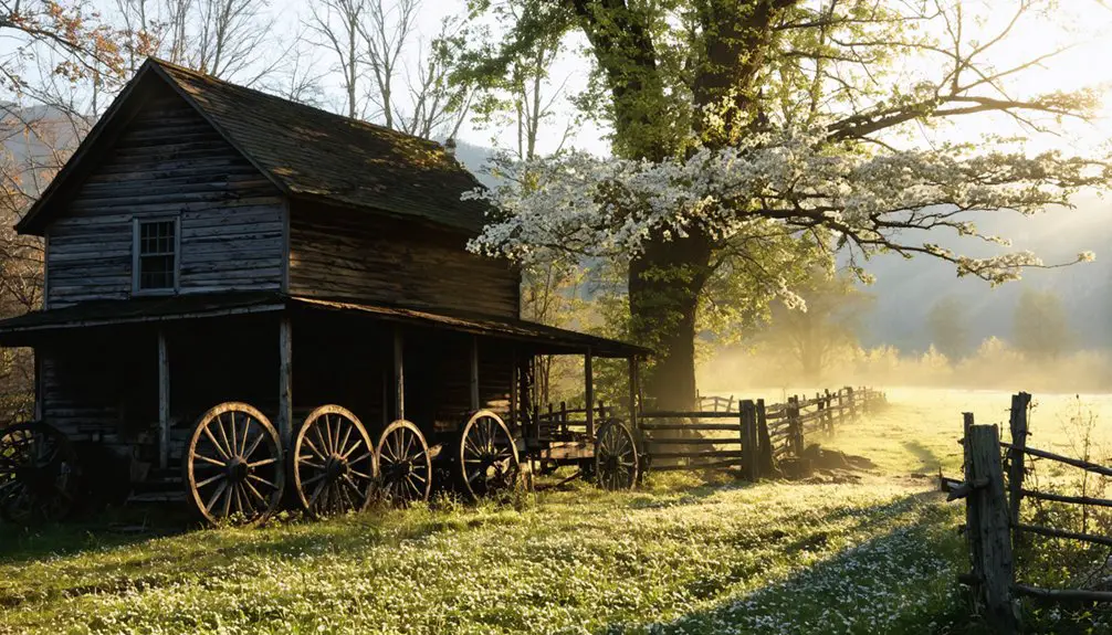
The resort flourished until the 1930s, when land acquisitions began dismantling this once-vibrant settlement. Today, you’ll find only early architectural remains—a cemetery and fading foundations marking where health-seekers once gathered.
How TVA’s Watts Bar Dam Changed Everything
When Franklin D. Roosevelt’s New Deal brought the Tennessee Valley Authority to this region in the 1930s, Rhea Springs’ fate was sealed.
The completion of Watts Bar Dam in 1942 transformed the valley forever—farmhouses, general stores, and the remnants of the old resort town vanished beneath the rising waters of the newly formed reservoir.
You’re now standing above what was once a thriving community, its streets and buildings entombed 30 feet below the placid surface of Watts Bar Lake.
Dam Construction Timeline Details
The U.S. Army Corps of Engineers first spotted this dam site’s potential in the early 1870s, but it’d take nearly seven decades before construction began. After TVA received authorization on March 16, 1939, they broke ground at Watt Island on July 1, 1939.
You’ll appreciate the urgency in the dam construction timeline—workers completed the massive 112-foot-high, 2,960-foot structure by January 1942, just three weeks after Pearl Harbor. The dam planning details reflected wartime necessity. The first generator sparked to life on February 11, 1942, delivering desperately needed electricity for the war effort.
Four more generators followed through 1944, creating hydroelectric power that’d forever transform this Tennessee River valley—and doom Rhea Springs beneath rising waters.
Communities Lost Underwater
As Watts Bar Dam‘s gates closed in 1942, rising waters swallowed entire communities whole—transforming a thriving valley into a 39,000-acre lake that buried lives, livelihoods, and generations of Tennessee history. Community displacement fractured Lower Piney Valley when roughly 800 families watched their world disappear beneath Watts Bar Lake.
By December 31, 1938, landowners surrendered 1,000 acres—dismantling homes, churches, and the grand Rhea Springs hotel that once drew fashionable crowds from Memphis and Atlanta.
Resident relocations scattered neighbors who’d shared generations along these tree-lined riverbanks. Most families rebuilt in Spring City or Dayton, while others ventured beyond Tennessee’s borders entirely. Today, you’ll paddle over their submerged schoolhouses and Methodist church—silent monuments to progress’s price, visible only to divers brave enough to explore what freedom cost.
What Lies Beneath the Waters Today
Ghostly remnants of Rhea Springs rest in their watery grave, some 80 feet below Watts Bar Lake’s surface. You’ll find seventeen small houses and the grand resort hotel foundations preserved in the depths, alongside the schoolhouse concrete blocks and the spring house’s marble columns.
When winter draws water levels low, you can spot the rusty water tower still standing above the waterline—a haunting sentinel marking where guests once sought healing in mineral-rich springs.
These submerged structures attract underwater archeological research teams documenting what TVA surveys recorded in the late 1930s. Historical preservation efforts focus on the visible mill stones and foundation remnants.
From Rhea Springs Park’s overlook, you’re gazing at Tennessee’s own “Lost Atlantis”—a complete community frozen in time beneath the waves.
Best Times and Methods to View the Ruins
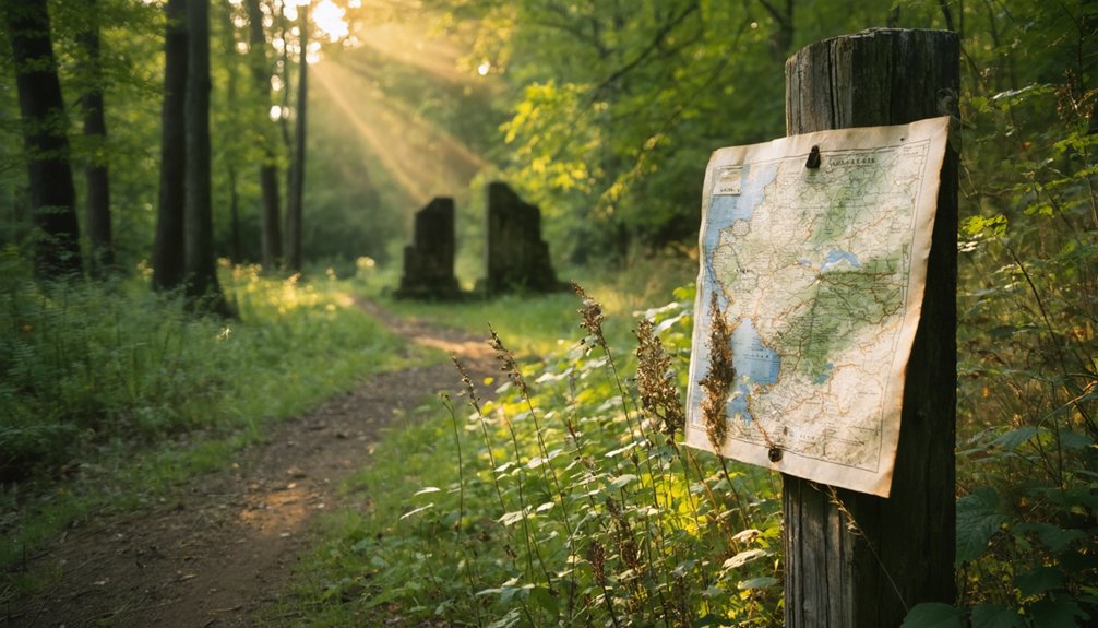
Timing your visit to these underwater ruins can mean the difference between glimpsing shadowy outlines and spotting actual foundation stones jutting through the surface. Launch your kayak from Rhea Springs Recreation Area at dawn when calm waters reveal structural remnants beneath glassy reflections.
Fall months offer dual rewards—lower lake levels expose more foundations while vibrant foliage frames your viewing angles. Check TVA water reports before departing; post-drought conditions can drop levels twenty feet, transforming submerged walls into visible landmarks.
For photography tips, paddle out during golden hour when low sun illuminates stone patterns underwater. Stand-up paddleboards provide elevated perspectives impossible from traditional boats. Weekday visits slash crowds by seventy percent, giving you uninterrupted exploration. Winter’s sparse vegetation opens shoreline sightlines you’ll miss during leafy seasons.
Activities at Rhea Springs Recreation Area
Beyond exploring submerged foundations, Rhea Springs Recreation Area delivers a full menu of lakeside activities that’ll keep you busy from sunrise to sunset. Cast your line from the 35-foot fishing pier where bass and catfish bite year-round, or launch your boat from the ramp to explore 38,000 acres of Watts Bar Lake.
The sandy beach beckons swimmers, while kayakers glide along 1,837 feet of pristine shoreline with scenic lake views stretching to the horizon. Pitch your tent at waterfront campsites equipped with fire pits and picnic tables, or claim one of 42 day-use tables for family friendly recreation.
Clean bathhouses, ample parking, and maintained facilities mean you’ll spend less time planning and more time living freely on Tennessee’s wild waters.
Other Submerged Communities Worth Exploring Nearby
The Tennessee Valley Authority’s dam-building spree throughout the 1930s didn’t just claim Rhea Springs—it swallowed entire communities across the state, creating an underwater museum of lost towns you can still explore today.
Head northeast to Norris Lake, where Loyston’s remains lie beneath the Clinch River. Lewis Wickes Hine photographed this century-old settlement in 1933, just before the waters rose.
Down at Chickamauga Dam, you’ll find Hamilton County’s flooded towns: Soddy, with its drowned hosiery mill and gristmill; Harrison’s submerged schoolhouse and stores; and Bakewell, an African-American community of forty families. The relocation challenges forced 2,000 families from their homes, devastating local economies.
Visit Jefferson in Davidson County—where engineering miscalculations left burned foundations exposed instead of underwater, revealing the human cost behind economic impacts and government overreach.
Essential Tips for Your Visit

Your ghost town adventure hinges on timing—monitor TVA lake level reports before heading out, since drought conditions reveal foundations and artifacts normally hidden beneath twenty feet of water.
Pack sturdy boots for rocky terrain, a camera with zoom capability, and topographic maps showing the old town layout against today’s shoreline.
Since you’re already in the region, plot a route connecting Rhea Springs with other submerged TVA communities like Butler or Loyston to maximize your journey through Tennessee’s drowned history.
Check Lake Level Timing
Planning your ghost town adventure at Rhea Springs hinges on one critical factor: water levels at Watts Bar Reservoir. Before you pack your gear, check NOAA’s WBTT1 gauge for real-time readings at Tennessee River mile 532.5R. You’ll also want to monitor reservoir discharge rates through USGS site 03542512 at Blue Spring.
When levels drop low, you’ll discover exposed shoreline revealing hidden remnants of this submerged settlement. Higher water transforms the experience—perfect for kayaking over what once was town streets, but limiting land exploration.
Check rainfall predictions year-round, as weather dramatically impacts your access along Old Rhea Springs Road. These forecasts aren’t just helpful—they’re essential for avoiding closures and ensuring the 1,837-foot shoreline remains accessible during your visit.
Bring Appropriate Exploration Gear
While most ghost town adventures require little more than sturdy boots, exploring Rhea Springs demands preparation for both land and water encounters. You’ll want suitable footwear that can handle muddy shorelines and slippery rocks near the water’s edge.
Winter visits, when lake levels drop to reveal the submerged schoolhouse remnants, mean traversing wet, uneven terrain around the exposed foundations.
Pack waterproof cameras to capture these haunting ruins without risking your equipment. The site’s accessibility as a public park means you won’t need specialized diving gear, but binoculars help spot distant structures from the shore.
Dress in layers—Tennessee winters can shift quickly from crisp mornings to mild afternoons. Bring water, snacks, and a sense of adventure for your lakeside exploration.
Combine Multiple Ghost Towns
East Tennessee’s ghost towns cluster together like forgotten pearls on a string, making it surprisingly efficient to visit several drowned communities and abandoned settlements in one ambitious road trip. You’ll cover 400 miles connecting Rhea Springs to Loyston, Tharpe, Devonia, and Hopewell—each representing different facets of communities decimated by progress.
Beyond the Tennessee borders, a fascinating exploration awaits in the underwater ghost towns in West Virginia. These submerged remnants are a haunting reminder of how nature reclaims its territory and how human ambition can lead to unintended consequences. As you venture into the depths, stories of the lives once lived there echo through the still waters, inviting further inquiry into the history of these lost communities.
The economic impacts of dams hit hardest at Rhea Springs and Loyston, where TVA projects swallowed entire resort towns beneath Watts Bar and Norris Lakes. Meanwhile, Tharpe’s iron furnace ruins and Devonia’s coal mine remnants tell parallel stories of industrial collapse.
This 2-3 day loop lets you camp at Big Ridge State Park, hike Land Between the Lakes trails, and kayak over submerged streets—experiencing Tennessee’s vanished worlds without government-mandated itineraries constraining your exploration.
Frequently Asked Questions
Are There Any Safety Concerns When Diving to Explore the Submerged Ruins?
Like traversing a murky time capsule, you’ll face serious hazards: poor underwater visibility from silt, sharp metal debris, unstable structures, dropping water temperature at depth, entanglement risks, and required TVA permits before exploring these haunting submerged ruins.
Can Visitors Access Pat Guffey’s Book About Rhea Springs History Locally?
You’ll need to contact Pat Guffey directly at (423)-493-3225, as local libraries don’t currently stock his book. The Rhea County Historical Society maintains community archives and resources that’ll help you explore this vanished town’s fascinating story.
Were Any Artifacts or Historical Items Salvaged Before the Community Was Flooded?
Yes, you’ll discover salvaged marble columns, granite stones, and school foundation blocks now incorporated into the memorial. While abandoned structures were flooded, historical documentation through these preserved materials and Pat Guffey’s research keeps Rhea Springs’ story alive.
Do Descendants of Displaced Families Ever Hold Reunions at the Site?
No formal reunions occur, though you’ll occasionally find descendants exploring the site independently, seeking family connections to their past. The location holds deep cultural significance for those whose ancestors called Rhea Springs home before displacement.
Is Scuba Diving Equipment Available for Rent Near Rhea Springs Recreation Area?
Yes, you’ll find scuba gear availability at Rhea’s Diving Services in Maryville, about 60 miles away. They’ve got top-quality SCUBAPRO rentals and can accommodate any diving experience requirements, from beginners to advanced technical divers seeking underwater freedom.