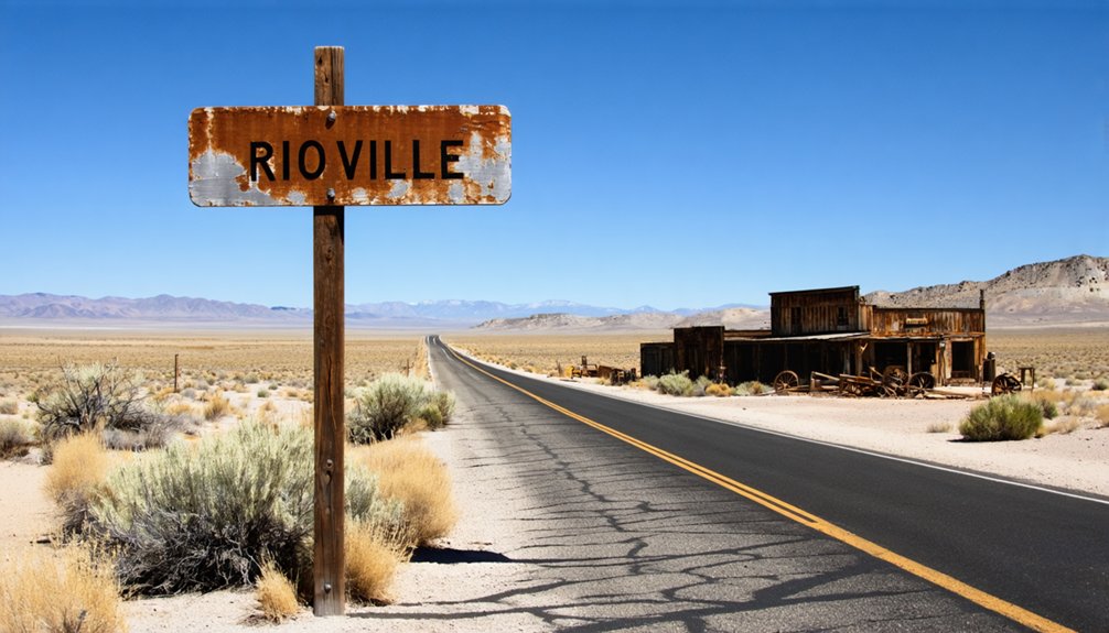
You’ll need diving equipment instead of hiking boots for your Rioville road trip, since Hoover Dam’s completion in 1935 submerged this former steamboat landing beneath Lake Mead. The town once served as the Colorado River’s uppermost navigable point from 1869 to 1887, where ferries charged $10 per wagon crossing until 1934. You can only explore Rioville’s ruins when water levels drop below 1,025 feet, requiring proper diving certifications and compliance with recreation area regulations. The challenges of accessing this underwater ghost town make nearby alternatives worth considering.
Key Takeaways
- Rioville is submerged beneath Lake Mead and only accessible when water levels drop below 1,025 feet.
- A traditional road trip is impossible; visiting requires boating licenses, diving certifications, and compliance with recreation area regulations.
- The town was a Colorado River steamboat landing from 1869-1887 before Hoover Dam’s 1935 completion flooded it.
- Plan visits during seasonal low-water periods to potentially view the underwater ghost town’s remains.
- Removing artifacts is prohibited; use drones and 3-D imaging for documentation while preserving the archaeological site.
The Rise and Fall of Rioville: From Ferry Crossing to Underwater Ghost Town
In 1865, Mormon settler Daniel Bonelli arrived at the muddy confluence where the Virgin River tumbled into the Colorado, carrying orders from Brigham Young to establish a foothold in this remote corner of Nevada. He christened it Junction City, and by 1870, he’d purchased Stone’s Ferry, transforming early settlement patterns into a thriving river crossing.
For two decades, Rioville flourished as the uppermost steamboat landing on the Colorado—440 miles from Fort Yuma. Captain Jack Mellon piloted the Gila here in 1879, while the sloop Sou’Wester hauled salt for silver operations. But economic activities impacting site couldn’t sustain the town forever. When silver mining collapsed in the 1890s, settlers drifted away.
Your road trip ends underwater—Lake Mead swallowed Rioville whole after Hoover Dam‘s completion.
Historical Significance: When Steamboats Reached Their Uppermost Landing
When Captain Jack Mellon steered the steamboat Gila into Rioville on July 8, 1879, he’d just piloted 440 miles upstream from Fort Yuma—and he couldn’t push any farther.
The significance of steamboat arrival transformed this remote Mormon settlement into the Colorado River’s head of navigation. The impact on local population was immediate—wonder-struck residents had never seen anything like it.
Key Facts About Rioville’s Steamboat Era:
- Steamboats operated 1869-1887 during high water seasons
- Sloop Sou’Wester handled low-water traffic 1879-1882, hauling locally mined salt
- Operations ceased in 1887 when silver mining declined
- Post office ran 1881-1906, supporting river commerce
- Ferry continued until 1934, charging $10 per wagon crossing
You’re standing where riverboat captains reached their absolute limit—440 miles of hard-won upstream navigation ended right here.
Understanding Why Rioville Now Lies Beneath Lake Mead
You’ll find Rioville’s story ends with one of America’s most ambitious engineering projects—the Hoover Dam. When workers completed the dam in 1935, the Colorado River’s waters began backing up behind the massive concrete wall, transforming the desert landscape into what we now call Lake Mead.
Hoover Dam’s Construction Impact
The transformation of Rioville from a bustling workers’ settlement into an underwater ghost town began the moment President Coolidge signed the Boulder Canyon Project Act on December 21, 1928. You’ll find that worker living conditions were brutal—480 men crammed into bunkhouses clinging to canyon walls while enduring Mojave heat and hazardous conditions.
Material sourcing challenges shaped everything:
- 3,250,000 cubic yards of concrete required continuous delivery operations
- Four 50-foot diameter diversion tunnels demanded round-the-clock excavation
- 1,250,000 pounds of conducting line stretched across unforgiving desert
- Explosives and dredging equipment traveled through primitive access routes
- 5,251 daily workers needed constant supplies despite remote location
When those Arizona tunnels diverted the Colorado River on November 13, 1932, Rioville’s fate was sealed. Lake Mead would eventually swallow this Depression-era outpost completely.
Lake Mead’s Rising Waters
Between 1935 and 1941, Colorado River waters crept steadily upward behind Hoover Dam‘s concrete face, drowning Rioville beneath what would become America’s largest reservoir. You’re witnessing history repeat itself in reverse—after hitting record lows around 1,050 feet in 2022, Lake Mead’s waters climbed above 1,080 feet thanks to heavy snowpack and experimental releases from upstream. Those exposed ruins you might’ve photographed? They’re underwater again.
Don’t pack your diving gear just yet. Future drought conditions remain the real story here. While recent storms bought temporary relief, water conservation challenges persist as hundreds of thousands of acre-feet evaporate annually from this massive desert surface. Climate scientists predict higher temperatures will accelerate these losses. You’ll need water levels dropping below 1,025 feet to explore Rioville’s streets—nature’s gatekeeping at its finest.
Accessing the Submerged Site: What Modern Visitors Need to Know
Visiting Rioville today presents unique challenges since the ghost town has rested beneath Lake Mead’s waters for nearly ninety years. You’ll need to understand what’s legally and practically possible before planning your expedition.
Exploring a ghost town submerged for nine decades requires careful planning, proper permits, and realistic expectations about what’s achievable.
Essential requirements for accessing the site:
- Comply with Lake Mead National Recreation Area regulations—federal ownership means permits are non-negotiable
- Obtain proper boating licenses and diving certifications for underwater exploration
- Time your visit during seasonal low-water periods when receding levels expose submerged structures
- Utilize drones and 3-D imaging technology for documenting submerged sites without physical disturbance
- Never remove artifacts—archaeological protections carry serious penalties
The hazards of water-based exploration include dangerous currents, extreme depths, and frigid temperatures. Boat tours offer safer viewing alternatives, letting you glimpse Rioville’s location at coordinates 36.1502603, -114.3994176 without risking your life.
Exploring Nearby Ghost Towns: Rhyolite and Gold Point Alternatives

Since Rioville remains frustratingly inaccessible beneath Lake Mead’s surface, you’ll find far more rewarding ghost town experiences at Rhyolite and Gold Point—two remarkably preserved Nevada mining camps that won’t require scuba certification or federal permits.
Rhyolite’s Golden Street showcases spectacular ruins: the Cook Bank Building’s marble staircases, Tom Kelly’s 50,000-bottle house, and Mona Bell’s “Grave” site where travelers leave whiskey tributes.
Below town, Goldwell Museum’s art installations include Szukalski’s haunting “Last Supper” sculptures—accessible 24/7 without entrance fees.
For authentic isolation, drive 90 minutes south to Gold Point’s 13 intact buildings. This privately-owned ghost town offers overnight stays in original miners’ cabins, letting you experience genuine frontier solitude minus bureaucratic restrictions.
Both destinations deliver tangible history you can actually touch.
Building Your Nevada Ghost Town Itinerary From Las Vegas
Las Vegas makes the perfect basecamp for a multi-day ghost town circuit that’ll take you from Rioville’s watery grave to bone-dry camps where wooden structures still creak in the wind.
Start your adventure with Rioville’s submerged history beneath Lake Mead, where ferry operations once charged $10 per wagon. The steamboat navigation marker at Bonelli Landing reminds you when the Gila established civilization’s edge in 1879.
Your Essential Ghost Town Circuit:
- Day 1: Rioville/Lake Mead area (100 miles from Vegas)
- Day 2: Rhyolite via US-95 (120 miles northwest)
- Day 3: Gold Point, Nevada’s living ghost town
- Day 4: Nelson’s cliffside ruins along Lake Mead
- Day 5: Goodsprings mining district return route
Pack your 4×4, camping gear, and curiosity. These forgotten settlements won’t explore themselves.
Frequently Asked Questions
What Was the Cost to Use Bonelli’s Ferry in the 1880S?
Like a toll bridge to frontier dreams, you’d pay $10.00 for your wagon plus two passengers at Bonelli’s Ferry. Typical ferry fees added $0.50 per extra person. Seasonal ferry schedules ran year-round, keeping your path to adventure open.
Who Piloted the First Steamboat to Reach Rioville in 1879?
Captain Jack Mellon piloted the steamboat Gila to Rioville on July 8, 1879. The steamboat’s captain proved this remote outpost was navigable, revolutionizing early transportation methods and opening 440 miles of freedom along the Colorado River’s wild waters.
When Did Rioville’s Post Office Officially Close?
The mail stopped forever in 1906, closing Rioville’s dusty chapter. You’ll find historical preservation efforts now protect these windswept ruins as tourism attractions, where you’re free to explore Nevada’s untamed past without boundaries or guided tours restricting your adventure.
How Far Is Lake Mead From Las Vegas by Car?
The driving distance from Las Vegas to Lake Mead spans 26-37 miles, depending on your chosen scenic route. You’ll enjoy freedom cruising this half-hour journey, where desert landscapes unfold dramatically before reaching the shimmering reservoir’s ancient shores.
What Was Rhyolite’s Peak Population During Its Boom Years?
Rhyolite peaked at around 5,000 residents during 1907-1908 before Rhyolite’s mining operations collapsed. You’ll witness how Rhyolite’s population decline transformed this once-thriving town into haunting ruins—a powerful reminder of boom-and-bust freedom that defined the Wild West.


