Start your Lost Colony road trip at Fort Raleigh National Historic Site on Roanoke Island, where you’ll explore reconstructed earthworks from the 1585 settlement. Drive 50 miles south along Highway 12 to Hatteras Island—the historic Croatoan—where archaeologists have unearthed 16th-century gunlocks and metalworking tools suggesting the colonists’ fate. Time your visit between spring and fall for ideal exploration, and catch “The Lost Colony” outdoor drama for immersive storytelling. The complete story behind each archaeological discovery reveals even more compelling evidence.
Key Takeaways
- Fort Raleigh National Historic Site preserves the 1585 earthen fort with reconstructed elements and archaeological treasures from the colony.
- “The Lost Colony” outdoor drama has run since 1937, offering summer performances about the mysterious disappearance of colonists.
- Highway 64 and 12 follow John White’s colonial map, creating a scenic coastal drive through historic exploration territory.
- Spring through fall provides ideal exploration conditions, while summer offers the best opportunity for outdoor theater performances.
- Archaeological sites display crucibles, musket balls, German jettons, and Elizabethan ceramics from the vanished 1587 settlement.
The Mysterious Disappearance That Started America’s Greatest Unsolved Mystery
When 117 English settlers stepped onto Roanoke Island‘s sandy shores in 1587, they couldn’t have imagined their names would echo through history as America’s most haunting mystery. Within a month, shortages plagued the settlement.
Leader John White sailed for England, leaving behind his newborn granddaughter Virginia Dare—the first English child born in America. War with Spain kept him away three years.
When White finally returned in August 1590, he found only silent earth and dismantled houses. “CROATOAN” carved on a post pointed toward possible Native American settlements fifty miles south. No bodies. No graves. No distress signals.
Factors impacting colony’s demise remain fiercely debated—starvation, disease, assimilation, or violence. The colonists vanished completely, launching 430 years of unanswered questions that still captivate freedom-seekers drawn to their defiant spirit.
What Happened to the Lost Colonists: Leading Theories Explained
When you examine the evidence, you’ll find compelling accounts suggesting the colonists split into smaller groups and integrated with nearby Native American tribes, forging new lives through intermarriage and cultural adaptation.
Captain John Smith documented reports of Europeans living among tribes in the Chesapeake Bay region during his 1607 explorations, yet these same accounts hint at a darker fate: Powhatan allegedly ordered an attack on colonists who’d relocated there.
Archaeological research supports both peaceful assimilation at some sites and the possibility that violence claimed those who ventured toward the Chesapeake, leaving you to reconcile how the same colonists might’ve experienced radically different endings.
Integration With Native Tribes
For over two centuries, historians and colonists alike believed the vanished settlers of Roanoke had woven themselves into the fabric of Indigenous life—a theory that first emerged in writings from 1605 and gained considerable weight when Captain John Smith‘s contacts among neighboring Native Americans described encounters with men wearing European clothing living west of Roanoke.
The carved message “Croatoan” pointed toward the Indigenous group inhabiting what’s now Hatteras Island. Archaeological evidence strengthens this narrative: hammer scale flakes from blacksmithing, radiocarbon-dated to the late 16th century, suggest societal integration rather than conquest.
Members of the Hatteras tribe later reported white ancestors with gray eyes—tangible proof of cultural exchange. Yet this accepted explanation mysteriously disappeared from historical narratives during the 1830s, coinciding with the Indian Removal Act‘s implementation.
Chesapeake Bay Massacre Theory
A darker possibility emerged from the testimony of Chief Powhatan himself, who confessed to Captain John Smith in 1608 that he’d orchestrated the slaughter of English colonists living among the Chesapean tribe near the bay’s southern shores. Motivated by prophecy warning that strangers would overthrow his rule, Powhatan exterminated both the Chesapeake tribe and any Europeans sheltered there. He displayed brass kettles and iron tools as trophies—artifacts unmistakably English in origin.
Yet the accuracy of Powhatan’s account remains contested. Critics suggest he exaggerated to intimidate Jamestown settlers. More troubling: archaeological evidence in lower Chesapeake has yielded nothing—no 16th-century settlements, graves, or genetic traces linking to Roanoke’s vanished colonists. Without excavation discoveries, this chilling theory stays tantalizingly unproven, hovering between historical fact and calculated deception.
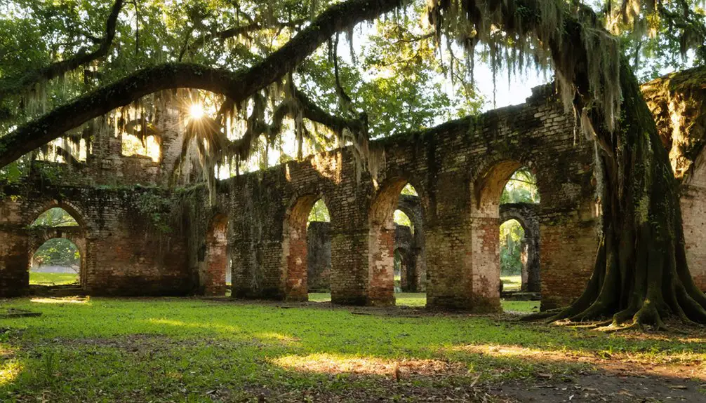
Fort Raleigh National Historic Site: Your First Essential Stop
Standing at the threshold of America’s oldest colonial mystery, Fort Raleigh National Historic Site beckons history enthusiasts to the windswept shores of Roanoke Island. You’ll discover reconstructed elements of the 1585 earthen fort, where England’s first New World colonists battled native attacks and supply shortages before vanishing without trace.
Ranger led tours guide you through archaeological treasures—Indian pipes, iron sickles, metal counters—that whisper stories of Algonquian peoples, desperate English settlers, and nearly 4,000 freed slaves who built their own community here during the Civil War.
The restored 1950s fort mound rises like a silent sentinel, commemorating the 116 colonists who disappeared into history’s shadows. This sacred ground defines America’s tradition of sacrifice, inventiveness, and courage against impossible odds.
Experience “The Lost Colony” Outdoor Drama at Waterside Theatre
Since 1937, America’s longest-running outdoor symphonic drama has transformed summer evenings into portals where history breathes across Waterside Theatre’s massive stage. You’ll witness over 100 performers bring the 1587 settlement to life through epic battles, Native American dances, and the haunting mystery of Virginia Dare’s disappearance. The actors’ performances unfold on a stage three times larger than Broadway’s, built precisely where colonists once stood.
Production evolution has elevated this Pulitzer Prize-winning drama from Paul Green’s original vision into an immersive experience with enhanced choreography and music. From May through August, you’ll sit under stars at the Roanoke Sound’s edge, watching history materialize around you.
The fort’s doors literally open to water views—the same waters that swallowed 117 souls into America’s oldest unsolved mystery.
Exploring Roanoke Island’s Historic Settlement Locations
Weathered earthworks rise from Roanoke Island’s soil, silent witnesses to two desperate English settlements that clung to this windswept shore before vanishing into legend. You’ll discover Fort Raleigh National Historic Site first, where 1585’s military outpost once stood—107 men who built their fortifications using wattle and daub before abandoning everything.
The role of environmental factors becomes clear as you explore how shallow waters and coastal isolation doomed both attempts at permanence.
At Roanoke Island Festival Park, you’ll step into the 1585 colony’s recreated life. Try blacksmithing, examine soldier’s armor, and understand their daily struggle. Seasonal interpretation changes bring authenticity—summer’s tree shade mirrors their experience, while winter campfires echo the urgency they felt building shelters before deadly cold arrived.
Freedom-seekers who became prisoners of circumstance.
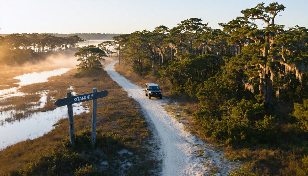
Journey to Croatoan: Following the Clues to Hatteras Island
When you stand before the weathered wooden post where “Croatoan” was carved in 1590, you’re reading the colonists’ own breadcrumb—a deliberate message pointing fifty miles south to Hatteras Island. This wasn’t a cry for help but a relocation notice, directing Governor White to their allies among the Croatoan people who’d befriended them since 1584.
Since 1998, archaeologists have unearthed compelling proof on Hatteras: blacksmithing workshops, repurposed English tools, and a bronze Tudor rose—tangible remnants of colonists who didn’t vanish but chose integration over isolation.
Carved Message at Roanoke
- “CROATOAN” carved in capital letters on the fort’s palisade post
- “CRO” etched into a tree along the sound shore’s bluff
- No Maltese cross—the pre-arranged distress signal’s absence suggested voluntary relocation
These carvings weren’t desperate scratches but carefully graven messages following the 1587 protocol White established with his colonists. The clear lettering pointed toward Croatoan Island, home of Manteo’s people near Cape Hatteras.
Without that telltale cross, White interpreted the message as hope—his daughter, granddaughter, and fellow settlers had chosen their destination freely.
The Croatoan-Hatteras Connection
Standing before those carved letters in 1590, John White knew exactly where his colonists had gone—fifty miles south to Croatoan Island, where his trusted ally Manteo’s mother ruled as chieftain. You’ll find this connection essential to understanding the mystery. Manteo, proclaimed Lord of Roanoke in 1587, provided the perfect refuge for desperate settlers.
Today’s Hatteras Island formed when a 1672 inlet closure merged Hatorask and Croatoan islands. Recent archaeological discoveries—including blacksmithing evidence and English metalworking tools—prove colonists lived among the Croatoan for decades. Their assimilation created descendants whose croatan influenced cultural preservation continues through eastern Carolina tribes.
Historic maps reveal Croatoan territory stretched across mainland Dare County, fueling modern ancestral land claims disputes. You’re following footsteps that vanished into willing integration, not tragedy.
Archaeological Evidence Since 1998
The sandy soil of Hatteras Island kept its secrets buried until Hurricane Emily tore through in 1993, exposing a dark midden layer in Buxton Woods that would rewrite the Lost Colony narrative. Dr. David Phelps’s 1998 excavations uncovered thousands of artifacts spanning Native American and European origins.
You’ll find evidence of colonial life intertwined with Croatan culture:
- 16th century snaphance gunlock and copper items indicating European presence
- Glass beads, lead shot, and pipe fragments suggesting trade networks
- Hammerscale flakes providing evidence of post colonial Croatan Indian metalworking
The discovery of a brass signet ring initially electrified researchers, though analysis revealed its composition of 17th century brass with high copper levels, dating it after the colonists’ arrival. These finds suggest English survivors integrated into Croatan society.
Scenic Outer Banks Drive Along the Colonial Exploration Route
As you trace Highway 64 eastward toward the Outer Banks, the landscape gradually transforms from mainland forests into the distinctive coastal geography that John White captured with remarkable precision in his 1585 Virginea Pars Map. You’ll cross bridges spanning the same sounds where colonial watercraft once navigated between Roanoke Island and the mainland.
The long barrier islands stretch before you—unchanged in their essential form since Harriot’s surveys documented them with NASA-level accuracy. Drive south along Highway 12, and you’ll pass Croatan Sound, Ocracoke Inlet, and Cape Lookout, each marked on White’s original map. These coastal landmarks guided desperate colonists seeking inland routes along the Roanoke and Chowan Rivers. Today’s asphalt simply follows their water-bound paths to freedom.
Getting There: Routes, Airports, and Best Times to Visit

Planning your journey to this haunted colonial outpost requires some strategic thinking about roads, airports, and seasonal timing. You’ll find modern infrastructure connects you seamlessly via U.S. Highway 64, bridging mainland to this mysterious island where 117 colonists vanished without trace.
Your arrival options:
- Fly into Norfolk International Airport (Virginia’s gateway), then drive Highway 64 across Roanoke Sound
- Navigate regional airports in Dare County with direct mainland access
- Utilize Billy Mitchell Airport for closer small-craft landings
While year round attractions include Fort Raleigh National Historic Site, spring through fall delivers prime exploration conditions. Summer brings peak crowds to outdoor theater performances, but shoulder seasons offer solitude among the whispers of history. Winter’s harsh Outer Banks weather might mirror the colonists’ struggles, though accessibility remains constant for determined ghost town seekers.
Archaeological Evidence and Artifacts You Can See Today
Beneath your feet on Roanoke Island lies tangible proof of England’s most baffling colonial mystery—fragments of crucibles, musket balls, and German jettons that J.C. Harrington’s team unearthed decades ago.
You’ll find evidence of early blacksmithing at Hatteras Island, where buckets of hammer scale reveal colonists forging alongside the Croatoan tribe.
Potential fort site excavations at Harriot Woods emerged after researchers examined John White’s 1585 map, uncovering artifacts that pinpoint colonial structures.
Venture inland to Sites X and Y near the Chowan River, where ground-penetrating radar detected wooden remains and Elizabethan ceramics.
Though most artifacts reside in museums, visiting these excavation sites connects you directly to America’s greatest disappearance—where 117 souls vanished into frontier wilderness.
Frequently Asked Questions
Are There Guided Tours Specifically Focused on the Lost Colony Mystery?
You’ll find guided tours by local historians at Fort Raleigh National Historic Site, exploring the Lost Colony’s vanishing daily. Self-guided walking tours wind through original earthworks, while evening ghost walks reveal haunting tales of Virginia Dare’s disappeared settlers.
What Dining Options Are Available Near Fort Raleigh and Roanoke Island?
You’ll find exceptional local seafood restaurants like The Hungry Pelican near Fort Raleigh, plus Poor Richard’s iconic waterfront dining. Explore Manteo’s vibrant seasonal produce markets, then savor fresh-caught fare at Lost Colony Tavern’s atmospheric setting overlooking historic waters.
Can Visitors Participate in Any Archaeological Digs or Citizen Science Programs?
Like treasure hunters glimpsing gold, you’ll watch ongoing archaeological surveys from the sidelines. Unfortunately, citizen science volunteer opportunities aren’t available—professional archaeologists control the digs, though you’re welcome to observe their fascinating excavations and attend educational symposiums freely.
Are There Accommodations on Roanoke Island or Nearby Outer Banks Areas?
You’ll find abundant lodging options on Roanoke Island, from charming bed and breakfasts in historic Manteo to waterfront hotels. The nearby Outer Banks offers vacation rentals and campgrounds nearby, letting you explore this mysterious coast at your own pace.
Is the Fort Raleigh Site Accessible for Visitors With Mobility Limitations?
Yes, Fort Raleigh welcomes you with excellent wheelchair accessibility throughout paved pathways connecting historic sites. You’ll find convenient handicap parking options near the visitor center, ensuring your journey through America’s mysterious lost colony remains barrier-free and adventurous.