Salem, Kansas is a ghost town in Douglas County that once carried three names—Louisiana, Brooklyn, and Salem—making it one of the region’s most layered frontier sites. You’ll find minimal structures, scattered foundations, and a historic cemetery near Eudora, so bring a printed map since cell service is unreliable. Start your road trip here, then compare it to Fall Leaf and other vanished settlements nearby. There’s far more to uncover about this forgotten corner of Kansas history.
Key Takeaways
- Salem, Kansas, also known as Louisiana and Brooklyn, is a ghost town in northeastern Douglas County near Eudora, worth exploring for its layered history.
- Railroads bypassing Salem caused economic decline, relocating commerce and gradually leading to population loss and full community abandonment.
- No interpretive signs or parking exist; bring a printed map, as cell service is unreliable and private property boundaries must be respected.
- Scattered foundation outlines, stones, and a local cemetery are the primary remnants; plat maps and historical society resources provide additional context.
- Start at Salem, then visit Fall Leaf and Douglas County historical markers to compare settlement patterns and understand regional ghost town history.
What Is Salem, Kansas: and Why Does It Have Three Names?
When you start digging into Douglas County’s forgotten settlements, Salem, Kansas pulls you in immediately — not just because it’s a ghost town, but because it can’t seem to agree on its own name.
Salem history shows this community carried three distinct identities: Louisiana, Brooklyn, and Salem. Each name reflects a different chapter in its development, tied to shifting settlers, changing ambitions, and evolving local priorities.
Name origins like these aren’t unusual in early Kansas. Communities renamed themselves as populations turned over, political winds shifted, or new settlers wanted a fresh start.
You’ll find Salem pinned at 38°48′15″N 95°12′36″W in the Eudora area of northeastern Kansas — a precise location for a place that couldn’t quite pin down its own identity. That tension makes it worth exploring.
Where in Douglas County Is the Salem Site Located?
Pinpointing Salem on a modern map takes a little patience, but the coordinates don’t lie: 38°48′15″N 95°12′36″W places the site squarely in Douglas County‘s northeastern corner, close to the Eudora area.
Once you’ve got those location details loaded into your GPS or plotted on a paper map, you’ll find the ghost town sits within a landscape shaped by river corridors and old settlement trails.
Load the coordinates and you’ll discover a ghost town cradled by river corridors and forgotten settlement trails.
Northeastern Douglas County rewards explorers willing to look past suburban sprawl toward quieter rural patches where history lingers.
Salem’s position near Eudora means you’re never far from paved roads, making access straightforward.
You can treat this ghost town as a natural anchor point and pair it with other vanished Douglas County communities on the same drive, maximizing your time and your freedom on the road.
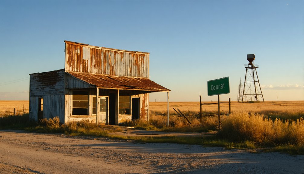
Why Did Salem Vanish? Railroad, Economics, and Decline
Salem didn’t vanish overnight—it faded the way most Kansas ghost towns do, through a slow drain of economic relevance that left little reason for anyone to stay.
Railroad impact played a decisive role. When rail lines bypassed smaller settlements, commerce naturally followed the tracks to better-connected towns. Businesses relocated, residents followed, and communities like Salem quietly dissolved.
Economic shifts compounded the damage. Agriculture, trade, and local institutions all depended on steady population and reliable transportation. Once those foundations crumbled, no post office, church, or school could hold a community together.
You can trace this exact pattern across Douglas County’s vanished settlements. Salem, Brooklyn, Louisiana—these names represent the same story told three different ways, each reflecting a community that simply ran out of reasons to survive.
What Survives at the Salem Site Today
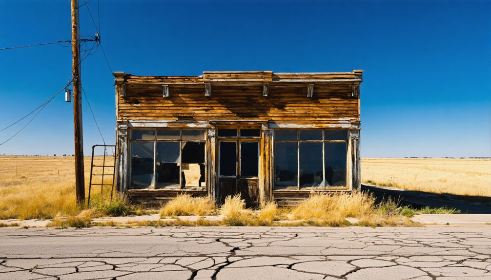
When you pull up to the Salem site today, you won’t find much standing above ground, but the remnants that remain still tell a quiet story about the community that once called this Douglas County corner home.
You can scout for foundation outlines, scattered stones, or any historical markers that local preservation efforts may have placed to anchor the site’s identity.
Bring your camera, because even a sparse landscape rewards a careful eye with textures, shadows, and structural fragments that photograph beautifully against the open Kansas sky.
Remnants Still Standing Today
Though Salem’s exact footprint has largely dissolved back into the Kansas prairie, scattered traces of the original settlement still anchor the site to its past. You may find old foundation outlines, remnant fence lines, or weathered stones hinting at structures that once defined daily life here.
A local cemetery, if preserved, often carries the strongest historical significance, linking names and dates directly to the families who built this community. These quiet markers carry the community legacy forward when buildings no longer can.
Bring a detailed county map or GPS coordinates — 38°48′15″N, 95°12′36″W — so you can navigate the site confidently. The land is subtle, so walk slowly, look carefully, and let the details speak rather than expecting dramatic ruins to announce themselves.
Historical Markers And Foundations
What little remains at the Salem site tells a quiet but legible story if you know how to read the land. Its historical significance lives in fragments you’ll need to seek out deliberately.
Look for these markers of community legacy:
- Foundation outlines — Stone or brick remnants mark where structures once anchored daily life.
- Depressed ground patterns — Sunken soil reveals former cellar locations invisible from a distance.
- Isolated cemetery plots — Small, fenced graveyards often survive long after buildings disappear.
- Historical survey markers — GPS coordinates (38°48′15″N 95°12′36″W) pinpoint Salem’s exact footprint.
You won’t find interpretive signage or manicured pathways here. That’s the point.
Salem rewards the curious traveler willing to piece together a vanished world from what the earth quietly preserved.
Photographing The Salem Site
Photographing Salem demands patience and a good eye for subtlety, because the site offers texture and mood rather than dramatic ruins.
You’ll find your best ghost town photography in the details — weathered depressions where foundations once sat, fence lines disappearing into overgrowth, and mature trees that once shaded doorways.
Shoot during golden hour when low light carves shadows across uneven ground, revealing contours invisible at midday.
Bring a wide lens for landscape context and a macro lens for close details like rusted metal or crumbling stone.
Your historical documentation work here matters because Salem leaves few obvious traces.
Each photograph preserves evidence of a community that existed under three names.
Caption your images carefully, noting coordinates and visible features so your record stays useful to future researchers and travelers.
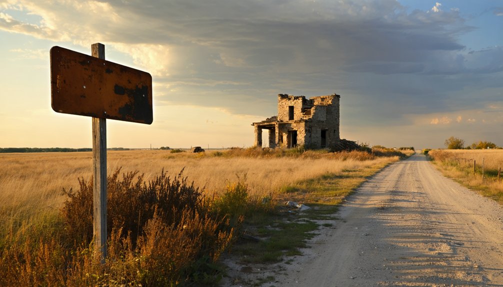
How Salem Compares to Fall Leaf and Other Eudora-Area Ghost Towns
As you explore the Eudora area, you’ll notice that Salem isn’t the only community that faded into history — Fall Leaf shares a strikingly similar story of early promise followed by quiet abandonment.
Both towns followed the same ghost-town blueprint: a burst of settlement activity, a loss of economic momentum, and a gradual disappearance from the map.
Comparing these neighboring sites helps you see that Salem’s decline wasn’t an isolated event but part of a broader pattern that reshaped Douglas County’s landscape.
Salem and Fall Leaf share a remarkably similar obituary: both communities took root in northeastern Kansas, built their identities around local institutions, and quietly collapsed once the economic or transportation forces holding them together shifted away.
Recognizing these shared decline patterns helps you appreciate what you’re actually visiting.
Both towns followed this trajectory:
- Establishment around a post office, church, or school anchoring early settlement patterns
- Growth driven by trail access or local trade before major transportation shifts reshaped the region
- Stagnation once railroads bypassed or rerouted away from the original corridor
- Abandonment leaving only foundations, markers, or scattered remnants behind
When you visit these sites, you’re reading Kansas history written in absence rather than architecture.
Comparing Nearby Ghost Towns
Nothing sharpens your understanding of a ghost town quite like standing next to another one. Near Salem, Fall Leaf offers a striking ghost town comparison. Both communities rose within Douglas County’s northeastern corridor, drew early settlers, and eventually lost their footing when economic and transportation forces shifted.
Fall Leaf left slightly more documented traces, making Salem’s significance clearer by contrast — you recognize what Salem once represented precisely because Fall Leaf followed the same arc. Louisiana and Brooklyn, Salem’s earlier names, add another layer, reminding you that identity itself was unstable in these settlements.
Pairing these sites on your road trip isn’t redundant; it’s revelatory. Each vanished town reinforces the other’s story, turning a single stop into a fuller picture of how Douglas County’s earliest communities quietly disappeared.
Plan Your Salem-Anchored Douglas County Ghost Town Route
Once you’ve pinpointed Salem’s coordinates (38°48′15″N 95°12′36″W) on a map, you can start building a Douglas County ghost town loop that connects several vanished communities in a single drive.
Understanding Salem history and ghost town dynamics gives your route real purpose beyond simple sightseeing.
Follow this four-stop framework:
- Salem/Brooklyn/Louisiana – Begin at the triple-named site near Eudora, grounding yourself in its layered identity.
- Fall Leaf – Head to this nearby ghost town for a direct comparison of settlement patterns.
- Douglas County historical markers – Stop at roadside signs that document vanished institutions.
- Local cemeteries – These often outlast every building, preserving names and dates no map captures.
Travel light, keep your GPS handy, and let Douglas County’s forgotten places tell their own story.
What to Know Before You Visit Salem and Nearby Abandoned Sites
Before you load up the car and head toward Eudora, there are a few practical realities about visiting Salem and its neighboring ghost towns that’ll save you frustration in the field.
Salem History lives largely in coordinates and county records, not standing structures. You won’t find interpretive signs or parking lots — just open land near 38°48′15″N, 95°12′36″W.
Salem exists today as coordinates and county records — no signs, no parking lots, just open land where a town once stood.
Bring a printed map, since cell service gets unreliable in rural Douglas County. Respect private property boundaries, as many ghost-town sites sit on working farmland.
Community Impact from Salem’s era shows in scattered foundations and old plat maps rather than dramatic ruins. Cross-reference local historical society resources before you go, and pair Salem with Fall Leaf for a more complete picture of Douglas County’s vanished settlements.
Frequently Asked Questions
Is There an Entrance Fee to Visit the Salem Ghost Town Site?
You won’t pay an entrance fee to explore Salem’s open landscape. Roam freely through Salem history on your own terms — it’s an accessible ghost town where you’re free to discover Kansas’s forgotten past firsthand.
Are There Guided Ghost Town Tours Available in Douglas County, Kansas?
You won’t find formal guided tours, but you can explore Douglas County’s ghost town history independently, uncovering local ghost stories and vanished settlements at your own pace, embracing true freedom of discovery.
What Is the Best Time of Year to Visit Salem?
Spring and fall offer the best season to visit Salem, Kansas. You’ll enjoy mild weather considerations like comfortable temperatures perfect for exploring. Avoid summer’s heat and winter’s cold — you’re free to roam when nature cooperates!
Can Visitors Legally Access the Salem Site on Private Land?
You’ll need to respect access restrictions before exploring Salem’s site. Legal considerations matter here — always secure landowner permission first. Don’t trespass on private property; instead, contact local Douglas County historical societies to confirm your legal access options.
Are There Nearby Restaurants or Hotels Close to the Salem Site?
Ironically, Salem’s ghost-town charm won’t feed you, but Eudora’s local cuisine and nearby attractions are just minutes away! You’ll find cozy restaurants and comfortable hotels there, perfectly fueling your freedom-filled Douglas County adventure.
References
- https://thewanderingpigeon.com/2015/10/03/day-of-kansas-ghost-towns/
- https://en.wikipedia.org/wiki/Louisiana
- https://www.hhhistory.com/2019/05/ghost-towns-of-kansas.html
- https://www.youtube.com/watch?v=dF7vGl5xasI
- https://legendsofkansas.com/cowley-county-extinct-towns/
- https://www.ksnt.com/news/kansas/keeping-kansas-history-alive-one-ghost-town-at-a-time/
- https://www.facebook.com/EudoraCommunityMuseum/posts/the-ghost-towns-of-the-eudora-area-series-will-profile-the-five-ghost-towns-loca/1087988367889918/
- https://en.wikipedia.org/wiki/List_of_ghost_towns_in_Kansas
- https://abandonedkansas.wordpress.com/2022/02/02/ransomville-kansas/
- https://esirc.emporia.edu/bitstreams/b4b4cde4-15d4-4284-a3b5-8430fb9e324e/download


