Navigate to coordinates 33°11’50″N 89°38’30″W in Attala County, 7.8 miles east of West, where Sand Hill’s red brick grocery store and debris-filled Presbyterian Church await your exploration. You’ll wander narrow dirt streets named Commerce and Magnolia, photographing crumbling foundations strangled by kudzu and peering through the Masonic Lodge’s open doors. Extend your journey to nearby Rodney’s intact church or Rocky Springs’ 19th-century ruins, creating a full day of Mississippi’s forgotten chapters. The routes connecting these sites reveal stories maps rarely tell.
Key Takeaways
- Sand Hill’s main ruins are located in Attala County at coordinates 33°11’50″N 89°38’30″W, 7.8 miles east of West.
- No visitor facilities exist; bring water, supplies, and wear appropriate clothing for exploring overgrown, deteriorating structures.
- Key sites include the Presbyterian Church, Masonic Lodge, Alston’s brick grocery, and remnants along former Commerce and Church streets.
- Combine your trip with nearby ghost towns: Rodney’s church, Grand Gulf Military Park, Rocky Springs, and Electric Mills.
- Access is unrestricted for wandering among ruins, offering an authentic historical experience without guided tours or amenities.
Understanding Sand Hill’s Location and Geography

Tracking down Sand Hill on a Mississippi map reveals an intriguing puzzle—multiple communities share this name across the state’s rural landscapes. You’ll find the Attala County version claiming official ghost town status at coordinates 33°11′50″N 89°38′30″W, perched at 469 feet elevation. This abandoned settlement sits 7.8 miles east of West, a fascinating destination for those seeking Mississippi’s forgotten places.
Meanwhile, Rankin County hosts another Sand Hill on Highway 25, seventeen miles northeast of Flowood at a lower 351-foot elevation. Greene County adds a third variant at the junction of Highways 42 and 63. Understanding this rural geography proves essential before you venture out—each location offers distinct character, though Attala’s ghost town status makes it the most compelling stop for adventurers chasing Mississippi’s lost communities.
The History Behind Sand Hill’s Abandonment
Sand Hill’s descent from prosperity to abandonment reads like a cruel catalog of 19th-century American disasters—epidemics, war, fire, and geography itself conspiring against survival.
You’ll discover a town built on cotton wealth from colonial slave labor, where fertile soil created fortunes until yellow fever struck in 1843. Survivors fled, newspapers from Cleveland to Philadelphia chronicling the exodus. The epidemic returned in 1847, then again in 1898—each wave hollowing out the population.
Civil War shelling damaged the church and homes. An 1869 fire consumed what remained. Then nature delivered the final blow: a massive sandbar shifted the Mississippi River two miles west in 1870, killing the port economy overnight.
The economic impacts of disasters proved insurmountable. By 1930, Mississippi’s governor officially declared Sand Hill dead.
What Remains to See at Sand Hill Today
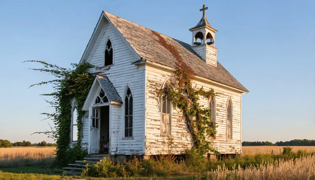
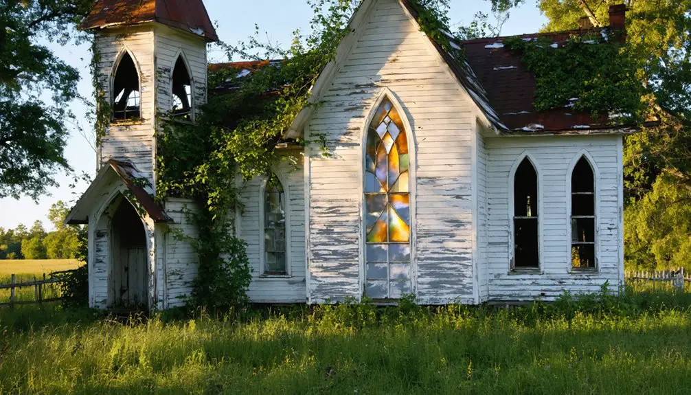
When you arrive at Sand Hill today, you’ll find the Presbyterian Church still standing with its replica cannonball embedded in the facade, though 2011 floodwaters left the interior littered with fallen paneling and debris.
The circa-1890 Masonic Lodge sits near the old Church Street intersection with its doors open, inviting you to peer inside at the decay.
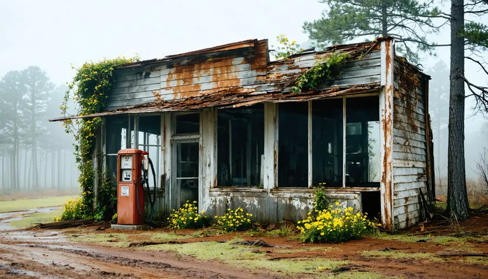
Down at the former Commerce Street corner, Alston’s two-story red brick grocery—the town’s last operating business—remains structurally sound despite years of abandonment.
Current Physical Structures
What you’ll encounter:
- White plastic-covered pews inside the Presbyterian Church, brick walls under repair
- The two-story Masonic Lodge standing sentinel beside Alston’s former grocery
- Crumbling homes swallowed by vegetation, though razor wire and fresh laundry reveal six stubborn souls remain
- Narrow dirt streets where Commerce, Church, Cypress, and Magnolia once thrived
The Mississippi River now flows four miles distant, leaving these structures suspended in abandonment.
Accessible Sites and Features
Driving down the narrow backroads of Attala County, you’ll find Sand Hill’s scattered remains at coordinates 33°11′50″N 89°38′30″W, approximately 7.8 miles east of West. The deteriorating structures stand as silent witnesses to abandonment, their weathered frames slowly surrendering to nature at 469 feet elevation.
You won’t encounter visitor amenities here—no welcome centers or marked trails guide your exploration. This raw authenticity appeals to those seeking unfiltered historical experiences away from commercialized attractions. While conservation efforts remain minimal, the site’s informal preservation allows unrestricted wandering among the ruins.
The quiet remnants evoke Mississippi’s economic shifts and transportation changes that sealed countless communities’ fates. You’re free to document crumbling foundations and overgrown pathways, connecting with the past on your own terms without crowds or regulations dictating your journey.
Exploring Other Mississippi Ghost Towns in the Region
The ghost towns scattered across Mississippi’s southwestern counties tell stories that echo far beyond Sand Hill’s weathered foundations. You’ll find Rodney thirty-two miles northeast of Natchez, where Presbyterian steeples still pierce the skyline above Confederate trenches. Historic preservation efforts have maintained its cemetery’s 200+ graves dating to 1828.
Mississippi’s ghost towns preserve forgotten histories through weathered steeples, Confederate earthworks, and cemetery stones predating the Civil War.
Grand Gulf’s military park showcases archeological investigations through preserved Civil War ruins, while Rocky Springs offers crumbling 19th-century structures you can explore without restrictions.
Regional Ghost Towns Worth Your Detour:
- Rodney – Former river town with intact church and sprawling overgrown cemetery
- Grand Gulf – Claiborne County site featuring military park with accessible ruins
- Rocky Springs – Abandoned settlement near Sand Hill with historical remnants
- Electric Mills – 1910s sawmill community in Choctaw County, peaked at 1,000 residents
Each location lets you wander freely through Mississippi’s forgotten chapters.
Finding Sand Hill requires pinpointing coordinates 33°11′50″N 89°38′30″W in Attala County—not the similarly named settlements in Greene or Rankin counties that’ll send you wandering Mississippi’s backroads in frustration. You’re targeting the spot 7.8 miles east of West, Mississippi, at 469 feet elevation in Central Time.
MapQuest handles traffic and road conditions, while TopoZone reveals terrain features offering cultural insights into why settlers chose this particular ridge. Plan your circuit linking Interstate 55 to rural paths threading past Lewis Ranch and other sites with historical significance. Download offline maps—cellular service vanishes here.
Fuel up in West or nearby communities before committing to these ghost town loops. Multiple Sand Hill locations demand GPS precision: 33.19722°N, 89.64167°W locks you onto the authentic Attala County location.
Photography and Documentation Opportunities
You’ll want to bring a macro lens to capture the weathered textures—I’ve photographed bullet holes in Rodney Church’s ceiling where Confederate rounds tore through during an 1863 service, and the grain of 150-year-old charred wood tells stories no history book can.
Document everything with GPS coordinates and multiple angles; when I returned to Sand Hill’s foundations at 33°11′50″N 89°38′30″W after just three years, flood erosion had claimed another two feet of the brick walls.
Sketch floor plans of ruins before they disappear, noting details like the dive marks still visible in Rodney’s pews from that 1843 pistol incident—these physical records often survive longer than the structures themselves.
Capturing Architectural Decay Details
Photographing Rodney’s ruins demands patience with Mississippi’s unforgiving humidity, which fogs camera lenses within minutes of stepping from an air-conditioned car. You’ll find tracking architectural disrepair most rewarding at the Presbyterian Church, where that replica cannonball sits above the middle window—a haunting reminder of 1863. The floorboards have softened to warm grits consistency, so tread carefully while cataloging architectural evolution.
Essential decay details worth capturing:
- Peach-hued brick walls mid-restoration, contrasting with broken windows and rotting wood
- Baptist Church’s dramatic pointed arches shifting from Greek Revival to Gothic Revival styles
- Spanish moss draping from surrounding trees, framing both silver-domed and bell-towered structures
- Cemetery’s 200+ graves tumbling down the embankment, tombstones fallen among overgrowth
Your best shots emerge during golden hour when low light softens the devastation.
Historical Research Documentation Methods
Beyond capturing crumbling facades, your camera becomes a time machine when you pair each shot with documented historical context. You’ll want to photograph that cannonball replica above the Presbyterian Church doors—it marks where Union gunboats shelled the town in 1863. Document the church’s position 300 yards from where the river once flowed before that 1870 sand bar shifted everything two miles west.
Preserving historical context means cross-referencing your shots with period newspapers. Those 1843 yellow fever reports reached Cleveland and Philadelphia papers, giving you primary sources to cite. When cataloging archival materials, note specific battle details: seventeen Federals captured, cavalry firing through windows, pistol shots through Confederate hats. This research transforms abandoned buildings into tangible evidence of lives disrupted by disease, war, and nature’s indifference.
Safety Considerations When Visiting Abandoned Sites

Exploring abandoned ghost towns demands respect for both the ruins and your own safety. Before heading to Sand Hill, complete thorough equipment maintenance—check your vehicle’s oil, fluids, and tire pressure. Pack recovery gear and share your route plan with someone you trust. Your safety attire matters: wear sturdy closed-toe boots, long pants, and gloves to protect against rusty nails and sharp debris.
When you arrive, assess structural stability before entering any building:
- Test floors by tossing a rock first
- Look up for falling hazards like loose roof materials
- Never explore solo—bring at least one companion
- Trust your instincts and exit immediately if something feels wrong
Always shower after your visit to remove dust and contaminants. Freedom means respecting these boundaries while satisfying your wanderlust.
Preserving Your Experience Through Research and Respect
Before you snap your first photograph at Sand Hill or Rodney, spend time understanding what you’re witnessing. Research the yellow fever epidemics that nearly emptied these streets in 1843, the Confederate cavalry’s bold gunboat capture, and how enslaved people built the cotton empire that once thrived here. These conservation methods—studying before visiting—transform abandoned buildings into meaningful encounters with history.
Walk carefully around the Presbyterian Church, noting the replica cannonball commemorating 1863’s bombardment. Don’t disturb deteriorating structures or remove artifacts; your respect preserves these sites for fellow adventurers. Community engagement means sharing Rodney’s story: the 1870 river shift, the bypassed railroad, the fires that consumed downtown. Document what you see through photographs and words, letting these ghost towns cast their bewitching spell while you tread lightly through Mississippi’s past.
Frequently Asked Questions
What Permits or Permissions Are Needed to Visit Sand Hill?
You won’t need any permits—it’s wonderfully free to explore. Just respect private property access boundaries and follow local historical society guidelines. The crumbling buildings stand open, waiting for your footsteps where Mississippi’s forgotten souls once walked.
Are There Nearby Accommodations or Camping Options for Ghost Town Visitors?
You’ll find accommodations ranging from $52-$109 nightly, including local bed and breakfasts like Wisteria (4.8 rating) and nearby RV parks. Over 1,300 lodging options surround the area, offering freedom to explore Mississippi’s haunting ghost town landscapes at your pace.
What Specific Supplies Should I Bring for a Ghost Town Road Trip?
Pack plenty of provisions: camera equipment captures crumbling memories, comfortable walking shoes conquer uneven terrain, and water keeps you wandering freely. Don’t forget sunscreen, snacks, and first-aid supplies—I’ve learned abandoned places demand self-sufficiency for true exploration.
Can I Legally Take Artifacts or Souvenirs From Sand Hill?
No, you can’t legally take artifacts from Sand Hill without landowner permission. You’ll preserve historic sites and respect cultural heritage by photographing remnants instead. I’ve found memories captured through lenses outlast physical souvenirs while keeping you legally free.
What Are the Best Seasons to Visit Mississippi Ghost Towns?
The best time of year is spring or fall when ideal weather conditions transform your ghost town exploration into pure adventure. You’ll discover mild temperatures, fewer crowds, and open roads—perfect freedom for wandering Mississippi’s forgotten places without summer’s oppressive heat.
As you journey through the region, don’t miss the ghost towns near Inwood Mississippi, which hold stories and remnants of a bygone era. Each abandoned building and overgrown path invites you to imagine the lives once lived there, enriching your adventure. Exploring these hidden gems allows you to connect with history in a way that few other activities can offer.