Scuffletown Bottoms sits along the Ohio River in Henderson County, Kentucky, where a once-thriving settlement has vanished beneath dense bottomland wilderness. Founded around 1800, it’s now a hauntingly beautiful stretch of wild fruit trees, earthen mounds, and reclaimed riverfront. You’ll want a four-wheel-drive vehicle, offline maps, and a close eye on flood advisories before you go. There’s far more to this strange Kentucky ghost town than its quirky name suggests — and its full story is worth uncovering.
Key Takeaways
- Scuffletown Bottoms sits along the Ohio River in Henderson County, Kentucky, accessible via nearby county roads at coordinates 37°55′22″N, 87°22′20″W.
- The 1937 flood erased most structures, leaving only foundation outlines, wild fruit trees, and earthen mounds as historical remnants.
- Visit in late summer or early fall for lower water levels, avoiding flood-prone seasons between February and April.
- Bring a four-wheel-drive vehicle, download offline maps beforehand, and consult locals, as cell service and road markings are unreliable.
- Nearby stops including John James Audubon State Park, Henderson Riverfront, and Shawneetown, Illinois enrich the historical road trip experience.
What Is Scuffletown, Kentucky’s Ghost Town?
Tucked along the banks of the Ohio River in Henderson County, Kentucky, Scuffletown is one of those ghost towns that feels like it’s been swallowed whole by history.
Sitting just above the mouth of the Green River, this forgotten settlement once thrived for nearly a century before floods and time erased it from the map.
Today, locals call it Scuffletown Bottoms, and it carries both ghost stories and historical significance that’ll make any road tripper stop in their tracks.
Scuffletown Bottoms lingers in local memory, haunted by ghost stories and history potent enough to freeze any traveler mid-step.
You’ll find no buildings, no streets, and no signs — just wild bottomland where a real community once stood.
Its coordinates place you at 37°55′22″N, 87°22′20″W, elevation 374 feet, but what you discover there goes far deeper than geography.
Why Scuffletown Has One of Kentucky’s Stranger Origin Stories
What makes Scuffletown’s origin story genuinely strange isn’t just its age — it’s who built it. Around 1800, Jonathan Thomas Scott, son of Shawnee leader Cornstalk, established a riverside tavern here with his Cherokee wife, blending two powerful Native American legacies into one settlement.
That Cherokee heritage deepened when James Martin led refugees from Arkansas to join relatives already rooted there. By the Civil War, Scuffletown had transformed into a rough, strategically significant river town.
Four facts that set this origin apart:
- The founder’s father was a celebrated Shawnee chief
- Cherokee refugees formally received state recognition in 1893
- The town survived the Civil War’s military presence
- Sacred ceremonies still continue near the site today
You won’t find another Kentucky ghost town with roots this layered.
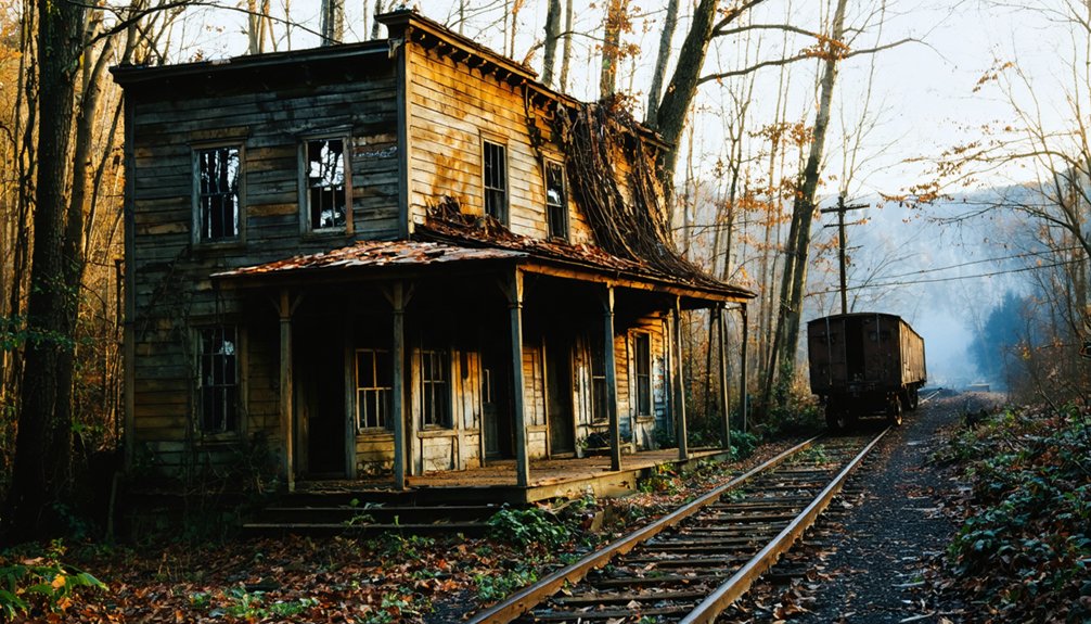
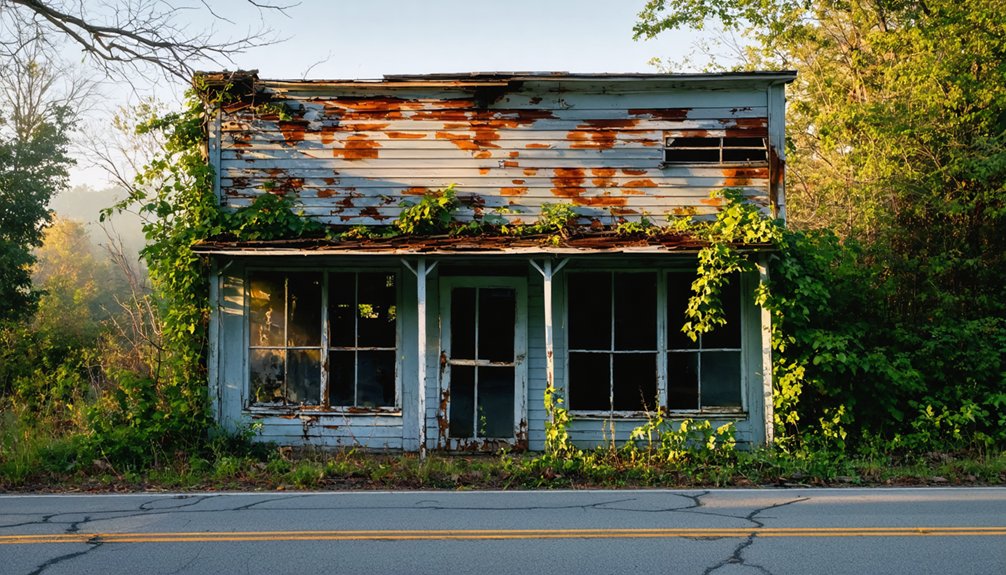
What You’ll Actually Find at This Kentucky Ghost Town
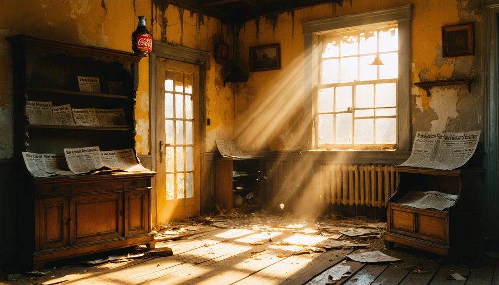
When you make your way to Scuffletown Bottoms today, you’ll find a flood-ravaged landscape where overgrown ruins and scattered remnants hint at a town that once thrived for nearly a century.
The 1937 flood didn’t just drive out the last residents — it erased orchards, homes, and structures so completely that nature has largely reclaimed the land.
What remains is a hauntingly quiet stretch along the Ohio River, quietly shifting into wetland habitat that locals and wildlife now share.
Overgrown Ruins and Remnants
Since the 1937 flood swept away the last of Scuffletown’s structures, nature has spent nearly a century reclaiming what was once a bustling river community.
Today, you’ll find overgrown structures barely visible beneath dense vegetation, and historical artifacts scattered across what locals call Scuffletown Bottoms. Exploring freely means knowing what to look for:
- Foundation remnants — stone and brick outlines of former homes and Scott Fox’s original tavern
- Orchard traces — gnarled, wild fruit trees marking where cultivated land once thrived
- Earthen mounds — natural formations shaped by two devastating floods
- River debris — fragments pushed inland during the 1913 and 1937 flood events
Every overgrown corner tells a story that official history rarely captures.
Flood-Ravaged Landscape Today
Beyond those crumbling foundations and wild fruit trees, the broader landscape itself tells an even rawer story of what two catastrophic floods left behind.
The 1913 flood triggered a mass exodus, but the 1937 deluge completely erased what remained — homes, structures, orchards, all of it gone. That flood history reshaped everything here permanently.
Today, you’ll walk through dramatic landscape changes that nature has fully reclaimed.
The Ohio River still creeps close, and the low-lying Scuffletown Bottoms remain vulnerable to seasonal flooding. Wetland vegetation dominates where neighborhoods once stood.
Muddy soil, tangled brush, and silent open flats replace what was once a functioning riverside community.
You’re fundamentally standing inside a natural timeline — one where water won decisively and never gave the land back.
Wildlife and Wetland Areas
What you’ll find replacing Scuffletown’s vanished streets and homes surprises most visitors — not eerie emptiness, but dense, thriving wildlife habitat.
Nature reclaimed every foundation and orchard after 1937, transforming the bottoms into remarkable wetland conservation territory. Discussions about establishing a protected national wildlife refuge have circulated for years.
Wildlife spotting here rewards patient explorers. Watch for:
- Migratory waterfowl following the Ohio River flyway
- White-tailed deer moving through the bottomland timber
- River otters and beaver working the Green River confluence
- Great blue herons wading the shallow wetland edges
You’re fundamentally walking through a self-rewilded landscape where human history dissolved back into wilderness.
No fences, no rangers, no crowds — just raw, unfiltered nature reclaiming its territory completely.
Best Time To Visit Scuffletown on a Road Trip
You’ll get the most out of your visit to Scuffletown Bottoms in late spring or early fall, when mild temperatures make exploring the overgrown remnants comfortable and the foliage isn’t so thick it blocks the remnants of the old townsite.
Since this low-lying area along the Ohio River sits just above the Green River’s mouth, you’ll want to avoid it after heavy rainfall or during known flood seasons, as the bottoms can become dangerously waterlogged fast.
Check local weather and river level reports before heading out, because the same geography that washed this town away twice can still catch unprepared visitors off guard.
Ideal Visiting Seasons
Though Scuffletown Bottoms rewards visitors year-round, late spring and early fall offer the most comfortable conditions for exploring this hauntingly quiet stretch of the Ohio River.
Each season reveals something different about this place steeped in local legends and historic preservation efforts:
- Spring – Mild temperatures and blooming river bottomlands make trail exploration easier.
- Summer – Long daylight hours let you linger, though humidity runs high.
- Fall – Crisp air and thinning foliage expose hidden foundations and landscape features.
- Winter – Stark, bare trees create an eerie atmosphere perfect for ghost town photography.
You’ll want to avoid visiting after heavy rainfall, since flooding remains a real concern along these low-lying bottoms.
Plan accordingly, and you’ll experience Scuffletown on your own terms.
Weather Considerations For Travel
Planning your road trip to Scuffletown Bottoms means keeping a close eye on the weather, since Henderson County’s Ohio River lowlands can shift from scenic to impassable faster than you’d expect.
Weather patterns here follow dramatic seasonal changes that directly impact road and trail conditions. Spring brings unpredictable flooding, mirroring the destructive 1913 and 1937 floods that ultimately erased the town.
Summer humidity makes the bottomlands dense and sticky, though vegetation creates an eerie, atmospheric backdrop.
Fall delivers the most reliable conditions, with cooler temperatures and reduced flood risk giving you cleaner access to the site.
Winter can mean icy river roads and limited visibility.
Always check Henderson County flood advisories before heading out, and build flexibility into your itinerary since river lowlands rarely respect rigid schedules.
Avoiding Flood-Prone Periods
Since Scuffletown Bottoms sits in Ohio River lowlands that flooded catastrophically in 1913 and again in 1937, timing your visit around flood-prone seasons isn’t just smart planning—it’s the difference between exploring a hauntingly beautiful ghost town and turning back at a water-covered road.
Scuffletown’s flood history proves these bottoms flood fast and hard. Follow these safety tips before heading out:
- Avoid late winter and early spring (February–April), when Ohio River levels peak.
- Check USGS river gauge data for the Green River mouth before departing.
- Target late summer or early fall for historically lower water levels.
- Monitor the National Weather Service Henderson County flood alerts within 48 hours of your trip.
Freedom means choosing when conditions work for you, not against you.
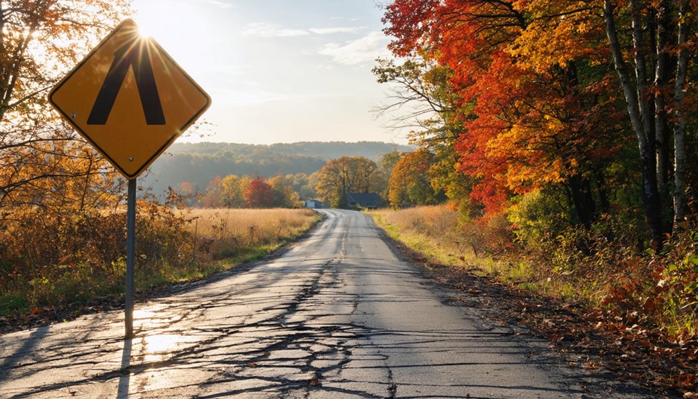
Getting to Scuffletown Bottoms

Tucked along the Ohio River in Henderson County, Kentucky, Scuffletown Bottoms isn’t exactly well-marked on modern maps, so you’ll want to plan your route carefully before heading out.
Head toward the mouth of the Green River, where it meets the Ohio, and you’ll find yourself approaching coordinates 37°55′22″N, 87°22′20″W. River access remains one of the most authentic ways to arrive, echoing how early visitors once reached Scott Fox’s riverside tavern — a fitting nod to Scuffletown history.
If you’re driving, use Henderson County roads and expect unmarked turns through rural bottomland. A four-wheel-drive vehicle helps considerably, especially after rain.
Download offline maps before you leave, since cell service gets spotty. Locals still call it Scuffletown Bottoms, so asking nearby residents can point you in the right direction.
Nearby Stops Along the Ohio River Worth Adding to Your Route
While you’re already making the drive out to Scuffletown Bottoms, it’d be a shame to turn around without exploring a stretch of Ohio River country that rewards the curious traveler.
You’ve already made the drive — don’t turn back before the river shows you what it’s hiding.
This region packs legitimate history and solid river activities into a compact route worth your time.
Add these stops to your plan:
- Green River Confluence – Watch two rivers meet where Scuffletown once thrived
- Shawneetown, Illinois – Cross the river to visit historical landmarks tied directly to the Scott Fox family story
- Henderson Riverfront – Local dining, boat launches, and open water access
- John James Audubon State Park – Nature trails and museum honoring the famous naturalist who roamed this exact region
Each stop deepens your understanding of why people lived, fought, and died along this river.
Frequently Asked Questions
Is There an Entrance Fee to Visit Scuffletown Bottoms Ghost Town?
There’s no entrance fee to explore Scuffletown Bottoms! You’ll freely roam this hauntingly beautiful ghost town, uncovering rich ghost town history and mysterious Scuffletown legends hidden along Kentucky’s Ohio River without spending a dime.
Are Overnight Camping Stays Permitted at Scuffletown Bottoms?
Like Thoreau seeking solitude in the wild, you’ll find camping regulations at Scuffletown Bottoms remain unclear. Don’t disturb the local wildlife; contact Henderson County authorities before pitching your tent to guarantee you’re exploring freely and legally.
Can Visitors Attend the Southern Cherokee Sacred Ceremonies Held Nearby?
You shouldn’t expect open access to the Southern Cherokee’s sacred customs, as these ceremonies are private community engagement. Respect their boundaries, honor their heritage, and focus your visit on exploring Scuffletown Bottoms’ fascinating ghost town history instead.
Is Scuffletown Bottoms Accessible by Boat From the Ohio River?
Like a hidden gem waiting to be discovered, you can access Scuffletown Bottoms by boat via the Ohio River. Practice proper boating safety and master river navigation to explore this ghost town’s mysterious, flood-scarred shores.
Are There Any Guided Ghost Town Tours Available for Scuffletown?
No official guided tours exist, but you’ll find YouTube explorers who’ve ventured into Scuffletown’s ghost town history and local legends. You’re free to discover its haunting secrets independently, making your adventure uniquely personal.
References
- https://en.wikipedia.org/wiki/Scuffletown
- https://kids.kiddle.co/Scuffletown
- https://www.onlyinyourstate.com/experiences/kentucky/12-ghost-towns-in-ky
- https://www.loquis.com/en/loquis/6633199/Scuffletown+Henderson+County+Kentucky
- http://unusualkentucky.blogspot.com/2009/08/scuffletown.html
- https://www.youtube.com/shorts/sBgTYUTH8kU
- https://www.youtube.com/watch?v=D9gOmfCuKLs
- https://wbkr.com/visit-these-20-creepy-kentucky-ghost-towns-for-a-halloween-road-trip/