You’ll need a 4WD rig to tackle barely passable gravel roads through Challis National Forest to reach Seafoam Mine at 7,598 feet, where your engine loses 23% of its power and your lungs work overtime in air containing 21% less oxygen. The route passes Wagon Town‘s abandoned freight wagons before reaching 16 patented claims holding collapsed adits and rusted ore carts from operations that supplied 90% of America’s wartime antimony, though extensive preparation covers everything from traversing property boundaries to essential high-altitude gear.
Key Takeaways
- Access requires 4WD vehicles on rough gravel roads through Challis National Forest, passing historic Wagon Town freight station en route.
- Visit July or August when temperatures reach 57-63°F; prepare for freezing nights and reduced vehicle performance at 7,598 feet elevation.
- Bring 2-3 liters of water daily as thin air causes headaches, increased heart rate, and rapid dehydration for visitors.
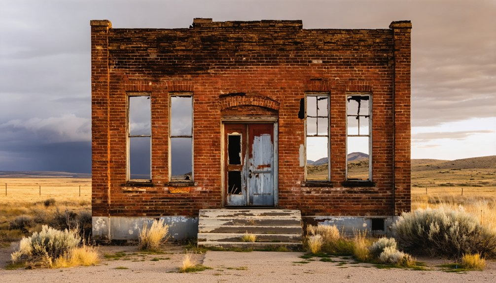
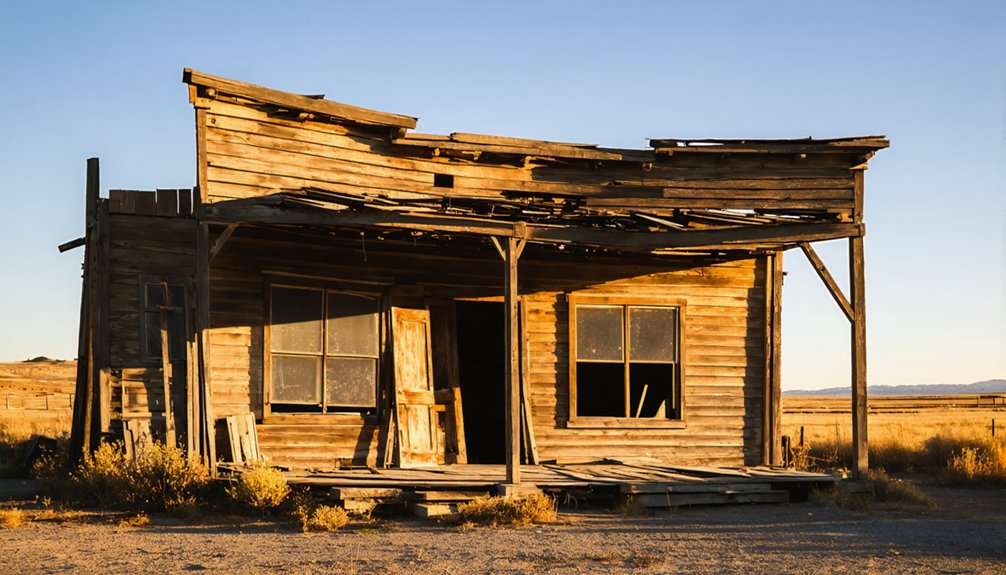
- Explore historic Golden townsite foundations, collapsed mine adits, and rusted ore carts marking America’s former antimony supply hub.
- Verify claim boundaries using TheDiggings.com before exploring; 106 active claims surround 16 patented properties requiring Forest Service permits.
Getting to Seafoam Mine in Custer County
Tucked into the northwest corner of Custer County at coordinates 44.5294° N, 115.12810° W, Seafoam Mine awaits those willing to tackle one of Idaho’s most challenging ghost town routes. You’ll need a capable 4WD vehicle to navigate the barely passable gravel roads winding through Challis National Forest‘s Seafoam Mining District.
The adventure takes you past Wagon Town, an old freight change station where unique mining artifacts and abandoned freight wagons still dot the landscape—visible through Google Earth before you arrive. Historic freighters once paid tolls along this route between the Greyhound Mine and Challis, stopping at way stations with bunkhouses and saloons.
Today’s adventurous drive follows their path from the Stanley-Lowman highway area, crossing both patented mining claims and national forest land. The district has been the subject of geological investigation since 1952, with subsequent reports documenting the area’s ore deposits and mining operations. The site sits at an elevation of 7,598 feet in the Salmon River Mountains.
What to Expect at 7,598 Feet Elevation
At 7,598 feet, you’ll notice your breath coming shorter during even modest hikes around the abandoned workings, while your vehicle may struggle on steep grades as the thinner air robs engine power.
Summer afternoons can shift from brilliant sunshine to sudden thunderstorms within hours, and what starts as a warm July morning often requires layering by evening when temperatures drop sharply.
Your water bottle will empty faster than expected, and that slight headache signals your body’s adjustment to the reduced oxygen levels found throughout Idaho’s Salmon River Mountains.
The Moonshine Prospect once drew miners seeking galena and quartz in this rugged Custer County terrain, leaving behind surface workings that mark their efforts to extract the area’s mineral wealth. The Red Star Prospect in nearby Camas County represents another example of the region’s lead-bearing vein deposits that attracted prospectors to these high-elevation sites.
Thinner Air Physical Effects
Your body will notice the altitude change before your mind does. At 7,598 feet, each breath delivers 21% less oxygen than sea level, forcing your heart rate up by 20-50% during exploration. Within six hours, you’ll likely feel the familiar tension headache affecting half of all visitors who ascend this quickly. Your breathing will quicken from 12 to nearly 20 breaths per minute—your body’s automatic compensation.
Altitude sickness remedies start with prevention: ascend gradually and rest frequently during your ghost town exploration. Hydration management becomes critical here, as you’ll lose 2-3 liters daily through increased respiration. Drink twice your normal water intake. The mine sits within Custer County, where the thin mountain air challenges even experienced hikers. The area’s mineral deposits span millions of years, with Late Cretaceous precious-polymetallic veins forming some of the region’s most significant ore bodies. Most symptoms resolve within 48 hours as your blood plasma expands and oxygen transport improves naturally.
Weather Changes Year-Round
Standing nearly 8,000 feet above sea level, Seafoam Mine experiences dramatic weather swings that’ll catch unprepared visitors off guard. Summer afternoons hover between 57-63°F, then plummet to near-freezing once darkness falls.
Winter travel considerations become critical from December through March, when maximum snow depths accumulate and temperatures barely crack 20°F during daylight hours. The site receives substantially less precipitation than surrounding wilderness—roughly 15 inches annually versus 60 inches just miles away—but those winter months still dump significant snowfall.
Off season hiking challenges intensify under temperature inversions that equalize conditions across elevations, making weather prediction tricky. July and August offer your best window for exploration, though you’ll still need layers for those 40-degree overnight temperature drops that define high-altitude living. The upper tunnel reached 700-800 feet into the mountain where miners discovered gold-bearing sulphides, while a lower tunnel extended 1000 feet but never yielded ore.
Vehicle Performance Adjustments
The thin mountain air that makes your lungs work harder also chokes your vehicle’s engine, stealing roughly 23% of its power between sea level and Seafoam Mine’s 7,598-foot elevation. Your 300-horsepower rig drops to 231 horses, turning mountain passes into grinding slogs.
Acceleration feels sluggish when passing slower traffic on winding roads, and turbocharged engines handle the oxygen deficit better than naturally aspirated ones. At sea level, your vehicle might achieve 0-60 mph in under 5 seconds, but at this elevation, expect those times to stretch by nearly a full second due to reduced air density. Monitor tire inflation concerns carefully—cold temperatures and altitude fluctuations cause pressure swings that affect traction on gravel switchbacks.
Engine cooling considerations become critical as your motor works overtime compensating for thin air, stressing components already battling steep grades. Lower air density compromises your cooling system’s efficiency, making regular inspection of coolant levels and radiator function essential before tackling mountain terrain. Before departing, tune your engine, check cooling systems, and pack a reliable tire gauge. Your vehicle needs preparation as much as you do.
The Mining History That Built This Remote Settlement
You’ll find Seafoam Mine‘s story begins in 1925, when prospectors first extracted gold from the quartz monzonite at this windswept elevation. The Providence Group’s underground workings carved into the mountainside represent the labor of miners who believed this small deposit would yield fortunes, despite poor transportation limiting their ability to process low-grade ore.
Today, you’re standing where William Swigert’s past-producing operation once hummed with activity, part of a broader mining rush that swept through Custer County in the late 1800s and early 1900s.
Early 1920s Gold Discovery
High in Idaho’s backcountry at 7,598 feet, fortune seekers hammered their first stakes into the rocky slopes of Harlan Creek valley during 1921. Mattie D. Martin and Otto B. Fleischer from Arco claimed the Creek, Frank White, South Side, and Spring properties that year, launching what would become the Seafoam Mining District.
These gold discovery tales gained momentum when prospectors struck pay dirt—assays revealed impressive grades of 0.25 to 0.75 ounces of gold per ton alongside stunning silver concentrations exceeding 100 ounces. By 1922, the Midway claim expanded their holdings as workings pushed deeper underground.
The prospector stories reached their climax in 1925 when first production began, followed by peak ore extraction in 1926. You’re standing where calculated risk met genuine reward. James B. Hood had blazed a similar trail decades earlier, preparing eight lead-silver veins in the Lava Creek area with outcrops testing 100-200 ounces of silver per ton.
Providence Group Mining Operations
Underground ambitions crystallized when the Providence Mining Group staked their claims across this rugged terrain, building on the momentum of earlier prospectors who’d flooded the Stibnite Mining District after the 1899 gold rush. You’ll find their legacy carved into the 50-million-year-old Idaho Batholith, where volcanic eruptions once forced mineral-rich fluids through granite fractures, depositing the ore bodies these miners pursued.
The group’s antimony extraction processes focused on stibnite—the district’s namesake mineral—while gold silver mineral yields drew intensified attention when operations shifted to Yellow Pine Pit in 1938. United Mercury Mining Company and Bradley Mining Company led these early ventures, pulling tungsten and antimony alongside precious metals from deposits that would sustain this remote settlement for decades, transforming wilderness into a functioning mining community.
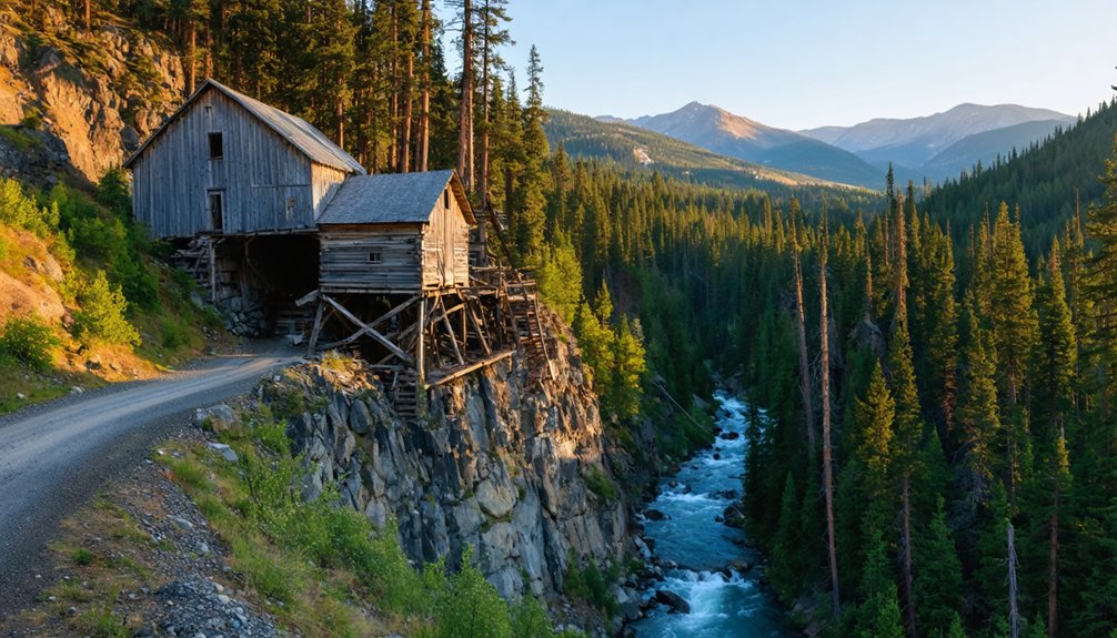
Exploring the Underground Workings and Providence Group Sites
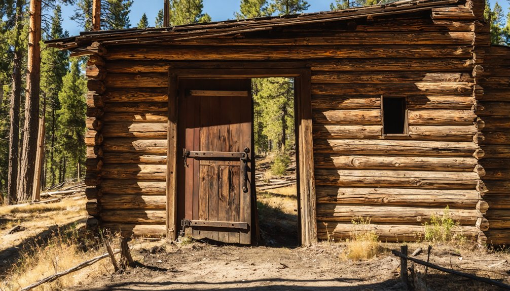
When you venture into the remote backcountry surrounding Seafoam Mine, you’re tracing the footsteps of wartime miners who carved vast networks of tunnels and shafts into Idaho’s rugged mountains between the 1940s and 1950s. These abandoned underground sites supplied 90% of America’s antimony and tungsten during critical conflicts, leaving behind adits, vertical shafts, and stopes reaching hundreds of feet deep.
You’ll find crumbling timber supports and rusted ore cars marking entrances scattered across elevations from 5,000 to 7,000 feet in the Providence Group formations. Public access remains severely restricted due to collapse risks, toxic gases, and heavy metal contamination requiring environmental remediation efforts. Forest Service permits are mandatory, and you’ll need hard hats, respirators, and GPS coordinates from historical mining maps before approaching these hazardous relics.
Geological Wonders of the Idaho Batholith Region
The Idaho Batholith sprawls across 15,400 square miles of central Idaho’s wilderness, forming one of North America’s largest exposed granite masses where ancient magma chambers cooled into cathedral-sized plutons beneath your boots. You’ll traverse 55 million years of geological composition—from Late Cretaceous granodiorites to Eocene dikes that sliced through cooling rock.
The Atlanta lobe’s biotite granodiorite weathers into those distinctive curved boulders you’ll scramble over, while pinkish feldspar crystals catch sunlight on ridge tops. Regional deformation left its mark through northeast-striking faults and rhomboid blocks where tectonic forces pulled the crust apart.
Those gold-bearing quartz veins you’ll spot near Seafoam? They’re Eocene fluid pathways that followed shear zones, concentrating precious metals into pockets that sparked mining rushes generations ago.
Key Locations: From Star Mine to Golden Idaho
Your journey through central Idaho’s mining heartland begins where Forest Road 671 intersects with the Middle Fork Salmon River corridor, a 45-mile gauntlet of switchbacks and stream crossings that separates casual tourists from committed explorers. This route delivers authentic remote wilderness scenery that few modern travelers witness.
This 45-mile backcountry passage filters determined adventurers from weekend tourists through relentless switchbacks and unbridged stream crossings.
Essential stops along your route:
- Seafoam Mine trailhead – Park here to access collapsed adits and rusted ore carts scattered across pine-studded hillsides
- Historic Golden townsite – Foundations and tailings mark where 200 prospectors once carved existence from granite
- Observation points – Pull-offs reveal canyon vistas that haven’t changed since the 1890s gold rush
You’ll encounter wildlife instead of crowds, experiencing the solitary outdoor experience that defines Idaho’s backcountry. Cell service disappears completely after mile marker twelve.
Stumbling onto private land transforms your ghost town adventure into a potential trespassing incident faster than you can pocket that interesting rock specimen. Seafoam Mine’s 16 patented claims sit on genuine private property at 7,598 feet elevation—not public exploration grounds.
The claim verification process demands you check beyond general ownership fields since patented status grants full property rights. Tools like TheDiggings.com map all 730 district claims by disposition, while Land Matters Idaho and BLM platforms offer click-based queries for specific sections.
Use transparency blending through boundary visualization tools to identify where 611 closed claims end and active ones begin. The 106 filed claims surrounding Seafoam require verification before you set foot anywhere near that weathered headframe beckoning from private ground.
Essential Gear for High-Elevation Forest Roads

When your vehicle bounces across washboard gravel at 7,000 feet, the equipment stashed in your cargo area determines whether you’ll conquer the route or spend hours waiting for rescue. Tire pressure considerations become critical as altitude increases—you’ll need a reliable gauge and portable compressor to adjust between pavement and rough terrain.
Your spare parts inventory should include:
- Full-size spare tire (not a donut) with adequate tread
- Basic tools: socket set, adjustable wrench, zip ties, duct tape
- Recovery gear: tow strap, shovel, traction boards
Pack redundant communication devices since cell service vanishes beyond civilization’s edge. A detailed paper map, first-aid kit, emergency food, and water transform potential disaster into manageable inconvenience.
Self-reliance isn’t optional on remote forest roads—it’s your ticket to genuine independence.
Current Status and Future Exploration Plans
The Seafoam Mine sits silent now, its tunnels sealed and equipment long since hauled away or left to rust beneath towering ponderosa pines. You’ll find no active operations at this 7,598-foot elevation site, classified as a past producer with no reopening plans since its last run in 1936.
Yet the surrounding Seafoam Mining District pulses with renewed interest—eleven active claims dot the landscape, and companies like Magellan Gold Corporation and Vault have secured exploration targets across the territory. Modern prospectors face permitting challenges their predecessors never imagined, traversing federal regulations on Challis National Forest land where 56 prospect sites still tempt fortune-seekers.
The district’s quartz vein systems, trending northwest and documented since the 1880s, continue drawing those who chase glints of possibility through Idaho’s backcountry.
Frequently Asked Questions
Are There Any Camping Facilities or Accommodations Near Seafoam Mine?
You’ll find Josephus Lake Campground at Seafoam Road’s end, offering lakeside sites with picnic tables. While local lodging’s limited given the remote location, you can also explore dispersed camping throughout the national forest. Nearby towns provide additional accommodation options.
What Wildlife Might Visitors Encounter in This Remote Area?
You’ll encounter thriving elk and deer populations roaming the high country, along with diverse bird species soaring overhead. Watch for moose near streams, black bears in forest clearings, and mountain goats scaling rocky ridges throughout your wilderness adventure.
Is Cell Phone Reception Available in the Seafoam Mining District?
You’ll find virtually zero cell phone network coverage in this wilderness paradise—Seafoam’s remote telecommunications infrastructure is practically nonexistent. Bring satellite devices for emergencies, embrace the digital detox, and enjoy true freedom from constant connectivity in Custer County’s backcountry.
What Time of Year Offers the Best Weather for Visiting?
Summer offers you’ll find the best conditions, with an ideal temperature range of 85-95°F and minimal seasonal precipitation patterns. You’ll enjoy upper 80s percentage sunshine through July-August, perfect for unrestricted exploration of this remote district.
Are Guided Tours of the Historical Mining Sites Available?
Like prospectors seeking fortune behind locked gates, you’ll find Seafoam Mine offers no guided tours or private tours. The historical site remains on private land with restricted access, preserving its ghost town mystique for future exploration possibilities.
As you venture deeper into Idaho’s rugged landscape, the remnants of ghost towns in idaho’s past reveal stories of dreams and despair. Each decaying structure stands as a testament to the lives built and abandoned, inviting explorers to imagine the vibrant communities that once thrived. The allure of these forgotten places continues to draw curious souls, eager to uncover the secrets held within their crumbling walls.
References
- https://www.magellancoppergold.com/blank-2-1-1-1
- https://westernmininghistory.com/mine-detail/10070827/
- https://history.idaho.gov/wp-content/uploads/2018/08/0009.pdf
- https://www.idahogeology.org/Uploads/Data/USBM-Publications/MLA_87-83.pdf
- https://pubs.usgs.gov/bul/0877/report.pdf
- https://thediggings.com/mines/usgs10070827
- https://www.mindat.org/loc-140406.html
- https://www.mindat.org/loc-39488.html
- https://topoquest.com/place/idaho/mine/seafoam-mine/390067
- https://www.idahogeology.org/pub/Pamphlets/P-96.pdf