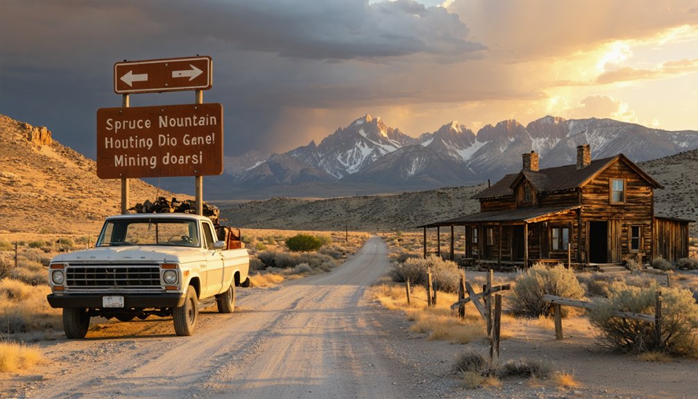
You’ll need a high-clearance 4WD vehicle to tackle the 36-mile journey south from Wells, Nevada, turning east onto rugged mining tracks that wind past eleven ghost towns scattered across Spruce Mountain’s slopes. The first 20 miles offer manageable gravel roads before narrow switchbacks climb toward 10,262 feet, where $5 million in silver-lead ore once poured from hard-rock mines. Winter snow blocks upper sections, so plan accordingly. Your route connects five historic camps through 135-year-old wagon roads that reveal Standard Mill ruins and abandoned mining equipment throughout this remote wilderness adventure.
Key Takeaways
- Drive 36 miles south from Wells, Nevada on US Route 93, then turn east onto East Clover Valley Road.
- First 20 miles offer excellent gravel conditions for two-wheel drive vehicles before terrain becomes challenging.
- High-clearance, four-wheel drive vehicle required beyond initial section to reach scattered ghost town ruins.
- Explore 135-year-old ATV trails connecting five ghost towns and historic mines across Spruce Mountain’s slopes.
- Plan for 4,800-foot elevation climb to 10,262 feet; carry traction devices in winter months.
Discovery and Development of Sprucemont’s Silver Mines
In 1869, prospectors struck lead-silver ore at the Kille prospect just north of North Spruce Mountain’s peak, and the rush was on. Within three months, three new mines roared to life as fortune-seekers swarmed the western slopes.
By 1870, nearly 100 miners worked claims stretching from west to east across the mountain. The ore quality analysis proved promising enough that three separate districts—Latham, Johnson, and Steptoe—organized in 1871 before consolidating into the unified Spruce Mountain Mining District.
The labor force dynamics shifted rapidly as the Ingot Company invested $80,000 in the Standard Mill in 1872, though it shuttered within a year. Still, early production topped $100,000, spawning multiple mining camps and the settlement of Sprucemont along the mountain’s western face. In 1926, Paramount Consolidated Mining Co. shipped several hundred tons of oxidized lead-silver ore and repurposed 100 tons of old slag from the mine dump. Production from the district’s four main mines continued into the late 1930s, with approximately $5 million worth of lead and silver extracted over the district’s operational lifetime.
Getting to Spruce Mountain’s Remote Western Slopes
Your journey to Spruce Mountain’s ghostly remnants begins with a 36-mile southbound trek on US Route 93 from Wells, Nevada, cutting through the high desert’s stark expanse.
The pavement ends where adventure starts—you’ll turn east onto East Clover Valley Road, shifting from smooth highway to rugged, unpaved mining tracks that wind toward the mountain’s western slopes at 10,267 feet. While standard vehicles can navigate the initial approach, reaching Sprucemont’s scattered ruins demands a high-clearance rig, preferably with four-wheel drive, to conquer the challenging terrain where nineteenth-century prospectors once hauled silver ore. These copper, silver, and lead deposits attracted miners to the western side of the mountain during the late 1800s, establishing a brief but bustling chapter in Nevada’s mining history.
The mountain connects to the Pequop Mountains through a low section of hills to the east, creating a natural corridor through this remote corner of Elko County.
Highway 93 Access Routes
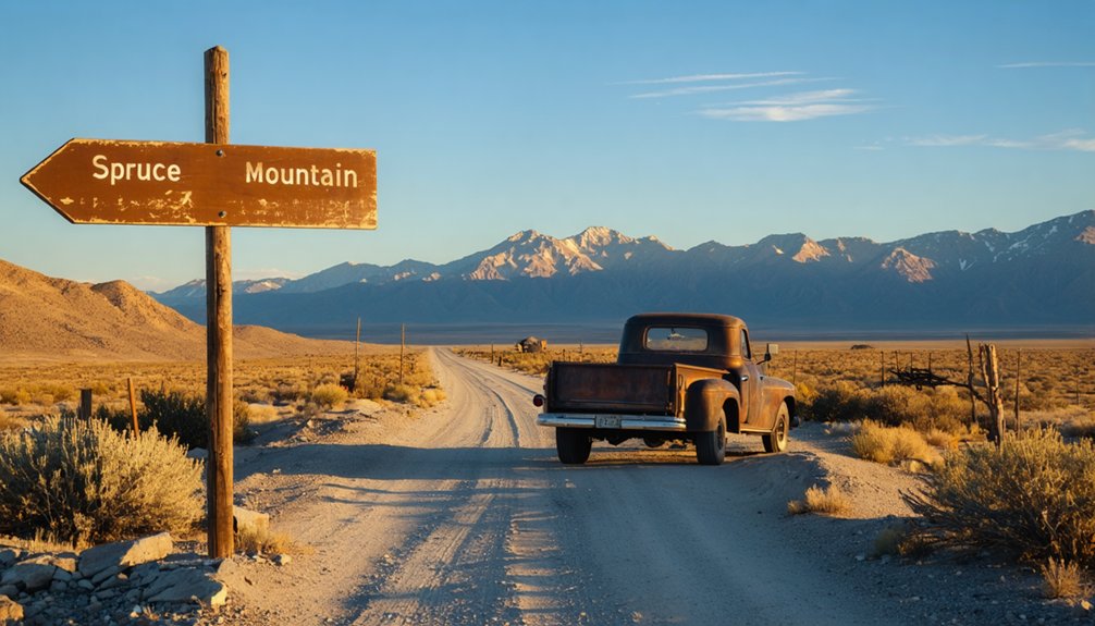
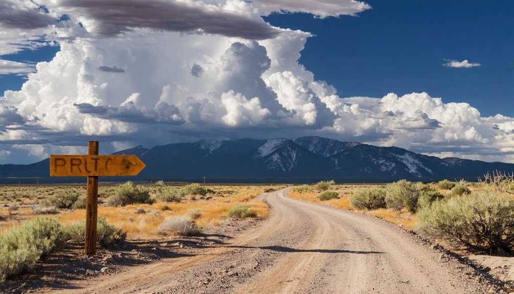
The journey to Spruce Mountain’s weathered ghost towns begins along a desolate stretch of US Highway 93, where sagebrush flats stretch endlessly toward distant ridgelines. You’ll head south from Wells for 37-38 miles, watching for an unsigned but unmistakable gravel road branching east. This turnoff sits 8 miles south of the US 93/NV 229 junction—your landmark for highway 93 travel recommendations. The turn’s easy to spot: it’s the only maintained eastbound route cutting through the scrubland.
US 93 distance considerations matter here since services disappear for long stretches. Fill your tank in Wells before departing. The highway passes Spruce Mountain’s southwestern end, offering glimpses of the massif you’ll soon explore.
Once you’ve turned onto Spruce Mountain Road, 20 miles of excellent gravel await—flat, wide, and beckoning you toward century-old mining camps. The first 7 miles roll along a wide dirt road where you can comfortably maintain 30-40 mph, making for quick progress toward the mountain’s interior. At 10,262 feet elevation, Spruce Mountain towers as a prominent peak east of the Ruby Range, its summit visible from various points along your approach.
Two-Wheel Drive Road Conditions
Once you’ve left Highway 93 behind, Spruce Mountain Road welcomes passenger cars with surprisingly civilized conditions. The first twenty miles stretch wide and flat across the desert, with excellent gravel creating ideal boondocking territory near Sprucemont. Road surface conditions remain consistently manageable for two-wheel drive vehicles throughout this initial section.
Beyond this point, the route transforms dramatically—narrow switchbacks and steep grades demand high-clearance vehicles or ATVs. You’ll face a choice: hike the final two miles to Monarch Mine or turn back. Winter travelers must carry adequate traction devices, as snow frequently blocks the upper sections. The desert doesn’t compromise, and neither should your preparation when venturing into these remote western slopes. RVs and campers should note that the rocky and very steep terrain beyond Sprucemont makes it advisable to turn around at the ghost town rather than attempting the challenging ascent to Monarch Mine. The Spruce Mountain complex features abandoned buildings, ore shoots, and mines that represent the area’s rich mining heritage dating back to the discovery of lead-silver ore.
Elevation and Distance Considerations
Rising from Clover Valley’s modest 5,500-foot floor, Spruce Mountain dominates the Pequop Range with a summit that punctures the sky at 10,262 feet—creating a vertical climb of nearly 4,800 feet across terrain that won’t coddle casual visitors.
This elevation change demands respect and preparation:
- Water sources concentrate above 6,500 feet—plan your cache points accordingly
- Unit 105 spans 726 square miles of roadless wilderness
- The nearest higher peak sits 44.1 km west-northwest—you’re heading into genuine isolation
Distance limitations become critical when US Highway 93 serves as your western gateway and Shafter Road provides eastern access. Between these arteries, you’ll navigate steep western slopes where two-wheel drive meets its match. The mountain’s 3,930-foot prominence isn’t just a statistic—it’s your challenge written in vertical stone. The U.S. Geological Survey maintains standardized coordinate data for Spruce Mountain and surrounding features, ensuring accurate navigation across this remote terrain. Primitive roads branch from these primary routes, offering direct pathways deeper into the unit’s interior terrain.
Network of Mining Camps Across Spruce Mountain
Scattered across the steep slopes of Spruce Mountain, eleven distinct mining communities once thrived in a network connected by rough wagon roads and prospectors’ trails. The early prospecting efforts of 1869 sparked simultaneous development on both western and eastern slopes, creating camps like Sprucemont, Jasper (originally Starr King), Black Forest, and Monarch. You’ll discover family homesteading stories woven through settlements that produced nearly $5 million in lead-silver ore from operations like the Monarch Mine.
Today’s 135-year-old roads form an ATV trail system linking five ghost towns and historic mines. Districts initially named Latham, Johnson, and Steptoe consolidated into Spruce Mountain District on September 26, 1871. Stone walls at Standard Mine and weathered cabins at Jasper still stand as a memorial to this mountain’s remarkable mining legacy.
Peak Production Years and Mining Operations
For three decades after the 1869 discoveries, Spruce Mountain’s mines produced minimal returns, their lead-silver veins frustrating prospectors who lacked the capital and technology to work the deposits profitably. Everything changed when Charles Spence organized the Black Forest Mining and Smelting Company in 1901, transforming the district into Elko County’s most profitable operation.
You’ll find the peak years occurred between 1901-1907, when profitable smelter operations in nearby Jasper produced 700 silver bars before expanding capacity to 45 tons daily. The boom attracted mining company acquisitions—Spruce Mountain Copper Co. absorbed Black Forest before the 1907 Financial Panic shuttered operations.
The district’s golden age featured:
- Four major mines producing $5 million in lead and silver
- A 7,000-foot tunnel connecting Black Forest to Monarch Mine
- Continuous employment of 30 miners through Missouri Monarch Co.
Historic Structures and Mining Equipment to Explore
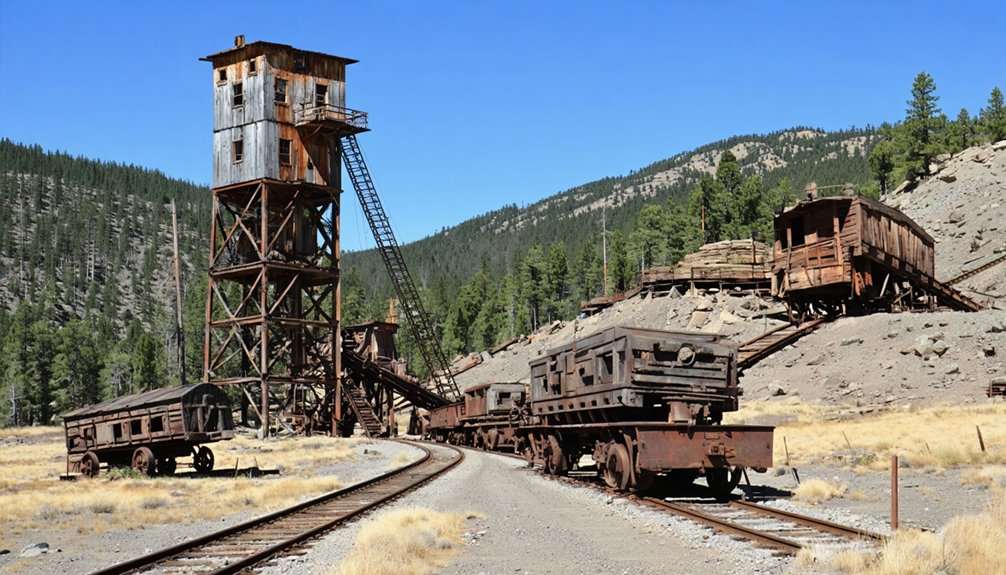
What makes Spruce Mountain truly exceptional for ghost town enthusiasts isn’t just its mining history—it’s the tangible evidence scattered across multiple camps that span nearly a century of operations. You’ll discover remarkable stone walls at the Standard Mine, where remnants of the 1872 smelter still stand.
The structural integrity of ruins varies dramatically—Sprucemont’s post office and store buildings remain visible, while Black Forest Camp offers an incredible preservation of equipment artifacts, including a massive Fairbank-Morse diesel engine and Ingersoll-Rand compressor. Don’t miss the blacksmith shop with its intact forge and smoke hood.
At Jasper Cabins (originally Star King), you’ll find several weathered structures that’ve endured remarkably well. The Monarch site and nearby Latham bunkhouse round out your exploration.
The Latham Mine Complex and Post Office Building
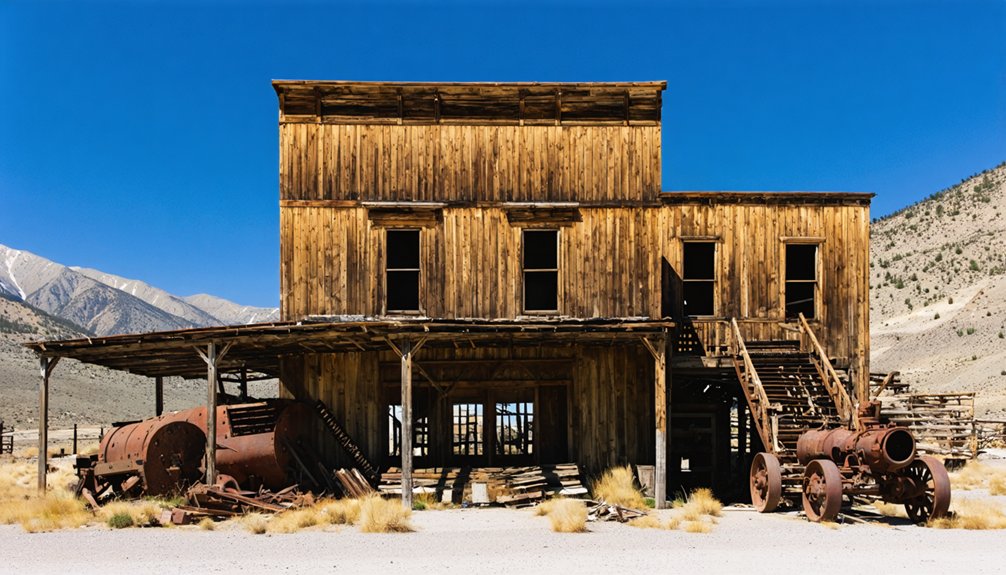
The discovery of silver-lead ore in 1869 transformed Spruce Mountain’s western slope into the bustling Latham Mining District, which merged with the Johnson and Steptoe districts on September 26, 1871, to form the unified Spruce Mountain district. You’ll find the Latham Mine Complex near Sprucemont, where a remarkably intact bunkhouse stands as evidence to historical mining operations that spanned 1869 to 1952.
A remarkably intact bunkhouse near Sprucemont stands as evidence to mining operations that transformed Spruce Mountain’s western slope from 1869 to 1952.
At Sprucemont itself, explore:
- The post office and store building, which served miners until 1947
- Equipment and structural remains from nearly 100 years of mining activity
- Newer buildings coexisting with original structures
While building preservation efforts remain minimal, these weathered remnants tell authentic stories of boom-and-bust cycles. The site sits 40 miles south of Wells, offering you unregulated access to Nevada’s mining heritage without modern constraints.
Standard Mine and Mill Overview
Rising from the limestone-granite contact zone where silver-lead ore first emerged in 1869, the Standard Mine became one of Spruce Mountain’s most ambitious ventures when the Ingot Company constructed its $80,000 mill in 1872 under J.J. Crawford’s supervision. You’ll find remarkable stone walls still standing—silent witnesses to the era’s ore processing technology that demanded a twenty-five ton smelter to extract wealth from high-grade silver-lead deposits.
The mill’s failure within one year bankrupted Ingot Company by 1873, yet the mine’s resource extraction methods proved valuable enough for revival attempts. By 1928, Sprucemont Standard Mining Company reconditioned the operation, continuing production into the mid-1920s. Today, you can explore these ruins where miners once pulled ore exceeding $100,000 from Spruce Mountain’s unforgiving geology.
Weather Patterns and Seasonal Considerations
Your journey to Spruce Mountain unfolds differently across Nevada’s dramatic seasons, where summer heat peaks at 93°F and winter plunges to bone-chilling 16°F lows.
Spring and autumn offer the sweet spot for exploration, with March temperatures climbing to comfortable 54°F highs and minimal precipitation of just 0.30 inches annually keeping roads passable.
Winter snow and freeze-thaw cycles at 6,296 feet elevation can transform access roads into treacherous passages, making timing your visit critical for a successful ghost town adventure.
Summer and Autumn Visits
July monsoons bring brief thunderstorms and flash flood risks, so monitor weather closely for your hiking options. By September, conditions mellow considerably:
- Temperatures drop to pleasant 79°F highs and 54°F lows
- Monsoon season ends, reducing storm threats
- Fall foliage emerges in nearby basins and canyons
October sweetens the deal further with 62°F days and minimal precipitation—ideal for exploring ghost towns without summer’s brutal extremes or winter’s snow.
Winter Snow Challenges
Winter flips the script entirely at Spruce Mountain, transforming October’s mild 62°F days into a harsh landscape where February’s snowiest week dumps nearly 10 inches across 2.4 days of continuous flurries.
You’ll face temperatures plummeting to 20°F lows while winds gust up to 36 mph from the southwest, creating blizzard conditions that’ll test your mettle.
Northeast Nevada’s winter reality means freeze-thaw cycles oscillate between -7°C mornings and 3°C afternoons, turning dirt roads into impassable ice rinks.
Upper-level lows drift slowly across the region, pumping moisture that reduces whiteout visibility to dangerous levels.
Snow depth accumulates rapidly during these cut-off low events, and you’re looking at nighttime temperatures below freezing from October through April—making winter access nearly impossible without serious four-wheel-drive capability.
Optimal Travel Timing
Planning your ghost town expedition to Spruce Mountain demands strategic timing, where nature’s calendar dictates success or disappointment. You’ll find the shoulder season travel window between late spring and early fall offers ideal conditions for sustainable visitation without battling winter’s harsh grip.
Consider these prime periods:
- Late May through September delivers comfortable temperatures averaging 68.9°F with minimal precipitation
- April’s awakening brings moderate 54°F highs, though you’ll face stronger 16 mph winds
- Early November provides solitude before winter strikes, with 47°F days and clear 10-mile visibility
The desert’s low annual precipitation of just 0.30 inches means you’ll rarely encounter muddy roads blocking your path. Summer’s 44% humidity and consistent winds under 20 mph create perfect exploration conditions, letting you wander these abandoned streets unhindered.
Multi-Day Itinerary Through Elko County Ghost Towns
For adventurers seeking an immersive exploration of Nevada’s mining heritage, Elko County’s ghost town circuit demands more than a single afternoon. You’ll need three days to properly experience this high desert territory.
Start with Spruce Mountain Road’s quartet—Sprucemont, Black Forest, Monarch, and Latham—plus Badger ghost town and Jasper Mine. Day two takes you along the Merritt Mountain/Sunflower Flat route spanning 68 miles to Rio Tinto’s mining remnants.
Reserve your final day for Tuscarora’s living ghost town and Metropolis’s 1911 farming experiment. Regional transportation options include high-clearance vehicles essential for backcountry access, while backcountry hiking trails connect several abandoned settlements. Remember: federal and state laws protect these sites, with trail cameras monitoring activity. Photograph everything, disturb nothing.
Photography and Exploration Tips for Mining Sites
Golden hour transforms Spruce Mountain’s mining ruins into photographer’s gold, casting amber light across weathered wood and rusted iron that’s stood sentinel for over a century. You’ll capture pristine historical architecture at Sprucemont’s post office and Latham’s bunkhouse, where photographic techniques meet preservation ethics.
Master these essential practices:
- Document head frames and ore chutes without entering unstable structures—your well-being guarantees continued exploration
- Frame bristlecone pines against mining camps during golden hour for dramatic contrasts between ancient nature and industrial decay
- Shoot panoramic valley views from elevated sites, capturing 19th-century relics blending seamlessly with surrounding wilderness
Observe without touching these fragile remnants. Your lens protects what hands might destroy. Stick to established paths, avoid artifact removal, and respect private claims. Historical preservation depends on adventurers who photograph rather than disturb these freedom-soaked landscapes.
Frequently Asked Questions
Are Camping Facilities Available Near Sprucemont or on Spruce Mountain?
You’ll find primitive camping scattered across BLM lands with ten occupants maximum at the lookout tower. Local lodging options remain nonexistent—you’re truly off-grid here. Basic campsite amenities include propane cooking gear and beds, but you’ll pack your own water.
Do I Need Permits to Explore Mines or Photograph Structures?
You don’t need permits for photographing structures from public areas, but exploring mines requires obtaining permission from landowners. Risks of unauthorized entry include collapse hazards and trespassing charges. Stick to exteriors and roadside views for safe, legal adventure.
What Safety Hazards Should Visitors Watch for at Abandoned Mining Sites?
Watch for unstable structures that can collapse without warning, concealed mine shafts hidden by vegetation, and toxic chemical residues in soil and water. You’ll also face drowning risks in deceptively deep flooded quarries and dangerous wildlife in deteriorated buildings.
Are Gas Stations and Supplies Available Between Highway 93 and Sprucemont?
No gas stations exist between Highway 93 and Sprucemont. You’ll need to fuel up in Wells before heading out. Pack supplies and consider alternative transportation options like 4WD vehicles, since nearby roadside attractions require self-sufficiency for exploration.
Can Mine Tunnels Be Safely Entered or Are They Closed?
Why risk your life for adventure? Mine tunnels aren’t safely enterable—they’re death traps. Structural integrity of tunnels has completely failed after decades of decay, while dangerous gases accumulate invisibly. Officials strongly warn: stay out or face serious injury.
References
- https://coyotestuff.com/sprucemont-ghost-town/
- https://www.ghosttowns.com/states/nv/sprucemountain.htm
- https://www.youtube.com/watch?v=PI7gqits6FY
- https://www.nevadaghosttownsandmininghistory.com/portfolio-2/spruce-mountain–standard-mine-&-mill
- https://www.nvexpeditions.com/elko/sprucemont.php
- https://travelnevada.com/nevada-magazine/odyssey-of-a-ghost-town-explorer-part-12/
- https://forgottennevada.org/sites/spruce.html
- https://cumoco.com/projects/spruce-mountain/
- https://westernmininghistory.com/library/38169/page1/
- https://en.wikipedia.org/wiki/Spruce_Mountain_(Nevada)


