
Your ghost town road trip to Sprucemont starts with serious preparation—this isn’t roadside Nevada history. You’ll need a capable 4WD vehicle to climb nearly 4,000 vertical feet from Currie through unmarked tracks reaching 10,267 feet. Check Nevada 511 for real-time conditions before departing US Route 93, as winter weather transforms rapidly at this elevation. Pack emergency supplies, fuel, and recovery gear for true wilderness exploration. The reward? Structures spanning 1869 to 1952 across an entire mining district that few visitors ever experience properly equipped.
Key Takeaways
- Sprucemont sits at 9,645 feet on Spruce Mountain’s western slope, accessible via unmarked 4WD tracks from Currie near US Route 93.
- A high-clearance 4WD vehicle with snow tires is essential for the nearly 4,000-foot ascent through challenging terrain and winter conditions.
- Check Nevada 511 and nvroads.com for real-time road conditions, chain requirements, and wind alerts before departing into remote wilderness.
- Standing structures from 1869-1952 include post office, store, and nearby Monarch Mine, Latham bunkhouse, and other mining-era ruins.
- Explore ten additional ghost towns across the 40-square-mile Spruce Mountain Mining District, including Black Forest, Jasper, and Standard Mine.
Discovery and Mining History of Sprucemont
The glint of silver-lead ore on Spruce Mountain in 1869 sparked a rush that would transform Nevada’s remote northeastern frontier. You’ll discover how prospectors consolidated three districts—Latham, Johnson, and Steptoe—into Spruce Mountain district by September 1871.
Early settlement patterns emerged as Sprucemont took shape on the western slope, attracting nearly 200 residents by 1872. The town boasted a hotel, four saloons, and mining technology advancements like the Ingot Mining Company’s impressive $80,000 twenty-five ton smelter.
Yet boom turned to bust when that same smelter failed within a year, bankrupting its owners. Mining persisted sporadically through revivals in 1886, the 1920s, and 1930s, with operations continuing until 1961—a chronicle to prospectors’ relentless pursuit of fortune.
Getting to Sprucemont: Routes and Mileage
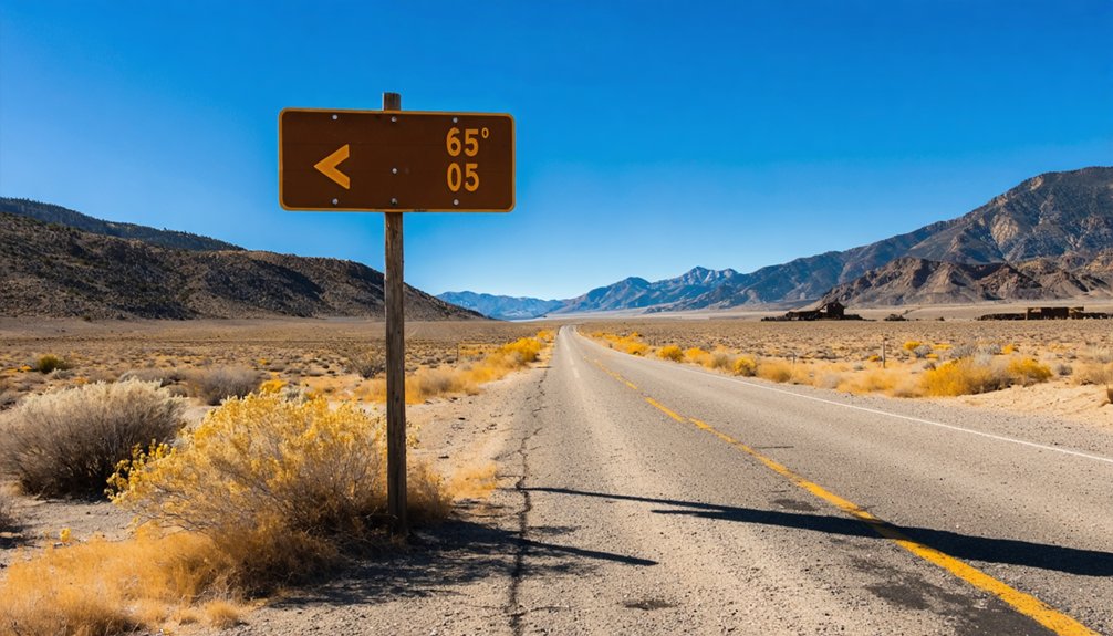
Reaching Sprucemont requires traversing Nevada’s stark northeastern backcountry, where US Route 93 serves as your gateway to this remote ghost town perched at 9,645 feet on Spruce Mountain’s western slope.
Nevada’s northeastern backcountry yields Sprucemont only to those willing to navigate Route 93’s gateway into genuine high-elevation wilderness.
From Currie, located twenty miles southwest at 5,804 feet elevation, you’ll navigate unmarked four-wheel drive tracks ascending nearly 4,000 vertical feet through rugged Pequop Mountains terrain. The summit road climbs directly to 10,267 feet, placing Sprucemont’s abandoned buildings within striking distance.
Since you’re exploring Bureau of Land Management territory with no access restrictions, visitor guidelines remain unencumbered—bring adequate supplies, navigation tools, and mechanical preparedness.
Understanding the regional context matters here: you’re entering true Nevada wilderness where self-reliance isn’t optional. The ghost town coordinates (40°33′24″N 114°50′W) mark your destination near the historic Monarch Mine, accessible only to those willing to earn their discoveries.
Road Conditions and Vehicle Requirements
Before attempting Sprucemont’s high-altitude approach, you’ll need real-time road updates from Nevada 511 at nvroads.com/roadconditions, where NDOT’s monitoring systems track everything from chain requirements to wind alerts affecting vehicles over nine feet.
Winter transforms US-95 into unpredictable terrain—dynamic condition changes can shift from clear pavement to “Chains Required, All Vehicles except 4-wheel drive with Snow tires” within hours. Check those Unix-formatted timestamps religiously; outdated intel means stranded travelers.
Your rig matters here. Four-wheel drive with snow tires grants exemption from chain mandates, but high-profile vehicles face wind caution advisories that aren’t suggestions—they’re survival intel. The RWIS Road Weather Information System feeds data directly to nvroads.com’s traffic cameras and SafeTravelUSA’s multi-state comparisons, giving you layered verification before committing to remote ghost town access roads.
What Remains at the Ghost Town Site
Standing structures at Sprucemont span nearly a century of Nevada mining ambition, from the 1869 ore rush through the district’s final operational gasp in 1952. You’ll find the post office and store still standing among a handful of survivors, their building materials used reflecting different eras—from rough-hewn timber to mid-20th century construction.
The architectural details tell stories of prosperity and decline: large, roomy two-story structures that replaced temporary shelters when miners struck it rich. Beyond Sprucemont’s core, you can explore nearby Monarch’s multiple ruins, Black Forest’s blacksmith shop with scattered machinery, and Jasper’s weathered cabins.
The Latham mine bunkhouse endures, while equipment and workings from the 1800s through 1940s dot the mountainside. It’s unrestricted exploration across authentic mining history.
Exploring the Monarch Mine
Among Sprucemont’s scattered satellite camps, the Monarch Mine stands out as the district’s most prolific producer and rewards explorers with Nevada’s most extensive collection of mining-era structures. You’ll discover buildings spanning the 1880s through the 1940s, each telling stories of lead and silver extraction that generated over $675,000 during active periods.
At the north camp’s end, you’ll find the oldest crumbling log cabin with its caved-in roof. The massive collapsed ore bin structures—built unconventionally from logs rather than timbers—dominate the landscape. Divided cabin interiors reveal how miners partitioned their limited space into two rooms. Storage shacks and bunkhouses scatter across the 8,501-foot elevation site, their torn-apart walls offering glimpses into harsh mountain living conditions that persisted through boom-and-bust cycles from 1870 to 1952.
Nearby Ghost Towns and Mining Sites
Beyond Sprucemont’s weathered buildings, the Spruce Mountain Mining District spreads across 40 square miles of rugged terrain, harboring ten additional ghost towns and mining camps that flourished between 1869 and 1961.
Black Forest’s preserved building features stand evidence of operations that lasted through 1943, though reaching them requires serious 4WD capability on the district’s roughest roads. You’ll find Jasper’s old cabins nestled nearby, remnants of the Star King camp that contributed to nearly a century of mining district history.
The Standard Mine showcases remarkable stone walls, while Latham and Badger mine sites emerge from the landscape along main routes. At Killie and Ada H., work continued even after Sprucemont faded, extracting lead-silver ore until the district’s final days in 1961.
Best Time to Visit and Weather Considerations
Your journey to Sprucemont demands careful timing, as Nevada’s high desert climate swings dramatically between scorching summer days and bone-chilling winter nights.
The remote roads leading to this abandoned mining site become treacherous during winter months when snow blankets the terrain and spring when snowmelt turns dirt tracks into impassable mud channels.
Plan your visit for late spring through early fall when you’ll encounter pleasant 67-88°F days, though you’ll need layers for nights that plunge 30-35 degrees cooler in the thin, dry air.
Seasonal Road Access Challenges
Critical seasonal obstacles include:
- Spring mud hazards post-snowmelt on gravel Spruce Mountain Road, demanding 4WD low-range capability
- Unpredictable April-May plowing schedules that mirror Sierra pass delays, creating dangerous uncertainty
- Rapid fall weather shifts bringing freezing nights and treacherous steep grades without warning
Check Nevada 511 obsessively before departing. High-clearance 4WD isn’t optional—it’s survival equipment for these unforgiving mountain approaches.
High Elevation Weather Patterns
Sprucemont’s 10,267-foot summit creates its own weather system, where temperatures can plunge 30 degrees in minutes and afternoon thunderstorms materialize from cloudless morning skies.
You’ll find the sweet spot between April and May when moisture availability peaks at half an inch monthly and temperatures climb into the 60s and 70s at lower elevations.
November through March brings freeze thaw cycles that transform roads into treacherous obstacle courses—snow dusts the peaks while valleys thaw, creating unstable conditions.
Wind whips across exposed ridges at 15 mph during spring months, while humidity drops to desert-dry 35%.
March offers moderate temperatures around 54°F, but pack layers regardless of season.
The mountain’s 3,930-foot prominence guarantees dramatic weather shifts that’ll test your adaptability.
Optimal Visiting Months
While summer brings perfect weather for ghost town exploration, each season at Sprucemont offers distinct advantages that’ll shape your adventure. June through October delivers ideal access with minimal weather interference, allowing you unfettered exploration of mining ruins scattered across this remote mountain terrain.
Variable weather patterns create unique opportunities throughout the year:
- Spring (April-May): Wildflower blooming periods transform surrounding meadows while reduced crowds grant solitary wandering through abandoned structures
- Summer (June-August): Extended daylight and dry conditions maximize exploration time, though you’ll share trails with fellow adventurers
- Fall (September-October): Mild temperatures and spectacular foliage frame photogenic ruins against crimson mountainsides
Winter’s heavy snowfall renders roads impassable without serious 4WD capability, demanding self-reliance that hardcore explorers crave despite brutal conditions.
Essential Supplies and Safety Precautions

Because Sprucemont sits miles from the nearest town with zero cell service and no amenities, packing the right gear transforms your adventure from risky gamble to memorable exploration. You’ll need outdoor gear recommendations that prioritize self-sufficiency: cold-rated sleeping bags for 3,800-foot elevation nights, headlamps for maneuvering abandoned structures, and a comprehensive first-aid kit with moleskin for blister prevention.
Limited parking options mean you’re hiking in with everything you’ll need. Stock your vehicle toolkit with jumper cables, a tire pump, and physical maps—GasBuddy won’t help here. Pack extra water bottles beyond what seems reasonable, plus non-perishable trail snacks. Don’t forget the sanitation trowel; there’s no bathroom for miles. Your freedom depends on thorough preparation.
Photography Opportunities and Scenic Views
Crumbling stone walls rise against sweeping mountain vistas at Sprucemont, creating a photographer’s paradise where human decay meets natural grandeur. You’ll discover the East Humboldt Range stretching endlessly from Sprucemont’s ridge, while Monarch Mine’s summit delivers unobstructed 360-degree panoramas. Cloud shadows dance across immense valleys below, emphasizing the raw isolation you’re seeking.
Capture these essential shots during your exploration:
- Post office and store ruins framing million-dollar mountain views
- Geometric stone patterns at Standard Mine against dramatic skies
- Bunkhouse structures and scattered machinery showcasing century-old decay
The steep rocky road between sites provides layered compositions worth documenting. Though vintage vehicle displays and experiential photography workshops aren’t available here, your self-guided journey offers unfiltered access to authentic ruins. Overcast-to-clear shifts create dynamic lighting perfect for dramatic sequences across multiple locations.
Combining Sprucemont With Other Eastern Nevada Destinations
Sprucemont anchors a remarkable Eastern Nevada ghost town circuit that rewards adventurous travelers with multiple 1800s mining camps within a single expedition. You’ll find Treasure Hill’s Shermantown ruins just hours away, along with the historic towns of Caliente, Panaca, and Currie, making it possible to explore six decades of silver boom history in one multi-day journey.
The isolation between these sites demands careful route planning—your 5-day loop will traverse long desert stretches with no services, connecting ghost towns active from the 1869 silver rush through the 1940s mining decline.
Nearby Ghost Town Circuit
Eastern Nevada’s White Pine County harbors a remarkable concentration of abandoned mining settlements, making it possible to visit five distinct ghost towns in a single day trip from Ely. You’ll discover photogenic ruins spanning Nevada’s silver boom era, each location offering distinct historical significance.
Your ideal 80-mile circuit follows this sequence:
- Ruth to Kimberly (15 + 5 miles): Active copper town shifts to landslide-devastated boomtown
- Sprucemont via Success Road (20 miles gravel): Mill foundations and ore cart tracks at 7,000 feet
- Ward detour (off US-6): Stone kilns and assay office remnants from 1876-1907 operations
You’ll need 4-6 hours driving time, with high-clearance 4WD essential for Sprucemont’s rough approaches. Stock up on fuel and supplies in Ely—these sites offer no services, just unobstructed exploration through mining history.
Route Planning Considerations
Strategic positioning along US Highway 93 makes Sprucemont an ideal pivot point for multi-destination itineraries across Nevada’s remote northeastern quadrant. You’ll find Wells 37 miles north offers essential visitor services—fuel, lodging, supplies—while providing I-80 access for expanded loops to Elko or Wendover.
Southbound, combine Sprucemont with Ely’s historic district (100 miles), then push to Great Basin National Park for a compelling 200-mile elevation-diverse circuit.
BLM camping guidelines permit primitive sites along the 20-mile access road, letting you establish base camp between destinations. Summer and autumn provide favorable conditions; winter snow closes high-elevation routes entirely.
The Benchmark Nevada Atlas proves invaluable for chaining together Ward Charcoal Ovens, Cave Lake, and White Pine mining districts into week-long explorations radiating from this high-desert gateway.
Frequently Asked Questions
Is Camping Allowed Near Sprucemont or the Monarch Mine Area?
Yes, you’ll find primitive campsites available on BLM land surrounding the Monarch Mine area. Nearby dispersed camping sites offer free stays up to 14 days, letting you explore ghost town remnants at your own pace.
Are There Any Fees or Permits Required to Visit Sprucemont?
No fees or permits are required—you’ll enjoy completely free site accessibility to Sprucemont’s ruins. Just follow visitor guidelines protecting artifacts under federal law, and embrace responsible exploration through these untouched BLM lands awaiting your discovery.
What Cell Phone Coverage Can I Expect in the Area?
You’ll encounter limited data connectivity and spotty signal strength near Sprucemont due to Nevada’s remote terrain. Download offline maps before departing, as you’re venturing beyond reliable coverage zones where independence means preparing for complete disconnection from networks.
Is Sprucemont Safe to Visit Alone or Should I Go With Others?
You can visit Sprucemont solo, though traveling with others is wiser. Potential safety concerns include abandoned mines, rough terrain, and limited cell coverage. The site’s accessibility requires 4WD vehicles and preparation—companions provide essential backup if trouble strikes.
Can I Collect Mineral Specimens or Artifacts From the Site?
No, you can’t collect specimens or artifacts from Sprucemont. Removing artifacts from this BLM-managed ghost town violates federal regulations, risking fines up to $500. Causing environmental damage compounds violations. Observe and photograph freely instead.


