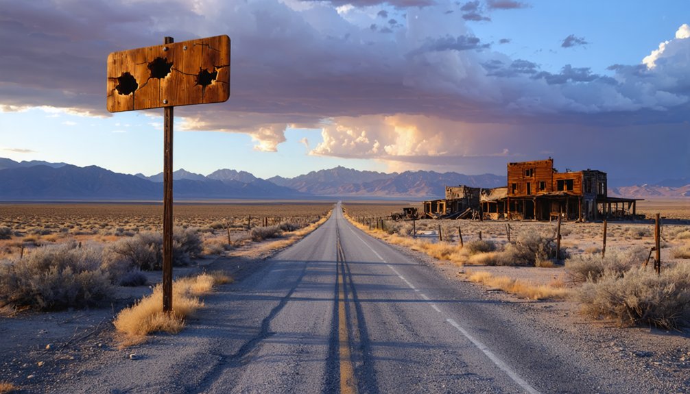
You’ll need a reliable 4WD vehicle and a sense of adventure to reach Stauffer, a forgotten homestead 100 miles southeast of Bend in Lake County’s unforgiving high desert. Pack extra water, fuel, and supplies before tackling the rough gravel roads that lead to crumbling foundations and a weathered community well slowly dissolving into sagebrush. The harsh terrain that defeated 1910s homesteaders—alkali soil, chunky bedrock, and brutal temperature swings—still challenges modern visitors who venture beyond the pavement to discover why this settlement’s dreams collapsed.
Key Takeaways
- Stauffer is in Lake County, 100 miles southeast of Bend via US-20; requires 4WD for remote, rugged high desert terrain.
- Plan for seasonal road closures and challenging gravel roads when accessing this remote ghost town near Tired Horse Butte.
- Explore crumbling structures, community wells, forgotten cellars, and geological markers from the failed 1910-1913 homesteading era.
- Respect BLM land boundaries and prepare for extreme temperatures: scorching summers and winters dropping to -20°F.
- July offers minimal rainfall (0.4 inches); bring adequate water and supplies for remote desert exploration conditions.
Getting to Stauffer: Location and Access Routes
The challenge with finding Stauffer, Oregon, is that you’re actually hunting for two different places that share the same name. Lake County’s Stauffer sits at 4,570 feet near Tired Horse Butte, roughly 100 miles southeast of Bend via US-20. You’ll navigate remote terrain challenges through high desert—pack extra fuel and supplies because services don’t exist out here. Environmental hardships include seasonal road closures and rugged conditions requiring 4WD capability.
Marion County’s Stauffer offers easier access: the historic John Stauffer House lies near Hubbard, just 2.5 miles south of Aurora off I-5. While Marion County provides paved highways year-round, Lake County rewards adventurous souls willing to tackle gravel roads and isolation for authentic ghost town exploration.
The Rise and Fall of a High Desert Homestead
You’ll find yourself imagining Charles Stauffer in 1910, staking his claim in this high desert expanse with visions of productive sheep ranches and thriving dry farms stretching across the rocky soil.
The reality hit hard—grazing feuds erupted with Bill Brown’s neighboring horse operation, while the unforgiving combination of scorching summers, brutal winters, and water scarcity turned every farming attempt into backbreaking failure.
Dreams of Homestead Prosperity
Between 1910 and 1913, hopeful homesteaders flooded into Lost Creek Valley’s sagebrush plains, transforming this desolate high desert landscape twenty-five miles southeast of Hampton into a patchwork of ambitious claims. You’d find families living in primitive tents on wooden floors, dreaming of self-sufficiency ideals while wrestling big sagebrush from stubborn earth.
Their vision of prosperity centered on three essential elements:
- Dryland farming of wheat and rye after clearing land with weighted logs and controlled burns
- Community bonds forged through the September 1913 petition for a post office in Charles J. Stauffer’s home
- Lumber shipments from distant Maury Mountain, Prineville, and Bend to construct permanent wooden houses
These scattered homesteads formed a region bound by shared determination rather than proximity.
Feuds and Failed Farming
Reality shattered those homestead dreams faster than a summer hailstorm on tender wheat shoots. Charles Stauffer’s sheep operations sparked bitter community conflict with neighboring horse rancher Bill Brown, competing for sparse grazing land across the unforgiving high desert. You can still sense that tension when you visit—two stubborn men carving out existence where water barely existed.
The chunky bedrock soil beneath Glass Butte refused to yield crops. Dry farming proved impossible in conditions swinging from 40°F summers to -20°F winters, with thunderstorms teasing relief but delivering nothing. This regional instability, fueled by incompatible livestock operations and agricultural failure, drove Stauffer from his namesake settlement around 1919. He retreated to Bend, then Portland, where he died—never returning to the dream that broke him.
Environmental Reality Wins
The sagebrush stood like an army of defiance—millions of silver-green soldiers that wagon teams spent weeks trying to uproot. You’d drag rock-weighted logs across the plains, burning what you cleared, only to face unpredictable precipitation that turned your wheat fields into dust bowls.
The homesteading hardships compounded relentlessly:
- Wind erosion stripped topsoil faster than crops could establish roots
- Water scarcity forced families to share a single community well
- Crop failures mounted year after year until economic collapse became inevitable
Why This Remote Settlement Was Abandoned
Standing among Stauffer’s weathered buildings, you’ll quickly understand why settlers couldn’t make it work here—the chunky bedrock beneath Glass Butte made plowing nearly impossible, and the ground that did break open yielded little under the punishing cycle of 40°F summers and -20°F winters.
Water was the ultimate dealbreaker; occasional thunderstorms teased hope, but consistent rainfall never came to this arid stretch of high desert. By the 1950s, the last holdouts packed up and left, defeated by land that promised opportunity but delivered only hardship.
Unfeasible Dry Farming Conditions
Beneath your boots, Glass Butte’s chunky bedrock lurks just inches below the surface—a geological reality that spelled doom for Stauffer’s would-be farmers. The challenging soil conditions created insurmountable obstacles for homesteaders seeking independence through agriculture.
These pioneers faced three crushing realities:
- Alkali-soiled terrain that refused to retain moisture necessary for crop survival
- Minimal precipitation totals insufficient for dry farming techniques that worked elsewhere
- Temperature swings from 40°F to -20°F that destroyed both soil structure and seedlings
While Central Oregon’s irrigated regions thrived after 1904, Stauffer’s remote location made such projects impossible. The obsidian-rich volcanic landscape couldn’t support deep root penetration, and dust storms regularly scoured whatever struggling plants managed to sprout. Economic survival demanded water these settlers simply couldn’t access.
Severe Climate and Water
When Stauffer’s homesteaders woke each winter morning, they’d crack ice inside their water buckets—the same buckets they’d carefully filled the night before from springs that trickled weaker each passing month.
You can still trace their desperation in the landscape: hand-dug wells that hit bedrock, abandoned cisterns that couldn’t capture enough rainfall, rusted pipes leading nowhere.
Eastern Oregon’s rain shadow trapped them between extremes—winter temperatures plunging to -37°F, summers delivering only 12 percent of yearly precipitation. Water scarcity crushed their drought resistance strategies.
Those ephemeral streams that flowed in March vanished by July, leaving families hauling water miles from distant sources. The mathematics were brutal: 490mm annual precipitation spread across thirsty crops, livestock, and households simply couldn’t sustain permanent settlement.
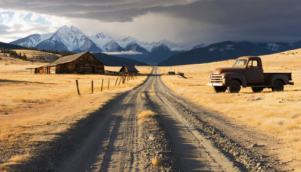
What You’ll Find Among the Ruins Today
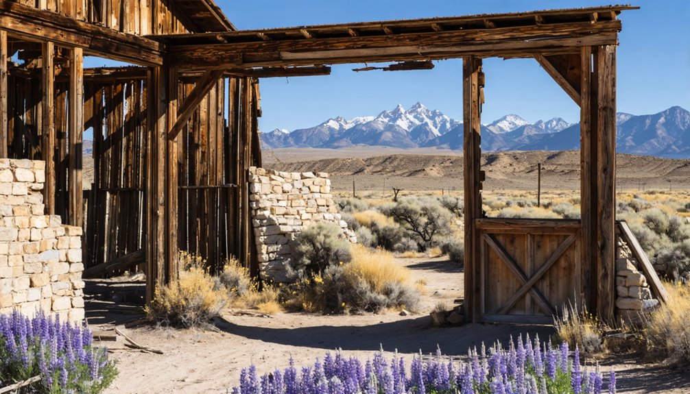
Visitors who venture to Stauffer today will find a scattered collection of crumbling structures slowly dissolving back into the high desert terrain. The weathered structures tell stories of families who once carved out lives in this unforgiving landscape before departing in the 1950s.
As you explore the site, you’ll discover:
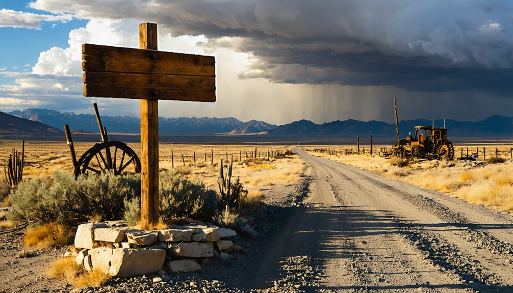
- The community well – still standing near deteriorated buildings, marking the social center of settlement life
- Geological survey markers – scattered throughout, reminding you this land was once measured, claimed, and documented
- Forgotten cellars and rubble – half-buried beneath decades of desert sand and sagebrush
Local artifacts peek through the debris if you’re observant. Navigate the muddy access roads carefully, and respect the BLM land boundaries as you wander these forgotten streets.
Understanding the Harsh Climate and Weather Patterns
The ruins you’re examining bake under an unforgiving sun that tells only half the story of why settlers abandoned this place. Summer’s mid-80s feel deceptive—those extreme temperature swings plunge to 24°F in February, when 5.5 inches of snow blanket these forgotten foundations.
You’ll understand the settlers’ struggle when considering the seasonal precipitation changes: November through March dumps relentless moisture, while July offers a mere 0.4 inches. Eastern Oregon’s cold semi-arid climate promised freedom but delivered isolation.
Stand here during winter’s overcast months, and you’ll feel why dreams crumbled. The wind cuts differently when you’re miles from help. Those 290 annual sunny days couldn’t compensate for winters that froze hope solid.
Best Times to Visit and Road Conditions to Expect
Your timing matters more than your vehicle when planning this journey into Oregon’s abandoned past. Ideal seasonal schedules revolve around fall’s comfortable temperatures and spring’s wildflower-framed ruins, while seasonal road challenges transform with each passing month.
Seasonal timing transforms ghost town adventures—spring wildflowers and fall colors create perfect backdrops while weather dictates which abandoned sites you’ll actually reach.
Consider these access patterns:
- Winter through early May – Snow buries high-country roads, making trails impassible and requiring weather checks before any departure
- Late May through October – Trails open, crowds thin after mid-September, and golden aspens frame your photography along mountain routes
- Year-round flexibility – Lower elevation sites remain accessible, though you’ll need self-sufficiency with water and supplies
Roads here follow rivers before climbing into rugged terrain where cell coverage vanishes. Check conditions beforehand, pack essentials, and embrace the isolation that makes ghost town exploration feel genuinely untethered.
Essential Supplies and Preparations for Your Trip
Packing essential tools means first-aid supplies for rusty nails lurking in collapsing structures, flashlights for pitch-black cabins, and emergency gear for breakdowns in cell-dead zones.
Load gallons of water, non-perishables, and layers for weather that shifts faster than your mood. Hand warmers, sturdy boots, and a compass complete your kit.
Tell someone your route—you’ll drive hours without seeing another soul near Stauffer’s abandoned ranches.
Nearby Ghost Towns to Add to Your Itinerary
From Sumpter, you’ve got access to three more sites with actual bones:
These aren’t just ghost towns on a map—they’re places where you can still touch the wood and walk through doorways that miners built.
- Bourne (7 miles north) – Cracker Creek placer camp where early residents worked claims through the 1870s
- Greenhorn – Seven remaining houses tell the site history better than any museum
- Galena – Middle Fork John Day River settlement with homesteads still standing in Malheur National Forest
Each location delivers tangible proof these towns existed beyond tax records and faded photographs.
Frequently Asked Questions
Are There Any Camping Facilities or Designated Overnight Areas Near Stauffer?
The background information doesn’t mention camping facilities near Stauffer specifically. However, you’ll find freedom exploring nearby hiking trails and abandoned mining sites during daylight, then camping at established parks within Oregon’s surrounding regions for overnight stays.
Is Cell Phone Service Available in the Stauffer Area?
Cell phone signal coverage is extremely limited in Stauffer’s remote terrain. You’ll find spotty mobile data connectivity at best, with Verizon offering your strongest chance. Plan accordingly—this area’s isolation means you’re truly off-grid.
Are the Old Buildings Safe to Explore or Enter?
There aren’t any old buildings left to explore—they’ve all vanished into Oregon’s dusty winds. You’ll find only empty prairie where homesteaders once stood, eliminating structural integrity concerns and potential trespassing risks. Just windswept freedom remains.
Do I Need Any Permits to Visit Stauffer Ghost Town?
You don’t need permits to visit Stauffer’s ghost town. The BLM roads offer free public access, letting you explore this site’s historical significance independently. Just respect cultural preservation by leaving artifacts undisturbed—take only photos, leave only footprints.
What Wildlife Might I Encounter in the Area?
Like whispers from Oregon’s wild heart, you’ll encounter deer, coyotes, and migratory bird species soaring overhead. Diverse insect populations buzz through sagebrush, while hawks circle freely above abandoned buildings—nature’s reclaiming what humans left behind in Stauffer’s solitude.


