You’ll find Sugartit marked on old USGS topographic maps at coordinates 38.97284°N, 84.66272°W, though nothing but farmland occupies the spot where men once gathered at a 19th-century general store that earned its cheeky name from wives who joked their husbands needed a “sugar tit”—a sugar-soaked cloth pacifier—whenever they lingered too long over pies and companionship. Plan your route from Florence through nearby ghost towns like Blue Heron and Paradise, visiting between September and November when Kentucky’s backroads reveal their forgotten stories.
Key Takeaways
- Sugartit sits at coordinates 38.97284°N, 84.66272°W near Florence and Union in Boone County’s rolling farmland at 794 feet elevation.
- Anchor your route at Blue Heron’s outdoor museum, then work toward Sugartit while visiting Paradise, Barthell, and other coal towns.
- Use U.S. Route 42 through Boone County and connect to state highways for eastern Kentucky sites by geographic clusters.
- Visit September through November for ideal weather; avoid winter’s 25°F lows and spring’s unpredictable rain showers.
- Bring GPS for unmarked sites, waterproof boots for muddy trails, and verify property access beforehand since some locations are private.
The Quirky Story Behind Sugartit’s Unforgettable Name
Few place names spark curiosity quite like Sugartit, Kentucky—a moniker that makes travelers do a double-take and locals grin with pride. The name traces back to a late 19th-century general store where winter-bound men gathered for pies, donuts, and warm companionship.
When they’d arrive home late for dinner, their wives joked they needed a “sugar tit” at the store—referencing the cloth-wrapped sugar pouches babies once sucked for comfort. The term itself comes from Old English word for teat or nipple, reflecting its origins as a pacifying treat for infants. That playful ribbing stuck, transforming Pleasant Ridge (1883) and later Gunpowder (1920s) into Sugartit.
The community embraced this cheeky identity with generational nostalgia, proving rural Southerners never shy from colorful language. Though this former community in Boone County is no longer in existence, it’s a chronicle to how sugar rush gatherings and small-town humor can immortalize a place long after it’s absorbed into Florence’s sprawl.
Where to Find the Former Site of Sugartit
Though Sugartit vanished decades ago, you can still pinpoint where this colorfully-named community once thrived in northern Kentucky’s rolling farmland. You’ll find the ghost town site at coordinates 38.97284°N, 84.66272°W in Boone County, roughly two miles from Union and Florence. The elevation sits at 794 feet above sea level, nestled among gently rolling terrain that’s easily scouted using USGS topographic maps.
Remote location access requires careful navigation since no markers identify the former settlement. Your GPS coordinates will guide you to the approximate area, where on-site exploration reveals only scattered foundations and overgrown traces of what once was. Interactive satellite imagery helps you plan your approach through private farmland. The Eastern Time Zone location makes day trips convenient from nearby towns. Boone County operates on UTC -5 hours, which aligns with major cities like Cincinnati just across the Ohio River. The site appears on the USGS Union, KY topographic map at the 1:24,000 scale for detailed navigation.
What Remains of Pleasant Ridge Today
Standing where Pleasant Ridge once bustled with activity, you’ll find virtually nothing of the original settlement that thrived here from 1859 until its post office shuttered in 1913. The three blacksmith shops, tobacco factory, and steam mill have vanished completely. No remnants of former buildings mark where Miss Julia Davis taught school or where Dr. Roselle tended patients among those 75 original inhabitants.
The community life legacy lives on only through old-timers’ memories and faded records. What was Pleasant Ridge became Gunpowder in the 1920s, then Sugartit—each name change reflecting the town’s gradual dissolution. Like Blue Heron, which was recreated with ghost buildings in the 1980s as a mining museum, some Kentucky ghost towns have found new life as historic destinations. Pleasant Hill, now known as Shakertown, stands as the largest restored Shaker village in the country and welcomes visitors as a National Historic Landmark just northeast of Harrodsburg. The ridge itself remains, offering that same attractive view that inspired the original name. But you’re free to roam unmarked land where determined pioneers once built their progressive village against coal famines and westward emigration.
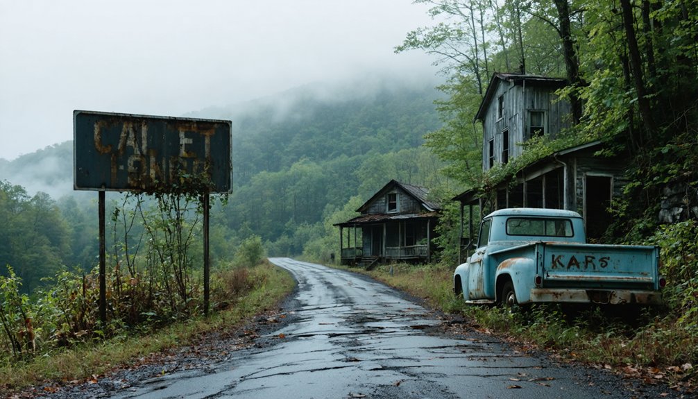
Nearby Kentucky Ghost Towns Worth Exploring
Where else can you chase Kentucky’s vanished communities without wandering too far from Sugartit? These ghost town histories await your discovery across the Commonwealth’s forgotten corners.
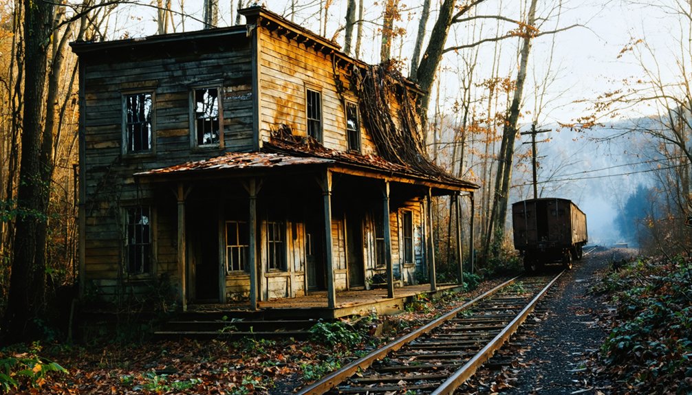
- Blue Heron – Explore Mine 18’s crumbling structures and abandoned mining equipment beneath a perpetual steam-like mist in Big South Fork
- Barthell – Wind through question-mark roads to restored company houses preserving coal camp authenticity near Stearns
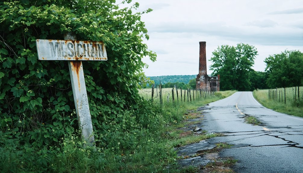
- Paradise – Stand where Muhlenberg County’s hilltop cemetery overlooks streets that vanished when TVA claimed the land
- Creelsboro – Trace Cumberland River’s bend seeking remnants of this Russell County settlement lost to memory. The flooded settlements category includes several communities submerged by Kentucky’s dam projects and rising waters.
- Bells Mines – Discover faint roadbeds and solemn cemetery stones where forest reclaims Big Rivers WMA’s coal heritage
- Airdrie – Marvel at the stone furnace rising from Muhlenberg County woods, where chisel marks preserve evidence of the ironworks that once promised a prosperous future
Each location offers unguarded access to Kentucky’s industrial past, rewarding those who venture beyond mapped boundaries.
Creating Your Multi-Stop Ghost Town Route
You’ll want to anchor your route around Blue Heron’s outdoor museum in McCreary County, then work backward toward Sugartit near Florence, weaving through coal towns like Paradise and Barthell that tell the story of Kentucky’s mining decline.
Plot your stops chronologically by their abandonment dates—starting with 1960s closures and moving toward more recent ghost towns—so you’ll experience the gradual erosion of these communities in reverse.
Check property access beforehand since some sites like Six Gun City sit on private land, though you can often capture striking drone footage from adjacent public roads. When you reach Paradise in Muhlenberg County, you’ll find a town that became empty after the Tennessee Valley Authority bought out all the residents in the 1960s due to poor air quality from a nearby power plant. The town’s Paradise post office operated continuously from 1852 until it finally closed in 1967.
Essential Ghost Town Stops
Since Kentucky’s ghost towns scatter across distinct regions—from coal country hollows to TVA-displaced river valleys—you’ll want to craft a route that clusters sites geographically while maximizing historical diversity.
Your essential stops should include:
- Blue Heron (McCreary County) – Explore preserved local landmarks at this outdoor museum showcasing 1937 coal camp life with restored miner housing and company buildings
- Paradise (Muhlenberg County) – Discover historic mining remnants and the hilltop cemetery overlooking TVA’s power plant that erased this river community
- Golden Pond (Trigg County) – Visit St. Stephen Catholic Church, the sole survivor among 700 displaced families
- Barthell – Experience authentic coal mining ghost town atmosphere in eastern Kentucky’s abandoned hollows
- Sugartit (Florence area) – Trace Pleasant Ridge’s 1883 origins where men once gathered for warm companionship
Maximizing Your Route Efficiency
Planning your ghost town circuit through Kentucky demands strategic thinking about distances, road conditions, and the sheer reality that some destinations—like Sugartit—offer more historical intrigue than physical remnants. You’ll want to anchor yourself in Florence or Union for lodging considerations, giving you reliable access to northern Kentucky’s ghost town cluster while maintaining comfort between exploration days.
Regional accessibility improves dramatically when you link Sugartit with Paradise in Muhlenberg County and eastern Kentucky sites like Blue Heron and Scuffletown. U.S. Route 42 serves as your primary artery through Boone County before connecting to state highways leading deeper into coal country. Map your stops by geographic clusters rather than historical significance—you’ll cover more ground and burn less fuel chasing phantoms across Kentucky’s backroads.
Local Attractions Around the Florence Area
Your ghost town adventure through rural Kentucky unfolds against a backdrop of rolling pastoral hills, where the countryside’s gentle slopes and weathered tobacco barns tell their own stories of changing times.
Beyond Florence’s urban attractions, you’ll discover the Creation Museum at Heritage Farms, where modern interpretations of ancient history occupy 75,000 square feet of exhibits nestled into the region’s natural landscape.
The winding country roads between Florence and Sugartit reward you with sweeping views of horse farms and creek valleys, transforming your journey into something more than a simple drive from point to point.
Creation Museum and Heritage Farms
The Creation Museum rises from the Kentucky countryside like a monument to biblical literalism, its 75,000-square-foot facility standing just seven miles west of Cincinnati’s international airport. Since opening in 2007, this $27 million privately-funded attraction has drawn visitors seeking its biblical history narrative—254,074 in 2011 alone. You’ll encounter animatronic dinosaurs alongside ancient fossils, all presented through a young Earth lens claiming 6,000 years of history.
The museum’s family friendly exhibits include:
- Allosaurus skeleton and 30-foot stegosaur bones
- Planetarium and special effects theater
- Botanical gardens and zip line adventure course
- Seven C’s of History walkthrough experience
- Nature trails and petting zoo
Open Wednesday through Saturday, it’s positioned forty miles from its sister attraction, the Ark Encounter in Williamstown, making both worth your exploration time.
Rolling Hills and Countryside
Beyond museum walls and biblical exhibitions, Florence’s surrounding countryside unfolds in a patchwork of green spaces and recreational havens that’ll pull you outdoors. Florence Nature Park‘s 15 acres offer paved trails winding through landscaped gardens, while Stringtown Park crowns a hilltop with sweeping vistas and a refreshing/invigorating/rejuvenating breeze.
For serious exploration, England Idlewild Park sprawls across 290 acres with fishing ponds, mountain bike trails, and a championship disc golf course beckoning adventurers.
The pastoral landscapes reach their peak at Big Bone Lick State Historic Site, where buffalo roam grounds once frequented by ancient mastodons. This rustic charm extends beyond recreation—it’s paleontology’s American birthplace.
Meanwhile, Turfway Park‘s thundering hooves and 300-inch screens prove the region balances natural beauty with electrifying entertainment year-round.
Best Time to Visit and What to Bring

When planning your ghost town road trip to Sugartit, Kentucky, timing becomes imperative for both accessibility and comfort. Fall emerges as your ideal window—September through November delivers 60-75°F temperatures while dodging peak mosquito season that plagues late summer farmlands.
Variable weather conditions throughout spring mean you’ll face blooming landscapes but unpredictable rain showers. Winter suits hardcore explorers willing to brave 25°F lows and shortened daylight.
Pack strategically for maximum freedom:
- Layered clothing for temperature fluctuations
- Waterproof boots for muddy rural trails
- GPS device to navigate unmarked historical sites
- Binoculars and camera for distant marker documentation
- Water and insect repellent for remote exploration
Check Kentucky DOT updates before venturing out, especially regarding rural road conditions near Florence-Union where Sugartit once thrived.
Frequently Asked Questions
Are There Any Historical Markers or Signs Indicating Sugartit’s Original Location?
No historical markers exist at Sugartit’s site—like whispers lost to wind. You’ll find Taylor County’s historical landmarks nearby, but land preservation efforts haven’t reached this ghost town. You’re exploring unmarked territory where freedom-seeking adventurers discover forgotten places independently.
Can You Still Purchase Property in the Former Sugartit Area?
Yes, you can purchase property there! The former Sugartit area offers clear land ownership status through Boone County records, with potential development opportunities including commercial parcels like the available 2.54-acre C-2 zoned lot on Dixie Highway.
Did Any Descendants of Original Sugartit Residents Remain in the Area?
Like ghosts fading into fog, original Sugartit families dispersed when Florence expanded. However, you’ll find family ties enduring through the Roseberry descendants, who’ve woven their ancestors’ stories into local lore at Dinsmore Homestead’s preservation efforts.
Were There Any Photographs Taken of Sugartit Before It Disappeared?
No verified photographs exist in photographic archives from Sugartit’s earlier days. You’ll find only oral histories and modern memories preserve this vanished community’s story, making it a mysteriously undocumented ghost town lost to time.
How Long Does a Complete Ghost Town Road Trip Typically Take?
A complete ghost town road trip typically takes 14 days minimum, covering thousands of miles. Your travel duration depends on trip planning considerations like how many stops you’ll explore and whether you’re chasing every abandoned whisper or hitting highlights.
References
- https://kids.kiddle.co/List_of_ghost_towns_in_Kentucky
- https://blog.kysupplyco.com/sugartit-ky/
- https://www.youtube.com/watch?v=3kMLESEo6NE
- http://freepages.rootsweb.com/~gtusa/history/usa/ky.htm
- https://en.wikipedia.org/wiki/List_of_ghost_towns_in_Kentucky
- https://kids.kiddle.co/Sugartit
- https://www.wcpo.com/news/insider/get-the-scoop-on-all-of-northern-kentuckys-weird-town-names-from-rabbit-hash-to-sugartit
- https://topoquest.com/place/kentucky/populated-place/sugartit/504705
- https://kentucky.hometownlocator.com/ky/boone/sugartit.cfm
- https://www.topozone.com/kentucky/boone-ky/city/sugartit/