You’ll need offline maps and patience to find Swissvale—this Osage County ghost town leaves no breadcrumb trail of historical markers, just scattered foundation stones and railroad grade cuts slicing through windswept pastures. Plan your visit between May and October when county roads stay passable, and approach via K-268 East through Overbrook before traversing unmarked rural routes toward Michigan Valley. Pack emergency supplies, respect private property boundaries, and prepare for Kansas weather that shifts faster than your GPS can recalculate—there’s considerable groundwork worth covering before you set out.
Key Takeaways
- Swissvale’s unmarked site lies in Osage County, accessible via US-75 to K-268 East or southern routes through Lomax Junction.
- Visit May through October for optimal weather; spring and fall offer wildflowers, golden light, and fewer crowds.
- High-clearance vehicles handle Landon Trail’s crushed limestone; real-time navigation apps help locate the unmarked ghost town.
- Bring offline maps, emergency supplies, weather-appropriate clothing, and tools for remote rural exploration without services.
- Foundation stones, railroad grades, and scattered bricks mark where Swiss Mennonite settlers built their Missouri Pacific whistle-stop.
Understanding Swissvale’s Swiss Immigrant Heritage
The weathered wagon wheels that once creaked across the Kansas prairie carried more than household goods and farming tools—they transported an entire culture’s hopes for religious freedom. You’re standing where Swiss Volhynian Mennonites planted their stakes in 1874, escaping religious persecution in Russia.
These weren’t typical swiss immigration patterns—seventy-three families led by Elder Jacob Stucky journeyed from Kotosufka through New York, guided by Santa Fe railroad agents to McPherson County’s open grasslands.
The swiss mennonite communities that emerged here represented generations of movement: Switzerland to Prussia to Russia, finally to Kansas soil under the Homestead Act. When you explore Swissvale’s remnants today, you’re tracing paths chosen by people like the Gering family, who built mills and carved out townships where faith could flourish without constraint.
Getting to Swissvale From Lyndon and Major Kansas Routes
Anticipation builds as your vehicle points southeast from Lyndon, where twenty-five miles of Osage County’s rolling Flint Hills separate you from Swissvale’s silent remnants. You’ll navigate thirty to forty minutes through territory where local highway accessibility meets backcountry charm.
Your route options:
- US-75 to K-268 East – Follow paved highways through Overbrook, then county roads southeast toward Michigan Valley’s oak-hickory corridors.
- Landon Trail Sections – High-clearance vehicles handle crushed limestone trail surface conditions at mileposts 25.2-32.2, offering direct access through Camp Creek Valley.
- K-68 Southern Approach – Connect via Lomax Junction south of the highway, avoiding closed trail segments between mileposts 32.2-38.5.
Real-time navigation apps prove invaluable where private property blocks original railroad beds, keeping you on public thoroughfares toward Swissvale’s ghost.
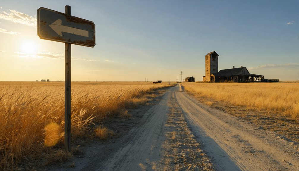
What Remains of This Missouri Pacific Railroad Settlement
Very little greets visitors at Swissvale’s coordinates today—a roadside cluster where prairie grass reclaims what Missouri Pacific’s ambitions once shaped. You’ll find scattered foundation stones marking where depot workers once loaded cattle bound for St. Louis markets after the railroad pushed through Kansas in its 1880s expansion.
The Missouri Pacific Railroad significance here mirrors countless whistle-stops that thrived briefly then faded when routes shifted.
Bring your GPS—no signs mark this spot anymore. Cultural heritage preservation efforts haven’t reached Swissvale yet, leaving you free to explore undisturbed earth where ties and ballast once lay. A weathered fence post, occasional brick fragments, and that telltale railroad grade cutting through pastureland confirm you’ve found it. It’s raw, unvarnished history without interpretive plaques or tourist infrastructure.
Best Time of Year to Visit Osage County Ghost Towns
Late May through September opens Osage County’s ghost towns to comfortable exploration, though you’ll trade ideal weather for sticky humidity that clings to your shirt as you wade through waist-high prairie grass obscuring old foundations.
Summer’s sticky embrace trades comfort for accessibility—prepare for humidity-soaked shirts and waist-high grass hiding the foundations of forgotten towns.
Optimal seasonal timing considerations:
- Spring/early summer (May-June) – Prairie wildflowers frame Arvonia’s 1869 school and church, plus moderate temperatures make photographing crumbling Havana stage stations bearable before peak heat arrives.
- Fall (September-October) – Crisp air eliminates muggy conditions while golden light illuminates weathered limestone. Smaller crowds guarantee solitude among ruins.
- Winter (December-February) – Bone-chilling winds and snow-obscured trails challenge hardy explorers, though event attendance considerations disappear entirely—you’ll have Swissvale’s abandoned streets completely to yourself.
County roads become treacherous ice tracks, but winter’s skeletal landscape reveals structural details summer vegetation conceals.
Essential Supplies and Preparations for Rural Exploration

Before you turn off the paved roads toward Swissvale’s weathered schoolhouse, you’ll need more than just curiosity in your tank. I learned this the hard way when my phone lost signal three miles past the last ranch gate, leaving me with a useless GPS and darkening skies overhead.
Your preparation checklist should cover three critical areas: reliable navigation tools that work offline, weather-ready clothing for Kansas’s unpredictable shifts from blazing sun to sudden storms, and emergency supplies that could mean the difference between an adventure and a crisis in these remote Osage County backroads.
How do you pinpoint a town that vanished over a century ago when modern GPS satellites can’t mark what no longer exists? You’ll need old-school tools to overcome site accessibility challenges and rural traversal risks at Swissvale.
Your essential navigation toolkit:
- Historical plat drawings from Lyndon’s land office reveal the original town layout, showing where the post office and railroad berm intersected at 129th and Paulen Roads.
- Topographic maps identify private property boundaries and terrain features like Camp Creek’s stone-bottom water stop, keeping you legal and oriented.
- Satellite imagery highlights the visible railroad berm and stone barn from above, giving you reference points before cell coverage vanishes.
Download everything offline. Out here, you’re navigating by landmarks that existed before your great-grandparents were born.
Weather-Appropriate Clothing Essentials
The Kansas prairie doesn’t negotiate with your wardrobe mistakes. When Swissvale’s temperature swings from 20°F winter mornings to 90°F summer afternoons, you’ll need layers for insulation that adapt faster than the weather. I learned this watching a storm roll across flatland—sunshine to sleet in twenty minutes.
Pack moisture-wicking base layers, insulated mid-layers, and windproof shells for those brutal gusts that flatten the grasslands. Your weather appropriate accessories matter: wide-brim hats shield you from relentless sun, while balaclavas cut wind chills that sting exposed skin. Waterproof boots handle mud from sudden downpours, and quick-dry fabrics keep you mobile when humidity spikes.
Convertible pants morph seamlessly through temperature shifts. This isn’t about fashion—it’s about staying comfortable enough to explore without constraints, moving freely through ghost town ruins regardless of what the sky throws at you.
Safety and Emergency Gear
When your vehicle coughs its last breath fifteen miles from nowhere on a dirt road that hasn’t seen a county maintenance crew since 2019, you’ll understand why I keep a fully stocked emergency kit wedged behind my passenger seat.
Emergency preparedness isn’t paranoia—it’s freedom insurance for backcountry exploration. Swissvale’s isolation means cell towers become distant memories, and roadside hazards multiply when pavement surrenders to gravel.
Pack these essentials:
- Jumper cables and tire repair kit with sealant and portable inflator for mechanical failures
- Road flares and high-visibility vest to signal approaching vehicles on blind curves
- First aid supplies, emergency blanket, and three-day water supply for extended delays
Add a paper atlas, flashlight with extra batteries, and basic toolkit. That multi-tool gathering dust in your junk drawer? Bring it. Remote Kansas doesn’t forgive assumptions.
Photography Opportunities at Abandoned Railroad Communities
You’ll find Swissvale’s crumbling stone structures and weathered railroad berm create striking subjects against Kansas’s endless prairie sky, especially when photographed during the soft amber light of dawn or dusk.
The pre-1900 circus barn’s limestone blocks and the converted stone schoolhouse offer textural contrasts that pop in early morning shadows or late afternoon’s warm glow.
Frame your shots to include the surrounding tallgrass and Camp Creek’s winding path, placing these abandoned relics within the vast landscape that swallowed them whole.
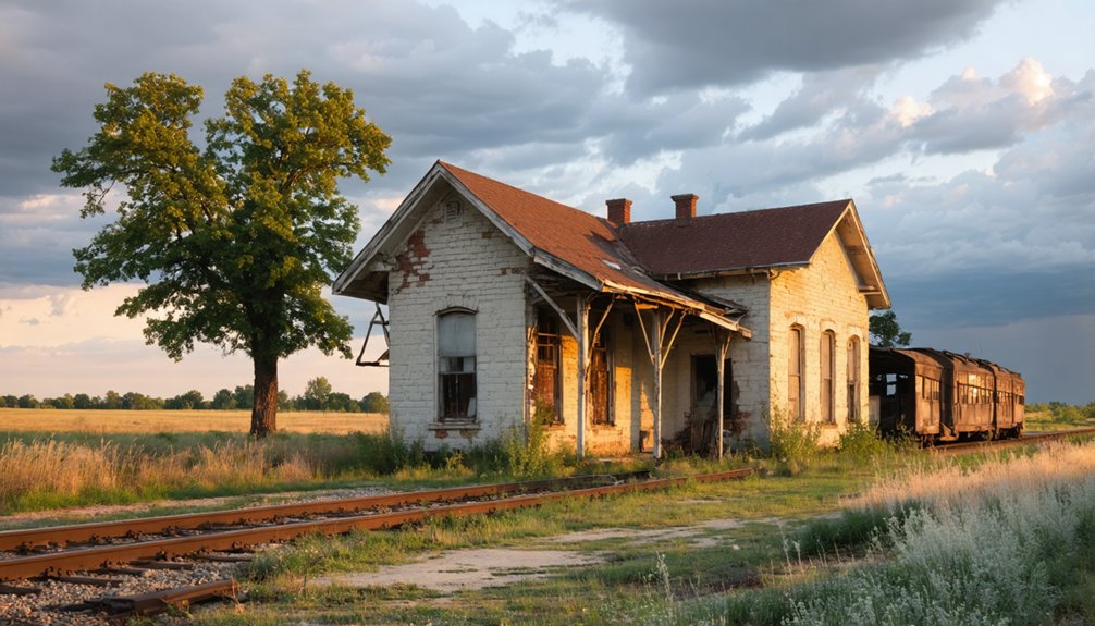
Historic Railroad Architecture Elements
Railroad architecture tells its story through weathered brick and rusting iron, and nowhere is this more evident than along the abandoned segments of Kansas’s historic rail corridors. You’ll discover authentic depot repair methods in structures like Emporia’s freight room, where the 32-foot expansion reveals construction techniques worth documenting. Station signage designs from the Howard Branch era showcase hand-painted lettering that’s fading into memory.
Essential architectural elements to photograph:
- Loading dock configurations at sites like Olpe, where 22-car stockyards and seven pens demonstrate cattle-shipping operations
- Diamond crossing remnants at Severy, where Frisco and Howard Branch lines intersected with gate-controlled precision
- Bridge abutments along abandoned Clay Center-Concordia segments, revealing 1873 construction standards before the 1933 abandonment
These structures won’t wait forever—document them while you can.
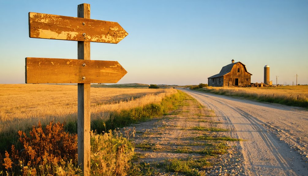
Prairie Landscape Composition Techniques
The abandoned settlements along Kansas’s forgotten rail corridors offer photographers a masterclass in prairie composition—if you know how to read the landscape.
You’ll find natural leading line usage everywhere—crumbling rail beds cutting through tallgrass, fencelines stretching toward weathered grain elevators, wagon ruts still visible after decades. Position yourself low with a wide lens, letting these paths pull viewers from foreground debris toward Swissvale’s skeletal structures.
Subject connection methods become critical when everything’s flat and exposed. Link that collapsing depot to distant storm clouds using the old roadbed as your connector. I’ve spent hours circling sites, watching how morning light transforms disconnected elements into cohesive stories. The prairie rewards patience—wait for golden hour when long shadows create the depth these landscapes desperately need.
Golden Hour Lighting Conditions
When that Kansas sun hangs two fingers above the prairie horizon, Swissvale transforms from a collection of weathered lumber into something worth the 90-minute drive from Wichita. You’ll capture 30-40 minutes of premium shooting time during summer golden hour, when 3000-4000K light wraps those abandoned grain elevators in amber fire.
Ideal exposure settings for Swissvale’s light quality characteristics:
- f/8-f/11 aperture keeps overgrown track foregrounds sharp while maintaining that vanishing point draw through collapsed structures
- 1/60-1/125s shutter speed balances handheld stability with the warm luminosity bouncing off rusted railcars
- ISO 100-400 range preserves those rich sunset tones without introducing noise into prairie dust hazes
Bracket ±2EV—that dynamic range between shadowed doorways and blazing western sky demands HDR treatment.
Nearby Ghost Towns to Add to Your Itinerary
Several forgotten settlements dot the countryside around Swissvale, offering you multiple opportunities to extend your ghost town adventure across northeast Kansas.
Northeast Kansas conceals numerous abandoned settlements beyond Swissvale, each waiting to reveal its forgotten history to intrepid ghost town explorers.
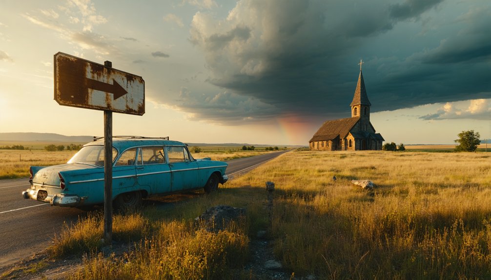
In Douglas County, you’ll find Prairie City’s weathered cemetery and crumbling stone house—tangible remnants of vanished community structures that unpublished regional histories barely mention.
Head northwest to Osage County where Michigan Valley’s grain elevator still pierces the skyline, with church ruins scattered along the abandoned railroad bed. The Peoria and Imus sites sit close together, perfect for a single exploration run.
Further south, Trading Post in Linn County rewards adventurers with actual standing buildings from Kansas’s first permanent settlement along the Marais des Cygnes River.
Each location demands self-reliance—bring navigation tools, water, and respect for private property boundaries.
Researching Swissvale’s History Before Your Visit
Before you venture down those dusty Osage County roads, you’ll want to trace Swissvale’s roots through county archives and Kansas Historical Society records, where land deeds and railroad maps reveal how Swiss immigrants carved out their community in the 1850s.
I spent an afternoon in the Lyndon courthouse basement scanning yellowed plat books, discovering how these settlers chose fertile bottomlands near the Missouri Pacific line—a pattern repeated across Kansas as European immigrants claimed homesteads.
You can also examine immigration records at the National Archives to understand why Swiss families traveled halfway across the world to this particular bend in the prairie, bringing their farming traditions to transform Kansas wilderness into productive orchards and grain fields.
Historical Archives and Records
Dusty ledgers and fading photographs hold more stories than any modern guidebook ever could, and that’s exactly what you’ll find tucked away in Kansas’s archival collections before you set out for Swissvale.
The Kansas Historical Society, established in 1875, preserves genealogical resources that’ll transform your ghost town exploration from casual wandering into genuine discovery.
Essential Archives to Explore:
- State Archives Division – Access historical sketches and county records that document Swissvale’s settlers and their stories
- Digital Archives of Kansas History – Browse 600,000 images from your computer before hitting the road
- FamilySearch County Records – Track birth, death, and marriage records that reveal who built this forgotten place
These historical preservation strategies connect you directly with Swissvale’s vanished residents, letting you walk their streets understanding who they were.
Swiss Immigration Settlement Patterns
Those archived records you’ve just discovered reveal something unexpected about Swissvale’s naming—the Kansas ghost town likely drew inspiration from broader Swiss settlement waves that transformed America’s heartland during the 1800s. Between 1851 and 1880, over 2,500 Swiss annually chose American freedom, establishing communities like New Basel in Dickinson County and Rose Valley in Osborne County.
You’ll notice swiss immigrant entrepreneurship flourished through these pioneers who transformed raw prairie into thriving farms and businesses. Their swiss cultural influence extended beyond agriculture—surnames like Baertsch, Sutter, and Yost marked townships across Kansas.
While Swissvale itself lacks confirmed Swiss settlers, its name echoes this migration pattern, suggesting founders recognized the economic success these industrious immigrants brought to neighboring settlements throughout the 1860s-1890s.
Respecting Private Property and Historical Sites
When you pull off the highway onto the gravel road leading to Swissvale’s remnants, you’re entering a landscape where history intersects with someone’s daily life. The Haven homestead and surrounding properties aren’t museum pieces—they’re working lands with real boundaries you must honor.
Essential protocols for exploring Swissvale:
- Seek permission before crossing fence lines or photographing structures beyond Oak Hill Cemetery’s public grounds
- Contact Osage County Historical Society to arrange legitimate access and support community involvement in historical preservation
- Stay on established pathways through cemetery grounds to prevent erosion around 1850s-era grave markers
You’ll find genuine freedom in exploring responsibly. Local property owners often share stories and grant access when approached respectfully, transforming your visit from trespassing into authentic historical discovery.
Where to Stay and Eat Near Northeastern Osage County
After hours of gravel roads and windswept prairie, you’ll want a comfortable base camp that doesn’t sacrifice the rural character that brought you here. The Pomona Lake Front Cabin delivers perfectly—picture yourself unwinding in the hot tub after exploring Swissvale, then paddling the 3-person kayak at sunrise.
For activity based lodging, Brood Ranch Farm near Melvern Lake puts 160 acres of walking trails at your doorstep, though you’ll trade internet for genuine solitude. Koch Guesthouse in Osage City offers the sweet spot: wood-burning stove ambiance with downtown proximity to nearby dining options. The Lyndon Guesthouse works for larger groups seeking communal evenings in that sunken living room. Most rentals include kitchens—essential when restaurants close early in these parts.
Frequently Asked Questions
Are There Any Guided Tours Available for Swissvale Ghost Town Exploration?
No guided tours exist—you’re free to wander Swissvale’s abandoned buildings solo, pondering the historical significance of mineral springs that once promised healing but couldn’t save the town itself. Just you, crumbling structures, and railroad ghosts nobody’s monetized yet.
What Cell Phone Coverage Can Visitors Expect in the Swissvale Area?
You’ll find patchy cell coverage in Swissvale’s remote terrain, with limited connectivity challenging even major carriers. Verizon performs best at 94.9%, but expect dead zones. Download maps beforehand—you’re venturing where signals fade into prairie silence.
Can I Bring My Dog When Exploring Swissvale Ghost Town?
You’re barking up the right tree—you can bring your dog to Swissvale’s roadside views. Dog-friendly policies are nonexistent since it’s private property, so take pet-related precautions: leash required, pack water, and respect no-trespassing signs.
Are There Restroom Facilities Available Near Swissvale for Visitors?
No restroom facilities exist at Swissvale or nearby—you’re exploring raw, untamed prairie here. There aren’t public restrooms nearby or picnic areas for visitors. Plan accordingly before your adventure, embracing the remote wilderness experience this authentic ghost town offers.
Is Camping Allowed Near Swissvale or Other Osage County Ghost Towns?
Camping isn’t officially sanctioned among Swissvale’s abandoned structures—because who’d regulate ghosts? You’ll find designated sites at nearby state parks respecting historical significance. County facilities require permits, offering you freedom to explore crumbling memories while enjoying modern amenities.


