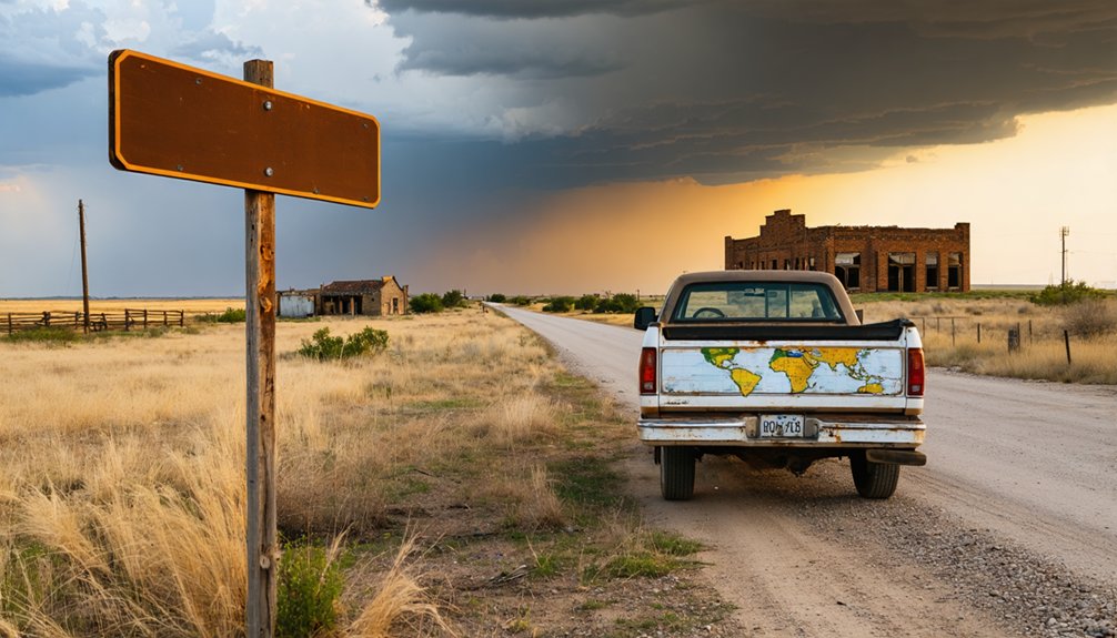
You’ll find Tuskegee’s scattered foundations in Muskogee County, where 100 residents once thrived before railroad bypasses sealed its fate in 1928. Start your journey along Highway 64, exploring Osage and Pawnee Counties’ oil-bust relics like Skedee’s Bond of Friendship Monument and Whizbang’s prairie-reclaimed remnants. Pack GPS coordinates from the 1966 Ghost Towns of Oklahoma map, since official markers are scarce among these 2,000 abandoned settlements. The route reveals Oklahoma’s boom-and-bust cycles through crumbling depots, weathered foundations, and stories waiting beneath tallgrass prairie.
Key Takeaways
- Tuskegee, once home to 100 residents in 1928, became a ghost town due to economic shifts and railroad bypasses.
- Visit nearby Skedee and Whizbang oil boomtowns to explore Oklahoma’s boom-bust cycle through scattered foundations and remnants.
- Plan stops at Texola’s Route 66 jail, Skedee’s Bond of Friendship Monument, and Picher’s toxic landscape for historic landmarks.
- Use Highway 64 as your primary route, connecting Pawhuska to Pawnee with century-old structures and abandoned post offices.
- Bring GPS coordinates from 1966 Ghost Towns of Oklahoma maps and Oklahoma Historical Society publications for accurate navigation.
Understanding Tuskegee’s Place in Oklahoma’s Ghost Town History

Something haunting lingers in the red Oklahoma soil where Tuskegee once thrived—a community that’s now joined the ranks of roughly two thousand ghost towns scattered across the state’s prairie and hills. You’ll find Tuskegee existed in that precarious space between vanishing and remembering, where around 100 residents called it home in 1928 before economic shifts and railroad bypasses claimed another victim.
When you’re analyzing Tuskegee’s cultural identity, you’re confronting the same forces that killed Boggy Depot and Perryville—communities abandoned when commerce moved elsewhere. Evaluating preservation initiatives here means accepting hard truths: some towns leave foundations and cemeteries, while others like Tuskegee fade completely. You’re chasing whispers now, not buildings, where families once planted roots in unforgiving territory.
Exploring Nearby Abandoned Oil Boomtowns of Skedee and Whizbang
The railroad’s whistle once echoed through Skedee when the Eastern Oklahoma Railway carved its path between 1900 and 1904, transforming a settlement called Lemert into a bustling depot town.
You’ll discover Skedee’s decline trajectory accelerated after 1935’s oil bust, with the bank failing in 1931 and the cotton gin closing by the late 1950s.
Three Remnants Worth Finding:
- Colonel E. Walters’ home – where the auctioneer who sold Osage oil leases still stands
- The oversized town square – designed for wealthy Osage residents’ Pierce Arrow automobiles
- Whizbang’s scattered foundations – early oil infrastructure decay marking where a 1920s boomtown vanished completely
Both towns reveal Oklahoma’s boom-bust cycle. Skedee survives as a commuter outpost with 64 residents, while Whizbang surrendered entirely to prairie grass and memory.
The Rise and Fall of Oklahoma’s Oil Economy
When the Nellie Johnstone Number One roared to life on April 15, 1897, spewing 50 barrels of crude daily near Bartlesville, drillers faced an ironic problem—they’d struck oil but couldn’t sell it. Without rail connections to Kansas refineries, they capped the well.
Everything changed in 1899 when trains arrived, triggering Oklahoma’s first boom.
You’ll understand the economic consequences of oil booms by examining the numbers: employment surged from 40,000 workers in 1975 to 120,000 by 1982—one in twelve Oklahomans depended on oil paychecks.
But historical factors driving decline proved brutal. After peaking in 1981, production crashed 6.6% annually through 1990. By the late 1990s, output had plummeted to 40% of 1986 levels, leaving ghost towns scattered across former boomtown country.
Historic Landmarks and Ruins to Discover
Across Oklahoma’s windswept plains, approximately 2,000 ghost towns stand as crumbling manifestations to boom-and-bust cycles that built and destroyed communities within single generations. You’ll find tangible history worth exploring:
Some of these former settlements have transformed into unique ghost town attractions in Cohn, where remnants of the past invite adventurers and history buffs alike. Visitors can stroll through the ruins, marveling at old storefronts and abandoned homes that tell stories of lives once vibrant. These locations offer a glimpse into the lives of those who once called these places home, making them a haunting yet fascinating addition to any travel itinerary.
- Skedee’s Bond of Friendship Monument (1926) depicts Colonel Walters and Osage Chief Baconrind—a rare artifacts preservation success amid oil-bust ruins six miles northeast of Pawnee.
- Texola’s Route 66 Relics showcase a one-room jail standing defiantly in fields surrounded by weathered buildings, where 30 resilient souls maintain presence despite infrastructure decay.
- Picher’s Toxic Landscape offers stark warnings near Kansas border—America’s most toxic ghost town features chat piles and demolition markers, accessible via Route 69.
These sites reveal Oklahoma’s authentic past, where community revitalization efforts clash against nature’s reclamation and economic reality’s harsh verdict.
Mapping Your Route Through Osage and Pawnee Counties
Your exploration of Oklahoma’s abandoned settlements requires strategic planning through Osage and Pawnee Counties—a 2,821-square-mile expanse where ghost towns cluster along highways that once promised prosperity. Highway 64 serves as your primary artery, connecting Pawhuska to Pawnee in just 25 miles while revealing points of interest along Highway 64 including the historic Osage town site with its century-old jail structure. You’ll find abandoned post offices in Pawnee County near Autryville’s remnants, which fell silent after the 1930s. Download GPS coordinates from the 1966 Ghost Towns of Oklahoma map before departing—cell service grows sparse across these prairies. County Road 4020 offers scenic alternatives through Keene’s scattered foundations. Pack your Oklahoma Historical Society publications; they’ll transform weathered ruins into stories of land rush ambitions.
Frequently Asked Questions
What Supplies Should I Bring When Visiting Remote Ghost Towns?
You’ll need sturdy footwear for traversing crumbling structures and pack extra water—dehydration hits fast in remote areas. Bring a reliable flashlight, first aid supplies, and navigation tools. I’ve learned these essentials prevent adventures from becoming emergencies.
Are Any Buildings Safe to Enter at These Abandoned Sites?
No, don’t enter any buildings—86% sit over hollow mine shafts like eggshells ready to crack. Without professional structural integrity assessments, you’re risking your life. Take safety precautions seriously: observe from outside, photograph the ruins, and keep moving.
Do I Need Permission to Access Private Property in Tuskegee?
Yes, you’ll need permission to access private property in Tuskegee. Contact landowners directly and check local laws before exploring. Trespassing charges aren’t worth the risk—most owners appreciate respectful requests and may grant access willingly.
What’s the Best Time of Year to Visit Oklahoma Ghost Towns?
You’ll find fall’s shoulder season ideal—temperatures drop 20°F from summer’s peaks, giving you freedom to explore without crowds. Spring season brings wildflowers but tornado risks. October offers the perfect balance for your adventure.
Are There Nearby Accommodations for Overnight Stays During the Road Trip?
You’ll find plenty of options, from nearby Airbnb rentals in historic homes to local bed and breakfasts like the 1911 Historical Mansion. Hampton Inn and La Quinta offer comfortable bases, while Sequoyah State Park’s campground lets you sleep under stars.


