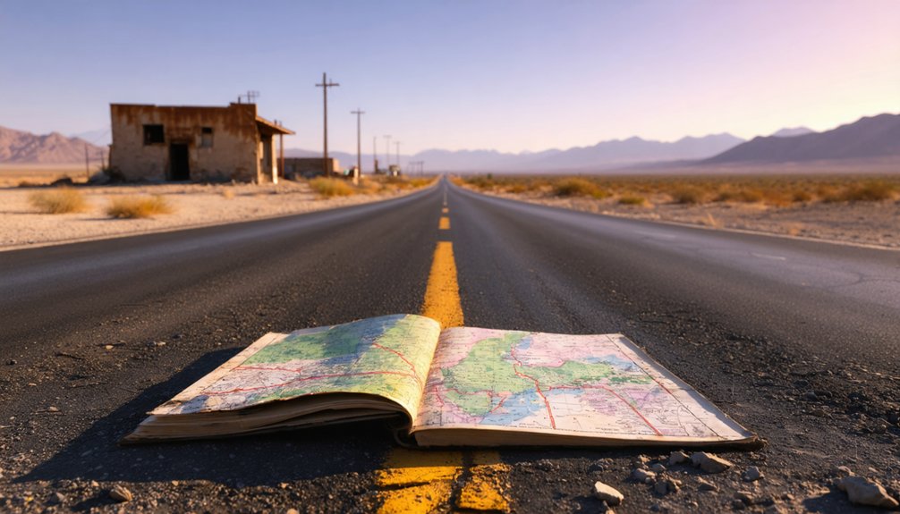
You’ll find Valley Wells ghost town off Interstate 15 near mile marker 270, where California Historical Landmark #443 marks the desperate 1849 emigrants’ discovery of undrinkable salt water. Plan your visit between mid-October and April when temperatures stay manageable, and bring plenty of water since facilities are limited beyond the rest area. Your high-clearance vehicle will navigate rough roads to reach weathered monuments, wild burros, and photogenic desert landscapes that tell stories of survival and tragedy across this remote Mojave outpost.
Key Takeaways
- Access Valley Wells via Interstate 15 northbound near mile marker 270; high-clearance vehicles required beyond the rest area.
- Visit mid-October through mid-December or February through April to avoid extreme summer temperatures exceeding 104°F.
- Explore California Historical Landmarks #443 and #773 commemorating the 1849 Bennett-Arcane emigrant stranding and Searles Lake discovery.
- Bring essential supplies including water, as the remote desert location lacks medical facilities and presents flash flood risks.
- Plan weekday visits for solitary exploration; limit summer activities to early morning before 10 a.m. heat becomes dangerous.
The Historic Significance of Valley Wells Since 1849
When desperate emigrants from the Middle West stumbled through a natural gateway into Death Valley in December 1849, they believed they’d found a shortcut to California’s gold fields—but they’d actually entered what would become their near-tomb.
You’ll discover Valley Wells marked the Bennett-Arcane contingent’s stranding point, where brackish water containing salt and sulphate of soda barely sustained them 260 feet below sea level. These emigrant stories resonate through William Lewis Manly and John Rogers’s heroic 300-mile rescue journey on foot.
Today, you’ll find tributes and memorials honoring their ordeal: California Historical Landmark No. 773 and Landmark No. 443 near Valley Wells commemorate where over 100 emigrants suffered starvation and thirst. The William Lewis Manly Monument stands along Highway 190, marking Bennett’s Long Camp where freedom-seekers faced death’s door. The Jayhawkers chose to abandon their wagons and cross the formidable Panamint Mountains on foot. Located 5.5 miles northeast of Trona, Valley Wells marks where Midwestern emigrants discovered Searles Lake’s salty nature and were forced to turn northward and westward toward the Argus Mountains.
Several routes converge on Valley Wells, but your journey through this remote Mojave Desert outpost demands careful planning before you leave pavement behind.
Interstate 15 northbound offers the easiest access near mile marker 270, where standard vehicles handle conditions perfectly. You’ll find the Valley Wells Rest Area equipped with water, restrooms, and EV charging—your last reliable services for 53 miles. The rest area remains open though conditions can change without notice, so always identify alternate stops along your route.
Mile marker 270 marks your final chance for civilization—water, restrooms, and charging before 53 miles of desert solitude.
Venturing beyond requires high-clearance vehicles as road maintenance challenges intensify on dirt alternatives. Weather impact on navigation proves significant; summer heat exceeding 120°F creates mirages and mechanical stress, while flash floods transform dusty tracks into impassable channels within minutes. The ghost town sits amid notable desert landmarks that once served mining operations throughout the region.
Stock extra water, fuel, and supplies. Cell service vanishes quickly. Your freedom here depends entirely on self-reliance and respecting this unforgiving landscape‘s demands.
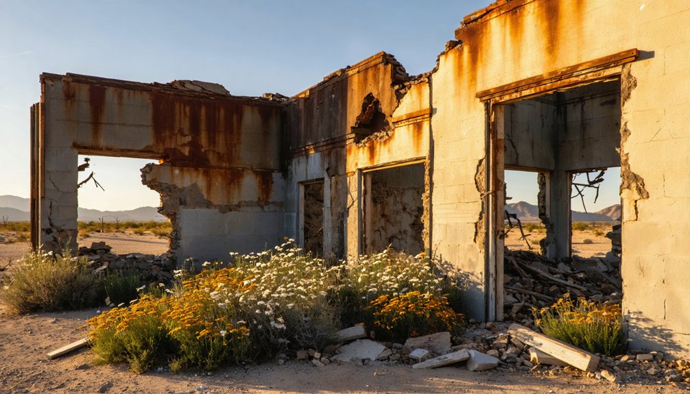
What Remains at California Historical Landmark #443
What greets you at California Historical Landmark #443 isn’t the weathered buildings or crumbling foundations you’d expect from a typical ghost town. Instead, you’ll find a historical plaque marking where desperate 1849 emigrants discovered Searles Lake’s salty, undrinkable waters before turning toward the mountains.
The vanished water infrastructure that once sustained mining operations has left no trace, but nearby you’ll spot John Dennis Seales’ Wagon Route Plaque commemorating borax transport routes to Mojave’s railhead. The plaque highlights two wagon routes used by the Searles Brothers during their borax hauling operations.
The real attraction? Photogenic landscape features stretching endlessly across the desert, punctuated by wild burros descended from mining pack animals roaming freely. At 2,234 feet elevation, this desolate spot offers unobstructed views where rugged individualists can explore undeveloped terrain without crowds—just raw desert solitude and historical significance. The marker stands as one of a series commemorating the Forty-Niner Expedition through Death Valley, alongside plaques at Death Valley Gateway, Bennett-Arcane Long Camp, and Burned Wagons Point.
Best Time to Visit This Inyo County Ghost Town
You’ll find Valley Wells most comfortable during the cooler desert months from mid-October through mid-December and again in February through April, when temperatures hover in the pleasant range instead of summer’s brutal 110°F highs. Plan your ghost town exploration for these windows to safely wander the ruins and photograph crumbling structures without risking heat exhaustion.
If you time your visit between mid-February and mid-April, you might catch the bonus of wildflowers blooming among the abandoned buildings, adding unexpected color to this desolate landscape. The desert’s dry air conditions make the daytime heat more bearable than humid climates, though you’ll still want to carry plenty of water. Since weekends and holidays draw larger crowds to nearby Death Valley National Park, visiting Valley Wells on a weekday might offer you a more solitary ghost town experience.
As you explore ghost towns in California, take the time to appreciate the rich history that lingers in these forgotten places. Imagine the stories told by the crumbling facades and rusted machinery, each a testament to a bygone era. Photographers and history enthusiasts alike will find endless inspiration in the eerie beauty of these abandoned sites.
Cooler Desert Months Ideal
While scorching summers send temperatures soaring across the Mojave Desert, Valley Wells reveals its dusty secrets most comfortably between March and April or mid-October through mid-November. You’ll escape the brutal heat that makes midday exploration nearly unbearable, instead enjoying pleasant daytime temperatures perfect for photographing weathered structures and wandering abandoned streets without time constraints.
Spring brings extended daylight for full-day adventures, while fall offers reduced wind impacts compared to Inyo County’s gusty summer months. October’s cooler desert conditions let you explore at your own pace, and if you venture toward nearby Bishop or Mammoth Lakes, fall foliage scenery creates stunning backdrops for your ghost town journey. The first week of October proves especially rewarding for capturing Bishop area fall colors alongside your ghost town exploration. Unlike reconstructed historic sites, Valley Wells remains left as is, giving you an authentic glimpse into its abandoned past. Best of all? You’ll encounter fewer tourists than summer brings, giving you authentic solitude among Valley Wells’ forgotten remnants.
Summer Heat Safety Concerns
Unless you’re prepared to battle relentless Mojave heat, summer visits to Valley Wells demand serious reconsideration. Daily temperatures surge between 104°F and 108°F from June through August, with extreme heatwaves pushing thermometers to 120°F.
Heat stroke prevention becomes critical when exploring this remote ghost town, especially since medical help lies miles away across empty desert. You’ll need off grid cooling strategies—pack ice chests, wet bandanas, and excessive water supplies.
The National Weather Service warns that these conditions pose serious dangers for children and older adults. Without shade structures or air conditioning, afternoon exploration turns hazardous quickly.
If you’re determined to visit during summer, limit outdoor activities to early morning hours and retreat to your vehicle’s AC by 10 a.m.
Spring Wildflower Season Bonus
If you time your Valley Wells ghost town exploration for late February through early March, you’ll witness the Mojave Desert’s most spectacular transformation—carpets of wildflowers erupting across sun-baked terrain. The 2026 season promises exceptional displays thanks to favorable seasonal rainfall patterns from fall 2025’s above-average precipitation.
You’ll encounter breathtaking seasonal photographic conditions with blooms against Sierra Nevada’s snow-draped peaks. Plan your visit around these highlights:
- Desert Gold and Brown-eyed Primrose blanket valley floors at 3,300 feet elevation
- Sand Verbena and Phacelia create purple-pink waves through abandoned structures
- Peak timing runs mid-February through late March before desert heat returns
- Extended exploration possible April-June at higher elevations (4,000-5,000 feet)
Follow snowmelt patterns and stay on established paths—safeguarding these fragile displays allows future adventurers to experience the same wild beauty.
Essential Supplies and Safety Precautions for Desert Exploration
Your desert adventure to Valley Wells demands meticulous preparation—pack at least one gallon of water per person daily, along with electrolyte tablets to combat the relentless Mojave heat.
Beyond hydration, you’ll need reliable navigation tools like GPS units with downloaded offline maps and a satellite communicator, since cell service vanishes completely in this remote corner of Inyo County.
Round out your supplies with emergency desert survival gear including a thorough first-aid kit, space blankets for those frigid 40°F nights, and high-calorie provisions that could sustain you through an unexpected 72-hour stranding.
Water and Hydration Systems
Everything changes when you venture into ghost towns scattered across California’s Mojave Desert, where dehydration strikes faster than in almost any environment on Earth. Valley Wells demands you pack serious hydration pack features—insulated reservoirs that keep water cold through scorching afternoons, plus backup bottles accessible without stopping. Historical water sources like contaminated pools and questionable springs won’t save you.
Your desert survival kit should include:
- One gallon minimum per person daily, stored in insulated containers
- Electrolyte tablets restoring minerals lost through constant sweat
- Purification systems for treating any natural springs you encounter
- Large vehicle-based coolers supplementing personal hydration packs
Plan water acquisition at your last civilization stop. The Mojave doesn’t forgive those who gamble on finding supplies mid-exploration, especially during 25-mile stretches between ghost town clusters.
Staying alive in the Mojave requires more than just water—you need to know exactly where you’re and how to call for help when everything goes wrong. Cell service doesn’t exist out here, making satellite communication devices your lifeline when isolation turns dangerous.
Download offline maps before leaving civilization—GPS coordinates 35.85694°N 117.34833°W mark Valley Wells, but getting there through washed-out sections demands southern routing through Ballarat ghost town. Pre trip coordination with hosts happens before departure since you can’t reach them once you’re committed to the desert.
Pack two-way radios for vehicle-to-vehicle contact and load USGS topographic maps at 1:24,000 scale. The featureless landscape swallows the unprepared whole.
Emergency Desert Survival Gear
How quickly can the Mojave turn from adventure into emergency? Pack these essentials before exploring Valley Wells’ forgotten ruins:
- Signaling devices: Mirror for sun reflection, police whistle, and bright-colored markers visible across vast desert expanses
- Water filtration systems: Purification tablets and portable filters transform questionable sources into drinkable water
- Sun protection: Wide-brimmed hat, emergency thermal blanket for nighttime temperature drops, and thorough sunscreen
- Fire-starting redundancy: Waterproof matches, lighter fluid, and portable stove for cooking and warmth
Your first-aid kit should include adhesive tape for cactus thorn removal and wound treatment. Carry multiple water bottles—dehydration strikes faster than you’d think in this unforgiving landscape. A tarp serves triple duty: rain shelter, sun shade, and water collection during rare storms. Freedom means self-reliance when you’re miles from civilization.
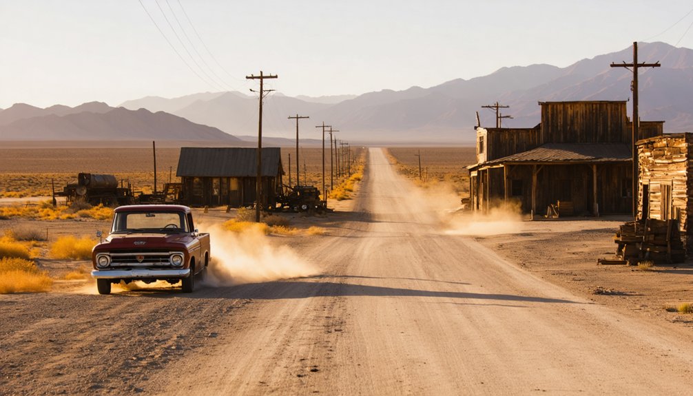
Combining Valley Wells With Nearby Abandoned Mining Camps
Valley Wells’ remote location in the Mojave Desert positions it perfectly as an anchor point for exploring a remarkable concentration of abandoned mining camps scattered across three distinct regions. You’ll find Death Valley’s 100+ ghost towns offering abandoned miners’ cabins and lost mining artifacts just northwest, including Harmony Borax Works and Chloride City.
Southeast lies Cerro Gordo, California’s largest silver producer with $500 million in historical ore output. Head northeast to discover Ward Mining Camp’s water-powered stamp mill near Green Creek and the Inyo Mountains’ Beveridge ghost town along the Lonesome Miner Trail. This proximity enables multi-day road trips looping through Mono, Inyo, and San Bernardino counties, where you’ll traverse terrain that defeated countless prospectors while uncovering authentic Western history beyond tourist crowds.
Photography Opportunities Among the Ruins
The crumbling walls and skeletal structures you’ll encounter across these mining camps offer remarkable photographic subjects that transform dramatically throughout the day. Evening’s soft bluish light creates cinematic lighting effects as it accentuates the decay while blurring boundaries between ruins and natural rock formations.
The decay transforms under evening’s bluish glow, merging skeletal ruins with natural rock in haunting, cinematic compositions.
Morning shadows sweep across partial jail structures and three-story bank remnants, revealing texture in whitish concrete that’s particularly stunning under full moon conditions.
You’ll find diverse artifact details scattered throughout:
- Abandoned chairs, bed frames, and rusty buckets frozen in time
- Faded advertisements on demolished store walls telling commerce stories
- Ladders descending into concrete pools creating abstract compositions
- Tin cans and ammo cases marking remote trailheads
The surrounding Sierra Nevada and Panamint ranges provide layered depth, while distant ridges frame your shots through decayed wall openings.
Understanding the Death Valley Emigrant Trail Connection
Dusty wagon ruts still trace faint lines across Valley Wells’ periphery, remnants of desperate 1849 emigrants who gambled their lives on unproven shortcuts to California’s gold fields.
You’re standing where the Lost ’49ers veered fatally off Captain Jefferson Hunt‘s proven route, chasing rumors of faster passages through southern Nevada’s badlands. The cultural significance of Lost ’49ers resonates here—their doomed detour claimed thirteen lives before survivors staggered into Spanish ranchos months later.
Historical route variations converged near Valley Wells as emigrants sought alternatives to crowded northern trails. Unlike rope-lowered wagons on Sonora Road or Lassen’s “Death Route,” these pioneers faced unmapped desert with neither water nor landmarks. Their desperation created the Death Valley connection you’ll discover exploring these silent ruins.
Extending Your Adventure Through Panamint Valley
Beyond Valley Wells’ haunting traces of emigrant desperation, Panamint Valley sprawls forty miles northward—a raw expanse where alkali flats shimmer between mountain walls that rise nearly two vertical miles. You’ll discover stunning geological formations shaped by Tertiary-era faulting, where 15,000-foot-thick rock sequences tell stories predating human memory.
Highway 190 cuts straight through this wilderness corridor, connecting you to:
- Darwin Falls: Year-round spring-fed cascade hidden in a narrow gorge
- Wildrose Charcoal Kilns: Ten beehive-shaped structures from 1876 silver boom days
- Father Crowley Vista: Overlooks of volcanic landscapes and Rainbow Canyon
- Panamint Dunes: Wind-sculpted sand against jagged peaks
Between sagebrush and creosote, diverse desert wildlife thrives—bighorns navigate steep slopes while ravens circle overhead. This valley demands self-reliance; cell service vanishes, supplies dwindle.
Frequently Asked Questions
Are There Any Entrance Fees to Visit Valley Wells?
Valley Wells doesn’t charge entrance fees—you’ll explore freely without tickets. Unlike nearby attractions like Calico Ghost Town, there aren’t additional facilities or managed services here. It’s pure desert adventure where you roam untethered across authentic, unregulated ghost town remnants.
Can I Camp Overnight at the Valley Wells Landmark Site?
Valley Wells lacks designated camping facilities, so you can’t officially camp at the landmark itself. However, you’ll find dispersed BLM camping nearby and overnight lodging options in surrounding desert communities for your ghost town adventure.
Is Cell Phone Service Available in the Valley Wells Area?
You’ll find yourself off the grid here—no cellular coverage exists in Valley Wells’ remote desert location. The area’s limited amenities include zero phone service, so download maps beforehand and embrace the disconnected adventure ahead.
Are Off-Road Vehicles Allowed on the Emigrant Trails Near Valley Wells?
No, off-road driving is prohibited on BLM lands near the Emigrant Trail. You’ll need to stick with street-legal vehicles on designated roads while exploring abandoned buildings, then use hiking trails to access remote areas on foot.
What Is the Nearest Town With Gas Stations and Food?
Shoshone, California’s your closest bet for gas and grub, about 30 miles north. You’ll find basic supplies there, though nearest grocery stores and lodging options expand if you venture to Pahrump or Beatty for more freedom.
References
- https://en.wikipedia.org/wiki/Valley_Wells
- https://www.moontravelguides.com/travel/national-parks/five-death-valley-ghost-towns-worth-the-trek/
- https://californiahighsierra.com/trips/explore-ghost-towns-of-the-high-sierra/
- https://sgphotos.com/photostories/inyos/
- https://www.youtube.com/watch?v=kCo0_mveFgU
- https://deathvalley49ers.org/monuments/
- https://www.nps.gov/deva/learn/historyculture/the-lost-49ers.htm
- https://www.parks.ca.gov/?page_id=24680
- https://mojavedesert.net/history/the-story-of-inyo-chalfant/death-valley-party-of-1849.html
- https://digital-desert.com/death-valley-history/lost-49ers.html


