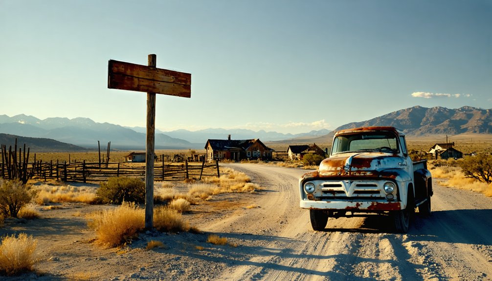
Drive 6.6 miles south from Cave Junction on Highway 199, then turn left onto Waldo Road where pavement gives way to dirt. You’ll find a metal gate blocking vehicle access, but the hilltop cemetery remains reachable on foot. Visit July through August for the best weather—pack sturdy boots, layers, and a sense of adventure. Nearby Kerbyville Museum and O’Brien Territory complement your journey through this vanished mining empire that hydraulic cannons obliterated in 1927, leaving only graves and geological scars to tell its story.
Key Takeaways
- From Cave Junction, drive 6.6 miles south on Highway 199, then turn left onto Waldo Road toward the townsite.
- Visit July-August for ideal conditions with 67-68°F temperatures; winter brings treacherous roads and heavy rainfall.
- Bring waterproof jackets, sturdy boots, layered clothing, maps, and flashlights for exploring the remote hilltop cemetery.
- Vehicle access is blocked by rocks and gates; the cemetery requires hiking up a narrow road.
- Hydraulic mining in 1927 completely erased the town; only the hilltop cemetery and commemorative signage remain.
The Rise and Fall of a Gold Rush Boomtown
When sailors from a wrecked schooner scrambled ashore at Paragon Bay during the winter of 1851-1852, they’d no idea their discovery would spark Oregon’s first major gold rush. Just one mile east, they struck coarse gold in Sailor’s Gulch, transforming wilderness into Waldo—southern Oregon’s first town and mining hub.
You’d have witnessed explosive civic growth by 1855, when 3,000 souls crowded the gulches. Four general stores, saloons, and dance-houses lined streets where Herman Reinhart once dug 2-3 feet to wash fortune from raw earth. This economic development produced over ten million dollars in gold within a decade. The boomtown even boasted stage routes to Crescent City starting in 1853, connecting miners to coastal supply lines. An eleven-mile ditch completed in 1854 brought precious water to expand mining operations across the diggings.
But freedom-seeking prospectors chase new strikes. By the late 1860s, they’d moved on. The 1926 Redwood Highway bypassed Waldo entirely. In 1927, hydraulic miners sluiced the town itself for remaining gold.
Getting There: Directions and Road Conditions
From Cave Junction, your journey to Waldo’s ghost town remnants begins with a 6.6-mile drive south on Highway 199 toward Crescent City, California. Turn left onto Waldo Road, where pavement surrenders to dirt as you venture deeper into history.
The asphalt ends where adventure begins—6.6 miles south, then left into the dusty corridors of forgotten fortune.
Road access challenges await at 2.7 miles:
- A dirt embankment topped with large rocks blocks vehicle passage
- A metal gate prevents drive-up access to the townsite
- The private land designation restricts exploration beyond this barrier
The mining impact on landscape becomes evident as you approach—hydraulic operations literally carved away portions of the town. Highway 199 remains navigable year-round in standard vehicles, but Waldo Road’s condition deteriorates progressively. You’ll find the GPS coordinates 42.06203, -123.64831 mark where freedom-seekers once struck gold, now inaccessible by vehicle. The area includes a cemetery located at 3300 Waldo Road, though no memorials have been documented there. Photographer Ben Maxwell documented the community hall and structures during visits in 1941 and 1954, capturing what remained of this declining settlement.
What Remains at the Waldo Townsite Today
When you reach Waldo’s location, you’ll find a haunting hilltop cemetery standing sentinel over an empty landscape where a bustling gold rush town once thrived.
The graveyard overlooks what should be streets and buildings, but hydraulic mining in the 1920s erased everything—the main street itself was run through a massive sluice box in 1926. By 1927, giant water cannons had completely leveled the townsite, leaving only the dead to mark where thousands once lived and worked.
The site sits on rich gravel benches that continue to attract interest for their mineral potential, though mining rights disputes persist to this day. Waldo served as the county’s seat of government during the latter half of the 19th century, making its disappearance all the more striking.
The Hilltop Cemetery
The earliest burial ground in the Waldo vicinity rests on a hilltop approximately one mile down from the weathered historical plaque, positioned across from where the main townsite once thrived. You’ll need a 4×4 to reach this cemetery on private property, where miners, business owners, and Chinese workers who shaped Waldo’s gold rush era now rest as sole witnesses to the community’s existence.
The commemorative signage placed in 2011 by E Clampus Vitus and Josephine County Historical Society marks burials documented between 1858 and 1910. Despite minimal cemetery restoration, the site reveals:
- First-generation settlement evidence from peak boomtown years
- Demographic diversity of the mining community
- Nature’s remarkable healing from hydraulic mining damage
This burial ground stands as Waldo’s primary historical marker—authentic, remote, and unpolished. The landscape around the cemetery shows no visible evidence of the hydraulic mining operations that leveled the entire town in 1927. The cemetery’s linear layout spans approximately one acre, with graves arranged in rows that reflect the organized planning of this early 1850s burial ground.
Vanished Town Below
While gravestones mark where Waldo’s pioneers sleep, nothing remains of the bustling townsite they built below. A local mining company converted the entire area into a rock quarry, hydraulically mining Main Street itself and running it through sluice boxes.
Between 1954 and 2011, every structure vanished—demolished for the rich gravel beneath. Today you’ll find only a weathered plaque with barely legible words and a dirt embankment blocking access behind a metal gate.
The complete erasure of this settlement speaks to how mining operations prioritized profit over historical significance and local cultural impact. What began as hydraulic devastation in 1927 ended with total removal by 2011. This place name disambiguation reflects how completely the original town has been removed from modern maps.
Google Maps reveals the stark reality: where pioneers once walked, only quarry operations remain visible from satellite view.
Exploring the Historic Waldo Cemetery
Perched on a windswept hilltop above what was once a bustling gold mining town, Waldo Cemetery stands as the sole surviving structure after hydraulic mining obliterated the entire townsite in 1927. You’ll find this haunting memorial south of Cave Junction, accessible via a narrow road climbing from the Sailor’s Diggings roadside marker.
The cemetery’s historical significance runs deep, containing:
- Early settlers from Allen Gulch mining operations
- Descendants of sailors who jumped ship in 1852
- Numerous unmarked graves from the town’s 3,000-person peak population
While locals discourage photography due to vandalism concerns, the site offers unmatched perspective. Standing among weathered headstones, you’ll gaze across remarkably healed terrain where Oregon’s first water rights were established and fortunes rose from gold-rich gravel. The cemetery grounds also preserve a large camphorwood cross, the only remaining structure from the original St. Patrick’s Catholic Church that once stood beside the burial ground.
The Hydraulic Mining Legacy That Erased a Town
From that hilltop vantage point, you’re witnessing one of American mining history’s most dramatic erasures. In 1927, powerful water cannons turned on Waldo itself—the unexpected town destruction came when miners realized the settlement sat atop valuable gold-bearing gravel. Giant monitors blasted Main Street through sluice boxes, obliterating stores, saloons, and homes where 3,000 people once lived.
The 1930s brought another hydraulic assault, erasing any remaining traces.
The environmental impacts of hydraulic mining reshaped these mountains entirely. High-pressure jets carved away hillsides, sending sediment cascading downstream to smother fish spawning beds and trigger floods. What you see today—recovering forests and healed contours—represents nature’s century-long recovery from technology that prioritized gold over everything else, including the town itself.
Tales of Outlaws and Buried Treasure
Beyond the environmental devastation, Waldo’s gold wealth attracted a deadlier force—outlaws who saw the remote mining camps as perfect hunting grounds. The notorious Triskett Gang‘s 1852 rampage left eighteen dead and countless terrified miners in its wake. Their violent gang exploits included robberies, assaults, and the theft of $70,000-$80,000 in gold before a posse gunned them down near O’Brien.
The Triskett Gang’s 1852 reign of terror claimed eighteen lives and $80,000 in gold before meeting their violent end.
The unrecovered Triskett treasure remains hidden somewhere on a hilltop, spawning generations of treasure hunters:
- Search the areas surrounding Waldo’s historic cemetery
- Study accounts placing the cache near the gang’s last stand
- Navigate challenging terrain where desperate men once buried their plunder
Notorious figures like Boone Helm and Ferd Patterson also frequented these lawless diggings, cementing Waldo’s reputation as genuine Wild West territory.
Best Time to Visit and What to Bring

When planning your exploration of Waldo’s abandoned diggings, timing can mean the difference between a memorable adventure and a miserable slog through mud and freezing rain. July and August deliver ideal weather conditions—67-68°F highs, minimal precipitation at 1.16 inches, and clear skies perfect for photographing weathered structures.
Winter’s 33°F temperatures and heavy rainfall create treacherous access roads, while spring and fall bring persistent fog that’ll shroud your discoveries.
Your essential packing list should include waterproof jackets for Oregon’s unpredictable drizzle, layered clothing for temperature swings, and sturdy boots to navigate muddy trails. Pack sunglasses and sunscreen for summer expeditions, plus flashlights for exploring shadowy ruins. Wind-resistant gear handles those persistent 9-10 mph gusts, and reliable maps guarantee you won’t lose your way when fog rolls through these forgotten hills.
Nearby Attractions and Ghost Towns
Your ghost town adventure doesn’t end at Waldo’s weathered remains—this corner of Josephine County conceals a network of forgotten mining settlements and historical landmarks that’ll amplify your expedition into Oregon’s gold rush past.
The history of Waldo, Oregon ghost town is rich with tales of once-thriving communities and the fortunes that lured hopeful prospectors to its rugged terrain. As you explore, keep an eye out for remnants of old cabins and the stories they could tell about life during the mining boom. Each step through these ruins offers a glimpse into a past that shaped the land and its people.
When considering the best seasons for Oregon ghost towns, spring and fall stand out for their mild temperatures and vibrant landscapes. During these times, the natural beauty surrounding these historic sites enhances the experience, with wildflowers blooming in the spring and stunning autumn foliage. Exploring the remnants of these ghost towns amidst such picturesque scenery can provide a deeper connection to their storied pasts.
Beyond Waldo’s ruins lies a labyrinth of abandoned settlements where Oregon’s gold rush history still whispers through forgotten trails.
Essential stops revealing the area’s historical significance:
- Kerbyville Museum – Three miles north in Kerby, where Waldo’s former county seat preserves original structures and artifacts from the region’s boom years
- Waldo Cemetery – One mile before the marker, accessible via 4×4, containing graves of pioneering miners who chased fortune through these hills
- O’Brien Territory – Where the infamous Triskitt Gang met their end after robbing Waldo’s assay office, allegedly leaving $70,000 in gold buried somewhere nearby
These neighboring ghost towns and landmarks transform a simple marker visit into a genuine exploration of southwestern Oregon’s untamed mining frontier.
Preserving the Memory of Oregon’s First Gold Strike
You’ll find a bronze plaque mounted at Waldo’s hilltop cemetery, placed in 2011 to mark where Oregon’s gold rush began 160 years earlier. The Waldo Mining District remains officially active today, though the town itself was obliterated by hydraulic equipment in 1927, leaving only photographs and memories of its bustling streets.
As you walk these quiet grounds where miners once struck it rich, you’re standing on one of the few tangible connections to a settlement that once housed thousands when the entire Oregon Territory claimed barely 10,000 residents.
Cemetery Marks Historic Site
Today, the hilltop cemetery stands as the sole sentinel of Waldo’s vanished glory—a solitary landmark watching over empty meadows where 3,000 souls once lived, worked, and dreamed of fortune.
This scenic cemetery viewpoint offers you an unobstructed connection to Oregon’s pioneering spirit, where weathered headstones mark the final resting places of both American settlers and Chinese miners who built the state’s first mining town.
The historic significance of cemetery reveals itself through:
- Territorial legacy – Graves dating to 1856 when Waldo served as Josephine County’s first seat
- Cultural diversity – Burial sites representing the town’s 1,500 citizens and 600 Chinese workers
- Archaeological value – Oregon’s last tangible link to its 1851-1852 gold rush origins
You’ll find authentic history here—unvarnished and preserved by time itself.
Mining District Still Active
While the cemetery preserves Waldo’s memory above ground, the earth below still whispers tales of Oregon’s first gold strike—a discovery that transformed winter prospecting into statewide fortune-seeking fever. You’re standing on ground that yielded over ten million dollars in its first decade alone, where ongoing gold mining investigations still probe the district’s 33-square-mile expanse for copper, placer, and chromite deposits.
The placers near Waldo remain Oregon’s largest producers of gold and platinum, though 1930s hydraulic operations obliterated most ghost town artifacts when miners reworked the townsite itself. Remarkably, nature’s healed these scars in less than a century. Yet beneath your feet, those same gravels that drew 3,000 fortune-seekers still hold untapped potential—the district’s geological secrets awaiting their next chapter.
Documenting Waldo’s Lost Structures
How does a town that once housed 3,000 souls vanish so completely that even its foundations disappear? You’ll find the answer in Waldo’s violent transformation through hydraulic mining. Those giant water cannons that once extracted gold eventually consumed the very ground beneath the settlement.
The vanished buildings that once lined Waldo’s streets—blacksmith shops, hotels, saloons, and bowling alleys—were literally washed away when mining companies purchased the rich gravel bench supporting the town. Today, you’ll discover only scattered remnants of structures:
- Occasional stone foundations emerging from eroded hillsides
- Rusted mining equipment fragments half-buried in creek beds
- Hand-hewn timber pieces weathering among second-growth forests
Your camera becomes essential for preserving what natural reclamation hasn’t yet claimed in this disappearing landscape.
Frequently Asked Questions
Are There Any Camping Facilities Near Waldo for Overnight Stays?
You’ll find three established campgrounds offering 200+ sites near Waldo Lake, plus nearly 50 primitive campsites present around the shoreline. While rustic cabins available at nearby Hipcamp locations like Castle Rock Farm provide cozy alternatives for your adventure.
Can I Metal Detect or Pan for Gold at Waldo Today?
You’ll need to verify current regulations before metal detecting or panning, as Waldo’s mineral deposits and historical prospecting activities fall under specific Oregon laws. Contact the U.S. Forest Service directly to confirm permits and designated areas for your adventure.
Were There Any Famous People Born or Raised in Waldo?
No notable historical figures were born in Waldo itself—the mining camp was too short-lived. However, the Waldo family became Oregon legends, with their name honoring the region’s pioneering spirit through landmarks and famous local businesses they established.
What Wildlife or Safety Hazards Should I Watch for Visiting Waldo?
You’ll face swarms of mosquitoes that’ll attack within seconds of arrival, plus rattlesnake sightings in dry areas. Watch for abandoned building hazards with unstable structures, and avoid burned trees that could fall unexpectedly in fire-damaged zones.
Are Guided Tours of Waldo Available Through Local Historical Societies?
No guided tours are offered by local historical groups—Waldo sits on private land, keeping its abandoned buildings off-limits. You’ll need to appreciate this site’s historical significance from the roadside plaque and distant cemetery views instead.
References
- https://www.oregonencyclopedia.org/articles/waldo/
- http://pnwphotoblog.com/ghost-town-of-waldo-oregon/
- https://www.douglasvanbossuyt.com/2013/02/17/sailors-diggings-and-the-disappeared-town-of-waldo/
- http://www.photographoregon.com/Waldo-Oregon.html
- https://westernmininghistory.com/towns/oregon/waldo/
- https://kids.kiddle.co/Waldo
- http://www.webtrail.com/history/waldo.shtml
- https://www.oregonencyclopedia.org/articles/waldo/pdf/
- https://truwe.sohs.org/files/jocodiscovery.html
- https://www.oregonhistoryproject.org/articles/gold/


