Your ghost town road trip to Welcome Industrial begins at Keysville Park on Edison Road, where you’ll navigate rural back roads like Jameson Road and Beulah Church Road to coordinates 27°52’8″N 82°5’45″W. Download offline maps since cell service disappears among the palmetto scrub where sawmill foundations hide beneath sandy soil. You’ll want sturdy boots, N95 respirator, and GPS accuracy within feet as you explore scattered remnants of timber camps, phosphate mining towns like Brewster, and nearby Popash’s weathered general store before discovering what else these forgotten settlements reveal.
Key Takeaways
- Start at Keysville Park on Edison Road to access Welcome’s timber camp remnants in southeastern Hillsborough County.
- Navigate to coordinates 27°52’8″N 82°5’45″W via Keysville Drive, Jameson Road, and Beulah Church Road with offline maps.
- Bring three people minimum, sturdy boots, N95 respirator, multiple light sources, and notify someone of your route.
- Explore nearby ghost towns Popash and Fort Lonesome for additional historical sites like New Hope Church and scattered foundations.
- Document sawmill foundations, phosphate mining remnants, and railroad corridors while checking for structural weaknesses before entering.
Discovering Welcome’s Pirate Origins on the Little Manatee River
Long before Welcome earned its name, the Uzita people shaped their lives around the dark waters of the Little Manatee River, settling at its mouth near Cockroach Bay over 10,000 years ago. They fished these waters freely, built burial mounds from shell deposits, and claimed the riverbanks as their own territory.
Everything changed when Hernando de Soto’s Spanish explorer encounters transformed this wilderness in May 1539. His expedition targeted the bayside Uzita village at Shell Point Road, turning it into a base for Tampa Bay operations. The first hand Uzita accounts came from these violent meetings, as Spanish squads roamed inland and natives fought back. One of these squads encountered Juan Ortiz, a Portuguese survivor who had lived with the Mocoso tribe for 11 years and would become de Soto’s interpreter.
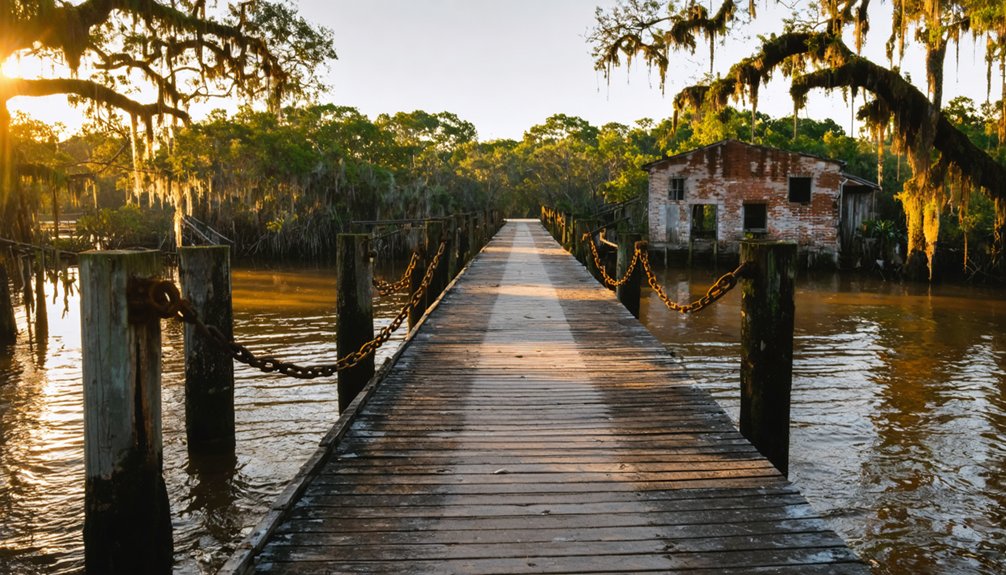
You’ll find their legacy along this unchanged river—a 40-mile blackwater stream that still winds freely, resisting every attempt at development. The South Florida railroad transformed the region when it arrived in 1884, multiplying the population and spawning small towns throughout the wilderness.
Getting to the Keysville Area Where Welcome Once Thrived
You’ll find the ghost town remnants nestled in southeastern Hillsborough County, where Keysville Drive and Doc Durrance Road still trace the old settlement patterns from the 1870s. Start at Keysville Park on Edison Road—it’s your gateway to exploring where Welcome’s timber camps once bustled along the Little Manatee River, just 12 miles south of Plant City.
Mark your coordinates at 27°52′8″N 82°5′45″W, and you’ll be standing where hundreds of pioneers carved out Florida’s second-largest community after Tampa. The name Keysville refers to distinct geographical locations that share this historic designation across different regions.
Before heading out, download a printable PDF map of the Keysville area so you can navigate the ghost town sites even without an internet connection.
Route Planning and Access
Finding your way to where Welcome Industrial once stood requires traversing the rural back roads of southeastern Hillsborough County, about 12 miles south of Plant City. You’ll navigate via Keysville Drive, Jameson Road, and Beulah Church Road—routes that haven’t changed much since the 1936 maps showed railroads cutting through this landscape.
Modern apps like Waze provide realtime updates on back road conditions, though cell service can be spotty among these pine flats. Consider alternate route options through nearby Lithia or along Edison Road to Keysville Park, your landmark reference point. The 1936 State Road Department map reveals how railroads and dwellings were distributed across this terrain, providing historical context for today’s scattered farm units.
Download offline maps beforehand—you’re venturing into territory where old Florida still breathes. The elevation sits at just 81 feet, meaning these paths flood during summer storms, so check weather conditions before departing civilization.
Historical Markers and Coordinates
Once you’ve planned your route through these lonesome back roads, pinning down exactly where Welcome Industrial once stood becomes the ghost hunter’s real challenge. Without official historical marker details to guide you, you’ll rely on old property records and local memory.
The Keysville area near Falkenburg Road holds similar vanished communities worth exploring:
- Site 8HI5085 at 6022 Falkenburg Road marks forgotten homesteads
- Site 8HI11461 at 12324 Old Morris Bridge Road reveals pioneer traces
- Site 8HI11462 at 8903 McRae Road documents rural settlement patterns
GPS coordinate accuracy matters here—you’ll need precision within a few feet. Use your smartphone’s mapping app, drop a pin, and capture those decimal coordinates. Zoom in as far as possible to get the most accurate coordinates for these remote locations. Freedom means discovering places the world’s forgotten, standing where history whispers through pine shadows.
If Welcome Industrial ever receives official recognition, the applicant would be responsible for installing any historical marker at the site.
Nearby Ghost Town Stops
The Keysville area sprawls across eastern Hillsborough County like a patchwork quilt of vanished dreams, where Welcome Industrial once hummed alongside other forgotten settlements that time’s erased from modern maps.
You’ll discover remote homesteads scattered throughout this backcountry, their weathered foundations peeking through palmetto scrub along forgotten dirt roads. The abandoned railroads that once connected these communities now exist as overgrown corridors cutting through pine flatwoods, their routes still traceable if you’re willing to bushwhack. Vegetation inevitably reclaims what developers once cleared, turning former streets into jungle pathways within decades.
These ghost towns weren’t isolated—they formed a network of phosphate-era settlements that rose and fell together. Like Brewster and Pierce in neighboring Polk County, these were company-owned phosphate mining communities that disappeared when the industry moved on. You’re free to explore this unmarked territory, where no tourist signs point the way and GPS coordinates matter more than street addresses. It’s authentic Florida history, unpackaged and waiting.
Notable Ghost Town Stops Along Your Florida Route
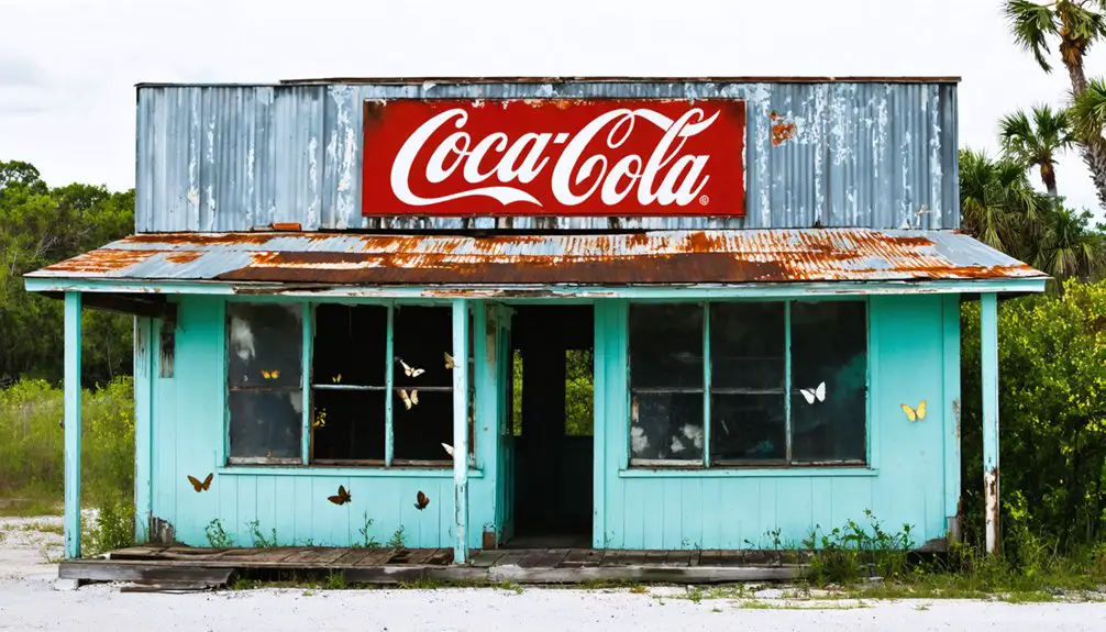
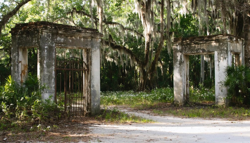
You’ll want to pull off at Popash first, where strawberry fields once dictated the school calendar and cattle grazed between the general store and New Hope Church—both still standing after all these years. I remember my grandfather telling stories about places like this, where entire communities rose and fell with the seasons and the railroad’s whims.
Fort Lonesome makes for a quick crossroads stop next, though don’t expect much more than scattered foundations and the weight of history hanging in the humid air. The intersection of SR 674/CR 39 marks this geographic point where the old settlement once thrived.
Popash’s Agricultural Heritage Remains
Today’s community preservation efforts have maintained several touchstones:
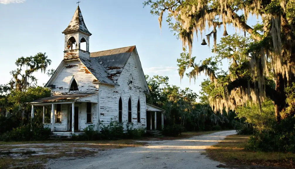
- New Hope Baptist Church, built after 1879, still serves worshippers
- New Hope Cemetery remains carefully tended by descendants
- The general store’s weathered shell stood visible through 2015
While the 1912 brick schoolhouse fell to demolition in 2009, you can still sense the independent spirit of settlers who built thriving farms without railroad access, proving self-sufficiency trumped convenience.
Fort Lonesome Crossroads Stop
Continuing south from Popash, you’ll encounter one of Florida’s most peculiarly named settlements—Fort Lonesome. The name’s rural isolation inspired a 1929 fruit fly inspector to hang that melancholy sign, and it stuck despite no fort ever existing here. You’ll find yourself at the crossroads of CR 674 and SR 39, where the Fort Lonesome Grocery Store marks what remains of a once-thriving logging community.
Back in the 1930s, this intersection bustled with competing stores and a steam-powered sawmill that drew workers seeking opportunity beyond civilization’s constraints. The historical significance lies in what’s vanished—the sawmill burned, stores closed, dreams scattered. Today’s convenience store stands where pioneers like F.M. Carter and Snyder built their freedom from crowded cities. Stop, stretch, and appreciate this enduring legacy to frontier independence.
What Remains of Popash’s 19th Century Settlement
Though decades have passed since Popash’s final residents departed, the landscape still whispers stories of the community that once thrived here in the Florida scrubland. You’ll find the cemetery remains the most compelling evidence to this 1850s settlement, where children’s gravesite accounts reveal the harsh realities of frontier life.
Small graves outnumber adults in Popash’s forgotten cemetery, where weathered stones chronicle the brutal toll frontier Florida claimed from its youngest settlers.
The schoolhouse demolition aftermath in 2009 erased the last physical landmark, but the burial ground tells deeper truths:
- Multiple children from single families rest side-by-side, some dying within days of each other
- Gravestones cluster from the late 1800s through early 1900s, marking fever epidemics that devastated young lives
- Weathered markers stand as silent witnesses to families who lost everything to disease
You’re standing where determination met tragedy, where settlers built dreams that couldn’t withstand railroad politics and childhood mortality.
Exploring Abandoned Structures at Bradley Junction and Brewster
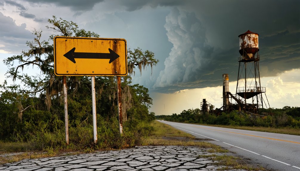
Along the sun-bleached stretches of Highway 37, two phantom settlements emerge from Florida’s phosphate mining legacy—Bradley Junction and Brewster, where rusted fuel islands and a solitary smokestack mark the boundaries between industrial ambition and abandonment.
You’ll find Brewster’s remnants one mile east of modern FL 37, where American Cyanamid’s 1910 company town once thrived. The power plant’s ceramic insulators and towering smokestack still pierce the skyline, evidence of old phosphate company operations that ceased in 1962.
Bradley Junction’s gas stations stand hollow—missing pumps, intact fuel islands, underground tanks frozen in time.
The environmental impact on land transferred deed ownership to Florida state. Today, Mosaic’s cattle pasture reclaims what miners once carved, keeping explorers at bay behind roadblocks and fences.
Essential Supplies and Safety Tips for Ghost Town Exploration
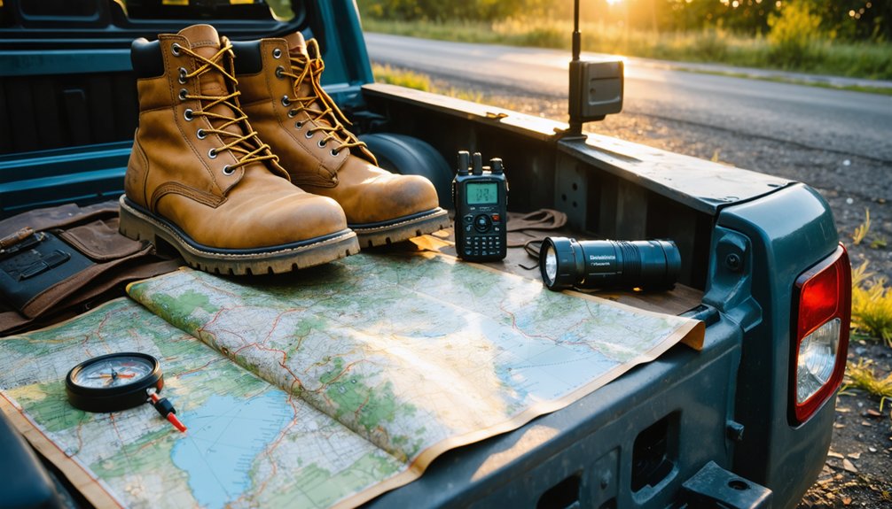
Before you venture into Bradley Junction’s crumbling fuel stations or circle Brewster’s lonely smokestack, you’ll need gear that could mean the difference between a memorable expedition and a medical emergency. Proper gear selection starts with sturdy boots and leather gloves—those rusted nails don’t care about your adventure spirit.
Rusted nails and crumbling structures won’t respect your enthusiasm—proper boots and gloves separate memorable adventures from emergency room visits.
Your essential kit should include:
- N95 respirator for decades of accumulated asbestos and mold
- Multiple light sources (headlamp plus backup flashlight)
- First-aid supplies with bandages and disinfectant
Environmental conditions assessment matters too. Scout the exterior first, checking for structural weaknesses and weather threats. Bring three people minimum—freedom doesn’t mean recklessness. Tell someone your route and return time. These ghost towns have witnessed enough tragedy; don’t become part of their legend.
Documenting Your Visit to Florida’s Forgotten Industrial Sites
Your camera becomes a time machine when you’re documenting Florida’s abandoned industrial sites, but the real story lives in the details most visitors overlook. Focus your lens on sawmill foundations, phosphate mining remnants, and railroad corridors that determined which settlements survived.
Photographic evidence preservation means capturing cemetery records showing those 1881-1893 gravestones, documenting infant mortality patterns that reveal harsh frontier conditions. You’ll want before-and-after shots tracking changes since archival photos, like Popash’s schoolhouse standing until 2009.
Primary source collection supplementation involves recording church records at surviving institutions, noting architectural details on general stores and power plants. Aerial photography reveals foundation outlines invisible from ground level.
Your documentation preserves what development and time haven’t already claimed—freedom to explore means responsibility to record.
Frequently Asked Questions
Are There Any Other Pirate Settlements in Florida Worth Visiting?
You’ll find Florida’s most authentic pirate experiences aren’t at theme parks—they’re hidden in historic pirate treasure sites like the Florida Keys’ shipwrecks and lesser known pirate hideaways around St. Augustine, where real buccaneers once roamed freely.
What Caused Most Florida Ghost Towns to Become Abandoned?
Most Florida ghost towns vanished through economic decline when railroads bypassed them or industries collapsed. Natural disasters like hurricanes and floods triggered population exodus, leaving once-thriving communities to nature’s reclaim—silent monuments to fortune’s fickle nature and human resilience.
Can I Camp Overnight Near Welcome or Other Ghost Town Sites?
Camping availability near Welcome’s ruins is limited, but you’ll find nearby accommodation options at state parks like Anastasia or private campgrounds in St. Augustine. I’ve found primitive sites in Ocala National Forest offer that off-grid freedom you’re craving.
Do I Need Special Permits to Explore Abandoned Buildings?
You’ll face trespassing laws since Florida doesn’t issue exploration permits for abandoned sites. Most urban explorers know 70% of old buildings carry liability concerns. I’ve learned respecting property boundaries protects your freedom while honoring these forgotten places’ histories.
What’s the Best Season to Visit Florida Ghost Towns?
You’ll find the shoulder season (March-April and September-October) perfect for exploring Florida’s forgotten places. Avoid peak visitation season’s crowds and costs while discovering history at your own pace, just like wanderers did generations before you.
References
- https://freepages.history.rootsweb.com/~gtusa/usa/fl.htm
- https://www.journaloffloridastudies.org/0102ghosttowns.html
- https://jennmoslekwordpress.wordpress.com/2018/05/02/ghost-towns-of-florida-popash/
- https://www.youtube.com/watch?v=0kzAaaal1X0
- https://www.youtube.com/watch?v=TJwAIkGtWvU
- https://en.wikipedia.org/wiki/List_of_ghost_towns_in_Florida
- http://www.shrimpnfishflorida.com/forums/threads/lake-county-fl-ghost-towns.5641/
- https://www.floridastateparks.org/parks-and-trails/little-manatee-river-state-park/history
- https://www.ospreyobserver.com/2020/05/claiming-our-history-the-legend-of-john-ortiz-little-manatee-river-landing/
- https://tampabay.wateratlas.usf.edu/upload/documents/LittleManatee-Byers.pdf