Your Wolf Hole ghost town adventure starts 18.8 miles south of the Arizona-Utah border, where BLM Roads 1069 and 1004 converge on the remote Shivwits Plateau. You’ll navigate graded gravel roads that turn treacherous after rain, discovering weathered foundations and one defiant structure still standing from the community’s 1917-1928 heyday. Plan your expedition for spring or fall, pack recovery gear and satellite communication, and allow two days to explore nearby Mount Trumbull Wilderness and neighboring ghost settlements that reveal the Arizona Strip’s untamed frontier legacy.
Key Takeaways
- Wolf Hole lies 18.8 miles south of the Arizona-Utah border where BLM Roads 1069 and 1004 intersect on the Shivwits Plateau.
- Visit in spring (April) or fall (October) to avoid extreme summer heat and unpredictable winter snow conditions.
- Bring recovery gear, multiple gallons of water, satellite communication, and navigation tools for complete self-sufficiency in remote wilderness.
- BLM-1004’s graded gravel becomes impassable after rain; steep dropoffs require cautious driving and yielding to oncoming traffic.
- Combine Wolf Hole with nearby Mount Trumbull Wilderness Area, White Hills, Chloride, and Santa Claus for a two-day expedition.
The History Behind Wolf Hole’s Rise and Abandonment
When Major John Wesley Powell first traversed the Arizona Strip in the 1870s, he christened a remote plateau settlement that would briefly flicker to life before fading into the high desert wind. Wolf Hole emerged thirty miles south of St. George, Utah, where ranchers and farmers carved out existence near Wolf Hole Mountain.
By 1917, the community’s past ranching significance warranted its own post office—a milestone proving you’d found civilization’s edge. For eleven years, this supply town supported cattle operations and possibly shipped timber northward to developing Mormon settlements.
Then 1928 arrived, bringing the impact of post office closure that effectively signed Wolf Hole’s death warrant. Without postal service, ranchers drifted away, leaving scattered foundations and a single derelict house standing sentinel over what you’ll discover today.
Getting There: Routes and Road Conditions to Wolf Hole
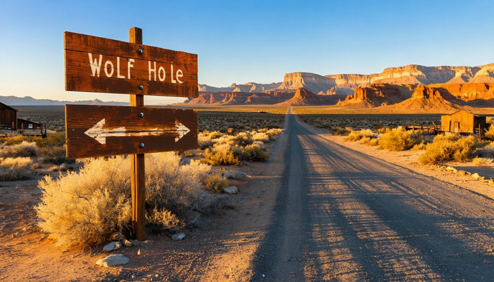
Your journey to Wolf Hole begins where BLM Roads 1069 and 1004 intersect, a critical junction sitting 18.8 miles south of the Arizona-Utah state line.
You’ll navigate BLM-1004 after a grueling 20-mile trek from your starting point, watching dust plumes rise behind your vehicle as the road cuts through the western Shivwits Plateau. These remote routes demand attention—mileage markers reference distances from St. George’s BLM offices, serving as your breadcrumbs through this high-desert wilderness.
Primary Access via BLM-1004
As your vehicle turns onto BLM-1004’s graded gravel surface, you’re committing to the primary artery into Wolf Hole’s remote valley—a 20.6-mile journey that shifts from Arizona State Trust Land to BLM’s Arizona Strip territory at mile 4.4. Your high-clearance 4×4 handles the well-maintained sections easily, though clay roadbed becomes impassable peanut butter after rain. Check AZ511 before departing.
Watch for soft shoulders and steep dropoffs on downhill stretches, where oncoming traffic gets right-of-way. The graded gravel permits faster speeds when dry, opening access to recreational activities available throughout Wolf Hole Valley. At mile 20.6, you’ll junction with BLM-1069, where nearby camping opportunities dot the basin. Weekend OHV riders frequent this corridor, sharing your quest for backcountry freedom across this designated Travel Management Area.
- Spring through fall offers favorable conditions for the 6.0-mile Wolf Hole Mountain crossing
- Summer and fall provide ideal windows for the 3.7-mile Hole in the Wall route
- Wet periods transform roads into muddy obstacles, demanding patience and proper clearance
Your high-clearance 4×4 becomes essential beyond the main track. Street tires won’t survive these technical passages where dust clouds mark your progress through Arizona’s untamed backcountry.
What You’ll Find at the Wolf Hole Ghost Town Site
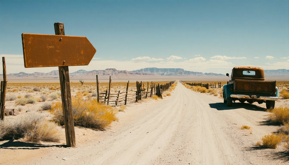
The remnants of Wolf Hole won’t overwhelm you with grand ruins or preserved buildings. You’ll discover weathered foundations scattered across the junction where BLM Roads 1069 and 1004 meet, with one derelict house still standing against the desert wind.
An old roof lies collapsed on the ground, bearing witness to the community that thrived here from 1917 to 1928. Modern fencing now surrounds the site, marked by a simple Wolf Hole sign on a fence post. Wood posts connected with wire trace the property boundaries.
For context beyond what remains physically here, you’ll want to examine historical photos and local artifact collections at the Washington County Historical Society, where the settlement’s ranching heritage comes alive through documented images and preserved memories.
Best Times to Visit and What to Bring
Timing your Wolf Hole adventure means chasing that sweet spot between March and April, when desert wildflowers bloom and temperatures hover in the comfortable 70s before the Mojave sun turns merciless. You’ll want to pack layers for those crisp 43°F evenings that follow warm days, plus enough water to sustain you through this roadless expanse where the nearest services lie miles away.
Your gear checklist becomes your lifeline here—navigation tools, sun protection, and a well-stocked first-aid kit aren’t luxuries but necessities in this isolated corner of Mohave County.
Ideal Seasonal Conditions
When planning your Wolf Hole adventure, you’ll find spring and fall offer the most rewarding conditions for exploration. These shoulder season attractions deliver perfect outdoor recreation suitability with temperatures hovering around 60°F.
Prime visiting windows include:
- April – Experience highs of 66°F with minimal rainfall (0.68″), creating ideal conditions for traversing ghost town ruins and desert trails.
- October – Enjoy warm, sunny days in the low 70s before winter arrives, with comfortable evenings perfect for camping under star-filled skies.
- March – Catch early spring’s awakening as temperatures climb to 79°F and low humidity (19-26%) makes hiking remarkably pleasant.
You’ll want to avoid summer’s sweltering 100°F days and winter’s unpredictable snowfall at higher elevations. Spring and fall provide that sweet spot where you’re free to explore without weather extremes limiting your adventure.
Essential Gear Checklist
Since Wolf Hole sits deep in Arizona’s unforgiving backcountry where self-reliance isn’t optional—it’s survival—you’ll need to pack with military precision. Your high-clearance 4×4 demands recovery gear: tow straps, shovel, and tire repair kit.
Load multiple gallons of drinking water since local springs contain undrinkable gypsum levels. Navigation accessories prove critical—download offline GPS maps before leaving St. George, as cell service vanishes 18 miles before the BLM-1069 junction. Pack satellite communication devices for emergencies in this remote Arizona Strip territory where the nearest help sits over 20 miles away.
Bring sun protection, first aid supplies, and extra fuel. At 5,043 feet elevation, temperature swings demand layered clothing. This isn’t weekend camping—it’s genuine wilderness exploration requiring complete self-sufficiency.
Weather Safety Considerations
The Arizona Strip’s weather personality shifts dramatically across seasons, transforming Wolf Hole from a spring wildflower sanctuary into a summer furnace that’ll drain your water reserves faster than you can pronounce “Paiute.”
April emerges as the sweet spot—daytime temperatures hover around 72°F while nights cool to a comfortable 48°F, with only two rainy days threatening your dusty trail.
Your weather-savvy strategy:
- Target shoulder seasons (March-May, September-November) when humidity levels stay manageable at 26-42% and temperatures won’t force you off remote trails
- Monitor wind speed trends averaging 17-20 mph for dust storm potential and tent stability
- Avoid June-August when 94-98°F heat transforms exposed routes into survival exercises
October’s comfortable 60°F temps offer another escape window before January’s 32°F frosts arrive.
Exploring the Mount Trumbull Wilderness Area Nearby
Perched on the Uinkaret Plateau in Arizona’s remote Strip country, Mount Trumbull Wilderness Area beckons adventurers with 7,880 acres of untamed terrain just 60 miles southwest of Fredonia. You’ll discover a basalt-capped mesa rising to 8,028 feet, crowned by ancient lava flows from the Uinkaret volcanic field’s 213 eruptions.
The flora diversity on Mount Trumbull shifts dramatically—from Mojave yucca and sagebrush at lower elevations to virgin ponderosa pines over 500 years old at the summit. Wildlife viewing opportunities abound as you traverse the 5.1-mile Mount Trumbull Trail. Watch for Kaibab squirrels darting through aspens, mule deer grazing cliffsides, and American Three-toed Woodpeckers hammering ancient bark. Mountain lions and bobcats roam these slopes, while hawks circle overhead. Set up camp at Nixon Spring Campground before your ascent.
Other Arizona Strip Ghost Towns Worth the Detour
Beyond Wolf Hole’s weathered remnants, Arizona’s Strip country conceals dozens of forsaken settlements where desert winds whistle through skeletal structures and time stands frozen. While exploring this untamed territory, you’ll discover ghost towns that reward your adventurous spirit:
- White Hills – Scattered ruins mark where miners once struck silver, leaving behind historic architecture remnants barely visible against stark desert landscapes
- Chloride – Twenty stubborn souls remain among creative art installations and junk sculptures that transform abandoned mining claims into open-air galleries
- Santa Claus – This peculiar 1937 Christmas-themed settlement stands as Arizona’s strangest ghost town, where holiday structures decay beneath relentless Mojave sun
Each site offers solitude far from commercialized attractions. You’re free to wander these forgotten outposts where Arizona’s wildest stories echo through empty doorways and crumbling walls.
Creating Your Multi-Day Ghost Town Itinerary
Planning your Arizona Strip ghost town expedition requires strategic routing across one of America’s most isolated regions, where sparse settlements lie separated by vast stretches of unforgiving desert. You’ll want to dedicate at least two days, launching from St. George and pushing south along BLM-1004 toward Wolf Hole.
Park at the Hurricane Cliffs junction for thirty minutes of exploration—enough time to photograph weathered foundations and that distinctive fence-mounted sign marking the historical significance of location. The rugged BLM roads demand daylight navigation, so break your journey into manageable segments.
Continue west through Hurricane Cliffs, where scenic overlook opportunities reveal the Strip’s raw grandeur, then press on to Mount Trumbull before dusk. This itinerary transforms isolated remnants into a cohesive narrative of frontier ambition and inevitable abandonment.
Frequently Asked Questions
Is Camping Allowed Near the Wolf Hole Ghost Town Site?
Yes, you’ll find dispersed camping allowed on BLM land near Wolf Hole. Expect no campsite amenities—you’re truly off-grid here. Trail conditions vary, so bring everything you need and embrace complete self-sufficiency in this remote desert freedom.
Do I Need a High-Clearance or 4WD Vehicle for Access?
You’ll need high-clearance vehicles minimum; the 3.7-mile trail handles most lifted trucks. However, dirt road conditions demand 4WD for Coyote Buttes South’s deep sand. Vehicle capability requirements intensify during wet weather, restricting access completely.
Are There Any Fees Required to Visit Wolf Hole?
You won’t pay any fees to explore Wolf Hole’s remote ruins. There aren’t public amenities or lodging options here—just pure wilderness freedom. You’re completely on your own, so pack everything you’ll need for this isolated adventure.
Is Cell Phone Service Available in the Arizona Strip Area?
Cell phone coverage reliability is extremely limited throughout the Arizona Strip, with only spotty Verizon service in scattered pockets. You’ll find minimal cellular data speeds, so download offline maps before venturing into this remote, untethered wilderness.
What Wildlife Might I Encounter Around Wolf Hole?
You’ll discover desert dwellers like mule deer, javelina, and striped skunks roaming freely. Expect exceptional reptile sightings including lizards and snakes, plus remarkable bird watching opportunities with raptors soaring overhead—true wilderness awaits your adventurous spirit.


