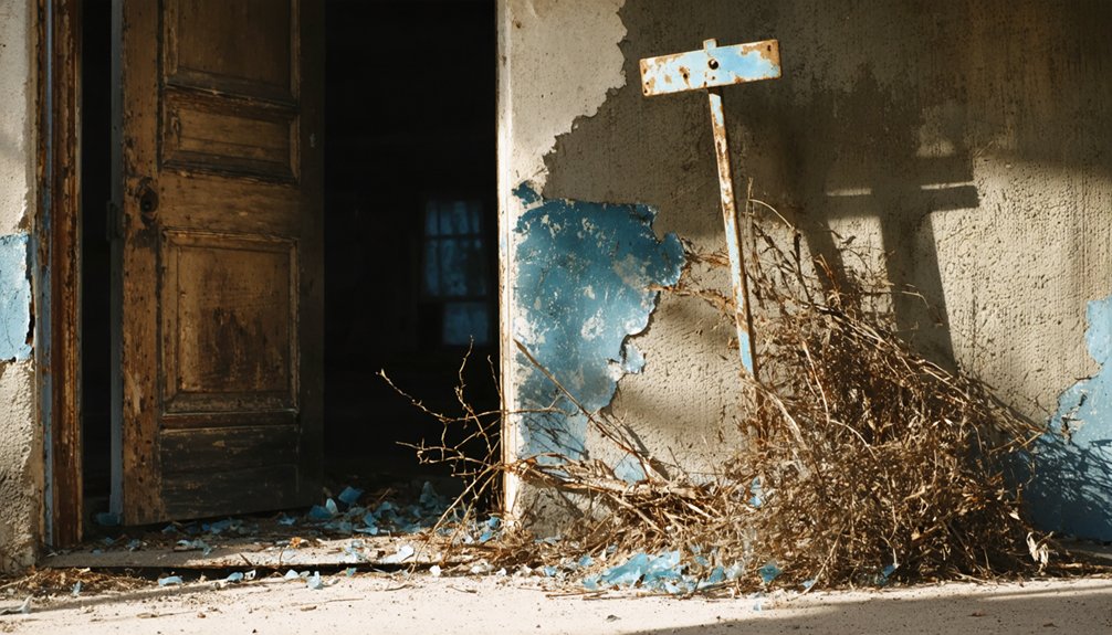
You’ll find Prado’s ghostly remnants beneath the waters of Prado Dam near Corona, California. This vibrant Hispanic settlement, established in the 1860s, met its fate when the catastrophic 1938 flood devastated the community, followed by government acquisition of 11,500 acres for dam construction. Residents scattered, their adobe homes and cultural heritage submerged forever. When water levels drop, glimpses of this forgotten frontier community reveal California’s hidden past.
Key Takeaways
- Prado was a historic settlement within Rancho El Rincon that developed into a community with approximately 33 adobe structures.
- The catastrophic 1938 flood devastated the community, leading to its eventual abandonment.
- Construction of Prado Dam in 1941 required 11,500 acres of basin land, forcing remaining residents to relocate.
- Archaeological excavations since 1983 have uncovered material remnants documenting Prado’s existence from the 1880s through 1960s.
- The community’s remnants lie beneath Prado Basin, which now serves as flood control infrastructure and wildlife habitat.
The Frontier Origins of Prado Basin’s Lost Community
Before the waters of the Prado Dam engulfed its memory, the lost community of Prado began as a frontier settlement nestled within the historically significant Rancho El Rincon.
You’d have found this land—once the camping grounds of Gabrielino Indians—patented to Jose Antonio Yorba and Juan Pablo Peralta in 1810 as part of a Spanish land grant.
The first true settlement at Horseshoe Bend emerged around 1864 when Manual Feliz, connected to the Peralta family through marriage, established roots there.
From this beginning, Prado’s agricultural heritage flourished on fertile riverbank soil. The frontier settlement grew into a vibrant community with approximately 33 adobe structures marking its significance.
This “corner” of California became a hub where indigenous, Spanish, and American influences merged into a distinctive frontier identity. Like many settlements across the state, Prado experienced the typical cycles of prosperity that characterized California’s developmental history. The completion of the Prado Dam in March 1941 ultimately buried the ruins of this historic town beneath its waters.
The Devastating 1938 Flood That Erased a Town
The peaceful rhythm of frontier life in Prado came to a violent halt when the skies opened in late February 1938. A catastrophic combination of heavy rainfall and snowmelt from the San Bernardino Mountains transformed the Santa Ana River into a rampaging torrent.
When the upstream Colton dam failed on March 3, floodwaters surged 30 feet above normal levels, obliterating nearly everything in their path. The Santa Ana River peaked at approximately 100,000 cubic feet per second, turning low-lying communities like Prado into shallow lakes. The disaster was amplified by the region’s arid climate which had hardened the soil and contributed to rapid surface runoff.
The flood legacy remains etched in Southern California’s memory through:
- The complete destruction of 5,601 homes and businesses across four counties
- Over 110 souls lost to the swirling waters that showed no mercy
- $78 million in damages ($1.62 billion today) that reshaped regional priorities
Despite the community resilience displayed by families like the Morenos, who sought shelter in dairy barns, Prado would never recover.
Government Acquisition and the Building of Prado Dam
Following the catastrophic 1938 flood that devastated Southern California, federal authorities swiftly enacted measures to prevent future disasters through the Flood Control Act of 1936 (PL 74-738). This legislation gave the Army Corps of Engineers the mandate to construct what would become the largest earthen dam in America.
You’d scarcely recognize the landscape as government land acquisition transformed over 11,500 acres of the Santa Ana River basin. The dam’s impressive 2,280 ft length stretches across the valley, dominating the view where communities once thrived.
Construction began immediately after the flood, resulting in community displacement as families were forced to abandon their homes and livelihoods. The area now supports a rich riparian forest that serves as critical wildlife habitat. By April 1941, the massive dam stood completed—a 217,000 acre-foot demonstration of federal power and engineering prowess.
The dam’s strategic location at the natural constriction near Corona provided ideal flood control, forever altering the relationship between the land and those who once called Prado home.
Displaced Lives: The Human Cost of Water Management
While memories of old Prado still lingered in the minds of its former inhabitants, their displacement created ripples of loss that extended far beyond mere physical relocation.
The scattering of families to Corona and Norco severed the deep community cohesion that once defined this riverside settlement. You’d find that the psychological impact ran deeper than statistics could capture – these were lives uprooted, cultural identity dissolved.
The human cost manifested in three profound ways:
- Trauma from witnessing both natural disaster and government-mandated exodus
- Erasure of generational connections to ancestral lands
- Dissolution of social fabric as residents assimilated into anonymous urban settings
What was lost wasn’t merely structures, but a way of life – sacrificed for water management priorities that would forever transform Southern California’s landscape. The basin where families once lived now hosts 465 acres of wetlands managed by OCWD as part of their water conservation efforts.
Unearthing Memories: Archaeological Discoveries and Preservation
Beneath the waters that now submerge old Prado’s footprint, a treasure trove of archaeological evidence remains, telling stories that might otherwise have been lost to time and flood.
Since 1983, when excavations began at the Bandini-Cota Adobe, archaeologists have uncovered rich subsurface deposits revealing decades of human activity.
You can trace settlement patterns through the material remnants spanning from the 1880s to 1960s.
The Prado Basin archaeological district preserves diverse structures—adobes, corrals, burial sites, and water facilities—each holding pieces of the area’s complex history.
The discovery of mining operations, from tin claims in Temescal Canyon to feldspar quarries, documents the economic forces that shaped this landscape.
These cultural materials, carefully documented through HABS and systematic excavations, guarantee Prado’s ghost still speaks.
Similar to Cerro Gordo, historical research suggests miners were often buried near worksites, creating informal cemeteries throughout the region.
The exploration process resembles Cerro Gordo’s approach, with researchers accessing previously sealed areas to document historical artifacts and mining techniques.
Frequently Asked Questions
Can Visitors Access Any Remains of the Prado Ghost Town Today?
Sadly, 90% of Prado ghost town remains are inaccessible as they’re on private property with no historical preservation efforts. You’ll find only scattered foundations if you venture beyond official boundaries.
Were There Any Indigenous Communities Displaced Before Prado’s Establishment?
Yes, you’ll find that Luiseño, Gabrielino-Tongva, and Serrano peoples were forcibly removed from this area. Their indigenous history was systematically erased, causing devastating community impact long before Prado existed.
What Happened to the Cemetery and Burial Sites?
Though you might expect they’d be lost to time, the cemeteries now exist in arrested decay. You’ll find burial site history preserved under California Parks System management, with weathered markers standing amid cypress and wildflowers.
In addition to these solemn sites, remnants of entire communities can be discovered in ghost towns in California history, where once-thriving settlements now lie silent. Exploring these locations offers a unique glimpse into the past, as rusted machinery and crumbling buildings tell tales of hardship and resilience. Visitors can wander through the ruins, imagining the lives of those who once called these forgotten places home.
Did Any Original Buildings Survive and Get Relocated Elsewhere?
You’ll find no verified cases of Rincon buildings being relocated despite their architectural significance. Historical preservation efforts weren’t prioritized then, leaving only foundations and scattered ruins as evidence of your freedom-loving predecessors’ settlement.
Are There Any Annual Commemorative Events Honoring Prado’s History?
Unlike Calico Ghost Town’s numerous annual events, you won’t find dedicated commemorative festivals specifically honoring Prado’s history. The submerged community’s heritage hasn’t inspired regular ghost town events celebrating its unique past.
References
- https://www.latimes.com/archives/la-xpm-2003-jan-23-me-prado23-story.html
- https://dornsife.usc.edu/magazine/echoes-in-the-dust/
- https://parks.sbcounty.gov/park/calico-ghost-town-regional-park/
- https://en.wikipedia.org/wiki/List_of_ghost_towns_in_California
- https://www.youtube.com/watch?v=hY9ix0upkuY
- https://apps.dtic.mil/sti/tr/pdf/ADA219773.pdf
- https://www.youtube.com/watch?v=J0qdTW6G8h4
- https://www.youtube.com/watch?v=OD9M6MP6RRU
- https://onepetro.org/SPEWRM/proceedings-abstract/97WRM/All-97WRM/188649
- https://earthobservatory.nasa.gov/images/5195/prado-dam


