To preserve lost frontier settlements, you’ll need to identify remains through stone foundations, aged roadbeds, and vegetation patterns. Gather essential documentation tools including cameras, measuring instruments, and archival notebooks. Use historical surveying techniques to establish boundaries, then excavate methodically while carefully cataloging artifacts. Apply period-appropriate preservation methods to deteriorating structures, focusing on authentic materials like lime-based mortar. Your preservation efforts connect communities to their past through these tangible links to frontier life.
Key Takeaways
- Identify settlement locations by searching for stone foundations, old roadbeds, nearby water sources, and distinctive non-native vegetation patterns.
- Document sites with high-resolution cameras, measuring instruments, and GPS devices before establishing preservation priorities.
- Conduct systematic excavations with proper soil screening techniques while maintaining stratigraphic integrity to preserve historical context.
- Repair deteriorating structures using authentic materials like lime-based mortar and traditional chinking for historical accuracy.
- Engage local communities through educational programs, skills workshops, and digital archives to ensure long-term preservation efforts.
Recognizing Abandoned Settlement Locations and Patterns
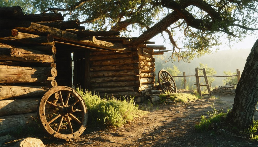
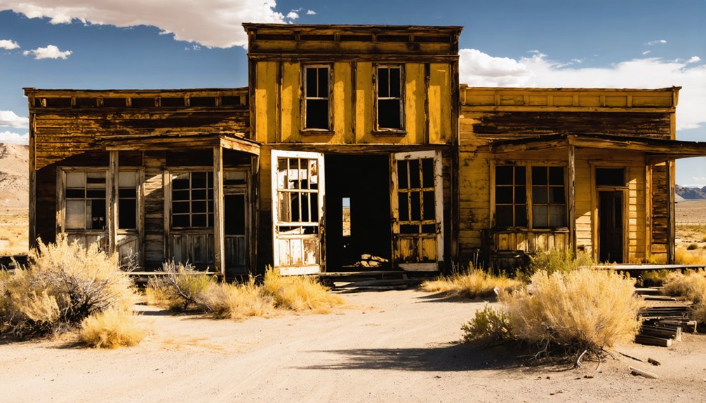
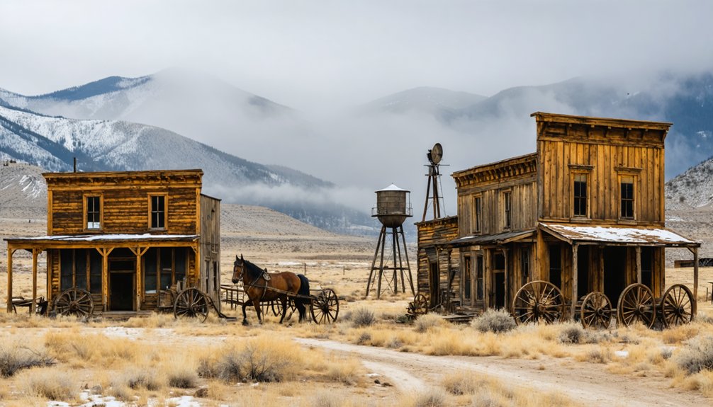
When surveying the countryside for forgotten pioneer settlements, you’ll discover that these ghosts of America’s past reveal themselves through distinct patterns and telltale signs.
Learn to spot clusters of stone foundations, weathered timbers, and overgrown cellars—the skeletal remains of frontier life.
The silent architecture of our past lies exposed in stone outlines, rotted beams, and earth-reclaimed root cellars.
Apply settlement identification techniques by tracing old roadbeds and trails that lead nowhere on modern maps.
These techniques can also unveil hidden beach towns on the east coast, revealing secret spots often overlooked by tourists. By understanding the historical routes, one can uncover charming coastal communities that maintain their rustic charm and offer a tranquil retreat from the bustling city life. Each town tells a story, waiting to be discovered by those willing to wander off the beaten path.
Locate nearby water sources, as settlers invariably built near streams, springs, or wells.
Historical mapping methods involve comparing current landscapes with aged county plats and surveyor records to pinpoint vanished communities.
Note how vegetation changes mark human presence—fruit trees, non-native species, or unusually straight tree lines often indicate homestead boundaries.
Cemeteries, though sometimes isolated, rarely existed without nearby settlements.
With practice, you’ll read the landscape like pioneers once read the stars.
In New England areas, search for concentrated village patterns that were established through group colonization methods, where town authorities allocated land parcels to families by communal decision.
The average farmstead would typically cover about 80 acres of land, often consisting of partially cleared sections with evidence of agricultural activity.
Preparing Essential Documentation Tools and Materials
You’ll need an extensive kit containing both digital and analog documentation tools—high-resolution cameras with spare batteries, precision measuring instruments, archival-quality notebooks, and detailed regional maps.
Your recording process must follow systematic methods, progressing from exterior overview photographs to detailed measurements of structural features and material compositions. Document all details that seem insignificant as they may provide valuable historical context for future research and restoration efforts.
When establishing your preservation strategy, prioritize thorough documentation of disappearing elements first, then develop a sustainable approach for cataloging both physical remains and community knowledge about the settlement’s historical significance.
Field Equipment Essentials
The proper documentation of frontier settlements demands five categories of specialized field equipment to guarantee accuracy, consistency, and preservation of historical data. Your survey techniques will falter without these essential tools at your disposal.
Arm yourself with documentation tools—waterproof pens, standardized forms, and durable clipboards that withstand frontier conditions. Carry high-resolution cameras with tripods and ample batteries for thorough visual records.
Your mapping arsenal must include GPS devices, compasses, and measuring tapes to precisely locate each settlement remnant. Maintain equipment history tracking documentation to chronicle the lifecycle of your tools from acquisition to repair. Using real-time location technology allows you to monitor the whereabouts of valuable equipment across vast frontier sites. Don’t venture forth without field references—architectural guides and local historical records that contextualize your findings.
Finally, secure robust data management supplies—tablets in waterproof cases and external storage—to protect the freedom of information you’ve reclaimed from time’s grasp.
Recording Historical Evidence
Properly recording historical evidence begins with a thorough planning approach that transforms fleeting observations into permanent records. Your documentation efforts must follow rigorous protocols to guarantee evidence synthesis captures the full historical context of frontier settlements.
Employ both written descriptions and visual documentation to build a detailed record that future researchers can trust.
- Establish clear research objectives before fieldwork begins
- Photograph structures systematically—from broad overviews to minute details
- Record precise measurements using rigid tools to prevent data distortion
- Document both tangible features and intangible spatial qualities
- Integrate traditional recording methods with digital technologies for preservation
These documentation practices preserve not merely the physical remnants but the lived experience of frontier settlements.
Your meticulous recording today safeguards historical knowledge that would otherwise vanish without trace. Maintaining detailed field notes with sketches serves as crucial primary documentation that preserves observations even when technology fails.
Preservation Planning Strategies
Before commencing any frontier settlement preservation effort, developing thorough planning strategies guarantees your fieldwork yields meaningful results rather than scattered observations.
While extensive resources remain scarce, you’ll need to assemble specialized documentation tools that bridge historical record-keeping with modern preservation methodologies.
Prepare acid-free sketchbooks, archival-quality photography equipment, and detailed mapping instruments. These tools become your lifeline when meticulously recording deteriorating structures and artifacts.
Establish baseline documentation protocols before arrival, ensuring consistent cataloging across your team.
Consider community involvement essential rather than optional—local knowledge often reveals settlement patterns invisible to outsiders.
Connect with regional historical societies who may possess fragmentary records of frontier life.
Integration of survey, GIS, and remote sensing data enhances your ability to analyze settlement patterns and environmental changes over time.
Understanding how spatial control policies shaped the physical layout of frontier settlements provides crucial context for preservation efforts.
Establishing Geographic Boundaries Through Survey Methods
Surveyors etched America’s frontier boundaries through a remarkable evolution of methods, each reflecting the particular needs and terrain challenges of expanding settlements.
When establishing your claim, you’ll encounter four predominant boundary determination methods that shaped our nation’s landscape.
- Metes and bounds, favored in eastern colonies, relies on natural landmarks like “the great oak” or “Johnson’s creek” to mark your property lines.
- Township and Range creates orderly grids of sections, enabling swift settlement across vast western territories.
- Long lot systems grant precious water access, stretching your land in narrow bands from riverbanks.
- Historical surveying techniques evolved from simple knotted ropes to precision instruments like the theodolite.
- Modern preservation requires understanding these original methods to accurately recreate settlement boundaries.
Advancements in surveying tools throughout history allowed surveyors to achieve increasingly precise measurements with instruments like the Groma enabling accurate right angles.
The Land Ordinance of 1785 established the Township and Range system that would transform the American Midwest into its characteristic checkerboard pattern visible from the air today.
Excavating Historical Structures and Foundational Elements
When you unearth the physical remnants of frontier settlements, you’re literally digging into America’s formative history.
Begin with systematic shovel testing at regular intervals to identify structure footprints before committing to full excavation. As you work, maintain stratigraphic integrity by excavating in controlled layers, documenting each soil change meticulously.
Your foundation analysis should identify construction techniques unique to frontier buildings—look for crib-work walls, sod revetments, or basket-weave reinforcements that tell tales of adaptation.
Employ proper excavation techniques: screen all soil for small artifacts and use block excavation for intact sections to preserve spatial relationships. Document exposed masonry and postholes immediately, as these elements deteriorate quickly once exposed.
Cover excavated areas nightly and coordinate with conservationists to guarantee your discoveries endure for future generations.
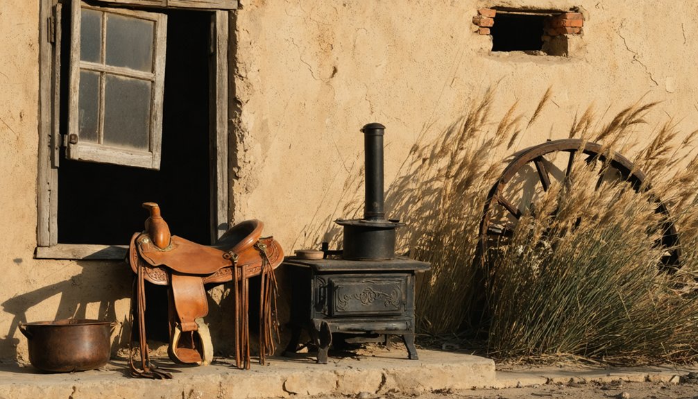
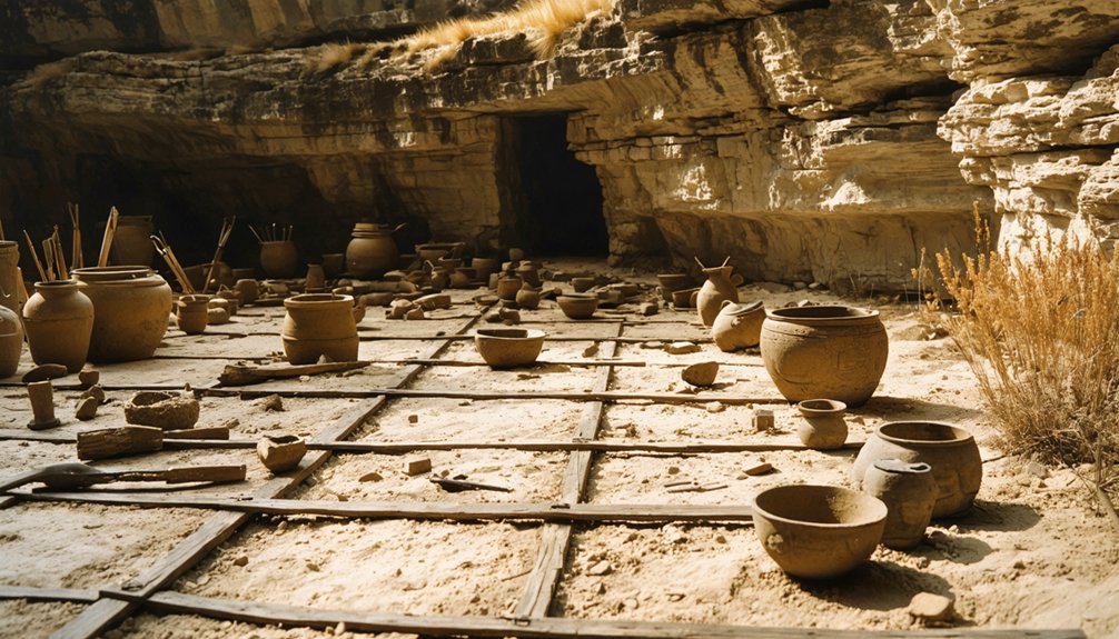
Cataloging Artifacts and Daily Life Implements
You’ll find proper documentation through detailed photography, meticulous labeling, and systematic classification forms the backbone of frontier artifact preservation.
Each artifact requires multiple photographs from different angles, with proper scale indicators and catalog numbers clearly visible in each frame.
Your classification system must adhere to standardized elements outlined in CDWA or CCO frameworks, ensuring each implement is categorized by material composition, function, and temporal context.
Documentation Through Photography
Throughout the preservation efforts of frontier settlements, proper photographic documentation serves as the cornerstone of historical record-keeping.
You’ll need to master photographic techniques that capture the true essence of frontier artifacts, transforming simple documentation into artifact storytelling that reveals our ancestors’ daily struggles and triumphs.
- Position your camera on a sturdy tripod, setting aperture to f/8 or higher to maintain focus across the entire implement.
- Utilize diffuse lighting from two opposing sources to highlight texture without creating deceptive shadows.
- Fill the frame with your subject against a neutral background, capturing front, back, side, and detail angles.
- Include scale markers in each composition to provide size reference for future researchers.
- Record thorough metadata for each image, ensuring your work stands as faithful testimony to frontier life.
Labeling and Classification
Once properly photographed, each frontier artifact must undergo systematic cataloging—a meticulous process that transforms scattered historical objects into organized knowledge.
You’ll need to assign unique catalog numbers using the “sandwich” technique—a protective base coat, the identification number, and a top sealant—placed away from diagnostic features.
Organize your finds using material composition classification systems. The modified Garrow approach sorts ceramics, bone, glass, and metal artifacts into functional groups that reveal daily life implements used by frontier settlers.
This practical taxonomy connects objects to their archaeological context.
Always document provenience information, including site numbers, collection units, and UTM coordinates.
Your labeling techniques should permanently mark artifacts without damaging them, while your classification systems must establish relationships between related household assemblages—preserving the story of America’s frontier settlements.
Preserving Deteriorating Structures With Period-Appropriate Techniques

When approaching the preservation of deteriorating frontier settlements, the integrity of each structure hinges upon meticulous documentation and period-appropriate restoration techniques.
You’ll need to thoroughly research the building’s history before intervening, guaranteeing your work honors traditional techniques while maintaining historical accuracy.
- Conduct extensive assessments using non-invasive methods like infrared scanning to detect hidden damage
- Repair rather than replace original logs whenever possible, using authentic chinking and daubing materials
- Source period-specific woods and employ hand-cut joinery methods reflective of frontier craftsmanship
- Use lime-based mortar instead of Portland cement when tuckpointing historic masonry
- Apply protective finishes such as whitewash or natural stains consistent with the settlement’s era
Address moisture issues immediately as they’re the primary threat to frontier structures, integrating period-appropriate drainage solutions to guarantee longevity.
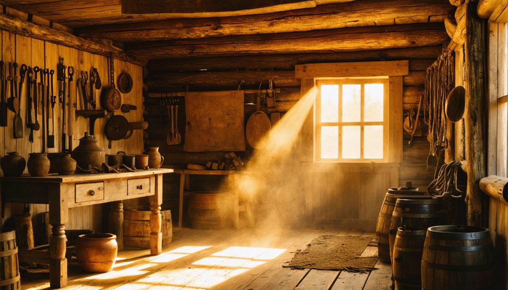
Recreating Historical Food Storage and Preservation Systems
Reconstructing the food storage and preservation systems of frontier settlements requires a deep understanding of how early settlers survived without modern refrigeration.
You’ll need to implement traditional techniques like salt-curing and smoking meats, which created antimicrobial barriers essential for winter survival.
For authentic historical preservation, establish root cellars maintaining temperatures between 32-50°F, where vegetables remain viable for months.
Practice pickling vegetables in vinegar or brine, and create pemmican by combining dried meat with rendered fat for concentrated nutrition.
Don’t overlook dairy preservation—make cheese and preserve eggs using slaked lime solutions for 8-month storage.
Install wooden drying racks near heat sources for fruits and herbs, and use crocks sealed with rendered fat for potted meats.
These freedom-enabling systems allowed self-sufficient frontiersmen to thrive through harsh seasons without external dependencies.
Developing Educational Exhibits and Community Engagement Programs
Developing effective educational exhibits and community engagement programs hinges on your ability to transport visitors mentally and emotionally into frontier life. Your educational outreach must balance authenticity with accessibility, ensuring visitors connect with their heritage while learning practical frontier skills.
The frontier experience lives in the delicate balance between historical accuracy and personal connection.
- Design immersive environments that recreate daily settlement life with period-accurate structures.
- Incorporate authentic artifacts alongside interactive stations for hands-on learning.
- Partner with local historical societies and descendants for authentic narrative development.
- Organize community workshops teaching traditional crafts and frontier skills.
- Collect visitor feedback systematically to refine your programming continually.
Remember to present multiple viewpoints, including settler and Indigenous perspectives. Your exhibits should rotate seasonally, maintaining fresh interest while accommodating various learning styles.
When done properly, your museum becomes not merely a repository of artifacts but a living connection to our self-reliant past.
Frequently Asked Questions
How Do Settlements Differ Between Cultural and Ethnic Groups?
You’ll notice settlements vary greatly through cultural influences shaping community layout and ethnic architecture revealing origins—Germans build solid timber homes while Scandinavians favor rural farmsteads with distinctive roof designs.
What Legal Permissions Are Required Before Beginning Preservation Work?
You’ll need property owner consent, SHPO approval, compliance with NHPA regulations, verification of land ownership rights, and local government authorization before disturbing any historic structure or archaeological remains.
How Can We Distinguish Between Multiple Settlement Periods?
You’ll distinguish settlement periods by examining archaeological stratigraphy, noting artifact types within each layer, and determining settlement chronology through absolute dating methods and typological analysis of material remains.
What Technologies Help Determine Precise Settlement Abandonment Dates?
Like detectives in time’s courtroom, you’ll uncover abandonment’s precise moment through radiocarbon dating of final organic remains and dendrochronology analysis of timber’s last rings. Archaeomagnetic readings from hearths provide additional testimony.
How Do Weather Patterns Affect Preservation Site Selection Priorities?
You’ll prioritize sites with less climate impact, considering seasonal variations that accelerate deterioration. Favor inland locations over flood-prone areas and structures built from materials resilient to your region’s weather extremes.
References
- https://fiveable.me/hs-appalachian-studies/unit-3/frontier-life-subsistence-farming/study-guide/soDnQlk2IEbeJiZk
- https://www.youtube.com/watch?v=-CUdfLOrhsE
- https://www.resources.org/archives/survival-of-the-american-frontier/
- https://colonialquills.blogspot.com/2021/10/how-frontier-folk-stored-food-for-long.html
- https://www.washingtoncrossingpark.org/preserving-harvest/
- https://www.history.nd.gov/hp/PDFinfo/Folk-Farmsteads-on-the-Frontier.pdf
- https://www.britannica.com/place/United-States/Settlement-patterns
- https://mlpp.pressbooks.pub/americanenvironmentalhistory/chapter/chapter-4-frontier-and-grid/
- https://americancenturies.org/essays/deerfield-massachusetts-a-17th-century-frontier-settlement/
- https://en.wikivoyage.org/wiki/Ghost_towns