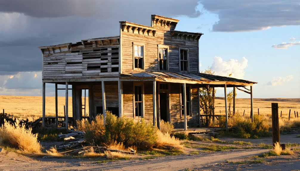
You’ll find Ragged Top nestled in South Dakota’s Black Hills, where gold was discovered in 1886. This bustling mining district once supported 300-400 residents across interconnected settlements including Preston, Victoria, and Cyanide. The area’s mines, like Portland and Ben Hur, produced rich ore worth $100 per ton. While the mining boom lasted from 1896-1906, today you’ll spot scattered remnants of ore bins, mine shafts, and processing tanks – each telling a story of the Black Hills’ golden age.
Key Takeaways
- Ragged Top was a thriving Black Hills mining town established in 1886, reaching a peak population of 300-400 residents during its gold boom.
- The town flourished between 1896-1906, producing over 15,000 ounces of gold valued at $316,000 through extensive mining operations.
- Multiple settlements including Preston, Victoria, and Cyanide formed an interconnected mining community around Ragged Top’s rich ore deposits.
- Mining declined due to depleted gold reserves and environmental restrictions, eventually leading to the town’s abandonment.
- Today, remnants include mine shaft barriers, cyanide processing tanks, and building foundations, marking Ragged Top as a preserved ghost town.
The Rise of a Black Hills Mining Town
When gold was discovered in the Black Hills region of South Dakota in 1886, the Ragged Top mining district quickly emerged as one of the area’s most promising ventures.
You’ll find this bustling district near Spearfish Canyon, where mines like Portland, Ben Hur, and Alameda drove the area’s explosive growth.
The district’s reputation for rich ore – averaging $100 per ton – sparked intense gold extraction operations and rapid community growth.
Towns like Ragged Top (originally Balmoral), Preston, Victoria, and Cyanide sprang up to support the mining boom.
As operations expanded, you’d have seen cutting-edge technology emerge, including a 100-ton cyanide plant and extensive tunnel networks stretching thousands of feet underground. Like the thriving Deadwood Gulch that produced $1.5 million in gold during its peak year, Ragged Top demonstrated the incredible mineral wealth of the Black Hills region.
The district’s success attracted miners and entrepreneurs who transformed this rugged Black Hills terrain into a thriving industrial hub. Today, the area encompasses 71 unpatented claims covering nearly 1,000 acres of historic mining land.
Life in Ragged Top’s Mining District
Life in Ragged Top’s mining district revolved around the daily rhythms of gold extraction, with a close-knit community of 300-400 residents calling this rugged terrain home.
The rugged terrain was formed by ancient volcanic activity, creating the distinctive rock formations that the miners worked within.
You’d find yourself among mining families spread across interconnected settlements like Preston, Cyanide, Dacy, and Balmoral, where community dynamics centered on the demanding work of underground mining operations.
As you’d walk through town, you’d notice the bustle of supporting industries and basic services catering to miners’ needs.
Multiple mining companies, including the prominent Spearfish Gold Mining and Milling Company, shaped daily life with their operations.
The physical demands of hauling heavy ore and working in hazardous conditions meant you’d face constant challenges, while the district’s remote location and limited infrastructure tested the resilience of everyone who called Ragged Top home.
Transportation Networks and Infrastructure
You’ll find abandoned railroad grades throughout the northern Black Hills around Ragged Top, where the Homestake Mining Company’s logging rails once extended south to Merritt and McLaughlin’s line ran from Nahant toward Wyoming.
Like many ghost town sites, the remaining infrastructure exists in various states of disrepair and abandonment, reflecting the area’s decline.
The steep terrain posed significant engineering challenges, with some rail sections conquering grades as severe as 28% ascending and 34% descending through the rugged landscape.
These rail networks, marked today by scattered crossties and spikes, supported both timber harvesting and ore transport essential to Ragged Top’s mining operations, though the lack of direct rail service to many claims ultimately hindered the district’s growth.
The shift from rail to truck transportation contributed significantly to the area’s eventual abandonment, following a pattern seen across many Black Hills communities.
Railroad Grades and Routes
Though South Dakota’s rail network expanded rapidly between 1870-1885, reaching over 2,400 miles of track, Ragged Top’s transportation infrastructure remained relatively sparse due to its challenging western terrain.
Unlike eastern South Dakota’s web-like network of agricultural branch lines, you’ll find that the Black Hills region required complex grade engineering to navigate its rugged landscape.
Railroad companies faced significant challenges when building through the area’s mountainous terrain, requiring carefully planned switchbacks, bridges, and strategic route placement to maintain manageable grades for steam engines. By the late 1910s, railway mileage in South Dakota reached its peak, though expansion into the western regions remained limited.
While major Black Hills towns like Deadwood and Rapid City enjoyed multiple rail connections by 1907, Ragged Top’s remote location and difficult topography meant you’d see fewer rail options, with any existing lines primarily serving mining operations through specialized spur tracks. Similar to the Mitchell-Kadoka line built between 1880 and 1907, many regional rail routes required extensive planning and substantial investment to overcome geographical barriers.
Mining Transport Systems
Operating mines at Ragged Top required an intricate network of transportation systems both above and below ground to move ore, equipment, and workers efficiently.
You’ll find evidence of sophisticated ore transport methods, including 150-foot steel headframes that controlled hoisting cages for vertical movement through the shafts.
Underground, a maze of haulage systems connected various workings through tunnels and drifts. The extensive network utilized electric rail systems to transport materials efficiently through miles of underground passages. Historical documentation from Engineering and Mining Journal between 1899-1902 detailed the transportation developments at the site.
Above ground, the mine’s infrastructure integrated with regional transportation routes like Highway 85/14A and State Highway 473.
Modern operations relied on haul roads connecting to the Wharf Mine’s processing facilities.
The transport network wasn’t just for ore – millions of board feet of timber and heavy machinery had to reach underground workings, demanding robust logistics that could handle both everyday operations and expansion projects.
Mining Operations and Economic Impact
Mining transformed Ragged Top into a bustling gold-producing district when operations began in 1886, with peak activity occurring between 1896 and 1906.
The district’s economic sustainability hinged on mining innovation, particularly the introduction of cyanide extraction in 1898, which allowed processing of low-grade ores at $4-8 per ton. Similar to the Homestake Mining Co. that dominated the Lead District, Ragged Top’s operations played a vital role in the region’s development.
Here’s what made Ragged Top’s mining operations remarkable:
- High-grade ore zones yielded an impressive $100 per ton during peak production
- The district produced 15,285 ounces of gold valued at $316,000 between 1896-1899
- Major operations included the Portland (Trojan), Ben Hur, and Alameda mines, covering over 1,200 acres
You’ll find evidence of this prosperity in the remnants of mining towns like Balmoral, Preston, and Cyanide, which grew around these profitable operations before environmental concerns and injunctions began limiting activities.
The Decline and Abandonment
After the prosperous mining period of the late 1890s, Ragged Top’s fortunes took a sharp downturn in the early 20th century. The depletion of easily accessible gold made mining unprofitable, triggering a swift community decline as miners and their families sought opportunities elsewhere.
You’d have witnessed the domino effect: businesses shuttered, schools closed, and churches fell silent.
The town’s isolation deepened as railroads bypassed the area, making transportation of supplies increasingly difficult and expensive. Economic shifts throughout the region favored other locations, while Ragged Top’s abandoned structures succumbed to harsh weather and neglect.
Mine shafts deteriorated, and nature began reclaiming the land. Without economic diversification, the once-bustling mining town couldn’t sustain itself, and the remaining residents gradually departed, leaving Ragged Top to join the ranks of Black Hills ghost towns.
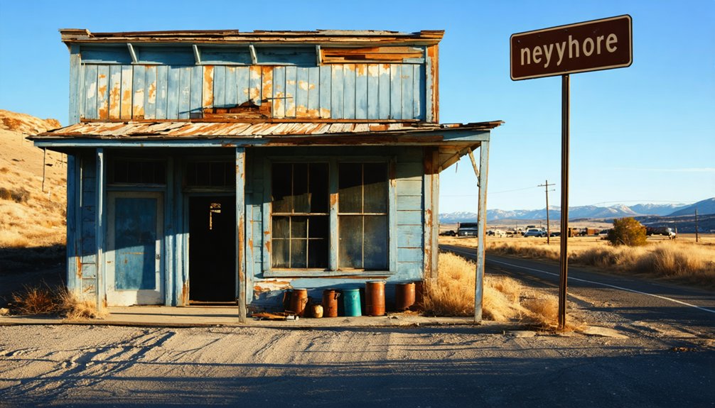
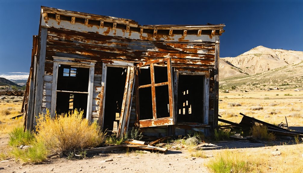
Remnants and Historical Traces Today
As you explore Ragged Top today, you’ll find scattered remnants of its mining legacy, including deteriorating foundations, rusted ore bins, and rotting timber supports from the original mine operations.
The site’s most prominent features are the surviving mine shafts, now covered with protective barriers, and the large cyanide processing tanks that once extracted gold from raw ore.
You can still trace the old railroad grade that served the mines, marked by fragments of ore carts and rail sections that hint at the town’s former transportation infrastructure.
Mining Infrastructure Ruins
Today at Ragged Top, scattered ruins tell the story of its once-bustling mining operations.
You’ll find remnants of vertical shafts and collapsed breccia mines across the landscape, with decaying timber supports still visible in select pit walls. While no standing smelter buildings remain, modern heap leach facilities and water treatment plants mark where mining activity evolved over time.
- Old square-set timbers peek through deteriorating stopes, revealing traditional mining techniques
- Primitive access roads following historic routes wind through overgrown terrain near Wharf Mine Road
- Fenced-off pits and environmental controls showcase ongoing reclamation efforts, protecting visitors from unstable ground
The site’s mining machinery may be gone, but environmental reclamation work continues, transforming these historic workings into safely managed archaeological features.
Visible Railroad Grade Remains
Traces of historic railroad infrastructure near Ragged Top can still be spotted several miles away at Crown Hill, where crucial supply lines once connected this remote mining settlement to the wider Black Hills region.
As you explore the area today, you’ll find evidence of impressive railroad engineering in the form of rock cuts and earthen grades carved into the challenging terrain.
While extensive salvage operations have removed most rails, ties, and metal components, you can still discover remnants of old roadbeds and occasional bridge abutments along the canyon edges.
The most visible traces appear on the outskirts rather than in the heart of the canyons, where erosion has taken its toll.
These surviving grades offer glimpses into the crucial transportation network that once sustained Ragged Top’s mining economy.
Legacy in South Dakota’s Mining Heritage
While many Black Hills mining communities have faded into history, Ragged Top’s legacy endures as a symbol of South Dakota’s rich mining heritage.
You’ll find evidence of both underground and placer mining techniques that shaped this rugged landscape near Spearfish Canyon, though environmental concerns eventually led to stricter oversight of mining operations throughout the region.
- The Victoria Mine’s substantial ore production in 1912 showcases the district’s golden age
- Mining claims spanning 1,519 acres tell the story of both small-scale prospectors and larger operations
- Ghost towns like Castleton serve as a testament to the boom-and-bust cycle that defined the area’s mining era
Today, you can explore these historical sites where determined miners once sought their fortunes, though they’re now carefully managed by the U.S. Forest Service.
Frequently Asked Questions
Are There Any Paranormal or Ghost Stories Associated With Ragged Top?
While 80% of Black Hills ghost towns have documented hauntings, you won’t find specific ghost sightings or haunted locations recorded at Ragged Top, though nearby mining towns share tales of spectral miners and accidents.
The history of Summit, South Dakota reveals a rich tapestry of settler life and community spirit. While it may not boast ghost stories like its neighbors, the town played a crucial role during the gold rush era. Today, remnants of its past can be found in local museums and historical landmarks, inviting visitors to explore the legacy of this hidden gem.
What Wildlife Currently Inhabits the Abandoned Ragged Top Area?
You’ll spot abundant wildlife through careful observation – from mule deer and coyotes to golden eagles and prairie rattlesnakes. The abandoned buildings now serve as natural habitat conservation zones for diverse species.
Can Visitors Legally Collect Artifacts or Minerals From Ragged Top?
You can’t legally collect artifacts or minerals at Ragged Top without specific permits. State and federal regulations protect these historical resources, and you’ll face penalties if caught removing items.
Was There Ever a Cemetery Established in Ragged Top?
Historical records and cemetery research don’t indicate any established cemetery in Ragged Top. You won’t find burial grounds there, as this small mining town likely relied on nearby communities for burials.
What Was the Peak Population of Ragged Top During Mining Operations?
You’d be amazed, but we can’t pinpoint Ragged Top’s exact mining boom peak – though given its smaller scale and transport challenges, it likely never topped several hundred during its brief operation.
References
- https://www.sdhspress.com/journal/south-dakota-history-2-2/some-black-hills-ghost-towns-and-their-origins/vol-02-no-2-some-black-hills-ghost-towns-and-their-origins.pdf
- https://www.sdpb.org/rural-life-and-history/2023-08-21/some-black-hills-ghost-towns-and-their-origins
- https://www.southdakotamagazine.com/galenas-ghosts
- https://www.blackhillsbadlands.com/blog/post/old-west-legends-mines-ghost-towns-route-reimagined/
- https://en.wikipedia.org/wiki/List_of_ghost_towns_in_South_Dakota
- https://unusualplaces.org/explore-a-scenic-ghost-town-in-mystic-south-dakota/
- https://mad-peak.com/blog-posts-and-info/f/black-hills-ghost-towns-are-real—and-you-can-ride-through-them
- https://dakotagoldcorp.com/portfolio/explore-our-gold-properties/ragged-top-property/
- https://thehillsiwander.files.wordpress.com/2016/12/historic-preservation-of-the-northern-black-hills1.pdf
- https://danr.sd.gov/Environment/MineralsMining/MiningHistory.aspx


