You’ll find Old Randolph, Kansas submerged beneath Tuttle Creek Reservoir‘s waters since 1962, when federal flood control projects forced relocation of this pioneer settlement founded in 1856. Originally named Waterville, the town was renamed for Tennessee pioneer Gardner Randolph in 1876. Swedish and German immigrants shaped the community with distinctive limestone architecture and craftsmanship. The town’s preserved stone structures and oral histories hold secrets of Kansas’s pioneering past.
Key Takeaways
- Original Randolph town site was submerged in 1962 by the construction of Tuttle Creek Reservoir, forcing residents to relocate.
- The town was moved to higher ground and rebuilt as “New Randolph,” making the original settlement a ghost town under water.
- Historical structures from Old Randolph, including an 1872 stone farmhouse, remain as preserved landmarks of the submerged community.
- The flooding displaced numerous families and covered 12,350 acres of farmland, effectively erasing the original pioneer settlement.
- Annual gatherings and preserved oral histories maintain the memory of Old Randolph’s community before it became a submerged ghost town.
Early Settlement and Pioneer Rivalries
While many Kansas settlements emerged during the territorial period, Randolph began as Waterville in 1856 before taking its permanent name in 1876 from Tennessee pioneer Gardner Randolph.
Kansas territorial town Waterville was renamed Randolph in 1876, honoring Tennessee pioneer Gardner Randolph who settled the area.
You’ll find that pioneer conflicts shaped the town’s early identity, as Randolph became known for its pro-slavery stance – a rarity in Riley County where Free-State sentiment dominated most settlements.
The settlement dynamics created distinct divisions, with Randolph and Ogden standing apart as southern-influenced communities among their Free-State neighbors. The town’s profile required careful disambiguation efforts to distinguish it from other Randolph settlements in Kansas.
Swedish and German immigrants later added cultural diversity, bringing valuable limestone craftsmanship to the area. The skilled limestone builders from Europe constructed many of the town’s original rock structures.
Located originally a mile east of its current site, the town formed around Randolph’s plantation near Fancy Creek, where his town company controlled much of the local property development.
Immigrant Heritage and Community Building
As Swedish and German immigrants settled in Randolph during the mid-1800s, they brought invaluable limestone craftsmanship and agricultural expertise that would shape the town’s character for generations.
You’ll find their influence in the enduring rock structures that still stand today, proof of their mastery of limestone masonry.
These pioneers established deep roots through their cultural traditions, with the Swedish Methodist Episcopal Church serving as a cornerstone of community life.
By 1882, nearly 300 residents, mostly of Swedish and German descent, had built a thriving agricultural economy in the Big Blue River Valley.
The town’s first post office and route operated directly from Gardner Randolph’s residence, connecting the growing immigrant population.
Their community resilience showed through shared ethnic bonds, frontier hardships, and dedication to education.
Even after the Tuttle Creek Reservoir Dam submerged Old Randolph in 1960, the spirit of these immigrant founders lived on through their displaced descendants.
Growth Years and Limestone Legacy
The early growth of Randolph began when Gardner Randolph settled near the Big Blue River Valley in 1855, though J.K. Whitson later contested and won the land claims, establishing Waterville in 1856.
You’ll find that the town’s development accelerated as Swedish and German immigrants brought their masterful limestone architecture skills to the region. The town was influenced by Free-State advocates who settled in the area during Kansas’ territorial period. Like many frontier settlements that faced harsh weather conditions, the town’s population fluctuated dramatically during its early years.
The Tuttle Creek Reservoir Impact
Following decades of devastating floods along the Big Blue River, construction of the massive Tuttle Creek Reservoir began in 1952, forever altering Randolph’s landscape and destiny.
Before the reservoir, the area experienced significant geological changes when the Kansan Nickerson glacier blocked eastward drainage, creating a deep gorge across the Randolph Divide.
Local resistance to the project was fierce, with concerned residents mounting campaigns against what they called Big Dam Foolishness.
You’ll find the reservoir, completed in 1962, sprawling across 12,350 acres of what was once prime farmland and thriving communities. While the Army Corps of Engineers justified the dam for flood control to protect millions of downstream acres, it came at a steep cost to Randolph and nine other towns.
Today, you’re witnessing new challenges as the reservoir battles 46% capacity loss from sediment accumulation.
The Corps now focuses on sediment management techniques like water injection dredging to preserve the reservoir’s function. Without intervention, this landmark of both progress and sacrifice could lose its ability to protect against the very floods it was built to control.
Modern Memory and Historical Preservation
While the physical town of Old Randolph succumbed to the Tuttle Creek Reservoir, dedicated preservation efforts have kept its rich architectural and cultural legacy alive.
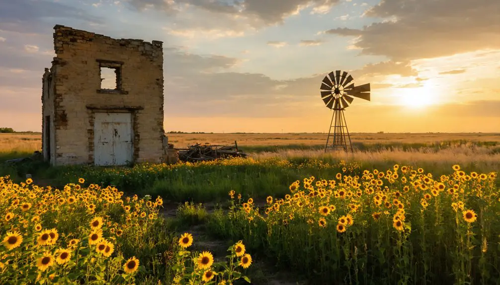
You’ll find this heritage most prominently displayed in the restored 1872 stone farmhouse, now serving as modern office space while maintaining its historical character. The building drew 150 visitors during its open house, demonstrating the community’s deep connection to its past. Much like the historic Cedar Point mill, the preservation of these structures represents a crucial link to Kansas’s pioneering past. Similar to the town of Army City, Randolph faced complete relocation due to infrastructure development.
The town’s cultural identity remains firmly rooted in its Swedish and German limestone craftsmanship. Through the Kansas Historic Resources Inventory and local preservation groups, you can explore detailed records of these enduring structures.
Many of these sites now exist as ghost towns of Kansas history, reminding visitors of the vibrant communities that once thrived. Preserving the stories and architecture of these locations is crucial in honoring the legacy of those who lived there. Each ghost town holds a unique tale, inviting exploration and reflection on the past.
Despite being displaced, relocated families maintain their bonds through oral histories, annual gatherings, and online repositories that document Randolph’s remarkable journey from settlement to modern times.
Frequently Asked Questions
What Happened to the Cemetery When Randolph Was Flooded?
You’ll find that cemetery relocation occurred before the flood aftermath, with authorities likely exhuming and moving remains to higher ground, though sparse records make it difficult to confirm exact details.
Did Any Original Buildings From Old Randolph Survive the Flooding?
You won’t find any intact original buildings that survived the flooding, though you can still spot some historically significant limestone ruins and foundations when water levels are low, reflecting Randolph’s architectural significance.
How Were Residents Compensated for Their Lost Properties?
While you might expect clear records, there’s no documented evidence of how property claims were settled. You won’t find proof of financial restitution – historical sources don’t show if residents received any compensation.
Where Did Most of Randolph’s Displaced Residents Relocate To?
You’ll find that most residents moved to Manhattan, Kansas, while others settled in Ogden. These relocation patterns followed established postal routes and kept community impact minimal by maintaining cultural connections in nearby areas.
Are There Any Annual Events Commemorating Old Randolph’s History?
You’ll find Randolph’s history celebrated at their Independence Day festival, held the Saturday before July 4th. It’s been running for nearly 50 years, featuring pork BBQ, fireworks, and exhibits about the town’s heritage.
References
- https://legendsofkansas.com/randolph-kansas/
- https://randolphks.com/more/history/
- https://www.youtube.com/watch?v=OyBXD18P_j4
- https://legendsofkansas.com/riley-county-extinct-towns/
- https://fhsuguides.fhsu.edu/kansasheritage/tregocounty
- https://en.wikipedia.org/wiki/Randolph
- https://www.rileycountyks.gov/441/History-of-Riley-County
- https://legendsofkansas.com/riley-county-kansas/
- https://www.kckcc.edu/files/docs/ejournal/volume-one/number-one-oct-2007/quindaro-underground-railroad-a-unique-ethnic-unity-in-americas-past.pdf
- https://octa-trails.org/wp-content/uploads/2023/05/Ellis-Uniontown-and-Plowboy–-Potawatomi-Ghost-Towns.pdf


