You’ll find Red River Landing at the historic confluence of the Red and Mississippi Rivers, where it flourished as an essential steamboat port from 1836 until the Civil War era. Once home to busy warehouses, hotels, and cotton merchants, this Louisiana trading hub declined after railroad competition and repeated flooding drove residents away. Today, only crumbling foundations and informal fishing spots remain, marking a site where America’s river commerce history runs deep.
Key Takeaways
- Red River Landing, established in 1836, transformed from a thriving river trade hub to a ghost town following economic decline and flooding.
- The town’s demise accelerated after the Civil War when railroads replaced steamboats as the primary transportation method.
- Once featuring busy warehouses, hotels, and saloons, the settlement declined when merchants closed businesses due to rerouted trade.
- A collapsed railroad bridge and repeated flooding contributed to population loss and the town’s eventual abandonment.
- Today, only remnants of port structures remain, serving as informal fishing spots and locations for river monitoring stations.
The Rise of a River Port (1836-1850)
When Red River Landing emerged at the strategic confluence of the Red and Mississippi Rivers in 1836, its establishment as a formal settlement was marked by the opening of a post office at Red River Point.
You’ll find this location quickly became crucial to river trade, with ferry service connecting Mississippi River traffic to Angola Plantation Landing and surrounding agricultural areas. Merchants and saloons established hotels and warehouses to accommodate the growing number of travelers and traders.
Captain Henry M. Shreve completed removal of major river obstacles by 1840, enhancing river commerce.
The settlement’s rapid economic growth through the 1840s transformed it into a bustling transport hub.
Red River Landing’s economic boom in the 1840s turned this river settlement into a vital crossroads of commerce and transportation.
By the 1850s, you’d see three weekly mail and passenger coaches linking New Orleans, Alexandria, and Shreveport.
The removal of the Great Raft logjam upstream improved navigation, while warehouses, inns, and provisioning businesses sprang up to serve travelers and boat crews.
The port’s strategic position made it indispensable for moving cotton and agricultural exports to national and international markets.
Engineering Marvel: Shreve’s Cut and Its Impact
You’ll find Shreve’s Cut stands as one of the most ambitious engineering projects of 1831, transforming navigation along the Mississippi River by shortening its course through Turnbull’s Bend.
While the cut revolutionized steamboat travel and increased river speeds from 0.25 to 3 mph in cleared sections, it triggered significant environmental changes that would reshape the region’s hydrology.
The project’s success in improving commerce came at a cost to Red River Landing, as altered water flows and riverbank erosion eventually submerged this once-bustling port beneath the waters of the mighty Mississippi.
Captain Shreve utilized his innovative snagboat design patents to efficiently clear waterway obstructions during the project.
By 1837, Captain Shreve’s efforts to clear the Red River Raft dramatically increased water flow into southern Louisiana.
The Mississippi River’s navigation system underwent a revolutionary transformation in 1831 with Captain Henry Shreve‘s ambitious engineering project known as Shreve’s Cut.
You would’ve witnessed a remarkable river engineering feat as Shreve carved a direct channel through Turnbull’s Bend, bypassing a lengthy meander near the Red River confluence.
Using innovative steam-powered snag boats equipped with sawmills, Shreve’s team cleared massive log jams and excavated through unstable sediments. This technique would later prove invaluable when tackling the 175-mile logjam that blocked the Red River.
Shreve’s expertise with river navigation began when he designed the steamboat Enterprise for shallower waters.
You’ll appreciate how this navigation history milestone slashed travel times for steamboats carrying cotton, whiskey, and mail through Red River Landing.
The cut transformed river commerce, allowing vessels to travel upstream at six miles per hour – faster than stagecoaches.
For merchants and travelers alike, this new shortcut opened unprecedented access to Arkansas, Texas, and northern Louisiana via the Red River.
Unintended Environmental Consequences
While Shreve’s Cut revolutionized river navigation, its engineering marvels released profound environmental changes throughout the Mississippi-Red River confluence.
You’ll find that the cut’s impact rippled far beyond its banks, transforming the region’s ecological fabric.
The project accelerated sediment transport dramatically, with canals pumping sediment into swamps at rates up to ten times higher than natural overflow.
Modern barging projects following similar engineering approaches have proven economically inefficient, with commercial traffic declining significantly below projected levels.
You can trace the disappearance of the Great Swamp northeast of the river directly to these changes.
The altered hydrology converted thriving wet prairies and swamp lakes into incised channels, while disrupted flooding patterns reduced natural nitrate removal in floodplain swamps.
This wetland degradation affected everything from tree growth to water quality, as baldcypress swamps struggled with modified flooding regimes and excessive sediment loads hampered young tree establishment.
These environmental alterations resulted in a devastating economic impact of approximately 295 million dollars in daily losses due to disrupted operations.
Reshaping Regional Commerce
Following Shreve’s Cut completion in 1831, Red River Landing transformed into a bustling commercial hub where steamboats laden with cotton, whiskey, and chinaware converged at the Mississippi-Red River junction.
You’d find hotels, saloons, and warehouses springing up to service the increasing river traffic, as trade networks expanded throughout the region.
The cut’s strategic location eliminated the notorious Red River Raft logjam, opening essential pathways to Alexandria and Shreveport.
However, by 1880, water no longer flowed between the Red River and Mississippi due to sediment buildup in the old river bend.
This engineering achievement accelerated economic integration between the southwestern territories and New Orleans markets. Merchants could now move goods more efficiently, while innovative snagboats kept the waterways clear.
The landing’s position at this significant intersection made it central to the region’s commerce, connecting previously isolated communities to the Mississippi River’s economic opportunities.
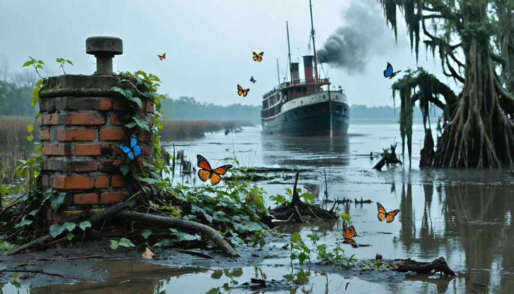
Golden Age of Steam and Commerce
During the early 1800s, Red River Landing emerged as an essential steamboat hub, transforming commerce across Louisiana, Oklahoma, Texas, and Arkansas. You’d find hundreds of steamboats plying these waters between January and June, with vessels like the Enterprise blazing new trading routes as early as 1831.
The Landing’s strategic location made it one of the region’s busiest commercial hubs.
At the heart of this steamboat culture, Ralph Smith Smith’s Red River Railroad created a powerful transportation network, connecting the Landing’s docks with inland plantations. The railroad’s five foot gauge track stretched approximately 40 miles inland to Bayou Hauffpaur. You could watch steam-powered vessels loading cotton and sugar cane, then sailing downstream to New Orleans.
Steamboats laden with cotton and sugar cane docked at Red River Landing, where Smith’s railroad linked river trade to inland wealth.
This golden age continued until the Civil War, when steamboats served military needs before gradually giving way to expanding railroad networks.
Natural Forces and Human Intervention
As natural forces shaped the landscape around Red River Landing, you’d witness the powerful interplay between the Red and Mississippi Rivers at their confluence. The area’s flood dynamics created constant challenges, with the massive Red River Raft acting as nature’s dam controlling water flow.
You’ll find that human intervention dramatically altered this delicate balance. Captain Henry Shreve‘s 1831 engineering project cut through the Mississippi, forever changing the region’s river management.
The Army Corps of Engineers later added control structures to tame the waters, but these changes came at a cost. The altered flow patterns reshaped the landscape, impacting local ecosystems and agricultural lands.
Some communities had to abandon their homes as the rivers carved new paths, demonstrating nature’s ultimate authority despite human attempts to control it.
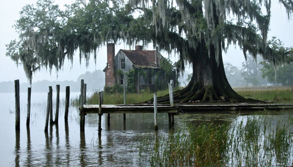
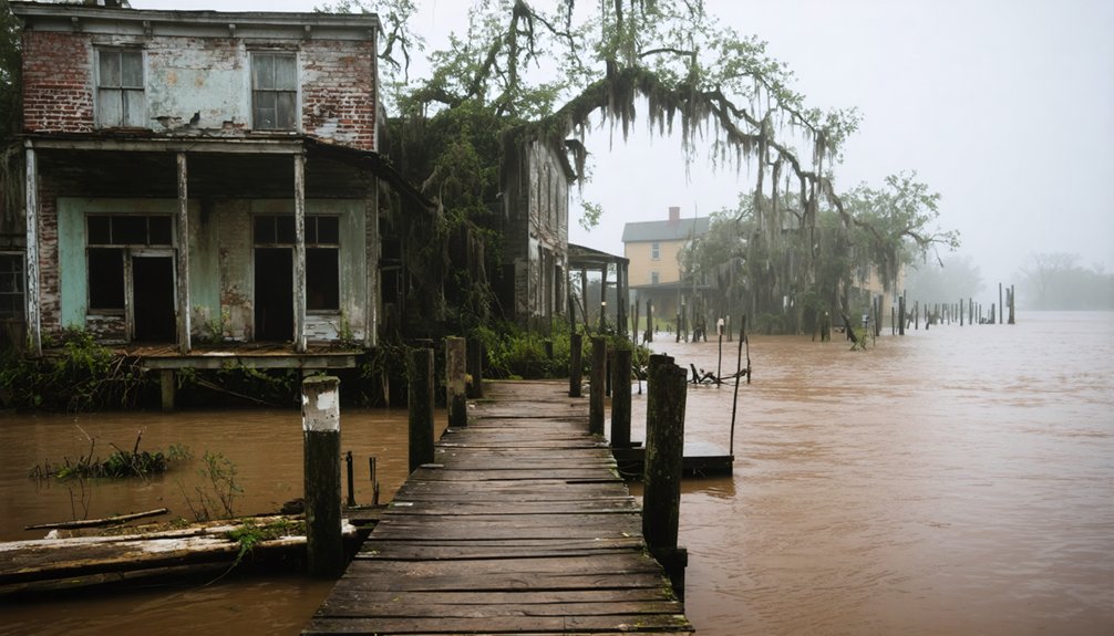
From Bustling Hub to Abandonment
While Captain Henry Shreve’s 1831 river cut initially sparked Red River Landing’s growth, the town quickly blossomed into an important commercial hub at the confluence of the Red and Mississippi Rivers.
Red River Landing emerged from Shreve’s innovative waterway into a vital trading center where two mighty rivers met.
You’d have found bustling warehouses, hotels, and saloons serving travelers bound for northern Louisiana and Texas, with daily stage service to Shreveport.
But the town’s fortunes shifted dramatically. The collapse of a crucial railroad bridge, combined with shifting river channels and repeated flooding, triggered widespread economic decline.
As railroads and highways redirected trade routes, merchants shuttered their businesses, and community displacement followed.
The once-thriving port town, which had masterfully handled cotton shipments and distributed goods like whiskey and chinaware, gradually emptied as livelihood options vanished and access became impractical.
Modern Legacy Along the Mississippi
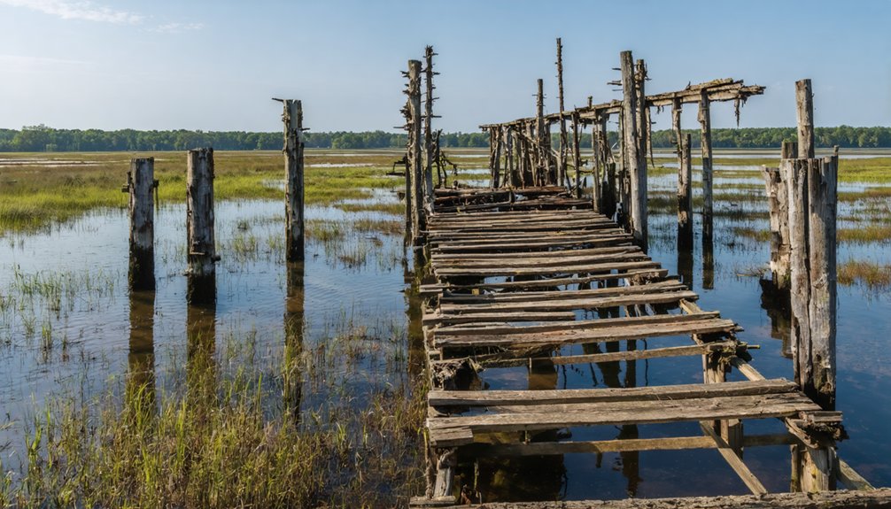
You’ll find fishermen casting their lines from the remnants of Red River Landing‘s old port structures, where the ghost town’s abandoned waterfront now serves as an informal fishing spot.
The site’s environmental legacy continues through the USACE and USGS monitoring station, which provides essential flood data for the Lower Mississippi basin.
While the original settlement has vanished, Red River Landing’s strategic location remains important for river management, serving as a significant reference point for tracking water levels and protecting communities downstream.
Fishing at Ghost Port
The Mississippi River’s ghost ports have evolved into prime fishing destinations, offering anglers unique opportunities to cast their lines where steamboats once docked.
You’ll find diverse fishing spots teeming with catfish, bass, and sturgeon, though you’ll need to check local regulations before casting your line.
For the best fishing experience at Red River Landing, remember these essential points:
- Navigate overgrown vegetation and challenging terrain by bringing appropriate gear and sturdy footwear.
- Research seasonal patterns as flooding and erosion can affect access to prime fishing locations.
- Support conservation efforts by practicing catch-and-release and following sustainable fishing guidelines.
While access might be limited in some areas, the reward of fishing these historic waters makes the extra effort worthwhile.
You’re not just fishing – you’re connecting with a piece of American history.
Environmental Changes Remain
Beyond the quiet fishing spots at Red River Landing lies a sobering reality of environmental transformation.
You’ll find evidence of environmental degradation along every bend of the Mississippi River here, where levee construction has disrupted natural sediment management patterns essential to the region’s stability.
The changes you’re witnessing aren’t just local – they’re part of a larger pattern affecting Louisiana’s entire coastal system.
You can see how climate change has intensified flooding in the area, while agricultural runoff continues to impact water quality.
Where Red River Landing once thrived, you’ll now observe the consequences of human intervention: accelerated coastal erosion, changing water levels, and altered landscapes that remind you of nature’s delicate balance and humanity’s lasting impact on this historic waterway.
Historic Monitoring Station Today
While Red River Landing‘s bustling port days have faded into history, its strategic location now serves an important modern purpose as home to significant river monitoring stations.
The U.S. Army Corps of Engineers and USGS maintain sophisticated monitoring technology that’s essential for modern water management along the Mississippi River.
Today’s monitoring stations at Red River Landing provide:
- Real-time water level data that’s important for flood prediction and control
- Advanced hydrograph analysis using CMIP5 modeling for future flow projections
- Thorough sediment load tracking to understand river dynamics
You’ll find this former ghost town’s monitoring stations about five miles downstream from the Old River Control Structure, where they continue to play a key role in maintaining the delicate balance between the Mississippi and Atchafalaya rivers.
In recent years, interest has grown in exploring ghost towns near False River, Louisiana, as they offer a fascinating glimpse into the past and the impact of the Mississippi River’s shifting course. History enthusiasts and adventurers alike are drawn to these abandoned places, each telling a unique story of resilience and change. As more visitors seek these hidden gems, local communities are beginning to recognize the potential for heritage tourism in the region.
Frequently Asked Questions
Are There Any Buried Artifacts or Treasures Still Found at the Site?
You’ll likely find buried artifacts since flooding preserved items under sediment, but don’t expect treasure. Metal detectorists occasionally uncover 19th-century bottles, ceramics, and trade goods near the former port’s location.
What Was the Peak Population of Red River Landing During Its Heyday?
You won’t find exact peak population records, but based on economic factors and population growth during the cotton boom of the late 1800s, it’s estimated several hundred people lived there.
Did Any Famous Historical Figures Pass Through Red River Landing?
Like ships passing in the night, you’ll find historical visitors Captain Henry Shreve and Admiral David Porter navigated through, while notable travelers from Freeman and Custis’s expedition stopped at this river crossroads.
Were There Any Major Steamboat Accidents or Disasters at the Landing?
You’ll find historical records documenting several devastating steamboat collisions and disasters near Red River Landing, including the Princess explosion and Louisiana’s deadly boiler blast that killed nearby passengers.
What Native American Tribes Originally Inhabited the Red River Landing Area?
Like ancient roots woven into the land, you’ll find the Caddo culture dominated this region, with confederacies including Natchitoches, Hasinai, and Kadohadacho tribes cultivating the rich Red River valley.
References
- https://www.redriverhistorian.com/post/shreve-cut-mississippi-atchafalaya-red-river-landing
- https://www.redriverhistorian.com/post/red-river-landing-of-pointe-coupee-parish
- https://www.youtube.com/watch?v=Z4Xj-oZYsHI
- https://en.wikipedia.org/wiki/Red_River_Landing
- https://en.wikipedia.org/wiki/List_of_ghost_towns_in_Louisiana
- https://ahgp.org/la/Bigraphicalmemoirs13/redriverparishhb1.html
- https://64parishes.org/clearing-red
- https://lisalandcooper.com/the-red-river-raft/
- https://www.louisianasportsman.com/fishing/river-wild-part-ii/
- https://www.tshaonline.org/handbook/entries/red-river