
You’ll discover over a dozen authentic ghost towns within 50 miles of Salida, Colorado’s gateway to mining heritage. St. Elmo stands as the state’s best-preserved ghost town, while Vicksburg earned National Register status for its exceptional historical value. You can explore Winfield’s mining remnants, Bonanza’s silver boom relics, and Hancock’s high alpine camp at 10,023 feet. These 1880s settlements offer free access to remarkably intact buildings and artifacts, with the best visiting conditions from late spring through early fall when mountain roads become passable and interpretive exhibits reveal each site’s unique story.
Key Takeaways
- Salida serves as a gateway to multiple ghost towns including St. Elmo, Colorado’s best preserved, and Vicksburg, a National Register treasure.
- Vehicle capability requirements vary by destination; visitors should research access conditions and plan trips during optimal seasonal windows.
- Vicksburg preserves Colorado’s mining heritage through maintained historic structures, with support from the Chaffee County Historical Society and local agencies.
- Ghost towns originated from gold and silver discoveries, with Vicksburg’s creation driven by silver, lead, and copper deposits in surrounding hills.
- Salida preserves mining heritage through the 1917 Smokestack, Mountain Heritage Park exhibits, and sustainable tourism allowing free ghost town exploration.
St. Elmo: Colorado’s Best Preserved Ghost Town
When surveyor LC Cornwall laid out Forest City in 1878, he created an impractical design that ignored the natural flow of Chalk Creek, but the settlement persevered nonetheless. Renamed St. Elmo in 1880 after Augusta Jane Evans’ novel, the town peaked at 2,000 residents following the railroad’s arrival through Alpine Tunnel.
You’ll find 43 original structures today—Colorado’s best-preserved ghost town—including the general store, schoolhouse, and hotel from the 1880s-1890s. The eccentric Stark family maintained the town for decades as sole year-round residents. Dark legends of Stark family members persist, with reported hauntings in St. Elmo including Annabelle Stark’s spectral presence and unexplained temperature drops in the American House Hotel. The entire district earned National Register status in 1979.
Vicksburg: A National Register Treasure
You’ll find Vicksburg’s remarkable preservation earned it National Register of Historic Places status in 1977, protecting approximately a dozen structures from the original 40-building complex.
The town’s story began in 1867 when prospectors following wayward burros discovered gold deposits in Clear Creek’s bed, though silver ultimately became the primary economic driver after 1879.
Despite lacking running water or modern utilities, several families maintain year-round residence in this authentic mining camp, while the Chaffee County Historical Society operates a museum section that’s accessible to visitors during summer months.
Historic Preservation and Recognition
Unlike many Colorado ghost towns left to decay, Vicksburg stands as a meticulously preserved record of the state’s mining heritage. You’ll discover this protection stems from its 1977 National Register listing as part of Clear Creek Canyon’s historical corridor.
The Chaffee County Historical Society, formed in 1971, actively maintains the public museum, operates the schoolhouse museum under government permit, and manages a 26-grave cemetery near Winfield.
What makes Vicksburg exceptional is continuous cabin occupancy since construction—residents hold Special Use Permits requiring authentic maintenance without compromising historical integrity. Community volunteers guarantee Balm of Gilead trees receive water from original ditches along Vicksburg Creek.
The District Ranger and Chaffee County Planning Commission supported preservation efforts, recognizing this accessible site’s value in showcasing Colorado’s mining past through both museum displays and functioning historic structures.
Gold Discovery Origin Story
The preservation efforts protecting Vicksburg today trace back to a chance discovery in 1867, when prospectors from Leadville made camp in Clear Creek Canyon and lost their pack burros overnight. You’ll find that these wandering animals led their owners directly to gold-bearing ore deposits in the creek bed—a discovery that transformed this remote canyon into a thriving mining camp.
The prospector experiences that followed drew hundreds seeking fortune in the high mountains. By 1879, silver had become the primary focus, attracting 600-700 miners who filed claims and worked their assessments with determination. This wasn’t just about gold anymore; the surrounding hills revealed silver, lead, and copper deposits that would sustain operations for decades and create the historic townsite you can explore today.
Seasonal Residents and Descendants
Since its founding in 1867, Vicksburg has never been truly abandoned—a distinction that sets it apart from most Colorado ghost towns. You’ll find ongoing family ties that stretch back generations, with small families maintaining the rough pioneer lifestyle preservation through the 20th century without water or electricity. This continuous occupation saved seven buildings from complete ruin.
Today, a dozen structures remain along the tree-lined main street, where hundred-year-old Balm of Gilead poplars still stand. The Chaffee County Historical Society maintains the Ball Cabin as a museum, while private residences function alongside preserved structures. Listed on the National Register of Historic Places in 1977, Vicksburg’s accessible 2WD roads welcome seasonal visitors spring through fall, though winter limits visibility at this 52°F mountain retreat.
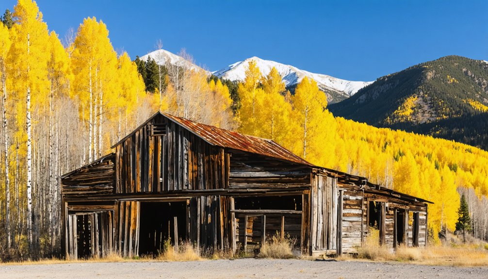
Winfield: Mining Settlement Remnants
You’ll find four original structures still standing in Winfield, a former mining settlement that peaked at 1,500 residents in 1890 before the silver crash of 1893 devastated the town.
The schoolhouse and Ball cabin now serve as museums operated by the Clear Creek Historical Society, preserving artifacts and displays from the mining era.
Access requires a 12-mile drive west from Buena Vista on County Road 390, with the Winfield Cemetery—containing 26 burials—located a quarter-mile beyond on a narrow 4WD road.
Historic Buildings and Preservation
Winfield’s architectural legacy spans over 160 years, beginning with a solitary cabin erected in 1861 that marked the area’s first permanent structure. Today, you’ll find the 1889 schoolhouse serving as the town’s primary museum, meticulously restored through Clear Creek Canyon Historical Society‘s architectural restoration efforts. Inside, you can examine authentic school furnishings and mining exhibits, while an open book documents Winfield’s rise from silver prospecting in 1867 to its 1893 collapse.
The Ball cabin across from the schoolhouse functions as a dedicated mining museum. Though numerous cabins remain standing, all are privately owned and maintained for seasonal operations. You must respect no trespassing signs throughout the settlement. These preservation initiatives showcase Winfield’s peak infrastructure from 1890, when 1,500 residents supported three saloons, hotels, and ore-processing facilities.
Cemetery and Burial Grounds
Beyond the preserved buildings, a somber quarter-mile journey north of Winfield’s townsite leads to the settlement’s pioneer cemetery, where 26 documented burials chronicle the brutal realities of 1880s mining camp life. You’ll navigate a narrow, winding road requiring high clearance 4WD, crossing Clear Creek before forking right toward spruce-shaded burial grounds within San Isabel National Forest.
Only two original stone markers remain—both commemorating Aude children, including Frederick Carl Aude Jr., the cemetery’s first burial on June 28, 1885. The remaining unmarked graves received wooden crosses during 2016 cleanup efforts by descendants and the Clear Creek Historical Society.
Death records reveal mining camp hazards: fires, avalanches, shootings, disease, and mining accidents. One victim was stoned to death by cheated Indians; another child perished in a snow slide, reflecting Winfield’s violent frontier existence.
Access and Location Details
Located at coordinates 38°59′05″N 106°26′27″W in the northeast quarter of Section 28, T12S, R81W 6th P.M., Winfield occupies a strategic position where Clear Creek‘s north and south forks converge within San Isabel National Forest. You’ll find this settlement fifteen miles northwest of Buena Vista in Chaffee County.
From Buena Vista, take Highway 24 north to Clear Creek Reservoir, then turn left onto County Road 390 for twelve miles. Alternatively, from Salida, head north on Highway 285 to Granite, then west on County Road 390. The gravel route features access limitations during winter months, with typical 2WD accessibility from May through October. While road maintenance keeps the fourteen-mile stretch generally passable, higher clearance remains recommended. You’ll pass Vicksburg ghost town four miles before reaching Winfield.
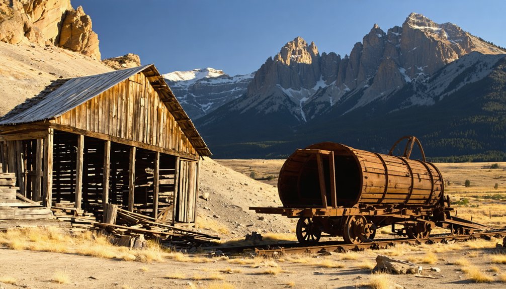
Bonanza: Rise and Fall of a Silver Town
In the spring of 1880, prospectors struck rich silver ore in the mountains north of Saguache and west of Villa Grove, at the head of Kerber Creek. When one miner saw the discovery, he shouted “It’s a Bonanza, boys!”—giving the town its name. The rush attracted 40,000 fortune-seekers, including former President U.S. Grant.
A miner’s exuberant cry of “It’s a Bonanza, boys!” christened the boomtown that drew 40,000 hopefuls to Colorado’s silver mountains.
By 1882, Bonanza’s peak featured:
- Over 1,000 residents in 400+ houses
- Four smelters and nineteen mill operations
- Forty saloons and four hotels
- Telegraph connections and Otto Mears’ toll road
Economic challenges emerged quickly. Deeper ores contained less silver and more lead, zinc, and copper—harder to mine and process. Most operations failed within years. The Rawley mine closed by 1930, fire destroyed the business district in 1937, and the post office shuttered in 1938.
Hancock: High Alpine Mining Camp
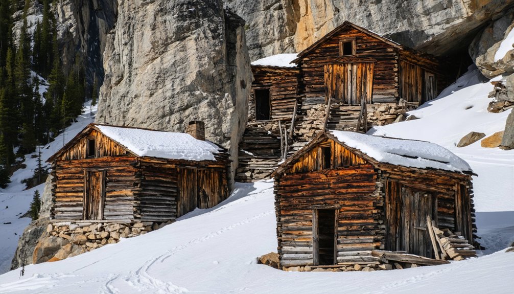
You’ll need a high-clearance four-wheel-drive vehicle to reach Hancock’s crumbling saloon remains at 11,000 feet above sea level.
This 1880 mining camp once housed nearly 200 residents who supported Alpine Tunnel construction and San Juan County mining operations. Today, only broken wooden structures survive along the treacherous rocky road, accessible through a short hike beyond the vehicle route’s end.
Remote Alpine Mining Remnants
Perched at 11,000 feet above sea level, Hancock stands as one of Colorado’s most remote alpine mining camps, where harsh conditions and elevation tested the resolve of nearly 200 residents who arrived within a year of its 1880 establishment. You’ll find scattered mining remnants throughout the site—rusted tools, old bottles, and square nails marking where determined prospectors extracted silver from frozen ground.
Today’s landscape reveals the camp’s struggle against nature:
- Snow-filled skeleton structures tower above head height
- A dilapidated saloon serves as the primary surviving building
- Stone walls display doorways and windows amid collapsed roofs
- A 200-foot-wide railway right of way cuts through the historic district
Harsh winters ultimately conquered this supply camp for Alpine Tunnel construction, forcing complete abandonment after the railway shutdown in 1910.
Four-Wheel-Drive Access Required
Reaching Hancock demands serious off-road capability, as County Road 295‘s five-mile stretch from St. Elmo tests even experienced drivers. Your 4WD vehicle will navigate past the Mary Murphy Mine and Romley’s ruins before arriving at this 11,027-foot elevation site where approximately 200 miners and railroad workers once endured a challenging alpine environment.
You’ll find only one saloon foundation remaining from the transient mining population that abandoned Hancock in 1910. The operational season runs May through October—snow blocks access the rest of the year. From here, you can tackle the additional one-mile 4×4 route to Alpine Tunnel or hike the two-mile trail. The wood frame depot, shacks, and cabins that housed this Denver, South Park and Pacific Railway terminus have vanished into Colorado’s high country.
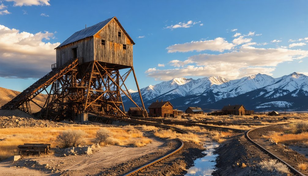
Historic Mining Structure Ruins
Today’s visitors encounter only sparse remnants of what once bustled as a 200-person mining camp and railroad hub at 11,027 feet. Hancock’s stone foundation ruins tell stories of saloons and supply stores that served tunnel workers and miners during the 1880s boom.
You’ll discover these remnants along the five-mile route from St. Elmo:
- Stone foundation ruins marking a former saloon location
- Old boxcars that housed railroad crews during construction
- Railroad transportation infrastructure including the depot site
- Scattered cabin remains from miner and worker dwellings
The Stonewall Mine and nearby Allie Bell operations connected directly to rail lines, where ore shoots loaded cars bound for processing facilities. After Alpine Tunnel’s 1910 closure, nature reclaimed this high-altitude settlement, leaving minimal evidence of its railroad-driven prosperity.
Salida: Gateway to Ghost Town Country
Nestled along the Arkansas River in the heart of Colorado’s Rockies, Salida serves as an ideal basecamp for exploring the region’s scattered ghost towns. You’ll find this cool riverside town perfectly positioned for adventures north to St. Elmo via Chalk Creek Canyon (32 miles) or south through San Luis Valley to Orient (26 miles). The drive to Bonanza takes 41 miles, while Winfield sits 51 miles away.
Beyond these adventures, the surrounding landscapes reveal the remnants of abandoned mining communities and the stories of resilience that define the ghost towns of American ranch. Each visit not only uncovers fascinating history but also offers a glimpse into the rugged beauty that once supported thriving livelihoods. Explore the intriguing structures and trails, which serve as a poignant reminder of the past amidst Colorado’s stunning wilderness.
Between expeditions, you can enjoy local cuisine in Salida’s historic downtown and pursue outdoor recreation along the river. The town’s railroad heritage—once the largest train repair facility between Denver and Salt Lake City—adds character to your explorations.
Founded in 1881 during the mining boom, Salida’s preserved brick buildings create an authentic launching point for your ghost town discoveries.
Planning Your Ghost Town Adventure
Your ghost town explorations require different vehicle capabilities depending on which sites you’ll visit. St. Elmo welcomes standard cars from Buena Vista, while Hancock demands higher clearance on CR 295. You’ll need 4WD for Teller City’s final three miles, and Crystal Mill near Marble requires high-clearance 4×4. Gravel bikes can navigate routes to Turret.
Distance and Access from Salida:
- Orient – 26 miles south with hiking trails to bat caves
- St. Elmo – 32 miles north featuring 43 preserved buildings and recreational activities including 18.5-mile loop rides
- Vicksburg – 41 miles with summer weekend museum access
- Bonanza – 41 miles for backcountry exploration
Winter season access varies considerably by elevation and road maintenance. E-bike tours and self-guided explorations offer flexible options for experiencing these authentic mining settlements.
Best Times to Visit These Historic Sites
Seasonal timing transforms your ghost town experience around Salida, with each period offering distinct advantages for exploration. Summer brings operational amenities—St. Elmo’s General Store opens, and the Monarch Crest tram runs—but expect droves of tourists at preserved sites.
Spring offers improved road accessibility as snow melts, with trails opening near ghost towns and reduced crowds before peak season. Fall exploration, particularly November, delivers peaceful environments with kids back in school and crisp weather ideal for walking historic districts.
Winter provides ultimate solitude at St. Elmo, where you’ll have the town nearly to yourself. Ideal visit timing depends on whether you prioritize amenities or isolation. Seasonal travel considerations include gravel road conditions requiring high clearance vehicles during variable weather, though St. Elmo remains accessible year-round via CR 162.
What to Bring for Ghost Town Exploration
Exploring abandoned structures around Salida demands specialized gear that directly addresses the hazards you’ll encounter in deteriorating 19th-century mining camps. Essential preparation tips include assembling equipment that protects against structural dangers while maintaining mobility through rugged terrain.
Proper equipment transforms dangerous urban exploration into calculated adventure—protection and preparation separate reckless thrill-seekers from responsible historical investigators.
Critical safety considerations for your pack:
- Protective wear – Sturdy boots, cut-resistant gloves, and respirator masks shield against nails, rusty metal, and airborne asbestos common in century-old buildings
- Dual lighting systems – Headlamp plus backup flashlight with spare batteries guarantee you’re never trapped in darkness
- Navigation tools – GPS device with offline maps and compass prevent disorientation in remote alpine locations
- Emergency supplies – First-aid kit, multi-tool, and water maintain self-sufficiency when exploring miles from civilization
This gear enables independent exploration without compromising personal safety.
Preserving Mining Heritage for Future Generations
While deteriorating ghost towns vanish across Colorado’s high country, Salida’s mining heritage stands preserved through decades of coordinated community action. You’ll find the 1917 Smokestack—once the tallest west of the Mississippi—protected since 1976 through grassroots activism and National Register listing. The “Save Our Stack” committee’s fifty-plus volunteers demonstrated how citizen determination overcomes bureaucratic demolition threats.
Today’s sustainable tourism infrastructure lets you explore freely without restrictions. Mountain Heritage Park‘s 2022 completion provides interpretive kiosks alongside native flora gardens. You’ll discover wayside exhibits at the smokestack base, connecting you to authentic mining narratives along the Collegiate Peaks Scenic Byway. The volunteer-staffed Salida Museum maintains artifacts from the 1880s railroad era, ensuring this community heritage remains accessible rather than locked behind gates or fees.
Frequently Asked Questions
Are There Guided Tours Available for the Ghost Towns Near Salida?
You’ll find guided tours at St. Elmo, featuring town preservation efforts across its 24 original buildings. The historical significance of sites shines through restoration work, though you’re free to explore independently at most ghost towns near Salida.
Can You Camp Overnight Near These Historic Ghost Town Sites?
You’d think ghost towns would welcome permanent residents, but you can’t camp at the sites themselves due to historical preservation efforts. Instead, follow dispersed camping guidelines on nearby BLM and Forest Service lands, respecting artifact protection zones.
Are the Ghost Town Roads Accessible in Winter Months?
Most ghost town roads aren’t accessible in winter months due to snow and ice hazards blocking high-elevation routes. Winter weather conditions make St. Elmo and Hancock impassable, though you’ll find Turret occasionally reachable with proper 4WD equipment.
Do You Need Special Permits to Explore These Abandoned Mining Towns?
You won’t need permits for publicly accessible ghost towns—freedom reigns! However, you’ll respect private property concerns where descendants still own cabins. Preservation efforts protect these historic sites, so tread carefully and leave everything untouched for future explorers.
Are There Restaurants or Gas Stations Between Salida and the Ghost Towns?
No restaurants or gas stations exist between Salida and the ghost towns. You’ll find only scenic vistas and historic buildings along these remote routes, so fuel up in Salida before exploring St. Elmo or Turret’s abandoned mining structures.


