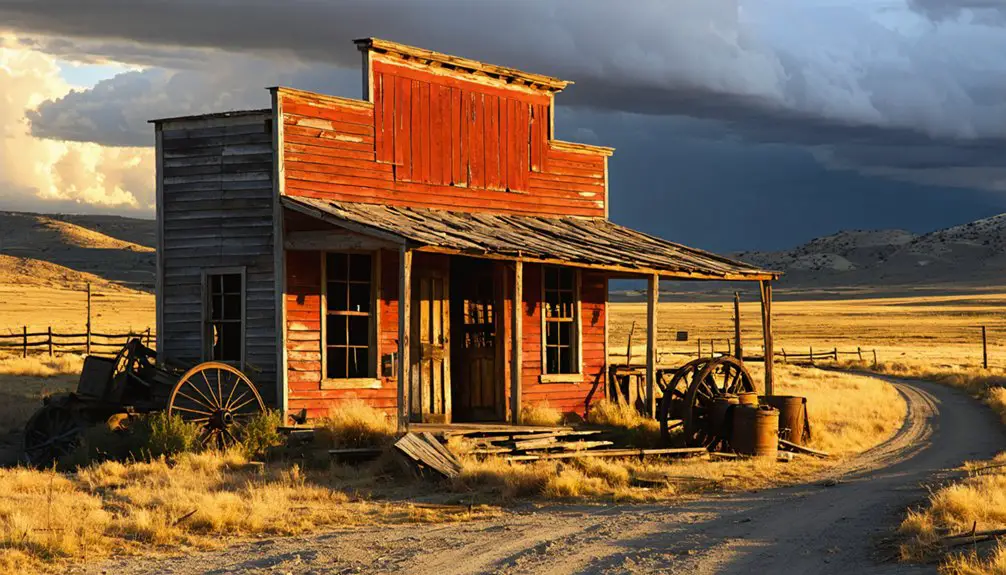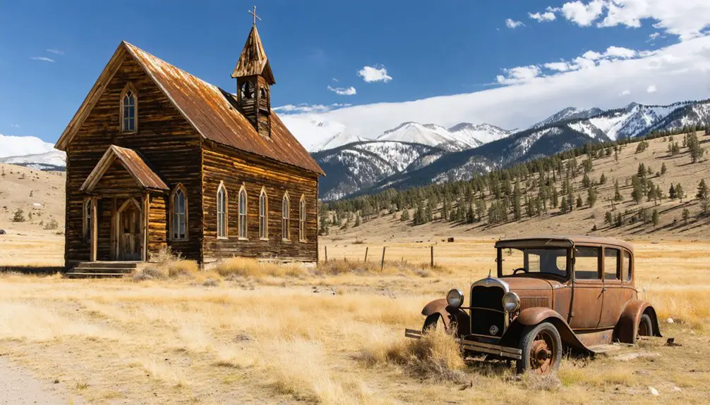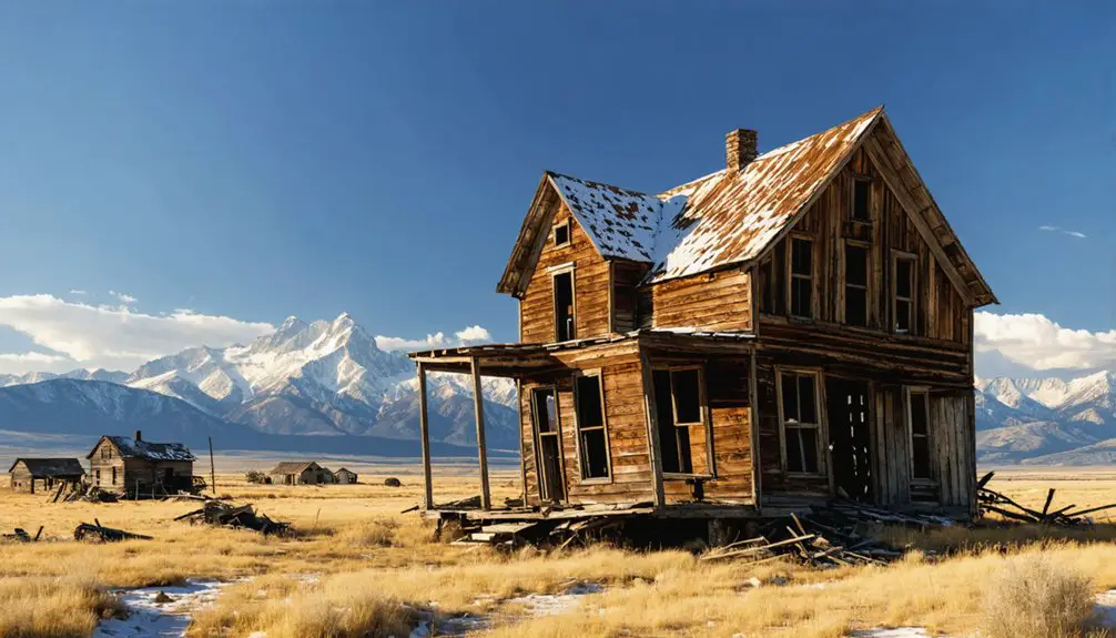
You’ll find Shirley Basin perched at 7,100 feet in Wyoming’s high country, where a once-thriving uranium mining community now stands frozen in time. As Wyoming’s second-largest uranium district in the 1960s, this remote settlement produced over 51 million pounds of uranium before the market crashed in 1979. Today, the ghost town‘s abandoned structures tell tales of Cold War ambitions, while ancient Native American sites and contemporary art installations add layers to its fascinating story.
Key Takeaways
- Shirley Basin transformed from Wyoming’s second-largest uranium mining district into a ghost town after uranium prices crashed in 1979.
- The town’s population declined dramatically after mining operations ceased in 1992, following the extraction of 51 million pounds of uranium.
- Located at 7,100 feet elevation, Shirley Basin’s harsh climate contributed to its abandonment, with extreme temperature swings and isolation.
- The ghost town now features contemporary art installations powered by solar spotlights, creating dialogue between past and present.
- Archaeological remains include 75 rock-walled structures and artifacts spanning 9,000 years of human habitation.
From Uranium Boom to Ghost Town: A Brief History
While many Western ghost towns trace their origins to gold and silver rushes, Shirley Basin’s story began with uranium in the 1960s. You’ll find this was Wyoming’s second-largest uranium district, where companies like Getty Oil and Texaco pioneered innovative uranium extraction methods in the area’s sandstone deposits.
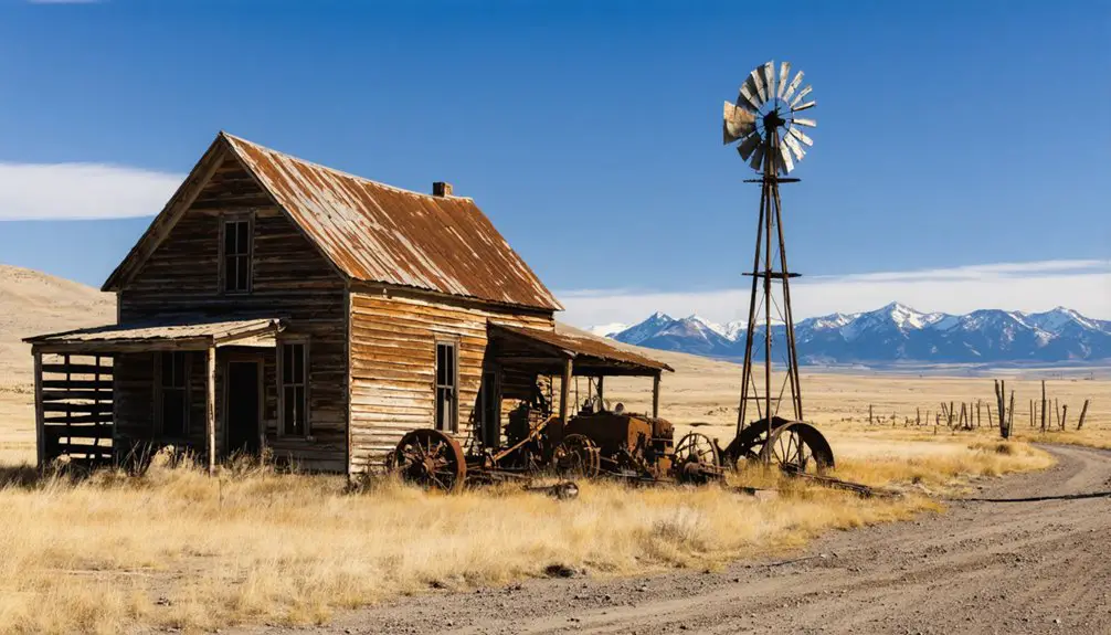
Located 40 miles south of Casper, Shirley Basin sits in a desolate high-altitude landscape that tested the resilience of its residents. You’d have seen a bustling community during the peak years, as miners and their families flocked to this remote basin. The district produced over 51 million pounds of uranium by 1992, riding waves of economic fluctuations tied to Cold War demands and nuclear energy growth. The area’s rich uranium deposits were found in the Wind River Formation, characterized by thick layers of sandstone hosting valuable mineral resources.
But when uranium prices crashed after the Three Mile Island accident in 1979, Shirley Basin’s fate was sealed. The mines closed, the people left, and nature began reclaiming the land, leaving behind four pit lakes where miners once worked.
Life at 7,100 Feet: The Harsh Wyoming Environment
Living at Shirley Basin’s 7,100-foot elevation presented a daily battle with nature’s extremes.
You’d wake up to brutal temperature swings, where summer days could hit 100°F before plummeting to the 40s at night.
Winter brought its own elevation challenges, with temperatures diving to -40°F and sudden snowstorms isolating you from the outside world.
You couldn’t escape the wind’s constant presence, gusting up to 30 mph across the semi-arid landscape.
The harsh winters lasted longer at this altitude, leaving you with a mere 90 to 110 frost-free days for growing food.
You’d learn to collect every drop of the scarce 11 inches of annual rainfall, mostly coming as wet snow and rain in spring.
Living here meant adapting to nature’s unforgiving rhythm or getting out of its way.
The average yearly temperature of 42.6 degrees Fahrenheit made this one of Wyoming’s most challenging places to settle.
The west wind blows steadily at 15 mph, adding to the daily weather challenges.
Mining Operations and Community Development
The discovery of uranium in 1955 transformed Shirley Basin from a windswept plateau into Wyoming’s second-largest uranium district.
this new interest led to an influx of miners and geologists eager to discover the history of shirley basin, revealing not only its geological treasures but also the rich stories of the people who lived and worked in the area. as the mining boom progressed, the small community began to thrive, transforming into a bustling hub of activity. local businesses emerged to cater to the growing population, further intertwining the region’s past with its vibrant present.
You’d have witnessed pioneering mining techniques evolve from underground operations battling massive groundwater flows to America’s first successful commercial in-situ recovery operation in 1964. At its peak, miners extracted high-grade ore using square set timbering, while pumping over 4,000 gallons of water per minute to keep the mines operational.
The community’s resilience showed through the boom years, with families building homes and lives around the mining operations.
When uranium prices crashed after the 1979 Three Mile Island accident, operations gradually wound down. By 1985, the mill had closed, and the once-bustling town began its shift to a ghost town, though its mining heritage endures in the reclaimed landscape.
Archaeological Treasures of the Basin
Beneath Shirley Basin’s windswept surface lies an archaeological treasure trove spanning 9,000 years of human history.
You’ll find evidence of ancient settlements that challenge everything we thought we knew about Wyoming’s earliest inhabitants – they weren’t just nomads passing through.
As you delve deeper into the region, you’ll discover even more about the lives they led and the environment they thrived in. Exploring bitter creek ghost town offers a haunting glimpse into a once-vibrant community, complete with relics of the past waiting to tell their stories. Each building and artifact serves as a reminder of the resilience of those who came before us.
The basin’s remarkable archaeological record includes 75 rock-walled structures and tipi rings spread across six miles, alongside countless stone tools and flint chips.
Recent monitoring efforts have revealed rich fossil deposits alongside these ancient human settlements.
You can trace prehistoric life through artifact analysis of these sites, where generations of people crafted their tools near silicified sandstone outcrops.
Inside the tipi rings, which measure 8 to 13 feet across, dense deposits of flint chips tell stories of extended stays.
The discovery of six extinct bison species and the High Rise Village, dating back 1,870 years, reveals a complex culture that called this rugged landscape home.
The presence of obsidian from New Mexico suggests these ancient inhabitants maintained extensive trade networks across vast distances.
Modern Art Meets Abandoned West
Since abandoning its uranium mining operations in 1992, Shirley Basin has transformed into an unexpected canvas for contemporary art.
You’ll find an artistic revival led by Hyperlink and Land Report Collective, who’ve turned this ghost town’s industrial remnants into thought-provoking installations throughout the landscape.
As you explore the site-specific exhibitions like “East 6,” you’ll discover how artists have woven their work into the town’s haunting atmosphere, creating a dialogue between past and present.
The artistic interventions invite ecological reflection, with installations that acknowledge both the land’s wounds and its regeneration.
Through digital platforms and physical artworks, you’re witnessing a unique fusion of contemporary creativity with Wyoming’s post-industrial heritage, where art breathes new life into forgotten spaces.
Solar-powered spotlights illuminate the artwork against the darkened ruins each night, creating an ethereal display.
Like Jackson’s WildWalls exhibition, visitors can experience augmented reality features that enhance their understanding of the site’s history.
Frequently Asked Questions
Is It Legal to Visit and Explore the Shirley Basin Ghost Town?
Like following ghost tracks in fresh snow, you’re legally free to explore under BLM regulations. Just respect posted signs, don’t remove artifacts, and avoid restricted mining areas and private property.
Are There Any Health Risks From Residual Uranium Contamination?
You’ll face health risks from uranium exposure if you venture too close to contaminated areas. Long-term contamination effects include kidney damage and cancer risks, so stick to marked public access areas only.
What Wildlife Can Visitors Expect to Encounter in the Area?
You’ll likely spot pronghorn antelope, mule deer, coyotes, and prairie dogs. Wildlife sightings depend on season and time of day. Sage grouse and raptors often show predictable animal behavior patterns.
Are There Guided Tours or Organized Visits Available to the Site?
You’ll need to explore this historical treasure on your own, as there aren’t organized guided tours available. Plan your adventure carefully, bringing maps and supplies for self-guided exploration of the site’s significance.
Can Visitors Collect Artifacts or Souvenirs From the Abandoned Town?
No, you can’t collect artifacts or souvenirs – it’s illegal and violates artifact preservation laws. Instead, respect souvenir ethics by taking photos and leaving historical items intact for future research and enjoyment.
References
- http://wyofile.com/ancient-town-yields-new-clues-early-life-wyoming/
- https://southwestcontemporary.com/hyperlink-land-report-collective-wyoming/
- https://www.geowyo.com/shirley-basin.html
- https://www.wyomingcarboncounty.com/blog/226-exploring-the-rich-history-and-attractions-of-hanna-wyoming
- https://www.ghosttowns.com/states/wy/shirleybasin.html
- https://www.nsenergybusiness.com/projects/shirley-basin-isr-uranium-project-us/
- https://www.wsgs.wyo.gov/products/wsgs-2011-m-06.pdf
- https://www.juniorminingnetwork.com/junior-miner-news/press-releases/3282-cse/nf/150709-nuclear-fuels-stakes-historic-uranium-resource-in-shirley-basin-wyoming.html
- https://eplanning.blm.gov/public_projects/nepa/1500610/20003347/250003979/201_D1_History_and_Land_Use_Text.pdf
- https://lmpublicsearch.lm.doe.gov/lmsites/4627-shirley_basin_ltsp.pdf