You’ll find South Scituate’s haunting story in the depths of Rhode Island’s Scituate Reservoir, where a thriving rural community once stood until 1926. Over 1,600 residents were displaced when Providence needed a larger water supply, forcing the demolition of 1,195 buildings across 23 square miles. Today, drought periods reveal glimpses of this submerged town’s foundations, while local legends tell of armed standoffs and seven suicides during the devastating exodus. The waters hold countless untold stories of this vanished New England village.
Key Takeaways
- South Scituate became a ghost town after the construction of Scituate Reservoir displaced 1,600 residents between 1915 and 1926.
- The Providence Water Project demolished over 1,195 buildings, including 375 homes and 233 barns, transforming farmland into a reservoir.
- Community resistance included legal battles and armed standoffs, with seven recorded suicides during the forced relocation period.
- Submerged structures become visible during droughts, revealing remnants of the once-thriving agricultural community beneath the reservoir.
- The area’s population declined 24% by 1930, leaving abandoned structures and creating a ghost town that attracts explorers and photographers.
The Native American Origins of South Scituate
Before European settlers established permanent colonies in South Scituate, the Nipmuc, Narragansett, and Moswansicut tribes called this fertile region home.
You’ll find their Native identity woven into the land itself – they named the area “Satuit,” meaning “cold brook,” and left their mark on places like Musquashcut Pond and Conihassett.
These tribes shaped the cultural landscapes through their farming practices, cultivating corn, tobacco, and beans in the rich soil. The movement and spread of their agricultural techniques influenced later European farming methods.
They’d gather at Council Bowl, a natural amphitheater where tribal leaders made essential decisions. This sacred meeting ground played an important role in 1638 when Roger Williams negotiated land purchases near Moswansicut Pond. The peaceful negotiations with Chief Canonicus resulted in Williams receiving land rights in 1637.
Early European Settlement and Village Formation
As Plymouth Colony‘s population expanded in the early 1700s, settlers from Scituate, Massachusetts ventured west to establish a new community in Rhode Island.
You’d find these pioneering families – the Mathewsons, Wilkinsons, and Arnolds – driven by settler motivations like the promise of abundant land and freedom from Massachusetts’ crowded towns.
This new settlement required careful disambiguation of place names to differentiate it from the original Scituate in Massachusetts.
Daily Life Before the Reservoir
Life in South Scituate revolved around a bustling agricultural community, where 375 households balanced farming duties with vibrant social activities.
Your daily routines would’ve centered on milking cows at one of the 30 dairy farms, tending to crops, or working at the local mills. The community dynamics thrived through six churches, six schools, and five entertainment venues where you’d gather with neighbors.
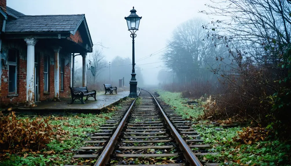
You’d have relied on the Providence and Danielson Railroad to ship your farm produce, granite, or lumber to Providence. The need for adapting to change shaped how the community evolved and responded to new transportation methods. Many residents were so attached to their homes that they chose to burn their properties rather than surrender them to the reservoir project.
The 233 barns and 11 ice houses dotting the landscape would’ve supported your agricultural lifestyle, while two fire stations and multiple post offices kept your community safe and connected.
Whether you were a businessmen-farmer like Arthur Steere or a mill worker, you’d have been part of a self-sufficient rural society.
The Providence Water Project Begins
When Providence’s growing population strained its Pettaconsett River water supply in 1910, city leaders knew they’d need a bold solution. Water consumption regularly exceeded the river’s natural flow, forcing temporary reliance on mill reservoir storage during droughts.
In January 1913, Providence City Council took decisive action by forming a committee to explore expanded water supply options. Their community planning efforts led to swift legislation enabling construction of what would become the Scituate Reservoir.
The ambitious project would dam the Pawtuxet River at the Kent village site, requiring the acquisition of over 23 square miles of land through eminent domain. The development displaced 1,600 residents from their ancestral homes and communities. As construction began around 1915, the massive undertaking would forever reshape the region by creating Rhode Island’s largest inland body of water. The completed reservoir would have an impressive 39 billion gallon capacity, ensuring a stable water supply for generations to come.
Forced Exodus: A Community Displaced
The Providence Water Supply Board‘s ambitious reservoir project came at an enormous human cost. Between 1915 and 1926, you’d have witnessed the forced exodus of entire villages as the PWSB seized 23.1 square miles of land through eminent domain.
The displacement trauma was devastating – more than 1,195 buildings were demolished, including 375 homes, while seven residents took their own lives rather than face eviction. The impact echoed the earlier history when parts set off to other towns caused similar community disruptions in 1840.
In the shadow of progress, seven souls chose death over displacement as bulldozers erased their community from existence.
Community resilience manifested in various forms of resistance. The Joslin family fought through legal channels, while others, like the Knights, burned their homes rather than surrender them.
Despite these acts of defiance, Scituate’s population plunged 24% by 1930. The project dismantled the region’s rural economy, shuttering 30 dairy farms and forcing the abandonment of crucial railroad infrastructure.
Personal Stories of Loss and Resistance
When South Scituate residents faced displacement for the Scituate Reservoir project, you’ll find compelling accounts of families who mounted fierce resistance, from the Joslins’ legal battle over mill properties to armed standoffs with authorities.
Through preserved family archives and oral histories, you can trace how displaced residents fought to maintain their community bonds even as the “men in black” property assessors methodically acquired their lands.
As South Scituate’s buildings were systematically demolished in the 1920s, these personal narratives reveal both the profound trauma of losing ancestral homes and the remarkable resilience of a community refusing to disappear quietly.
Resistance Amid Forced Exodus
Despite mounting pressure from Providence Water authorities, many South Scituate residents fiercely resisted the forced exodus from their ancestral lands during the 1920s reservoir construction.
The community’s resilience manifested in armed standoffs with eviction officers, known locally as “men in black,” while historical narratives reveal prolonged legal battles mounted by prominent families like the Joslins.
You’ll find stories of defiant homeowners who refused to leave until the last possible moment, standing their ground against Providence’s expansion.
The Joslin family, operating significant mills in the area, led legal challenges against eminent domain seizures, though ultimately unsuccessful.
Their resistance, along with others who fought through courts and personal confrontations, embodied the fierce pride of a community unwilling to simply disappear into history’s waters.
Memories Through Family Archives
Preserved within yellowing photo albums and handwritten diaries, South Scituate’s painful transformation lives on through family archives that document the community’s forced displacement in the 1920s.
Through archival preservation, you’ll find personal accounts of defiant residents like the Joslins, who waged legal battles against their eviction.
Family narratives reveal mixed emotions at local bars, where patrons expressed both pride in the reservoir project and heartache over their vanishing community.
You’ll discover records of 1,195 razed buildings, including 375 homes and 233 barns that formed the backbone of family homesteads.
The archives paint a vivid picture through property records, maps by George Madison, and poignant testimonies of residents who watched as their churches, schools, and ancestral burial grounds succumbed to the rising waters.
The Transformation of a Rural Landscape
If you’d visited South Scituate before 1920, you would’ve found a vibrant rural community filled with dairy farms, mills, schools, and churches dotting the countryside.
When the Providence Water Supply Board began construction of the reservoir, they systematically dismantled this agricultural way of life, demolishing nearly 1,200 buildings and clearing vast swaths of farmland.
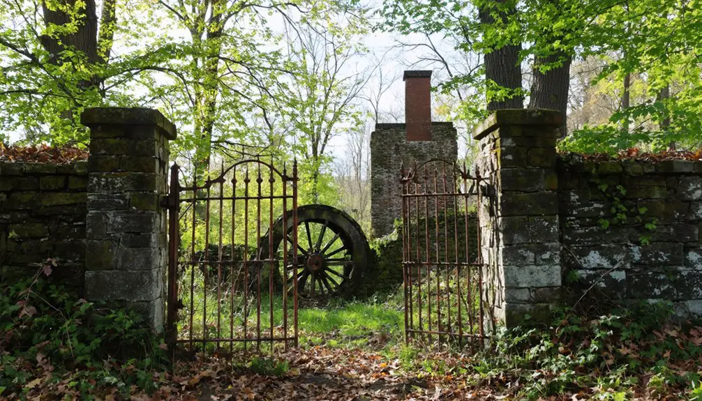
Nature has now reclaimed these spaces, with the 1,195 razed structures lying beneath the reservoir’s waters, while stone walls and foundations occasionally emerge during drought conditions to remind us of the community that once thrived there. The Suddard farm on Darby Road became a secret FCC radio listening post in 1940, intercepting critical wartime intelligence. The project’s $20 million cost led to the creation of a 39 billion gallon reservoir that continues serving Rhode Island today.
Rural Life Before Reservoir
Before South Scituate vanished beneath the waters of Providence’s reservoir project, the village exemplified traditional New England rural life in the early 1900s.
You’d have found tight-knit community dynamics centered around the Six-Principle Baptist Church, where lifelong friendships and multi-generational families formed the social backbone. In the face of agricultural decline, most families managed subsistence farms, producing just enough food for themselves with minimal surplus for trading necessities.
The landscape you’d have seen featured modest two-and-a-half-story homes with prominent brick chimneys, surrounded by functional outbuildings and miles of stone walls marking centuries-old field boundaries.
As Rhode Island’s farming communities faced economic pressures, many residents began shifting toward factory work in nearby towns, gradually transforming the once-open fields into reforested land.
Farms Vanish Under Water
During the 1920s, Providence’s massive reservoir project transformed South Scituate’s rural landscape, consuming over 23 square miles of farmland and forcing the demolition of 1,195 buildings.
You’ll find the vanished farms’ legacy scattered beneath the reservoir waters – 375 homes, 233 barns, and countless agricultural outbuildings that once sustained the region’s thriving dairy industry.
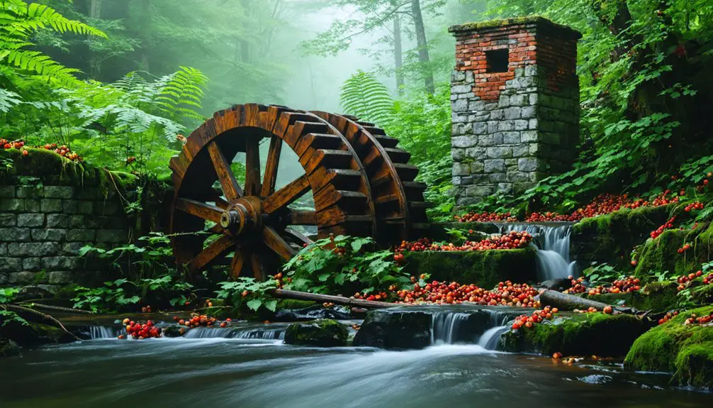
When drought conditions expose the reservoir’s depths, you can glimpse this submerged history: stone walls marking old property lines, mill foundations, and the ghostly remains of homesteads.
The project’s devastating toll included 30 dairy farms, seven schools, and six churches – all sacrificed for Providence’s water supply.
Today, the reservoir’s shoreline conceals a different world, where generations of farming families once tended their land before being forced to abandon their way of life.
Nature Replaces Community
While the reservoir project radically altered South Scituate’s landscape through flooding, nature’s inexorable forces have transformed the surrounding unflooded areas just as dramatically.
You’ll find evidence of natural reclamation everywhere as native trees and understory vegetation have steadily replaced former farmland and village sites.
The landscape now tells a story of cultural nostalgia through:
- Dense forests of oak, pine, and maple that have engulfed abandoned stone walls and cellar holes
- Scattered family cemeteries and headstones emerging from woodland undergrowth
- Wildlife populations flourishing where communities once stood
During droughts, you can glimpse the ghostly remnants of village foundations beneath the water’s surface.
But above it, nature’s regenerative power has created a new wilderness, complete with diverse ecosystems supporting everything from migratory birds to foxes and deer.
What Lies Beneath the Waters
The depths of Rhode Island’s Scituate Reservoir conceal a remarkable underwater landscape of lost communities and infrastructure. Below its surface, you’ll find the submerged history of 1,195 razed buildings, including 375 homes, 233 barns, and numerous community landmarks that once defined village life.
The underwater archaeology reveals traces of six churches, seven schools, and multiple mills that served the area’s residents.
Hidden beneath the reservoir’s surface lie the remnants of community life: six churches, seven schools, and mills awaiting rediscovery.
During drought periods, you can glimpse remnants of this lost world – stone walls, house foundations, and even the old Andrews iron bridge emerge from their watery grave.
The reservoir, reaching depths of 60 feet, holds not just 39 billion gallons of water but also the physical evidence of displaced communities, including relocated cemeteries and abandoned Native American grounds like Council Bowl.
Preserving the Memory of a Lost Village
Preserving South Scituate’s submerged history has become a multi-faceted effort spanning documentation, oral histories, and physical preservation.
Through dedicated community preservation initiatives, you’ll find a rich tapestry of remembrance that keeps the village’s legacy alive.
Historical documentation efforts include:
- Extensive film and video projects capturing oral histories from descendants and former residents
- Detailed mapping of remnant stone walls, foundations, and pathways that emerge during low water periods
- Archival collections featuring maps, photographs, and written accounts of the structures and families displaced by the reservoir
You’ll discover interpretive signs and guided tours in reservoir-adjacent woods that tell the story of the ghost village, while relocated family cemeteries at New Rockland Cemetery serve as permanent sites of remembrance for those seeking connection to their roots.
The Ghost Town’s Environmental Legacy
Construction of the Scituate Reservoir in the early 1920s triggered massive environmental changes across South Scituate’s landscape, transforming 23 square miles of agricultural fields, forests, and settlements into an expansive water body.
The environmental impact extended far beyond mere flooding – you’ll find that over 1,195 buildings were razed, including 375 homes and 233 barns, forever altering the region’s character.
The massive destruction of nearly 1,200 structures reshaped not just the physical landscape, but the very essence of South Scituate’s community.
Nature’s resilience became evident in the decades that followed. While the reservoir submerged historic waterways and disrupted local ecosystems, surrounding areas underwent a remarkable transformation.
You’ll notice how abandoned farmlands returned to forest, creating new habitats for native wildlife.
Today, the reservoir’s protected status guarantees minimal development, preserving water quality while inadvertently fostering a “re-wilded” environment that stands as proof of both community resilience and ecological adaptation.
Frequently Asked Questions
Can Visitors Scuba Dive to See Remnants of South Scituate Underwater?
Like a bird circling a closed window, you can’t use scuba equipment to explore the underwater remnants. The reservoir’s protected water supply status prohibits underwater exploration of these historic ruins.
Are There Any Surviving Buildings From South Scituate Outside the Reservoir Area?
You’ll find several preserved 18th-century farmhouses of historical significance, including the Martin Smith Farm (c.1740), Brown House (c.1745), and Battey-Barden House (c.1750-60), showcasing traditional New England architectural styles outside the reservoir.
What Happened to the Cemetery Plots in South Scituate?
You’ll find that cemetery plots were disinterred and relocated to New Rockland Cemetery in Clayville, with original headstones moved too. No burial sites remain, as they cleared everything for reservoir construction.
Do Any Original South Scituate Residents Still Live in Rhode Island?
Time has washed away the original residents, but you’ll find local descendants scattered throughout Rhode Island like seeds in the wind, though none remain in their ancestral South Scituate home.
When Does the Reservoir’s Water Level Drop Enough to Reveal Old Foundations?
You’ll spot old foundations when reservoir levels drop considerably during historical droughts. This rare occurrence typically happens during extensive dry periods, making these glimpses into the past unpredictable and brief.
References
- https://www.youtube.com/watch?v=4C0ajLzzzVI
- https://www.youtube.com/watch?v=hAVOfTGz1Lc
- https://en.wikipedia.org/wiki/Scituate_Reservoir
- https://preservation.ri.gov/sites/g/files/xkgbur406/files/pdfs_zips_downloads/survey_pdfs/scituate.pdf
- https://www.youtube.com/watch?v=JdOJzLC7m4c
- https://usgenwebsites.org/RIProvidence/histories/hist20.html
- http://www.scituateri.net/qrtour/NativeAmericans.htm
- http://www.southshoreregionalbasketball.com/lucky-to-live-in-scituate.html
- https://accessgenealogy.com/massachusetts/history-of-scituate-massachusetts.htm
- https://en.wikipedia.org/wiki/Scituate