Stickneys Ferry operated as an essential transportation link across the San Joaquin River during California’s post-Gold Rush era. Established by the Stickney family in the mid-19th century, it served travelers along the Stockton-Los Angeles Stagecoach Road until railroads rendered it obsolete by the 1870s. Today, virtually nothing remains of this once-vital crossing point, its story preserved only in historical documentation. The site’s abandonment mirrors the transient nature of California’s frontier transportation hubs.
Key Takeaways
- Stickneys Ferry operated on the San Joaquin River during the post-Gold Rush era as a critical transportation link on the Stockton-Los Angeles Stagecoach Road.
- The ferry site became abandoned after the 1869 transcontinental railroad completion rendered stagecoach services obsolete.
- Today, virtually no physical evidence remains of Stickneys Ferry, with only historical documentation preserving its story.
- The ghost town exemplifies California’s boom-and-bust transportation settlements that thrived briefly before technological shifts caused their decline.
- Stickneys Ferry’s historical significance stems from its role in connecting northern and southern California before modern transportation infrastructure.
The Birth of a Crossing Point: Origins of Stickneys Ferry
Pioneer innovation propelled the establishment of Stickneys Ferry during the mid-19th century.
You’ll find its roots in the ambitious Stickney family, who arrived in California amid the post-Gold Rush migration wave. They recognized the strategic potential of this San Joaquin River location, establishing a crucial crossing that would transform regional settlement dynamics. The ferry operation began during a time when nearly 90,000 people arrived in California in 1849, creating unprecedented demand for transportation infrastructure. Early records show that women’s property ownership rights significantly influenced the development of ferry operations across California during this period.
Life Along the Stockton-Los Angeles Stagecoach Road
The Stickney family’s entrepreneurial ferry establishment marked the beginning of a broader transportation story that would reshape California’s economic landscape.
The humble ferry that launched a transportation revolution and transformed California’s economic future
As you traveled the Stockton-Los Angeles Road, you’d encounter a crucial commercial artery that connected northern and southern California following the 1853 Kern River Gold Rush. This historical route utilized the Fresno Crossing to safely navigate travelers through the challenging Fresno River watershed.
Your stagecoach adventures would include challenging river crossings at locations like Stickneys Ferry, where mud wagons and Concord coaches transported miners, mail, and supplies at speeds of 5-8 miles per hour.
You’d find respite at strategically placed relay stations every 10-15 miles, where fresh horses awaited and inns offered essential services. These rest stops later influenced the development of similar amenities along the Old Ridge Route when automobile travel became prevalent.
The road’s economic significance diminished with the Central Pacific Railroad‘s arrival in the 1870s, which offered freedom from the dangers drivers faced: mechanical failures, robberies, and unpredictable weather.
The Ferry Operation: Transportation Lifeline
As travelers required safe passage across northern California’s unpredictable waterways after 1854, Stickneys Ferry emerged as a crucial transportation nexus connecting isolated communities to significant trade networks.
The operation utilized flatboats or barges guided by cables, requiring constant maintenance to guarantee reliable service despite seasonal river fluctuations.
You’d find ferry operations coordinated meticulously with stagecoach schedules and later with regional railroads, creating an integrated transportation system that maximized efficiency.
This connectivity yielded substantial economic impact, particularly for timber transport and agricultural shipments between inland producers and coastal markets.
The ferry functioned as a critical logistics link before rail expansion, supporting shipbuilding activities indirectly and enabling population growth through improved accessibility.
These water crossings remained essential alternatives when rail or road disruptions occurred, maintaining commercial continuity during California’s transportation evolution.
Positioned where the White River met Tyler Gulch, Stickneys Ferry became an indispensable waypoint on the Stockton-Los Angeles route for gold rush travelers.
Similar to the historic Ferry Point in Richmond, this crossing point served as a vital connector between communities separated by challenging terrain.
Daily Life at a California River Crossing
Beyond the operational aspects of the ferry business, daily life at Stickneys Ferry embodied the rhythms and challenges of nineteenth-century California river settlements.
You’d find a microcosm of frontier society where river commerce dictated economic fortunes, with agricultural products and mining supplies constantly moving across White Creek. The ferry didn’t merely transport goods—it created a dynamic social space where news and opportunities spread throughout the region.
Community gatherings at the overnight lodgings fostered information exchange among travelers, teamsters, and locals alike. Ferry operators became influential community figures who petitioned for infrastructure improvements. Competing ferry crossings like Smiths Ferry operated along the route, creating a network of river transportation options.
Your experience at the crossing would vary dramatically with seasonal changes—summer droughts or winter floods could transform operations overnight. When conditions were favorable, many ferry operators maintained 24-hour service to accommodate travelers regardless of when they arrived. The ferry represented a nexus of freedom and connectivity in an otherwise isolated landscape.
Decline of the Stagecoach Era
While stagecoaches had dominated California’s transportation landscape for decades, their inevitable decline began with the 1869 completion of the transcontinental railroad.
You’d find that despite various stagecoach innovations, they couldn’t compete with the faster, more efficient rail service that expanded westward throughout the late 19th century.
By the 1870s, railroad networks rendered stage service unnecessary in developed areas.
Transportation shifts accelerated when Danforth Porter consolidated competing Santa Cruz stage companies in 1875, only to cease operations by 1876 when the Santa Cruz Railroad eliminated the necessity for his service.
The Pacific Ocean House, which opened in April 1866, became a central departure point for many of the stagecoach services operating in Santa Cruz County.
In the San Joaquin Valley, stagecoaches were once renowned for their essential role in mail delivery service, connecting communities like Visalia to surrounding towns.
Stagecoaches lingered only in remote regions without rail access.
The final death knell came with automobiles and electric railways in the early 1900s, with Visalia’s last stagecoach run on April 13, 1911, ending over fifty years of service.
Vanishing Into History: When and Why Stickneys Disappeared
The stagecoach’s demise directly precipitated Stickneys Ferry’s transformation from thriving waypoint to forgotten ghost town.
You’re witnessing, through historical records, a classic case of transportation evolution rendering once-vital infrastructure obsolete. As railroads carved new arteries across California in the late 19th century, the ferry’s strategic position on the Stockton-Los Angeles route became increasingly irrelevant.
This economic transformation devastated the settlement. Without passengers or commerce, residents migrated to developing population centers.
Geographic limitations prevented diversification, while environmental challenges accelerated the site’s deterioration. The community disintegrated as institutions vanished and buildings decayed.
Unlike other ghost towns that preserved their stories, Stickneys Ferry faded almost completely from public consciousness, with minimal documentation or preservation efforts.
Nature gradually reclaimed the settlement, erasing physical evidence of this once-important river crossing.
What Remains Today: Searching for Traces

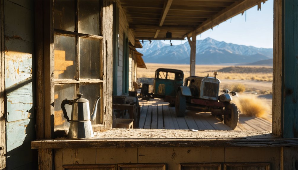
Searching for physical evidence of Stickneys Ferry today presents a stark contrast to California’s more prominent ghost towns, as virtually nothing substantial remains of this once-vital river crossing.
Unlike its famed counterparts, Stickneys Ferry has vanished almost completely, leaving California’s landscape to reclaim this lost river crossing.
Your remnant exploration will yield few tangible rewards, with the landscape having returned largely to its natural state. Historical documentation, rather than visible structures, now tells the ferry’s story.
- The approximate crossing location is identifiable where the Stockton-Los Angeles Stagecoach Road once traversed the waterway
- No maintained pathways, interpretive signage, or tourist infrastructure mark the site
- Archival records and historical maps serve as primary sources for ghost town traces
- Unlike developed ghost towns with standing structures, Stickneys Ferry falls into the “barren” classification
- The surrounding terrain has reverted to rural landscape with minimal topographic clues
Similar Ghost Towns Along California’s Transport Routes
You’ll find California’s landscape dotted with vanished transportation hubs similar to Stickney’s Ferry, where stagecoach stops, railroad stations, and river crossings once connected isolated communities.
These forgotten nexus points typically thrived during specific transportation eras—whether water, rail, or early automobile—before technological advancement rendered them obsolete.
Like Stickney’s Ferry, ghost towns such as Bagdad, Ludlow, and Termo exemplify the transient nature of settlements that existed primarily to facilitate movement across California’s vast terrain.
Among these lesser-known sites is the history of stoutenburg ghost town, which tells a unique story of the region’s boom and bust cycles. Many of these towns were once bustling with miners and traders but are now mere remnants of the past. Exploring their ruins offers a glimpse into the challenges and aspirations that shaped California’s development.
Transportation Hubs Vanished
California’s transportation evolution has transformed once-thriving communities into ghostly reminders of technological change, with numerous settlements along historic transport routes now standing abandoned.
The economic impact of shifting transportation needs has repeatedly spelled doom for specialized communities across the state.
- Bagdad and Siberia flourished briefly as steam engine service points before technological advances rendered them obsolete.
- Owenyo and Zurich Station served as significant rail hubs until road development redirected commerce.
- The steamship “Bessie Brady’s” destruction in 1882 symbolized Owens Valley’s shift from water to rail transport.
- Route 66 towns experienced devastating population loss when Interstate 40 bypassed them.
- Boca’s decline followed both industrial changes (refrigeration) and devastating fires that destroyed its economic foundation.
You’ll find these abandoned transportation centers standing as poignant reminders to how quickly prosperity can vanish when transportation patterns evolve.
Stagecoach Stops Forgotten
While rail hubs and shipyards fell victim to modernization, an equally fascinating chapter of California’s transport history lies buried in its forgotten stagecoach network.
You’ll find places like Patchen and Lexington—once essential California Stage Company stops—now reduced to mere foundations or submerged beneath reservoirs. Vallecito Stage Station stands as a rare preserved landmark amid this vanishing heritage.
These forgotten waypoints birthed remarkable stagecoach legends. Travelers along Butterfield’s southern trail reported spectral sightings of a phantom coach traversing moonlit deserts between stations.
The “White Lady” allegedly haunts former stage stops, while mysterious wagon tracks materialize in sand following ghostly sightings near Carrizo Wash. These stories persist even as communities like Wright’s Station, once thriving around transportation corridors, vanished after Highway 17 construction redirected California’s human flow.
River Crossings Abandoned
When river crossings became obsolete in nineteenth-century California, entire communities disappeared from the landscape almost overnight.
You’ll find these transportation ghosts scattered throughout the state, each telling a story of transportation evolution and economic obsolescence.
- Drawbridge in Alameda County once thrived on rail and ferry traffic before bridges rendered it unnecessary
- Amboy served desert travelers along vital transport corridors before being bypassed
- Bodie’s decline paralleled mining’s collapse, its water-dependent transport links abandoned
- Dogtown vanished after 1859 when gold rush activity diminished around its river ferry
- Stony Bar in Calaveras County faded as river transport waned and mining resources depleted
These settlements didn’t merely accommodate crossings—they facilitated California’s economic integration, connecting isolated mining camps and agricultural regions until technology rendered them obsolete.
Preserving the Memory: Historical Significance and Documentation
Despite its inclusion in California’s ghost town registries, you’ll find a noticeable gap in thorough historical documentation about Stickneys Ferry.
The site’s coordinates (37°27′54″N 121°58′28″W) and references in transportation records provide tangible evidence of its existence, yet detailed accounts remain scarce.
Your research into Tulare County archives and Stickney family genealogical materials might yield additional insights about this transportation heritage landmark that once facilitated essential crossings along the Stockton-Los Angeles Stagecoach Road.
Historical Records Gap
The documentation of Stickneys Ferry’s history suffers from a systemic fragmentation that complicates efforts to construct a thorough historical narrative.
You’ll encounter significant archival challenges when researching this settlement, as records exist across multiple California institutions without centralized coordination.
- Records from the Stockton-Los Angeles Stagecoach Road era require cross-referencing between county archives and state repositories.
- CHRIS Information Centers operate on a fee-for-service basis, restricting access to essential historical data.
- Documentation gaps result from transfers and redistributions among regional Information Centers.
- Materials must be collected from disparate sources including government records, manuscripts, and maps.
- Appointment-based access systems at repositories like Tuolumne County Archive create additional research barriers.
These documentation gaps demonstrate how California’s preservation infrastructure often fails to adequately safeguard the stories of smaller settlements.
Transportation Heritage Evidence
Transportation heritage evidence from Stickneys Ferry offers essential insights into California’s mid-19th century connectivity infrastructure. This critical crossing point on the Stockton-Los Angeles Stagecoach Road exemplifies early transportation evolution, linking northern and southern California when reliable pathways were scarce.
Lieutenant R.S. Williamson’s 1853 topographical survey documents the ferry’s strategic position on White River, precisely 11.1 miles southeast of More’s Creek. This location’s significance lies in its integration within a broader network including Smith’s Ferry and Hills Ferry, creating a cohesive transportation system.
Ferry technology here addressed unique challenges of seasonal water variations, enabling the passage of miners, cattle drives, and immigrants.
As part of California’s primary mid-century transportation artery, Stickneys Ferry represents freedom of movement that fueled economic development along the Sierra foothills corridor.
Frequently Asked Questions
Who Was Stickney and How Did the Ferry Get Its Name?
Joseph Stickney Emery established the ferry operation as part of his transportation infrastructure legacy. You’ll find his surname immortalized in this crossing, reflecting his entrepreneurial vision for California’s regional connectivity.
Were There Any Notable Crimes or Outlaws Associated With Stickneys Ferry?
No documented evidence, no notorious outlaws, no exceptional criminal activity can be found in historical records relating to Stickneys Ferry. You’ll find it was primarily a transportation crossing, not a center of lawlessness.
Did Any Famous Historical Figures Pass Through Stickneys Ferry?
Historical records don’t definitively identify famous travelers at Stickneys Ferry. You’ll find its historical significance remains understudied, with no verified documentation of notable figures visiting this California transit point.
What Indigenous Tribes Inhabited the Area Before the Ferry’s Establishment?
As clear as day, you’d find the Yokuts and Tübatulabal Native tribes inhabiting this area, maintaining rich Cultural Heritage through riverine practices, acorn harvesting, and seasonal migrations between the Sierra foothills and valleys.
How Much Did It Cost to Cross the Ferry in Its Heyday?
Historical records haven’t preserved specific ferry tolls for Stickneys Ferry. You’d likely have found crossing fees ranging from 25¢-$1 for individuals and $3-5 for wagons during California’s mid-1800s ferry operations.
References
- https://www.youtube.com/watch?v=OD9M6MP6RRU
- https://www.legendsofamerica.com/ca-mojaveghosttowns/
- https://en.wikipedia.org/wiki/Stickneys_Ferry
- https://en.wikipedia.org/wiki/List_of_ghost_towns_in_California
- https://originalpeople.org/allensworth/
- https://www.seekingmyroots.com/members/files/G002067.pdf
- https://archive.org/download/stickneyfamilyge00stic/stickneyfamilyge00stic.pdf
- https://rbscarchives.library.ubc.ca/westwold-b-c-last-of-camels-used-on-cariboo-trail-in-early-1860-s
- https://www.emeryville.org/Government/About-Emeryville/History/Americans-Arrive-1840s-to-1890s
- https://sarasota.wateratlas.usf.edu/upload/documents/03HistoricalDevelopment.pdf


