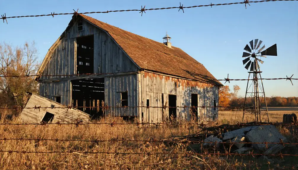
You’ll discover Tadmor’s ruins along Ohio’s Miami and Erie Canal, where a bustling 19th-century transportation hub once connected waterways, railroads, and major roads. At its peak, this strategic crossroads saw canal boats carrying whiskey, timber, and agricultural goods while supporting a vibrant community of workers and merchants. The devastating Great Flood of 1913 destroyed the town, leaving only scattered stone remnants that nature has steadily reclaimed – each weathered fragment telling a deeper story of ambition and resilience.
Key Takeaways
- Tadmor was a thriving 19th-century transportation hub in Ohio where major routes, including the Miami and Erie Canal, intersected.
- The town served as a crucial commerce center with a covered bridge, train depot, and post office supporting multiple transportation modes.
- The Great Flood of 1913 devastated Tadmor with 20-foot floodwaters, destroying infrastructure and forcing permanent abandonment.
- Only scattered stone ruins and bridge abutments remain, accessible via a 1.25-mile hiking trail from U.S. 40.
- Nature has reclaimed the abandoned town site, transforming it into a thriving ecosystem with native trees and wetland vegetation.
The Rise of a Transportation Hub
The strategic confluence of major transportation routes transformed Tadmor into a bustling 19th-century hub at the intersection of the National Road, Miami and Erie Canal, Great Miami River, and Dayton & Michigan Railroad.
You’ll find this historical significance reflected in Tadmor’s innovative design, which seamlessly connected multiple modes of transport for both freight and passengers.
The village’s transportation innovations included a covered bridge spanning the Great Miami River, a train depot, and a post office to handle growing commerce.
Tadmor’s pioneering spirit shone through its infrastructure, from its covered bridge to its bustling train depot and commerce-driven post office.
By 1809, keelboats were already maneuvering upriver to transfer goods, and when the canal system emerged, Tadmor became even more essential.
As an original “crossroads of America,” the village’s infrastructure supported seamless transfers between canal boats, river vessels, trains, and road traffic.
A dam constructed in 1922 made the site uninhabitable, permanently flooding the area.
The Great Flood of 1922 ultimately led to Tadmor’s abandonment and transformation into a ghost town.
Life Along the Miami and Erie Canal
You’d find Tadmor bustling with activity as canal boats moved goods and passengers through the Miami and Erie Canal’s complex lock system at speeds of 4-5 miles per hour.
The town’s workers, including boatmen, lock tenders, and maintenance crews, kept commerce flowing by managing the locks and maintaining the essential infrastructure that enabled boats to navigate elevation changes. The canal’s impressive 103 canal locks helped boats traverse the challenging Ohio terrain. During the 1840s peak period, the waterway saw its heaviest traffic as trade flourished along the route.
The canal-based trade transformed Tadmor into a vibrant transportation hub where travelers and workers gathered at local establishments, while German American immigrants helped shape the cultural fabric of the growing community.
Canal Commerce and Trade
During the mid-19th century, commerce along the Miami and Erie Canal transformed Ohio’s economic landscape, connecting Cincinnati to Toledo through a 274-mile water route that revolutionized trade.
You’d find canal boats, pulled by mules or horses at 4-5 miles per hour, transporting everything from coal and timber to agricultural products and manufactured goods. The challenging work was performed by Irish and German immigrants who helped construct and maintain the waterways. A single barge could transport 500 barrels of whiskey, making it a primary cargo for many merchants.
The canal trade brought unprecedented economic benefits to communities along its path. You could witness towns like Akron flourishing as service centers, while farmers and merchants gained access to national and international markets through connecting waterways.
Local economies thrived as transport costs decreased, making goods more profitable to move. The system reached its peak in the 1850s, with bustling warehouses and trading posts dotting the waterway before railroad competition began reshaping commerce.
Daily Life of Workers
While life along the Miami and Erie Canal promised economic opportunities, canal workers endured brutal conditions that defined their daily existence. You’d find these laborers, mostly Irish, French, and German immigrants, toiling from sunrise to sunset for a mere 30 cents per day.
Their worker struggles included battling mosquito-infested swamps, snowy prairies, and snake-filled waters while performing backbreaking tasks like digging, draining, and maintaining canal infrastructure. The workers faced additional hardships without OSHA safety regulations. Workers typically rotated between five to six hour shifts while tending to the mules and boats.
Living conditions were equally harsh – workers crowded into makeshift camps or lived aboard boats with poor food quality and limited provisions. You’d see entire families living year-round on canal boats, with children only attending school during winter breaks.
Local communities often viewed these hardworking individuals with disdain, treating them as outcasts despite their vital role in building America’s waterways.
Lock System Operations
Beyond the daily hardships of canal workers lay an intricate network of locks that powered the Miami and Erie Canal’s commercial success.
Just like New York’s canal system with its 57 locks, operators carefully managed water flow and boat traffic through this engineering marvel. You’d find state-employed locktenders managing these water elevators, carefully orchestrating the passage of 80-foot boats through chambers that conquered dramatic elevation changes.
At its peak in 1855, the canal system reached its highest revenue as commerce flowed through this complex network of waterways.
- You’re witnessing a marvel of engineering – 103 to 106 locks climbing 395 feet above Lake Erie and 513 feet above the Ohio River.
- You’re watching skilled locktenders operate massive wooden gates with precision using gears and cranks.
- You’re observing the constant flow of lock maintenance crews keeping the system running smoothly.
- You’re seeing mule teams and boats moving in harmony at 3-4 miles per hour through this aquatic stairway.
These locktender responsibilities transformed impossible terrain into a crucial commercial artery connecting Cincinnati to Toledo.
Where Four Paths Crossed: A Strategic Location
Four essential transportation arteries converged at Tadmor, making it one of Ohio’s most strategically positioned settlements in the early 19th century.
You’d find the National Road connecting the East Coast to the western frontier, the Miami and Erie Canal linking the Ohio River to Lake Erie, the Dayton & Michigan Railroad carrying freight and passengers, and the Great Miami River providing natural resources and passage.
This strategic significance meant you could transfer between canal boats, trains, river craft, and stagecoaches with remarkable efficiency.
The transportation evolution that initially fueled Tadmor’s growth centered on this rare confluence of routes, creating a crucial hub for commerce and travel.
While the town’s destiny would later shift as newer routes bypassed it, Tadmor’s crossroads location marked a pivotal chapter in Ohio’s transportation history.
The Great Flood of 1913: Nature’s Fury
In March 1913, a catastrophic flood devastated Ohio’s communities when nearly three months’ worth of rain fell in just five days. The disaster struck Tadmor with unprecedented force, forever altering its future.
As waters rose to deadly levels, the community faced nature’s raw power alongside neighboring towns like Findlay and Ottawa.
- You would’ve witnessed floodwaters reaching depths of 20 feet, destroying homes and sweeping away livelihoods.
- Your ancestors might’ve been among the 65,000 displaced residents fighting for survival.
- You can imagine the heartbreak as 1,400 horses and 2,000 livestock perished.
- You’d have seen the decade-long flood recovery reshape the region’s identity.
Urban resilience emerged through determination, yet Tadmor’s story reminds us how one event can permanently transform a thriving community into a ghost town.
Abandonment and the Ghost Town’s Birth
After the devastating 1913 flood ravaged Tadmor’s infrastructure and buildings, you’d be hard-pressed to find any residents willing to rebuild their lives in the vulnerable riverside settlement.
The community’s swift exodus transformed the once-promising transportation hub into an abandoned ghost town virtually overnight, with families seeking safer ground in neighboring areas.
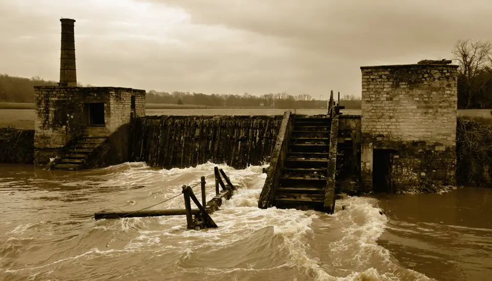
You can now find only scattered stone ruins and bridge abutments among the dense forest that has reclaimed this lost village, serving as silent witnesses to nature’s triumph over human ambition.
Devastating Flood’s Fatal Impact
The devastating Great Miami River flood of 1913 marked Tadmor’s final chapter as a living community, washing away the village’s infrastructure and forcing its residents to permanently abandon their homes.
The flood’s impact destroyed essential structures including the covered bridge, train depot, and post office, effectively ending all economic activities that had sustained the village.
- You’d find homes and businesses completely washed away, leaving families with nothing to return to.
- You can imagine the heartbreak as residents watched their transportation hub disappear beneath the waters.
- You’ll notice how the 1922 dam construction sealed Tadmor’s fate, making reoccupation impossible.
- You’re now walking through a ghost town where only stone bridge supports and scattered ruins remain.
The flood delivered the final blow to a village already weakened by economic struggles and declining transportation routes.
Rapid Exodus of Residents
When devastating floodwaters swept through Tadmor in 1913, residents faced an impossible choice that led to their community’s swift abandonment. Rather than rebuild their damaged homes and businesses, you would’ve witnessed a mass exodus as families chose to seek opportunities elsewhere, abandoning the once-promising village overnight.
The swift migration wasn’t just a response to the flood – it reflected a deeper community disintegration. As essential services disappeared, including the post office and train depot, remaining residents had fewer reasons to stay.
The final blow came in 1922 when the Miami Conservancy District constructed a dam that made the area completely uninhabitable. What you’ll find today at Taylorsville MetroPark are only stone foundations and bridge abutments – silent reminders of Tadmor’s rapid transformation from bustling village to ghost town.
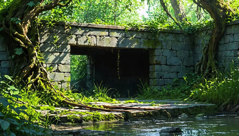
Nature Reclaims Lost Village
Nature’s relentless force gradually transformed Tadmor’s ruins into a verdant sanctuary following the devastating 1913 flood and subsequent dam construction.
Today, you’ll find a reflection of nature’s resurgence where stone bridge abutments and scattered foundations peek through dense forest growth, marking what was once a bustling transportation hub.
The site’s ecological recovery has created a thriving ecosystem within Taylorsville MetroPark, where:
- Native oaks, maples, and sycamores have reclaimed former streets and homesteads
- Wetland vegetation now flourishes in the floodplains that once devastated the town
- Wildlife has established new habitats in the absence of human activity
- Natural erosion and plant growth steadily dissolve the last traces of civilization
This transformation from village to wilderness stands as a powerful reminder of nature’s ability to heal and renew itself.
Hidden Remnants: What Survives Today
Deep within Taylorsville MetroPark‘s wooded landscape, scattered stone remnants mark what’s left of Tadmor’s once-bustling village.
You’ll find bridge abutments along the Great Miami River and building foundations peeking through the forest floor, silent witnesses to the town’s historical significance. The ruined canal lock system offers glimpses into Tadmor’s role as a transportation hub.
While no intact structures remain, you can explore these traces of the past via a 1.25-mile hike from U.S. 40.
A historical marker guides your discovery, though you’ll need to look carefully to spot the weathered stones among the vegetation. The MetroParks mobile app helps identify these subtle clues, transforming seemingly random rocks into meaningful connections to Tadmor’s vanished community.
Exploring Tadmor’s Historical Trail
Located within Taylorsville MetroPark near Ross Road in Vandalia, Ohio, Tadmor’s historical trail offers visitors a glimpse into one of America’s most intriguing ghost towns.
Visitors can also discover the history of Shaker Village, where the unique lifestyle and philosophy of the Shakers have left a lasting impact on American culture. Engaging exhibits and immersive experiences allow guests to appreciate the artistry and craftsmanship that defined this remarkable community. As you explore, be sure to soak in the serene landscape that makes this site not only historically rich but also visually stunning.
You’ll find this hidden gem by hiking approximately one mile from the U.S. 40 entrance along the Great Miami River Bikeway, where historical markers guide your journey through time.
- Stand where the “original crossroads of America” once thrived, exploring stone bridge abutments and canal lock remnants.
- Walk the paths where legendary transportation routes converged – the Miami-Erie Canal, National Road, and Michigan-Ohio Railroad.
- Discover the profound historical significance of this abandoned village through interpretive signage.
- Experience the mysterious atmosphere of Tadmor legends in the clearing where this once-promising town stood before the devastating 1913 flood.
Tales and Legends of the Lost Village
While Tadmor’s physical remnants tell a story of abandoned infrastructure, the site’s mysterious atmosphere has spawned numerous ghostly tales since the 1980s.
You’ll hear accounts of smokey shadows drifting between stone bridge pillars and shimmering, spectral buildings materializing in the darkness. The forest clearing where Tadmor once thrived particularly unsettles local children, who find the stark contrast with surrounding woods unnaturally disturbing.
Though no infamous deaths mark Tadmor’s history, eerie legends persist. The sudden abandonment following the 1913 flood, coupled with the site’s isolation after the 1922 dam construction, has amplified its ghostly reputation.
When you explore the area today, you’ll discover how these ghostly sightings have transformed a once-bustling transportation hub into a haunting reminder of Ohio’s past.
Engineering Marvel to Nature’s Reclamation
You’ll find Tadmor’s engineering legacy in its intricate canal lock system, where the Miami and Erie Canal once intersected with the National Road and Michigan-Ohio Railroad to create a bustling transportation hub.
While this 19th-century marvel showcased human ingenuity through its covered bridge and essential infrastructure, the Great Miami River’s raw power ultimately proved too formidable, culminating in the devastating flood of 1913.
Nature has since reclaimed the abandoned village site, with woods and vegetation slowly erasing most traces of urban development, leaving only stone remnants as silent witnesses to Tadmor’s former glory.
Canal Lock System Design
Standing as a proof to 19th-century engineering ingenuity, Tadmor’s canal lock system employed a sophisticated stair-step design that enabled boats to navigate Ohio’s challenging terrain.
The canal engineering masterpiece featured precisely crafted stone chambers that could accommodate vessels up to 90 feet long and 14 feet wide, while innovative water management systems maintained consistent navigation depths of 4 feet.
- You’ll marvel at the preserved lock walls, evidence of the durability of 19th-century stonework craftsmanship.
- You can trace the original 40-foot-wide waterway, flanked by 10-foot towpaths where horses once trudged.
- You’re witnessing the legacy of complex water supply networks that connected to nearby reservoirs.
- You’re standing where lockkeepers once monitored the precise filling and emptying of chambers within minutes.
Nature Overtakes Urban Progress
After the devastating Great Flood of 1913 washed away Tadmor’s urban core, nature began its relentless reclamation of this once-thriving canal town.
You’ll find evidence of urban decay in the scattered stone foundations and bridge abutments, now wrapped in vines and covered in moss. The 1922 Miami Conservancy District Dam sealed Tadmor’s fate, transforming the area into wetlands unsuitable for rebuilding.
What you’re witnessing today is remarkable ecological restoration in action. Native hardwoods have replaced streets and buildings, while their roots slowly break down the remaining man-made structures.
As you walk the trails, you’ll discover how the forest has embraced the ruins, creating a wilderness that tells the story of nature’s triumph over human engineering.
Engineering Meets River Power
The convergence of four major transportation modes at Tadmor in the 19th century created an engineering marvel that showcased human ingenuity in taming the Great Miami River.
River management evolved dramatically as each new transportation method emerged, shifting from river traffic to canal boats, then to railroad dominance.
When the devastating 1913 flood struck, engineering innovation reached new heights under Arthur Morgan’s leadership.
The Miami Conservancy District’s ambitious flood control project transformed Tadmor’s landscape through:
- Five massive dams that protected communities along the Great Miami River
- 44 miles of levees that reshaped the region’s flood defense
- Revolutionary concrete dam construction techniques near Tadmor
- Strategic rerouting of the National Road and railroad tracks to higher ground
These engineering feats demonstrate how human determination can harness nature’s power while respecting its force.
Legacy of Early Ohio Settlement
While many frontier settlements faded into obscurity, Tadmor’s legacy as an early Ohio settlement exemplifies both the ambitions and vulnerabilities of 19th-century development.
You’ll find its transportation significance reflected in the convergence of four major routes: the Miami and Erie Canal, National Road, Great Miami River, and Michigan-Ohio Railroad. This strategic positioning promised a thriving future until nature intervened.
Today, as you explore Taylorsville MetroPark, you’ll discover the scattered remnants of this ghost town – stone bridge abutments and building foundations that tell a powerful story.
These ruins stand as silent witnesses to the broader patterns of Ohio’s settlement history, where communities rose and fell based on changing transportation needs and environmental challenges, reminding you that even the most promising frontiers faced uncertain futures.
Frequently Asked Questions
How Many Residents Lived in Tadmor During Its Peak Population?
You’d find only a couple dozen residents during peak population, with roughly 20-30 people making their home there. Life centered around transport activities rather than growing a large residential community.
Were There Any Documented Crimes or Murders in Tadmor’s History?
You won’t find any documented crimes or murders in historical records, despite local folklore suggesting unsolved mysteries. Research shows the town’s decline was due to natural causes, not criminal activity.
What Businesses and Shops Operated in Tadmor Before the Flood?
You’d find local shops like general stores, post office, and transportation-related businesses along the railroad depot. Historical businesses included blacksmiths, grain mills, and canal service operations supporting travelers.
Did Any Famous Historical Figures Ever Visit or Pass Through Tadmor?
While famous visitors may have traveled Tadmor’s bustling crossroads, you won’t find concrete evidence of any historical significance – the devastating 1913 flood washed away records of notable passers-through.
What Was the Average Property Value in Tadmor Before Its Abandonment?
You won’t find precise property appraisal records from that era, but economic decline dramatically reduced values, especially after the 1913 flood and 1922 dam construction made the area largely uninhabitable.
References
- https://www.thislocallife.com/tadmorghosts
- https://www.metroparks.org/celebrate-spooky-season-with-a-hike-through-history/
- https://girlaboutdayton.com/blog/tadmor-ohio-village/
- https://www.youtube.com/watch?v=eH7A40HqE60
- http://gemcityghoststories.yolasite.com/taylorsville-dam-and-canal-lock-park.php
- https://www.hmdb.org/m.asp?m=224957
- https://www.hmdb.org/m.asp?m=135245
- http://chambers-architecture.com/InProgressProjects/TadmorStationHistoricalInterpretationSite.html
- https://en.wikipedia.org/wiki/Miami_and_Erie_Canal
- https://libraries.wright.edu/about/library-news/2025/01/29/miami-erie-canal