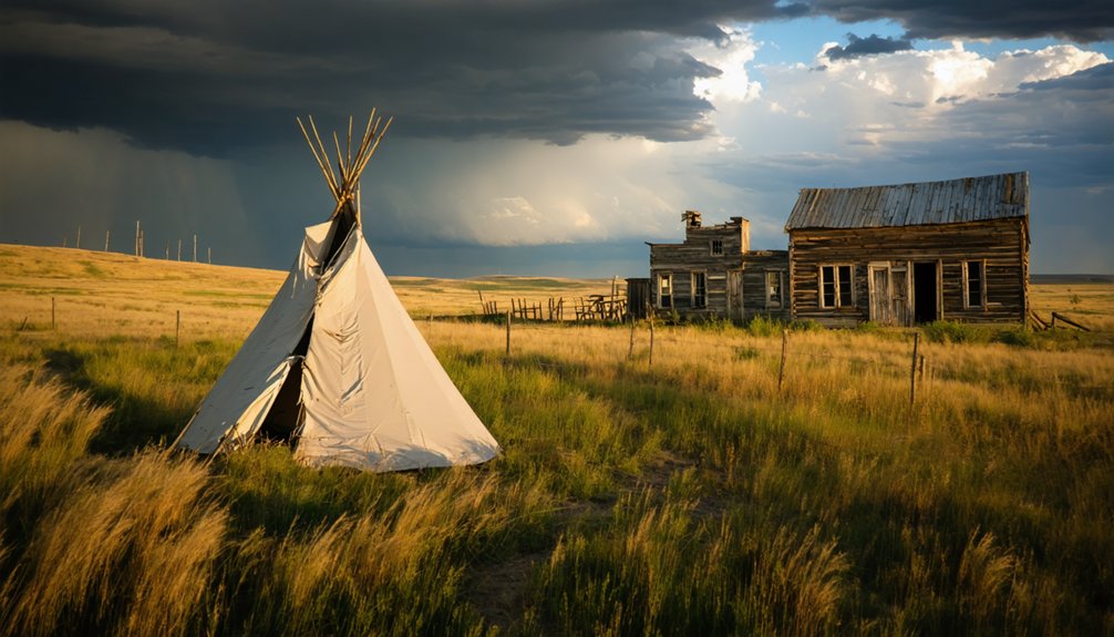
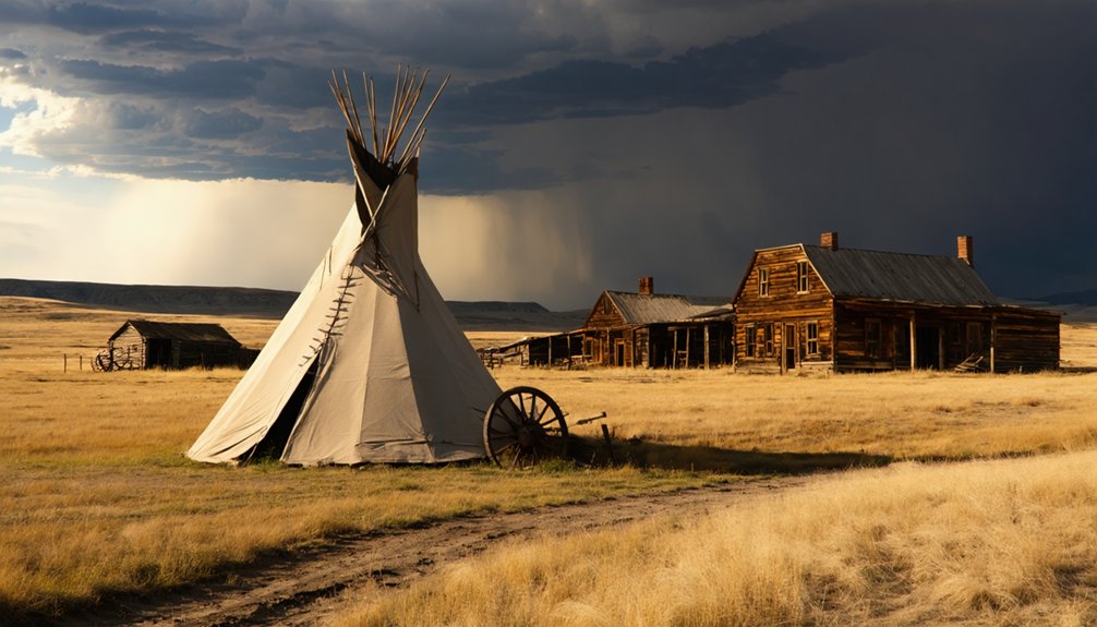
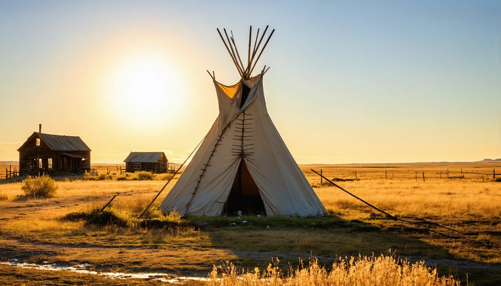
You’ll find Teepee marked on South Dakota’s 1905 maps as a small frontier settlement in Butte County, named after the traditional Lakota Sioux dwellings. The community faced severe economic challenges due to its isolation from railroad networks, poor soil conditions, and limited rainfall. While no physical structures remain today, archaeological evidence reveals over 12,000 years of human habitation in the region. The story of this vanished prairie town holds deeper insights into South Dakota’s rich frontier heritage.
Key Takeaways
- Teepee first appeared on South Dakota maps in 1905, named after the Lakota Sioux’s conical dwellings common in the region.
- The settlement’s isolation from railroad networks severely limited its economic prospects and contributed to its eventual abandonment.
- Poor soil conditions, limited rainfall, and high transportation costs for agricultural products made farming unsustainable in Teepee.
- No physical structures remain of Teepee today, and it is notably absent from most literature about South Dakota ghost towns.
- Archaeological investigations in the area reveal evidence of human habitation spanning 12,000 years, including tool manufacturing sites.
The Origins of Teepee on Early Maps
While many South Dakota ghost towns have faded from memory, Teepee’s cartographic history begins distinctly on the 1905 South Dakota map, where it appeared alongside other established settlements of the era.
You’ll find various spellings across early Teepee maps, including “Tepee” and “Tipi,” reflecting the challenges cartographers faced when transcribing Native American terms.
The name itself pays homage to the Plains tribes, particularly the Lakota Sioux, who constructed their iconic conical dwellings in this region since the 1600s. These dwellings featured wooden pole frameworks arranged in a circular pattern for structural integrity.
The Lakota Sioux crafted their distinctive teepee homes across these plains, leaving an enduring mark on South Dakota’s cultural identity.
By 1968, official USGS maps specifically identified the Tepee Buttes in Harding County, cementing the Native influence on the area’s geography. The sole edition of this map remains a crucial historical document, never revised or reprinted.
This careful documentation shows how indigenous architectural heritage shaped South Dakota’s landscape naming conventions, even as Euro-American settlement expanded across the territory.
A Mysterious Disappearance From Records
Unlike many ghost towns that left behind tangible remnants, Teepee’s presence in South Dakota history exists almost exclusively on early maps.
You’ll find no historical legends, local folklore, or documented accounts of daily life in this mysterious settlement. While other ghost towns like Okobojo and Terry have left behind compelling historical mysteries and physical evidence, Teepee has vanished without a trace.
What makes Teepee’s case particularly intriguing is its complete absence from detailed historical records. Many South Dakota ghost towns contain old church ruins and cemeteries marking their past existence.
You won’t find it in literature about South Dakota’s ghost towns, and there’s no archaeological evidence at its suspected location near the present Tepee Ranger Station. Ghost town enthusiasts often use snowshoes in winter to explore these historical sites, but Teepee remains elusive.
Even the pattern of its disappearance differs from documented cases like Dumont, where clear economic factors led to abandonment.
Life in Butte County’s Lost Settlement
You’ll find Teepee’s early settlement patterns mirrored those of other Butte County communities, where pioneers established homesteads along promising transportation routes and near potential railroad lines.
Life centered around agricultural pursuits, with families working to cultivate crops and maintain livestock in South Dakota’s challenging climate. The pioneers struggled with cramped living conditions in their modest homes. Many residents moved away when the railroad bypassed their community, similar to what happened to Texas Town in 1860.
Your understanding of daily existence in Teepee must account for the harsh realities settlers faced, including drought periods, market instability, and the critical need for reliable rail connections to sustain their fragile economy.
Early Settlement Patterns
As settlers pushed westward into South Dakota during the early 1800s, Butte County’s promising landscape drew pioneers who established scattered communities across its plains.
The settlement geography naturally formed around essential resources and transportation routes, with community dynamics shaped by both European immigrants and Native American influences. The fur trade economy dominated the region during the 1830s, with over 100 trading posts operating throughout the territory.
- Trading posts and stage stops became natural gathering points, creating the seeds for larger settlements.
- Agricultural opportunities in the fertile plains attracted farmers seeking independence and prosperity.
- European immigrants brought their cultural practices, enriching the area’s developing communities.
You’ll find that the early settlement patterns in Butte County reflected a delicate balance between survival needs and economic opportunities. Similar to Buffalo Gap’s early days, many settlements first emerged as stage stop locations that served travelers during the region’s various economic booms.
The establishment of fur trading posts in 1817 marked the beginning of organized European settlement, while the later arrival of railroads transformed these initial communities.
Agricultural Life Challenges
Life in Teepee’s agricultural community presented formidable challenges that tested settlers’ resilience throughout the 1800s. You’d have found yourself battling against the harsh Plains climate, where unpredictable weather patterns made crop adaptation a constant struggle.
While local tribes had mastered nomadic practices that allowed them to move with the seasons, settlers faced the intimidating task of establishing permanent farming operations in unforgiving conditions. The Plains military societies formed to protect valuable hunting territories from rival groups, highlighting the intense competition for resources in the region.
Your success would’ve hinged on understanding the region’s complex soil variations and managing limited water resources. The recurring droughts posed a particular threat to your livelihood, often devastating carefully cultivated maize fields.
You’d have needed to adapt traditional farming methods, much like the indigenous peoples who’d learned to balance hunting with small-scale agriculture, to survive in this demanding environment.
Economic Challenges That Shaped Teepee’s Fate
If you’d visited Teepee in its declining years, you’d have witnessed how the town’s isolation from railroad networks severely limited its economic prospects.
The settlement’s distance from major rail lines meant merchants couldn’t efficiently transport goods to larger markets, while farmers struggled with the high costs of moving their produce to distant rail stations.
Similar challenges faced nearby Quinn and Gettysburg, whose historic buildings were later relocated to 1880 Town to preserve their legacy.
These transportation challenges, combined with the area’s limited agricultural potential due to poor soil conditions, created insurmountable barriers to Teepee’s long-term survival.
Railroad Access Problems
The declining fortunes of Teepee, South Dakota became inextricably linked to its railroad access problems during the post-World War II era.
You’ll find that railroad history in the Black Hills region presented unique challenges, with steep terrain and rocky canyons making both construction and maintenance costly. The harsh transportation economics of the time saw rail companies prioritizing profitable freight routes while abandoning passenger service to remote locations.
- The Spearfish Canyon line struggled with severe grade issues, requiring trains to be secured at stops.
- Geographic obstacles made new rail routes or spurs financially unfeasible.
- Loss of rail service isolated Teepee from major markets and supply chains.
Without rail connections, you couldn’t effectively ship agricultural or mining products, and new industries wouldn’t consider locating in Teepee.
This transportation void ultimately accelerated the town’s decline into ghost town status.
Limited Agricultural Resources
Beyond the railroad difficulties, agricultural limitations posed significant hurdles for Teepee’s survival.
You’ll find the town’s prairie soils lacked the rich organic matter needed for reliable crop production, while limited rainfall and frequent droughts made farming techniques extremely challenging. Without modern fertilizers or developed irrigation systems, settlers struggled to adapt their conventional farming methods to these harsh conditions.
The short growing season forced farmers to experiment with crop adaptation, particularly with maize varieties that could mature quickly. Yet their efforts yielded mainly subsistence-level harvests, providing little surplus for trade.
The combination of poor soil quality, water scarcity, and climate constraints ultimately created an unstable agricultural foundation. You can trace Teepee’s decline directly to these environmental limitations that prevented sustainable farming operations.
Neighboring Ghost Towns and Their Stories
While Teepee’s own history remains shrouded in mystery, several notable ghost towns in its vicinity paint a vivid picture of South Dakota’s tumultuous past.
South Dakota’s forgotten settlements whisper tales of boom and bust, their abandoned streets echoing the state’s pioneering spirit.
You’ll find Buffalo Gap, once a bustling stage stop on the Sidney-Deadwood Trail, now stands as a memorial to the region’s gold rush era.
Nearby Owanka, whose Lakota name means “good camping ground,” succumbed to drought and economic hardship despite its promising location.
- Minnesela lost its county seat status when the railroad bypassed it, leaving intact buildings that create an eerie, abandoned atmosphere.
- Texas Town, established by escaped slaves, flourished briefly as a lumber center before vanishing into history.
- Buffalo Gap’s natural gap once sheltered massive buffalo herds before becoming a critical supply depot.
The Role of Railways in Town Survival
In South Dakota’s frontier era, you’ll find that a town’s fate hinged heavily on whether it secured railway access, as trains enabled rapid transport of agricultural goods, mail, and supplies that wagons simply couldn’t match.
When railroad companies bypassed a settlement, you could almost guarantee its eventual decline, since merchants and farmers needed reliable shipping routes to sustain their livelihoods.
If you’d visited South Dakota’s railroad towns in their prime, you’d have seen bustling depots serving as essential community hubs, where residents gathered to conduct business, receive news, and connect with the wider world.
Railway Access Changes Everything
During the 1880s, the arrival of a railroad line meant the difference between a town’s survival and its eventual abandonment.
You’ll find that railroad expansion transformed frontier settlements overnight, bringing crucial connections to distant markets and essential supplies. The stark reality of ghost town dynamics played out in places like Minnesela, which faded into obscurity after failing to secure rail access, while Belle Fourche thrived by offering free right-of-way to the railroad.
- Railroads replaced stagecoach routes, dramatically reducing travel times and making goods more accessible.
- Towns strategically lobbied railroad companies, knowing their survival depended on securing a rail connection.
- Rail depots became bustling centers of commerce and community life, fundamentally reshaping settlement patterns.
The impact was clear – if you weren’t on the rail line, you weren’t likely to survive the evolving frontier economy.
No Tracks, No Growth
The stark reality of railway economics shaped the destiny of countless South Dakota towns through the late 1800s and early 1900s. Without rail access, you’d watch your town’s prospects wither while neighboring communities flourished. These economic implications weren’t just theoretical – they determined whether your town would thrive or disappear.
The settlement patterns tell the story: towns with rail connections developed in a distinctive T-shape, with businesses clustering around the depot.
But if you weren’t on the rail line, you’d face devastating isolation. When rail companies chose different routes or abandoned existing lines, towns often couldn’t survive.
The rise of automobiles only accelerated this decline, leaving places like Teepee to join the ranks of South Dakota’s ghost towns, stark reminders of how vital those steel rails were to a town’s survival.
Life Along The Lines
Life along South Dakota’s rail lines pulsed with economic and social significance, as railways transformed isolated settlements into bustling centers of commerce.
Through essential railway connections, you’d find communities thriving around depots that served as lifelines for agricultural shipping, communication, and trade. These hubs became the heart of town life, where you’d witness daily community gatherings as locals exchanged news and welcomed visitors.
- Your local depot brought the world to your doorstep through telegrams, newspapers, and mail delivery.
- You’d rely on the railway for shipping grain, receiving goods, and connecting with distant markets.
- You could find work opportunities in railroad operations, supporting your family while building community ties.
The railroad’s influence reached far beyond transportation, shaping the economic and social fabric of your town’s very existence.
Archaeological Evidence and Historical Traces
Archaeological investigations in South Dakota’s ghost town regions have revealed complex layers of human habitation, with sites near Teepee offering glimpses into both ancient and recent history.
When you explore these areas, you’ll find archaeological findings spanning over 12,000 years, from Plains Archaic settlements to more recent mining operations.
Historical artifacts are often preserved within the region’s unique geological features, particularly in eolian sediments that have buried numerous sites over time.
Sediment layers across South Dakota’s landscape act as time capsules, protecting historical treasures beneath wind-blown deposits.
You’ll discover evidence of tool manufacturing from materials like chert and chalcedony, while nearby ceremonial stone formations reveal sacred spaces that tribal elders have helped interpret correctly.
The South Dakota State Plan for Archaeological Resources guides preservation efforts, ensuring these essential traces of human activity aren’t lost to time.
Preservation Efforts in South Dakota Ghost Towns
Building upon decades of archaeological discoveries, preservation efforts in South Dakota’s ghost towns now represent a coordinated approach between state agencies, local communities, and dedicated volunteers.
The State Historic Preservation Office oversees these initiatives through matching grants and professional guidance, while you’ll find local historical societies tackling preservation challenges through hands-on community involvement.
- Receive financial support through Certified Local Government grants for preservation planning and site stabilization
- Join volunteer programs focused on trail maintenance and historical marker installation
- Participate in grassroots initiatives protecting sites from vandalism while promoting heritage tourism
In the Black Hills region, you’ll encounter unique preservation approaches that balance historic significance with environmental conservation, especially around former mining sites like Golden Crest.
The coordinated efforts guarantee these valuable historical assets remain accessible while preserving their authentic character for future generations.
Cultural Legacy of Teepee and Similar Settlements
Through its deep connection to the Black Hills Gold Rush, Teepee stands as a symbol of South Dakota’s rich mining heritage and diverse cultural tapestry.
As you explore this ghost town’s legacy, you’ll discover how mining and railroad industries shaped its identity, bringing together miners, traders, and families from various backgrounds.
The cultural influences of Teepee extend beyond its physical remains. You’ll find its spirit woven into regional folklore, where ghost town narratives blend historical fact with frontier legends.
Legends of Teepee whisper through Black Hills folklore, where ghostly tales intertwine with the authentic stories of frontier life.
The town’s abandoned landscapes continue to inspire artists and photographers, while its archaeological sites offer valuable insights into frontier life.
Through local historical societies and archives, you’re able to trace the stories of those who sought fortune in these hills, contributing to the broader cultural heritage of the Black Hills region.
Modern Tourism and Historical Significance
Today, Teepee’s historical legacy draws visitors seeking authentic connections to South Dakota’s frontier past.
You’ll find that ghost town tourism has transformed these forgotten settlements into living history museums, where you can explore the remnants of the Old West. Through historical education initiatives and preservation efforts, you’re enabled to experience firsthand the cultural significance of these abandoned communities.
- Visit restored structures and participate in guided tours that bring the town’s mining heritage to life
- Explore nearby attractions like Fort Sisseton Historic State Park and the famous Concrete Interstate Tipis
- Join special events and festivals that celebrate the region’s rich frontier history
The site’s integration into South Dakota’s heritage tourism network guarantees that Teepee’s story continues to inspire and educate future generations about the state’s pioneering spirit.
Frequently Asked Questions
Were Any Native American Artifacts Found in the Teepee Area?
You’ll find abundant native artifacts of historical significance in the area, including tipi rings with central hearths, quartzite tools, petroglyphs, arrowheads, and ceremonial items like quill-decorated bags.
What Natural Landmarks or Geographical Features Exist Near Teepee’s Former Location?
Rising 7,000 feet above the Great Plains, you’ll discover natural formations like Tepee Canyon’s limestone cliffs and agate-rich buttes. The area’s geological history showcases rugged Black Hills terrain and mineral-laden outcrops.
Did Any Families From Teepee Relocate to Nearby Surviving Towns?
You’ll find no direct evidence of specific family migration patterns from Teepee, though regional trends suggest families likely moved to surviving communities along railroad routes, particularly Buffalo Gap.
What Was the Primary Water Source for the Teepee Settlement?
You’ll find the settlement history’s water supply remains a mystery, as no definitive records exist. While nearby towns relied on creeks and springs, Teepee’s exact water source isn’t documented.
Were There Any Notable Weather Events That Contributed to Teepee’s Abandonment?
You’ll find no single catastrophic weather event documented, but regional drought conditions and severe storms common to South Dakota likely contributed to Teepee’s gradual decline alongside other environmental and economic pressures.
References
- https://hpr1.com/index.php/feature/culture/festivals-of-history-in-south-dakota
- https://www.southdakotamagazine.com/1880-town
- https://www.legendsofamerica.com/buffalo-gap-south-dakota/
- https://www.youtube.com/watch?v=uCaj6m8TXv4
- https://www.blackhillsbadlands.com/blog/post/old-west-legends-mines-ghost-towns-route-reimagined/
- https://www.youtube.com/watch?v=GQH5mp2emBw
- https://www.tripadvisor.com/LocationPhotoDirectLink-g54726-d622050-i373305127-South_Dakota_s_Original_1880_Town-Murdo_South_Dakota.html
- https://en.wikipedia.org/wiki/List_of_ghost_towns_in_South_Dakota
- https://www.sdpb.org/rural-life-and-history/owanka-south-dakota
- https://npgallery.nps.gov/NRHP/GetAsset/076e272c-a150-4169-a47e-323b7f0e55e7


