You’ll discover Tipp’s Branch nestled along Salt Creek as one of Lancaster County’s earliest ghost towns. Founded in 1857, this frontier settlement thrived due to its strategic location near major transportation routes and rich agricultural land. Native American tribes, including the Otoe and Pawnee, originally inhabited the area before pioneer families like the Preys established permanent homesteads. While economic challenges led to its abandonment in the late 1800s, archaeological findings continue to reveal fascinating details about this lost community.
Key Takeaways
- Tipp’s Branch was a promising 19th-century settlement in Pawnee County, Nebraska, strategically located near transportation routes and agricultural lands.
- The town thrived initially through farming, community cooperation, and its position as a rest stop along the Nebraska City-Fort Kearny Cut-Off.
- Economic decline began in the late 1800s due to failed investments and shifting transportation routes that isolated the community.
- The town’s abandonment was marked by population exodus, closure of essential services, and withdrawal of Methodist church support.
- Archaeological evidence reveals both Native American and pioneer settlements, with artifacts indicating extensive trade networks and cultural transitions.
Early Settlement Along Salt Creek
Before settlers established permanent roots along Salt Creek in 1857, four Native American tribes – the Otoe, Missouri, Kansas, and Pawnee – called this region home.
Long before the first settler’s footsteps, the Otoe, Missouri, Kansas, and Pawnee tribes lived freely across these ancestral lands.
These tribes roamed freely across the land, using the area primarily for hunting and seasonal travel rather than fixed settlements. The tribes avoided permanent settlements because of the flooding risks from seven local creeks.
You’ll find the story of permanent settlement beginning with John D. Prey and his family, who ventured from Wisconsin to stake their claim.
They weren’t alone for long – the Davidson, Dunham, Eatherton, and Kirke families soon followed, creating a growing community from Hickman to Saltillo.
The area was rich in natural resources, featuring magnesian limestone that early settlers could use for building materials.
Under the Preemption Act of 1841, these brave settlers could purchase 160 acres before public sales, allowing them to build their dreams on the vast prairie where buffalo grass still swayed and limestone ledges dotted the landscape.
The Rise of Tipp’s Branch
As pioneer families carved out their homesteads along Salt Creek, another settlement took root in Pawnee County – Tipp’s Branch.
Despite pioneer struggles, this strategic location near crucial trade routes and fertile farmland attracted determined settlers ready to forge their own destiny in Nebraska Territory.
You’ll find the town’s early success was built on three key foundations:
- Rich agricultural land that supported innovative farming methods
- Strategic positioning along established transportation networks
- Access to essential water resources from nearby creek branches
The settlement quickly developed the hallmarks of frontier prosperity – trading posts, grain storage facilities, and blacksmith shops emerged to serve the growing community. Like many towns of the 1880s, Tipp’s Branch was part of an era when one town per ten square miles dotted Lancaster County’s landscape. Much like Sarpy Center’s school, the town established educational facilities to serve local families.
Agricultural innovations helped early residents overcome the challenges of prairie farming, while strong community bonds formed through cooperative farming efforts and social gatherings.
Life in a Frontier Community
While the frontier settlement of Tipp’s Branch lacked modern conveniences, its residents created a vibrant community through shared labor and tight-knit social bonds.
You’d find families working together during planting and harvest seasons, sharing tools and expertise to guarantee everyone’s survival. Cultural traditions centered around community gatherings like barn raisings, quilting bees, and holiday celebrations that strengthened social connections. Much like in Potash Ruins towns, the community’s economy depended heavily on local industry and agriculture. The decline of the town began when railroad routes changed, leading families to seek opportunities elsewhere.
Daily life revolved around subsistence farming, with most families growing their own food and bartering for necessities at local general stores.
Frontier families sustained themselves through hard work on their land, trading surplus crops for essential goods they couldn’t produce themselves.
You’d attend church services and town meetings in simple log structures, where important decisions were made by consensus. Despite harsh weather, isolation, and constant challenges, you’d rely on your neighbors’ support, forming resilient bonds that defined frontier life in Tipp’s Branch.
Transportation Routes and Development
When steamboat trade flourished on the Missouri River in the mid-19th century, you’d find Tipp’s Branch strategically positioned between major transport arteries. The town’s location capitalized on the flow of pioneers and supplies between bustling river ports and the westward migration routes along the Platte Valley. Similar to Brownville’s economic foundation, the area’s growth depended heavily on steamboat commerce. Congress responded to the growing migration needs by initiating extensive road projects to improve travel conditions.
You could witness these transportation innovations transform the region:
- Up to fifteen steamboats would dock simultaneously at nearby river towns.
- Nearly 500,000 settlers traversed the nearby migration corridors between 1840-1866.
- Railroad development shifted trade routes and settlement patterns after 1855.
As transportation evolved from river to rail, Tipp’s Branch faced the harsh reality of changing trade routes.
Like many frontier communities, its fate hinged on the unpredictable paths of progress as newer transport technologies reshaped Nebraska’s landscape.
Notable Families and Pioneers
Several pioneering families laid the foundation for Tipp’s Branch‘s early development, with the Bischof clan standing prominent among them. Edward H. Bischof’s land acquisitions south of Nebraska City proved vital to the settlement’s establishment, while Charles F. Hunter’s property holdings shaped the area’s initial growth.
You’ll find pioneer contributions woven throughout the community’s fabric, from the creation of village parks to essential infrastructure along Little Nemaha Creek. Like other ghost towns that were named after officials, Tipp’s Branch followed the common practice of honoring railroad associates through its naming. Settlers often used the pattern matching feature to solve local crossword puzzles in their community newspapers.
Family resilience showed particularly after the 1864 destruction, as settlers rebuilt their homes and businesses. Many families managed public spaces and participated in local governance, demonstrating their commitment to collective progress.
The railroad’s arrival brought new settlers, with some small settlements named after railroad employees who influenced the region’s development.
Economic Activities and Trade
As Salt Creek’s fertile bottomlands supported the local economy, Tipp’s Branch emerged as a modest agricultural hub in Lancaster County. The settlement’s trade dynamics centered around crop farming and livestock raising, with families working their land using traditional methods before mechanization arrived.
You’d find the community’s agricultural sustainability built on these core activities:
- Family-operated farms producing corn and wheat in the rich Nebraska soil
- Cattle and hog raising to supplement crop income
- Local commerce through trading posts and general stores, where settlers bartered and traded goods
The settlement’s position near the Nebraska City-Fort Kearny Cut-Off made it a natural rest stop for traders and travelers.
Strategically located along a major pioneer route, Tipp’s Branch provided weary travelers refuge during their westward journeys.
You’d see horse-drawn wagons carrying surplus produce to neighboring towns like Centerville and Saltillo, fostering economic interdependence throughout the region.
The Decline and Abandonment
Despite its early promise as an agricultural hub, Tipp’s Branch succumbed to a perfect storm of economic and infrastructural challenges in the late 1800s.
You’ll find that failed speculative investments dealt the first blow, as land values plummeted and economic expectations crumbled. The town’s fate was further sealed when transportation routes shifted elsewhere, leaving it isolated from essential trade networks.
Migration trends followed a familiar pattern – young residents left first, seeking opportunities in more prosperous areas.
As the population dwindled, you could witness the town’s institutional framework collapse: the Methodist conference withdrew support, the post office closed, and schools shuttered.
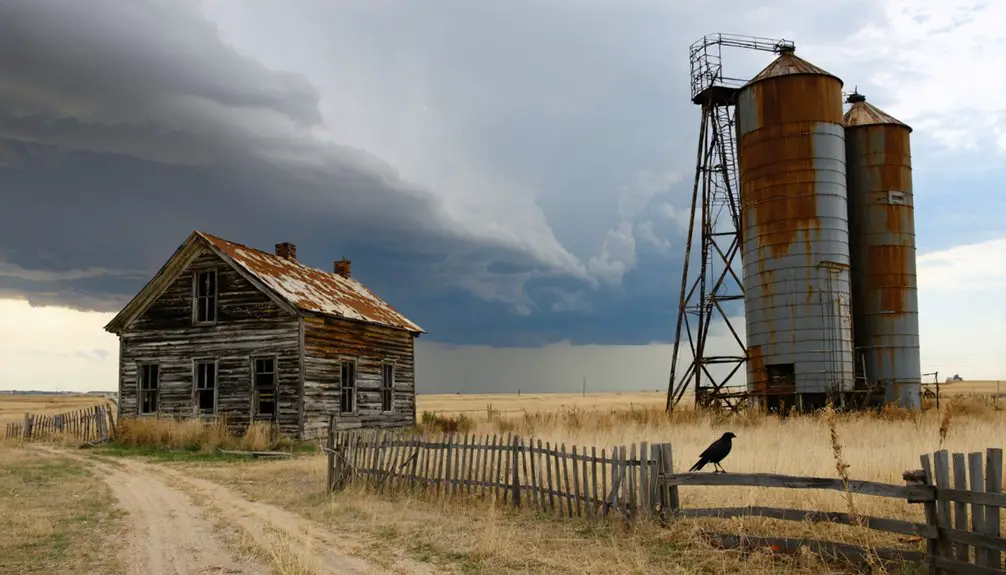
What remained was a shadow of the once-thriving community, with only the cemetery standing as a silent reminder of Tipp’s Branch’s brief but vibrant existence.
Archaeological Findings and Remnants
The rich archaeological landscape of Tipp’s Branch reveals both Native American and pioneer settlements through distinctive physical remnants. The site’s archaeological significance is evidenced by earth lodge depressions, stone rings, and hearths that tell stories of past inhabitants.
You’ll find cultural artifacts scattered throughout, including chipped stone tools and pottery fragments that connect to Woodland and Central Plains traditions.
Key discoveries at the site include:
- Obsidian chips from Idaho, indicating extensive trade networks
- Stone-lined hearths and fire pits marking activity zones
- Tipi ring formations suggesting Plains Apache encampments from 1650-1700s
While few standing structures remain, the site’s subsurface features and artifact scatters continue to provide valuable insights into the region’s complex cultural heritage.
Historical Legacy in Lancaster County
If you’d explore the early days of Lancaster County, you’ll find Tipp’s Branch emerging as a notable settlement during the county’s 1859 organization near the iconic Great Elm tree along Salt Creek.
The town’s strategic position along Salt Creek made it a promising transportation hub, particularly after the arrival of the Atchison & Nebraska Railroad in 1872.
While Tipp’s Branch ultimately succumbed to its floodplain location, its role in Lancaster County’s development reflects the broader pattern of how geographic features shaped the viability of early Nebraska settlements.
Early Settlement Patterns
Before European settlers reshaped Lancaster County’s landscape, indigenous peoples including the Pawnee, Omaha, Oto, Missouri, Arapaho, and Cheyenne tribes established complex settlement patterns across the region.
Their villages featured earthlodges, bark houses, and tipi dwellings, reflecting sophisticated indigenous agriculture and settlement dynamics.
You’ll find evidence of their presence in sites like:
- Pike-Pawnee Village, with over 100 lodge sites and ceremonial grounds
- Traditional farming plots along waterways, where tribes cultivated native crops
- Extensive hunting territories that supported bison-based economies
This indigenous landscape transformed dramatically after the 1862 Homestead Act, when European immigrants claimed parcels through federal land treaties.
The change marked a shift from communal village life to individual homesteads, forever changing how people lived on Lancaster County’s rolling plains.
Salt Creek Transportation Hub
Located at the heart of Lancaster County’s early development, Salt Creek emerged as an important transportation corridor that shaped Nebraska’s territorial expansion and commerce.
You’ll find the creek’s transportation evolution deeply intertwined with the region’s growth, as it served as a natural pathway for freight routes connecting Nebraska City to Fort Kearny. The commerce dynamics around Salt Creek flourished in the 1860s, particularly with salt production ventures and the establishment of transfer points for travelers and merchants.
If you’d explored the area then, you’d have witnessed the bustling activity of stagecoach lines and freight roads, with crucial infrastructure like bridges being built to guarantee year-round travel.
The creek’s strategic location ultimately influenced Lincoln’s development, particularly in the Haymarket district where railroads and warehouses transformed the landscape.
Frequently Asked Questions
Was Tipp’s Branch Ever Connected to Native American Settlements in the Area?
You’ll find Native American connections around Tipp’s Branch were likely, given its historical significance within Otoe, Omaha, and Ponca territories, though no direct settlement records exist there.
What Natural Disasters Affected the Development of Tipp’s Branch?
Imagine watching your homestead sink into rising waters. While specific records aren’t preserved, you’d have seen the flood damage along Salt Creek and likely felt drought impacts common to Nebraska settlements.
Were There Any Notable Crimes or Lawlessness in Tipp’s Branch?
You won’t find documented crime history or major lawlessness at this settlement. With minimal law enforcement typical of frontier towns, the community likely handled minor disputes through informal local arrangements.
Did Any Famous Personalities Visit or Stay in Tipp’s Branch?
You won’t find any famous visitors or historical figures documented in this settlement’s history. Available records and research show no evidence of any notable personalities ever staying there.
What Kinds of Entertainment and Social Activities Existed in Tipp’s Branch?
Where there’s life, there’s fun! You’d find community gatherings at general stores, church socials, barn dances, and local festivities. Hunting, fishing, picnics, and storytelling filled your leisure hours.
References
- https://llcgs.info/cpage.php?pt=54
- https://history.nebraska.gov/wp-content/uploads/2017/12/doc_publications_NH1937GhostTowns.pdf
- https://www.youtube.com/watch?v=tJWaL6_ovK8
- https://visitnebraska.com/trip-idea/explore-7-authentic-ghost-towns-nebraska
- https://www.youtube.com/watch?v=redtU6GT-BY
- https://www.lancaster.ne.gov/859/Historical-Background
- https://llcgs.info/cpage.php?pt=48
- http://www.kancoll.org/books/andreas_ne/lancaster/lancaster-p1.html
- https://en.wikipedia.org/wiki/History_of_Lincoln
- https://history.nebraska.gov/wp-content/uploads/2017/12/doc_publications_NH1959SalineLandGrant.pdf


