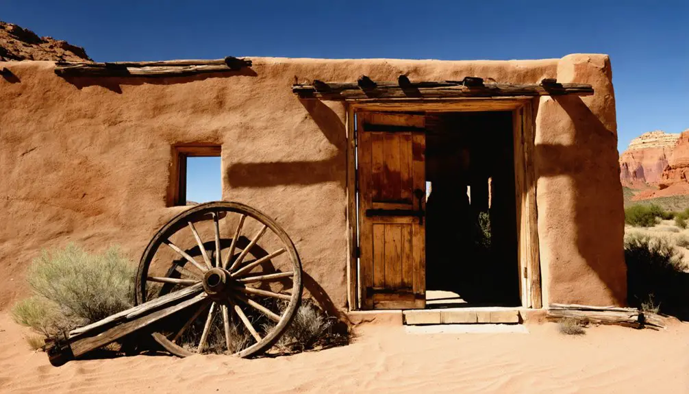
You’ll find Tonaquint’s ghost town story at the meeting point of Santa Clara Creek and Virgin River in southwestern Utah. Mormon pioneers established this settlement in 1856, building log cabins and irrigation systems for cotton farming. Swiss immigrants later joined, adding fruit and grape cultivation to the community. The devastating flood of 1862 destroyed the settlement, leaving only memories preserved in modern St. George’s place names and landmarks. The area’s dramatic pioneer history holds many more untold tales.
Key Takeaways
- Tonaquint was established in 1856 as part of the Mormon Cotton Mission at the confluence of Santa Clara Creek and Virgin River.
- The devastating flood of 1861-1862 destroyed homes, irrigation systems, and farmland, leading to the settlement’s permanent abandonment.
- Originally home to Southern Paiute farmers, Tonaquint became a diverse community of Swiss and English-speaking Mormon settlers.
- The ghost town’s location is now part of modern St. George, with no original pioneer buildings remaining.
- Tonaquint’s legacy lives on through local place names, including Tonaquint Park, cemetery, and business park in St. George.
The Birth of a Pioneer Settlement
Two Mormon pioneers, Rufus C. Allen and Hyrum Burgess, carved out a new settlement in 1856 at the convergence of Santa Clara Creek and the Virgin River.
You’ll find that their bold venture, establishing three log cabins in this untamed territory, marked the birth of Tonaquint – named after the local Southern Paiute band.
As part of the ambitious Mormon Cotton Mission, they tackled pioneer challenges by transforming the arid landscape through agricultural innovations.
The settlers quickly constructed irrigation systems to support cotton and corn farming, recognizing the valley’s potential for cultivation.
By winter 1856-57, they’d built a protective fort with help from Cedar City and Pinto communities.
The settlement’s strategic location in the gently sloping valley proved ideal for their farming aspirations, setting the stage for a promising agricultural community.
Indian missionaries from Fort Harmony worked closely with the local tribes to maintain peaceful relations.
Like many early Mormon settlements, the community prioritized close-knit gatherings to strengthen their shared religious and social bonds.
Life Along the Santa Clara River
Life along the Santa Clara River blossomed into a vibrant agricultural community as Swiss Mormon families arrived in 1861, bringing their expertise in fruit and grape cultivation.
Swiss Mormon pioneers transformed the Santa Clara River valley in 1861, cultivating fruits and grapes in this promising new agricultural frontier.
You’d have found a diverse cultural heritage where Swiss immigrants worked alongside English-speaking settlers, transforming the river valley into productive farmland. The warm climate and clear skies created ideal conditions for growing cotton, fruits, and vegetables, while the river ecology supported extensive irrigation systems.
Extensive flooding in 1862 destroyed many of the original structures and farmlands. The settlers faced constant challenges from flooding, which forced them to relocate to higher ground and build protective riverbank reinforcements. The community was part of Utah’s larger Cotton Mission initiative, which sought to establish self-sufficient agricultural settlements during the Civil War period.
Despite these setbacks, you would’ve seen a thriving settlement where surplus produce made its way to markets in Utah and Nevada, while the Swiss settlers’ viticulture skills produced wine for both sacramental and commercial purposes.
Native American Connections
Before Mormon settlers arrived in the Santa Clara River valley, the Tonaquint band of Southern Paiute Native Americans had already established a thriving agricultural presence at the confluence of Santa Clara Creek and the Virgin River.
You’ll find that Tonaquint culture centered around farming wheat, beans, and corn in this fertile area just south of modern-day St. George.
When Mormon missionaries arrived in the 1850s, they worked alongside the Tonaquint people to enhance irrigation systems, including a 100-foot diversion dam.
Under the leadership of Chief Tutsegabits, nearly 250 Native Americans collaborated with settlers to farm 100 acres.
Like the Ute tribes who lived in harmony with the land, the Tonaquint people developed sustainable practices that respected the environment while maximizing agricultural output.
Native agriculture flourished with Mormon tools and expertise until the devastating flood of 1862.
The settlement became known by several names including Lower Clara due to its location downstream.
As settler populations grew and logging depleted water resources, the Tonaquint’s traditional way of life gradually declined, though their legacy lives on in local place names.
The Great Flood of 1862
As winter storms pummeled Utah Territory in 1861-1862, a devastating flood struck the settlement of Tonaquint, transforming the normally placid Virgin and Santa Clara Rivers into raging torrents up to a quarter-mile wide.
For forty straight days, relentless rains overwhelmed the community’s flood resilience, destroying homes, cotton farms, and essential irrigation systems. Jacob Hamblin’s fort was among the many structures destroyed in the region.
You’ll find the flood’s impact was catastrophic – washing away five-mile ditches, depositing massive debris fields, and forcing inhabitants to seek refuge in St. George’s school tents. The flood was part of a larger weather system that brought unprecedented Pacific storms across the western United States.
The community recovery proved impossible, as Tonaquint never rebuilt. While the land continued to be farmed using the “Seep Ditch” irrigation system, the settlement itself became a ghost town.
Today, you’ll only find Tonaquint’s legacy in local place names around St. George.
From Settlement to Modern St. George
While Tonaquint’s original pioneer buildings are long gone, you’ll find its legacy woven into modern St. George through park names, roads, and local businesses that honor the ghost town’s history.
You can trace the evolution from Tonaquint’s humble beginnings to St. George’s expansion, as the city grew to encompass the former settlement’s lands between the valley’s volcanic ridges. Like early Summit County villages, this settlement was strategically positioned near water sources.
The area where pioneer farmers once tended cotton fields has transformed into thriving suburban developments, yet maintains connections to its roots through preserved place names and local historical markers. The settlement’s rich agricultural history began when Jacob Hamblin planted the first cottonseed in the area in 1855.
Pioneer Roots Still Visible
Although most physical traces of Tonaquint have vanished, the pioneer settlement‘s legacy remains woven into modern St. George.
You’ll find the Tonaquint name preserved throughout the city on parks, cemeteries, roads, and businesses – each a symbol of the pioneer resilience that shaped this corner of Utah Territory.
The settlement’s agricultural innovation lives on through the Seep Ditch irrigation system, which still waters land that was once home to Utah’s first cotton farms.
While the devastating 1862 flood forced settlers to abandon their original homesteads, their spirit of determination helped establish St. George as the region’s primary community.
Today, as you explore the area where Santa Clara Creek meets the Virgin River, you’re walking the same ground where Mormon pioneers and Paiute Indians once cooperated to build a thriving agricultural settlement.
Growth Through Urban Evolution
Since its humble beginnings in 1861 as part of the LDS Church’s Cotton Mission, St. George has undergone a remarkable urban development journey.
You’ll find traces of this transformation from the pioneering days when settlers first established irrigation systems to support cotton farming through periods of significant community transformation.
The city’s evolution accelerated with the construction of the LDS Temple in 1877 and the establishment of Utah’s first bank.
As you explore today’s St. George, you’ll see how it’s grown from its agricultural roots into a thriving hub of over 105,000 residents.
The city’s modern landscape reflects a dynamic mix of commerce, tourism, and cultural attractions, while still preserving its historic religious buildings.
You’ll discover how strategic planning has shaped neighborhoods, commercial districts, and recreational spaces around the iconic red rock scenery.
Legacy in Local Names
You’ll find the Tonaquint name preserved throughout modern St. George in landmarks like the city park, cemetery, and high-tech business park near I-15 and Dixie Drive.
The name originated from the Tonaquint band of Southern Paiute Indians led by Chief Tut-se-gavits, who lived in the area before Mormon missionaries established a settlement in 1856.
While the original settlement vanished in the 1862 flood, its legacy continues through these place names, connecting present-day residents to this significant piece of regional history.
Modern Places Using Tonaquint
Today, the legacy of Tonaquint lives on throughout St. George, Utah, where you’ll find its name gracing numerous public spaces and landmarks. The most prominent reminder is Tonaquint Park, a popular urban recreational area that honors the area’s heritage.
You can also visit Tonaquint Cemetery, a historic burial ground that preserves the cultural significance of this former settlement.
Throughout Washington County, you’ll discover various businesses, real estate developments, and local services that incorporate the Tonaquint name into their branding.
The area’s rich history is further commemorated at Crosby Family Confluence Park, where a historic marker educates visitors about Tonaquint’s past.
Local roads, trails, and recreational paths also bear the name, ensuring that this essential piece of Utah’s pioneer history remains woven into the fabric of modern life.
Early Name Origins Preserved
The historical name Tonaquint traces back to the indigenous Tonaquint Band, who lived along Santa Clara Creek under the leadership of Chief Tut-se-gavits.
You’ll find this rich Indigenous heritage preserved through early missionary records and settler documentation, offering a window into the region’s cultural foundations.
- The settlement earned colorful nicknames like “Seldom Stop,” reflecting its remote location
- “Never Sweat” captured the intense desert climate settlers endured
- “Lick Skillet” spoke to the hardships of frontier life
While the physical town has vanished, Tonaquint history lives on through historical markers, church records, and John W. Van Cott’s “Utah Place Names.”
These preserved names tell the story of cultural intersection between Native Americans and pioneers, maintaining a lasting connection to this significant chapter of Utah’s past.
Lost Towns of Washington County
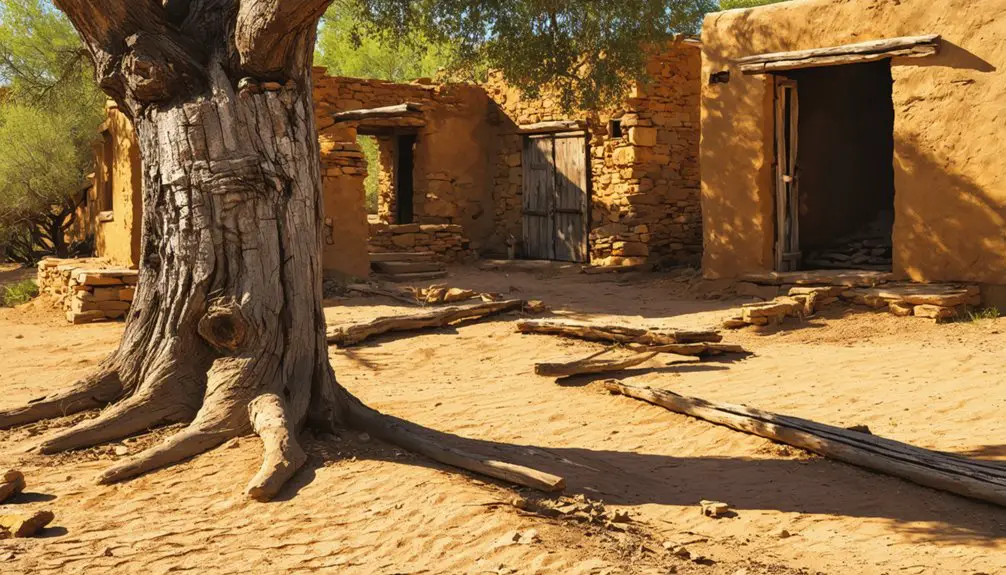
Throughout Washington County’s rich pioneer history, at least 28 documented ghost towns have emerged and faded into memory, each telling a unique story of hope, hardship, and eventual abandonment.
You’ll find these lost settlements scattered across the region, from mining boomtowns like Silver Reef to small farming communities that succumbed to nature’s fury. The ghost town phenomena reflects the volatile settlement patterns of southwestern Utah, where communities rose and fell with changing economic fortunes and environmental challenges.
The history of Thistle, Utah ghost town serves as a poignant example of these fleeting communities. Once a thriving hub, Thistle faced devastating challenges, eventually leading to its abandonment. Today, its remnants stand as a testament to the harsh realities faced by settlers in the region.
While some towns have left behind physical remnants and marked graves, others have vanished completely, surviving only in historical records.
Today, you can explore preserved sites like Silver Reef, offering glimpses into the determination and struggles of early pioneers who shaped Washington County’s landscape.
Frequently Asked Questions
What Did the Settlers of Tonaquint Eat to Survive?
With a half-mile irrigation ditch, you’d survive on corn, potatoes, squash, and cottonseed grown near rivers. You’d supplement survival strategies with wild grapes, local resources like porridge, and small livestock.
Were There Any Conflicts Between Settlers and Native Americans in Tonaquint?
While there’s no direct evidence of major settler conflicts in Tonaquint specifically, you’ll find the area was part of broader regional tensions between Mormon settlers and native peoples during Utah’s territorial period.
What Was the Average Population of Tonaquint During Its Peak?
Like a small cluster of stars, your pioneer ancestors joined about 50-60 souls during the peak years around 1861, with average demographics showing twelve families settling this rugged frontier outpost.
Did Any Original Settler Families Return to Rebuild After the Flood?
No, you won’t find evidence of original settlers returning. Settler motivations shifted toward St. George’s development, while the flood impact made Tonaquint’s lands unsuitable for immediate resettlement or reconstruction.
What Crops Were Successfully Grown in Tonaquint Before Its Abandonment?
Picture sun-ripened fields where you’d find thriving corn and cotton crops, alongside sweet pumpkins and hefty onions. Despite challenging irrigation techniques, settlers also successfully cultivated tobacco, lettuce, and sesame before abandonment.
References
- https://usgenwebsites.org/UTWashington/towns/tonaquin.html
- https://www.youtube.com/watch?v=AoiIha-3iNo
- https://www.ksl.com/article/51308628/restored-utah-ghost-towns-that-should-be-on-your-summer-travel-bucket-list
- https://sceniccolorcountry.net/StGeorge/StGeorgeHistory.php
- https://www.sgutah.com/southern-utah-ghost-towns.php
- https://wchsutah.org/documents/virgin-water-below-confluence.pdf
- https://library.utahtech.edu/special_collections/Juanita_Brooks_lectures/2001.html
- https://digitalcommons.usu.edu/context/etd/article/9708/viewcontent/HISTetd2022Aug_McConkie_SpencerWayne.pdf
- https://usgenwebsites.org/UTWashington/pioneers/intro.html
- https://www.uen.org/utah_history_encyclopedia/c/COLONIZATION_OF_UTAH.shtml


