You’ll discover Ohio’s most fascinating ghost towns scattered across the state’s diverse landscape. From Moonville’s haunted tunnel and mining legacy to Shawnee’s coal-driven cultural hub, each site tells a unique story of boom and bust. Notable locations include Knockemstiff’s notorious moonshine past, Claylick’s flood-erased history, and Sprucevale’s canal commerce ruins. These abandoned settlements hold centuries of tales within their weathered structures and overgrown paths, waiting to reveal their secrets.
Key Takeaways
- Moonville, renowned for its haunted tunnel and 21 documented railroad fatalities, stands as one of Ohio’s most legendary ghost towns.
- Shawnee transitioned from a thriving coal mining hub of 3,265 people to a near-ghost town with only 665 residents by 2010.
- Knockemstiff, famous for its moonshine and violent history, remains mostly abandoned with only its church and schoolhouse marking its existence.
- Claylick completely vanished after two devastating floods, with no physical structures remaining from this once-prosperous mill town.
- Sprucevale, a former canal boom town, preserves its ghost town status through Hambleton’s Mill ruins and visible portions of the canal system.
Moonville: A Haunted Mining Legacy
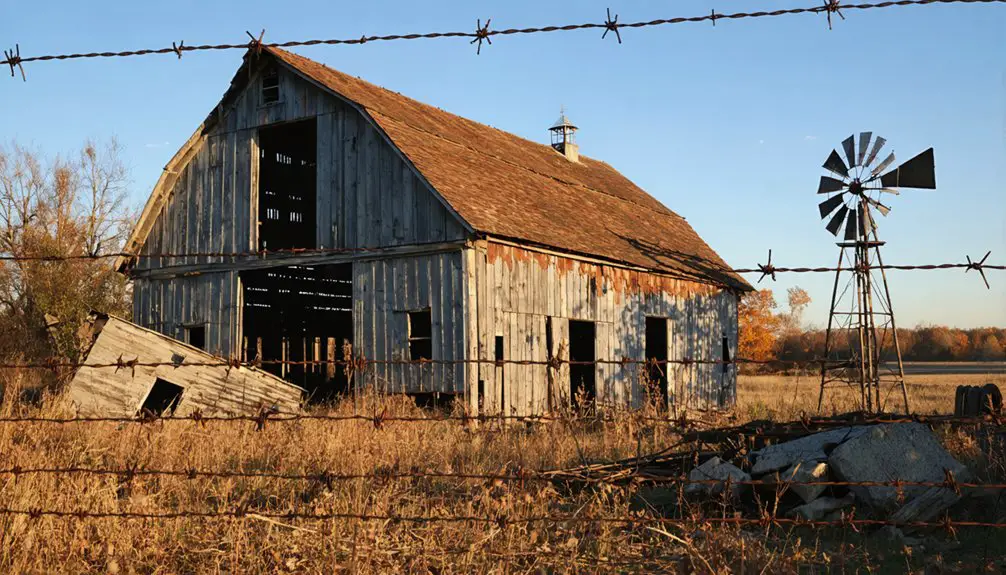
While many abandoned towns dot Ohio’s landscape, few capture the imagination quite like Moonville, a former coal mining settlement established in the mid-1800s in southeastern Brown Township, Vinton County.
You’ll find its haunting legacy centered around the infamous Moonville Tunnel, constructed in 1856 by the Marietta and Cincinnati Railroad. The town’s history is marked by over 21 documented fatalities near the tracks, fueling numerous ghost stories that persist today. Today, the tunnel remains accessible to visitors via the Vinton County Rail Trail.
Named for the moon’s luminous display above the tunnel, Moonville consisted primarily of two families – the Coes and Fergusons – alongside scattered residents. The area requires careful disambiguation from other Moonvilles when researching its history.
The community thrived briefly with its depot, schoolhouse, and homes, but declined with the coal industry’s downturn. By 1947, the last family departed, leaving only the tunnel and cemetery as silent witnesses to its existence.
The Mystery of Eugene in Sabina
Perhaps no other ghost town mystery in Ohio stirs as much controversy as the story of Eugene, an unidentified Black man whose preserved remains became a macabre tourist attraction in Sabina from 1929 to 1964.
You’ll find Eugene’s identity remains one of Ohio’s most perplexing historical riddles. After being spotted wandering through Sabina in 1928, he was found deceased in a ditch.
Instead of receiving a proper burial, his body was preserved and displayed at 1118 Yale Avenue, where locals would regularly change his clothing as it wore out. The brick house, situated near a busy bus stop, drew countless visitors and even detectives investigating the unusual setup. Much like the case of William Hewitt, whose remains were exhumed for study, Eugene’s body became the subject of intense public interest. It’s estimated that 1.5 million visitors viewed Eugene’s body during the decades he was on display.
Local folklore suggests various theories about Eugene’s origins, but the true reasons behind his decades-long display remain unexplained to this day.
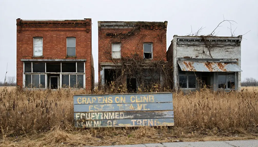
Shawnee’s Coal Mining Glory Days
As you travel through southeastern Ohio, you’ll find Shawnee, a town that transformed from a small mining settlement into a booming cultural hub during the late 1800s when Perry County became Ohio’s leading coal producer.
You’d have witnessed immigrants from across Europe flooding into the town, creating vibrant ethnic neighborhoods and establishing entertainment venues like the Tecumseh Theater that made Shawnee the entertainment capital of eastern Appalachian Ohio. Many immigrants came seeking escape from oppressive regimes abroad and found new opportunities in the mines. Workers experienced harsh conditions as large coal companies controlled nearly every aspect of their lives.
The prosperity wouldn’t last, however, as mine closures by 1972 led to economic decline, leaving behind abandoned buildings on Main Street and a population that dwindled to just 665 residents by 2010.
Coal Wealth Fuels Growth
As the region’s leading coal producer in the 1870s and 1880s, Shawnee’s population swelled to 3,265 residents by 1890.
The town’s wealth supported theaters, restaurants, and entertainment venues, making it eastern Appalachian Ohio’s entertainment capital. The historic Tecumseh Theater served as a cultural center where residents gathered for movies and events.
While prosperity flourished, the community also became a center for labor activism, with miners demanding better wages and safer working conditions through organizations like the Knights of Labor. African American miners were required to live in the nearby community of blacks-only Rendville.
The post-Civil War railroad expansion proved vital, connecting Shawnee’s coal wealth to industrial cities like Chicago.
Mines Close, Town Fades
When the coal mines of Shawnee began closing in the early 20th century, the town’s once-vibrant population of over 3,000 residents rapidly declined. Today, 665 residents remain, reflecting the devastating impact of industrial collapse.
You’ll find evidence of this dramatic transformation throughout the community, where boarded-up buildings and deteriorating infrastructure tell the story of a declining population and cultural erosion. Ohio saw coal production surge from just 1 million tons in 1850 to over 30 million tons by the 1920s.
- Immigrant communities from England, Italy, Wales, Ireland, and Scotland dispersed as jobs vanished
- The iconic Tecumseh Theater, once hosting plays and basketball games, fell silent
- Former industries, including brick and fiberglass factories, shut down
- Welsh Hill neighborhood largely disappeared as families moved away
- Mining infrastructure, like concrete shafts, now stands as decaying reminders
The town’s economic foundation crumbled as coal extraction ceased, forcing families to seek opportunities elsewhere and leaving behind a shell of Shawnee’s former glory.
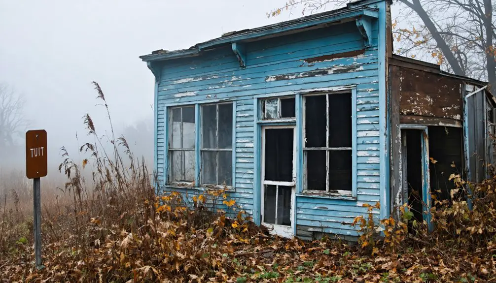
The Peculiar Tale of Knockemstiff
Nestled in Ross County’s northeastern Huntington Township, the unincorporated community of Knockemstiff stands as one of Ohio’s most curiously named ghost towns.
You’ll find no formal infrastructure here – just scattered rural residences where roughly 200 people lived as of 2008. The town’s provocative name reportedly stems from violent tavern brawls where patrons were “knocked stiff,” though local lore offers several competing origins.
During Prohibition, Knockemstiff gained notoriety for its potent moonshine, known by colorful names like “Coffin Varnish” and “Stagger Soup.”
The area’s dark reputation extends to its ghost stories, including tales of Lindy Sue, a murdered woman whose cries still echo near Paint Creek bridge.
While the old Shady Glen Church and a 1923 schoolhouse once anchored this community, today Knockemstiff exists primarily as a haunting reminder of Ohio’s colorful past.
Claylick: Lost to the Waters

Once thriving along Clay Lick Creek in Licking County, Ohio, the small community of Claylick met a tragic fate at the hands of devastating floods. Established in 1852 with a post office, this self-sufficient settlement served local farmers with its mill and general store until nature altered its course.
Like countless forgotten communities, Claylick’s bustling mills and shops succumbed to nature’s fury along the banks of Clay Lick Creek.
- Post office operated continuously for 66 years until 1918
- First major flood struck in 1919, causing significant damage
- Second devastating flood in 1959 sealed the town’s fate
- Government dam project followed the 1959 disaster
- All structures were removed for flood control measures
You won’t find any remnants of Claylick today, as both floods and progress claimed this piece of Ohio history.
The waters that once sustained the community ultimately led to its complete disappearance, leaving only historical records to tell its story.
Sprucevale: Where Canal Commerce Died
If you’d visited Sprucevale in its heyday, you’d have found a bustling canal town where Hambleton’s Mill, twelve homes, and various businesses thrived along the Sandy & Beaver Canal system.
The town’s fortunes were inextricably tied to canal commerce, which led to its swift abandonment by 1870 when the canal ceased operations.
Today, you can explore the haunting ruins of Hambleton’s Mill within Beaver Creek State Park, where local folklore, including the famous tale of Esther Hale, adds a supernatural dimension to this preserved piece of Ohio’s canal-era history.
Canal Life Before Closure
During the mid-1800s, Sprucevale flourished as an essential hub along the Sandy and Beaver Canal system, where agriculture and industry merged to create a thriving commercial center.
You’d find a bustling economy driven by canal commerce, where freight rates dropped from $125 to $25 per ton, revolutionizing trade opportunities for local businesses.
- Hambleton’s Mill anchored the local industry, processing grains shipped via canal
- A wool factory, locksmith shop, and general store formed the economic backbone
- Agricultural products like flour, wheat, and corn dominated canal shipments
- Natural resources including lumber, lime, stone, and coal flowed through town
- The canal system connected you to major markets in Cleveland and Portsmouth
This transportation network transformed what was once a frontier settlement into a crucial link in Ohio’s canal history, though winter closures would periodically interrupt commerce.
Rapid Economic Collapse
The flourishing canal economy of Sprucevale came to an abrupt halt when the Sandy and Beaver Canal system failed in 1850.
You can trace the town’s rapid descent through a series of cascading infrastructure failures that exposed its economic vulnerability.
The once-bustling Hambleton’s Mill, along with the general store, locksmith shop, and woolen factory, lost their commercial lifeblood as canal traffic dwindled.
Remnants Still Stand Today
Standing as silent witnesses to a bygone era, Sprucevale’s remaining structures offer glimpses into Ohio’s vibrant canal history.
Today, you’ll find the haunting remnants of this once-thriving canal town within Beaver Creek State Park, where the historical significance of the region comes alive through preserved ruins and ghostly legends.
- Hambleton’s Mill stands as the most prominent structure, featuring its distinctive dual stone arches
- One original house remains intact among the dozen that once lined the settlement
- Portions of the Sandy & Beaver Canal lock system are still visible throughout the landscape
- The original mill site showcases the engineering marvel of 19th-century water-powered industry
- Rugged terrain and wilderness now embrace these architectural remnants, creating an ethereal atmosphere
The park’s natural setting provides an authentic backdrop for experiencing these preserved pieces of Ohio’s canal-era past.
Frequently Asked Questions
Are Any of These Ghost Towns Legally Accessible to Visitors Today?
You’ll find several ghost towns legally open for exploring Ohio’s history, including Moonville’s trails and tunnel, Sprucevale’s canal locks, and Ghost Town Findlay, though visitor regulations vary by location.
As you venture through the forgotten towns of Ohio, be prepared to uncover fascinating stories and remnants of a bygone era. Each location holds unique treasures waiting to be discovered, from dilapidated structures to historical markers that tell tales of the past. A visit to these sites not only provides a glimpse into history but also evokes a sense of nostalgia for the communities that once thrived.
Among the many sites, you can also find historic landmarks in ghost towns that showcase the engineering marvels of their time. Each structure stands as a testament to the ingenuity and perseverance of those who lived there, often providing a stunning backdrop for photography enthusiasts. Exploring these remnants offers a deeper understanding of the cultural heritage that shaped the region’s identity.
What Safety Precautions Should Be Taken When Exploring Ohio Ghost Towns?
Like a seasoned adventurer traversing uncharted waters, you’ll need proper safety gear, wildlife awareness, sturdy footwear, and first aid supplies. Stay alert, travel with companions, and respect structural hazards.
Do Any Guided Tours Operate in These Abandoned Ohio Communities?
You’ll find guided explorations at Ohio State Reformatory and Providence ghost town, where trained guides offer historical insights through lantern tours, paranormal investigations, and storytelling experiences year-round.
Which Seasons Are Best for Photographing These Historic Ghost Towns?
You’ll capture the best ghost town aesthetics during fall and winter, when seasonal photography conditions reveal hidden structures through bare trees and create moody lighting perfect for architectural details.
How Many Undocumented Ghost Towns Might Still Exist in Ohio?
Like buried treasures beneath Ohio’s surface, you’d find hundreds of undiscovered settlements scattered across the state. Based on historical records and research patterns, there could be 200-300 hidden ruins still unaccounted for.
References
- https://www.onlyinyourstate.com/experiences/ohio/ghost-towns-in-oh
- https://kids.kiddle.co/List_of_ghost_towns_in_Ohio
- https://www.youtube.com/watch?v=QWTtG6njIDs
- https://wrkr.com/ohio-ghost-towns/
- https://ohioghosttowns.org/top-10-ghost-towns/
- https://en.wikipedia.org/wiki/Moonville
- https://www.moonvilletunnel.net
- https://www.statenews.org/news/2023-10-12/how-the-ghosts-of-moonville-are-keeping-the-towns-history-alive
- https://www.moonvilletunnel.net/Moonville_History.htm
- https://visitvintoncounty.org/history/moonville-tunnel/