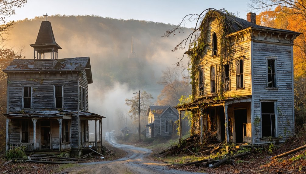
You’ll find haunting photographic opportunities in Appalachia’s forgotten communities—from Proctor’s submerged foundations beneath Fontana Lake to Lost Cove’s isolated moonshiner hideaway. Capture Andersonville Island’s weathered church remnants during drought cycles, or document Elkmont’s decaying resort structures frozen in time. Dawn photography at Norris Lake reveals ghostly Loyston ruins during TVA drawdowns. Each location tells a story of displacement where nature slowly reclaims what progress abandoned.
Key Takeaways
- Submerged Proctor town foundations emerge during low lake levels, revealing ghostly stone structures best captured at dawn with morning mist.
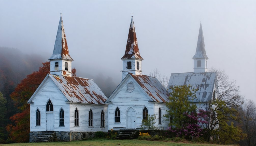
- Andersonville Island offers compelling compositions of weathered Baptist church remnants alongside fifty-nine undisturbed graves on Cemetery Island.
- Elkmont’s 70 decaying resort structures provide accessible ghost town photography with key sites including Wonderland Hotel ruins.
- Lost Cove, accessible only by hiking specific trails, features abandoned moonshiner cabins marked by seasonal daffodils blooming at former homesteads.
- Extreme drought conditions at Lake Hartwell expose submerged Appalachian community relics, creating haunting historical landscapes not normally visible.
Stone Sentinels: The Chimneys of Lost Cove, NC
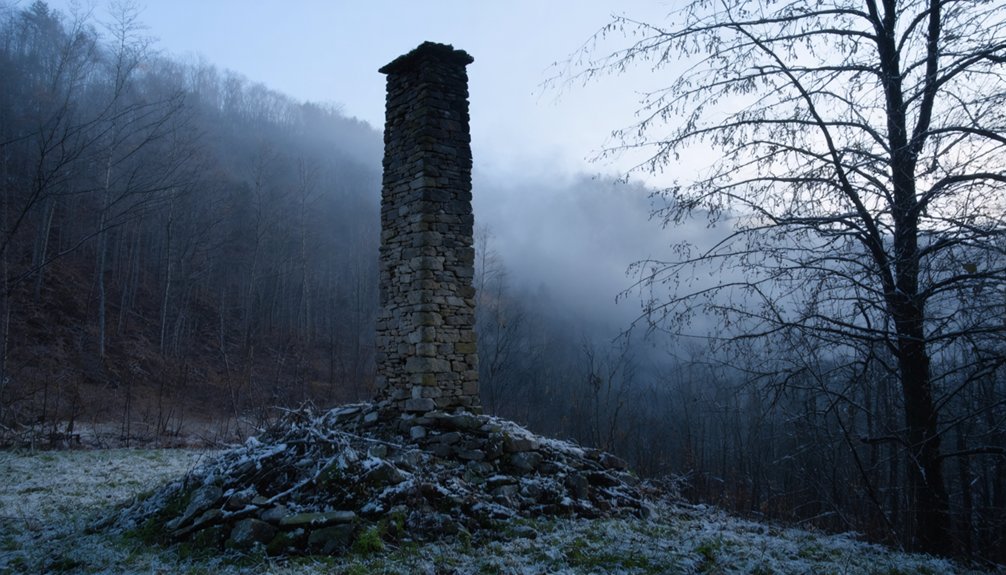
While time slowly erodes the wooden frames and metal fixtures of Lost Cove‘s abandoned dwellings, the stone chimneys stand as stoic sentinels of a forgotten era.
These remnants, dating from the settlement’s 1864 founding through its 1957 abandonment, showcase the distinctive chimney architecture that characterized Appalachian self-sufficiency.
The stone sentinels of Lost Cove stand as testimony to mountain ingenuity across nearly a century of Appalachian life.
As you explore the 400-acre site, you’ll find these stone markers scattered throughout the landscape, each representing a former home among the community that once reached 100 residents.
The weathered mortar and stacked stone techniques visible in these structures reflect 19th-century Appalachian building traditions.
The chimneys’ historical significance extends beyond mere construction—they’re physical anchors to Lost Cove’s story, from Morgan Bailey’s Civil War-era settlement to the timber boom that sustained generations before the final exodus. Christy Smith’s Master’s thesis research provides invaluable documentation of these architectural remnants and their place in Appalachian cultural heritage.
The Southern Appalachian Highlands Conservancy’s purchase of a 95-acre portion of Lost Cove in 2012 has helped preserve these historical structures for future generations.
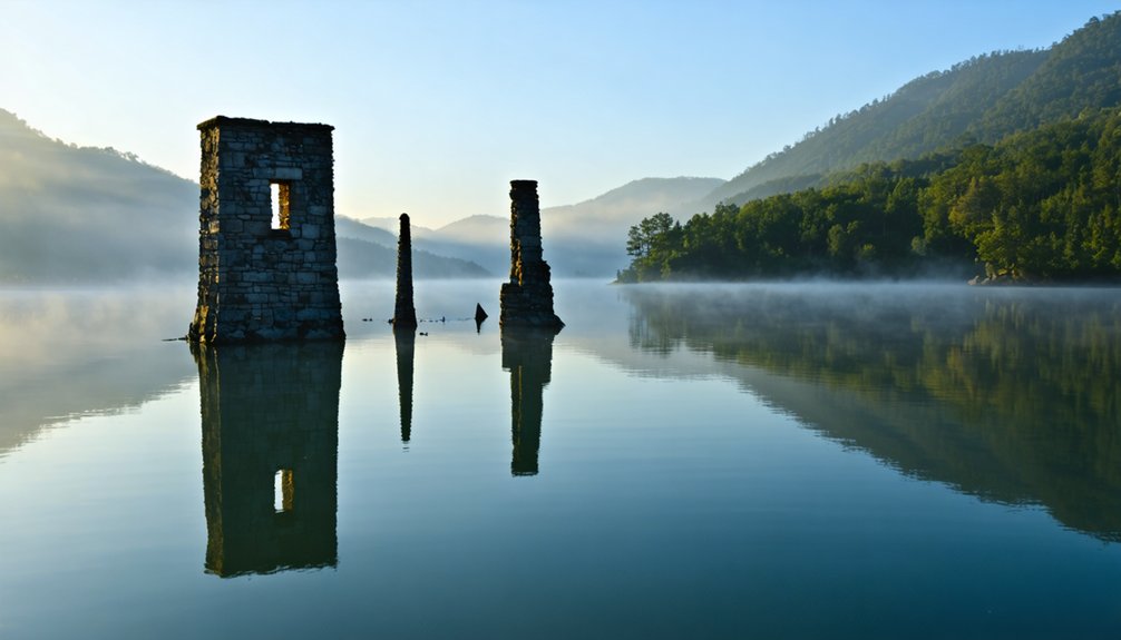
Underwater Echoes: Capturing Proctor’s Hidden Ruins When Water Recedes
Unlike Lost Cove‘s persistent stone chimneys, the abandoned community of Proctor slumbers beneath the fluctuating waters of Fontana Lake, revealing its secrets only when the reservoir levels retreat.
This WWII-era hydroelectric project submerged an entire valley’s worth of history, now accessible only through deliberate underwater exploration when conditions permit.
When timing your expedition to coincide with low water seasons, you’ll discover:
- Stone foundations emerging from receding waters like archaeological ghosts
- Rusted metal artifacts scattered among aquatic vegetation, offering textural contrast
- Faint outlines of former roads creating compositional lines through your frame
Historical preservation demands respect for these fleeting remnants. For successful underwater photography here, consider using wide-angle lenses to capture the expansive scene while preserving the context of these submerged structures.
You’ll find no cell service here—only silence and the resonant absence of a community displaced by progress.
The area was once a bustling logging town with a schoolhouse, church, and post office before the dam construction forced families to relocate.
Prepare thoroughly for backcountry conditions while photographing these ephemeral windows into Appalachian memory.
Fontana’s Forgotten: Dawn Photography at the Shore of Proctor’s Watery Grave
You’ll find Proctor’s submerged remains most enchanting at dawn, when mist hovers above Fontana Lake and the TVA’s 1943 flooding becomes palpable in the ethereal light.
Access requires either boat transportation or hiking through National Park Service trails, though water levels occasionally recede enough to reveal concrete foundations and other structural remnants. The old Calhoun House still stands as one of the few surviving buildings from the once-thriving lumber town.
The shoreline’s haunting character intensifies when photographed against the backdrop of preserved cemeteries—silent witnesses to the 1,200 families displaced during World War II’s industrial demands. Local preservation efforts led by Lee Woods and the North Shore Cemetery Association help maintain these historical connections for descendants and visitors alike.
Dawn Light Photography Tips
When dawn breaks over the submerged remnants of Proctor, North Carolina, photographers are gifted with a fleeting opportunity to capture hauntingly beautiful compositions beneath Fontana Lake’s misty veil.
The distinctive dawn color shifts rapidly here, with light filtering through mountain gaps to create ethereal scenes where history and nature converge.
To maximize your Proctor dawn shoot:
- Use manual focus and a small aperture (f/8-f/11) for sharp details of emergent foundations when water levels drop.
- Position yourself with the rising sun at a 45° angle to capture sidelight that reveals textural elements of the drowned town.
- Shoot in RAW with graduated neutral density filters to balance the bright sky against the darker shoreline remnants.
Arriving at least 30 minutes before sunrise allows you to experience the full magical atmosphere as light gradually transforms the landscape.
Scout locations beforehand, as accessible vantage points change seasonally with fluctuating water levels. Consider using long exposures to capture romantic renditions of the water’s surface reflecting the morning light, similar to evening photography techniques.
Accessing Proctor’s Shore Legally
Reaching the submerged remnants of Proctor requires careful navigation through both bureaucratic channels and challenging Appalachian terrain.
You’ll face a 440-foot deep watery barrier where Highway 288 once connected this vibrant community to civilization. For backcountry access, commit to a demanding 24-mile round-trip hike from Fontana Dam, or secure boat rental from Fontana Village Marina.
The Park Service’s annual Decoration Day shuttle offers your most straightforward option, facilitating cemetery preservation while honoring the 1943 government promise to former residents. The once-thriving lumber town of Proctor experienced a significant economic boom in the early 1900s before being sacrificed for the dam project.
This regulated passage grants legal entry to twenty-six cemeteries housing over 1,000 graves—silent monuments to displaced mountain culture. The incomplete “Road to Nowhere” stands as evidence of unfulfilled obligations, while permits remain mandatory for all explorations of this historically contested, hauntingly preserved landscape. During your exploration, note that Hazel Creek area near Proctor forms part of the largest roadless territory in the eastern United States.
Underwater Remnants Visibility
Dawn breaks differently at Fontana Lake’s northern shore, where the boundary between earth and water blurs with Proctor’s ghostly presence below. Your lens might capture underwater visibility of submerged history during specific conditions that reveal the town’s remains beneath the surface.
For ideal documentation of Proctor’s watery grave, note:
- Early morning hours (5:30-7:00 AM) provide superior light penetration when the sun’s angle maximizes underwater clarity.
- Late autumn/winter months offer improved visibility due to reduced algae and sediment disturbance.
- Low water periods expose additional structural elements normally hidden beneath 70+ feet of lake water.
You’re witnessing a rare convergence of war-era infrastructure development and displaced Appalachian culture—suspended in time since 1944, when residents’ final footsteps marked their involuntary exodus from this once-thriving logging community.
The remnants of these towns offer a glimpse into a bygone era, highlighting the rich history that deserves attention. Preserving appalachian ghost towns effectively not only honors the memories of those who lived there but also provides insights into the environmental and economic changes that have shaped the region. Efforts to revitalize these sites could transform them into cultural landmarks, attracting visitors eager to connect with the stories of the past.
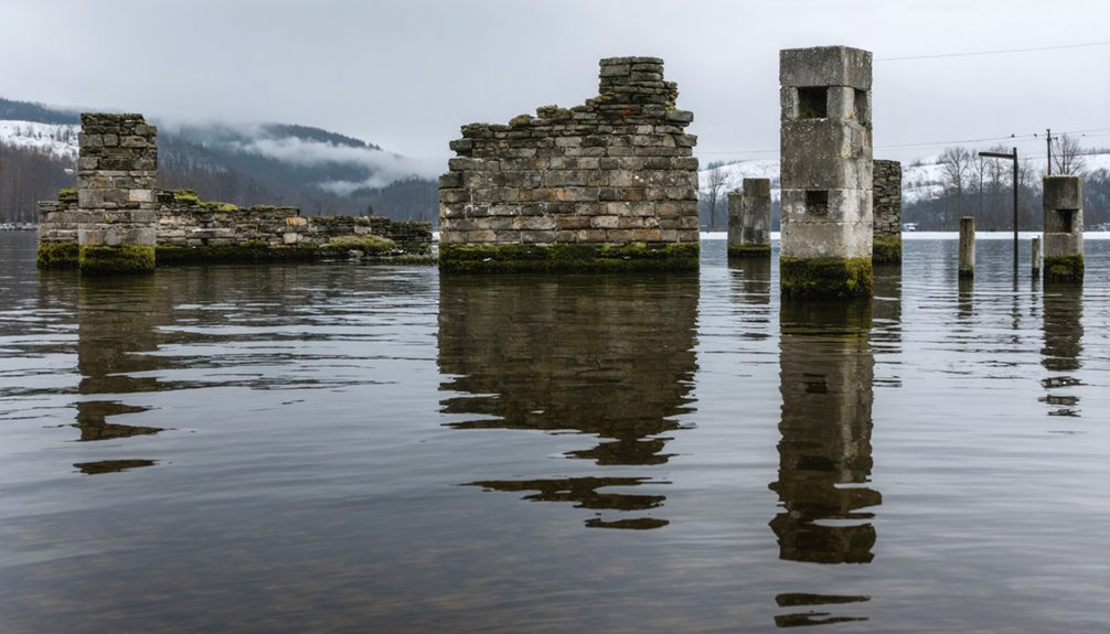
Island Memories: Documenting Andersonville’s Last Stand Above Lake Hartwell

Standing as the last vestige of a once-thriving river trade hub, Andersonville Island offers photographers a chance to frame forgotten shoreline foundations against dawn’s golden reflections on Lake Hartwell.
You’ll capture the haunting dichotomy between what remains above water and what lies beneath—a settlement sacrificed to progress when Hartwell Dam transformed the landscape in 1962.
The island’s isolated position accentuates its historical significance, with remnant structures casting long shadows that tell stories of the nineteenth-century community’s rise and submergence.
Isolated Island Remnants
As the impounded waters of Lake Hartwell rose in 1962, they forever transformed the landscape of South Carolina’s rolling foothills, yet they couldn’t quite claim all of Andersonville.
What remains—a defiant two-mile ridge now known as Andersonville Island—offers photographers rare island exploration opportunities amid documented ghostly encounters.
The isolated fragments of this once-thriving township provide three distinct photographic subjects:
- The weathered Baptist church remnants that stand as sentinels to community resilience
- Cemetery Island with its fifty-nine undisturbed Harris family graves, now reclaimed by wilderness
- Dawn mist formations where locals report apparitions along the shoreline
You’ll need to navigate by kayak or motorboat to reach these public lands, where the boundary between documented history and folklore blurs beneath your lens.
The submerged structures below remain pristine, frozen in their 1962 submersion.
Dawn Light Reflections
The first rays of sunlight striking Andersonville Island transform this watery memorial into a photographer’s sanctuary of temporal dissonance. You’ll capture ghostly landscapes as dawn reflections reveal the island’s dual existence—simultaneously present yet historically absent.
Position yourself at the eastern shore before sunrise, where the forty-room hotel once welcomed travelers, to document how light gradually discloses the ridge that refused complete submersion beneath Lake Hartwell.
The Baptist church’s former location offers compelling compositions as morning mist rises from waters concealing an entire community sacrificed for progress.
Frame your shots considering what lies beneath: intact structures, weathered walls, and unmarked graves of the enslaved—all testimonies to Andersonville’s economic rise and decline between devastating floods and railroad bypassing.
This photography transcends documentation; it’s reclaiming forgotten narratives from deliberate inundation.
Forgotten Shoreline History
Few modern visitors realize they’re floating above an entire community when traversing Lake Hartwell‘s glassy surface near Portman Marina. This watery tomb conceals Andersonville—once a thriving port town that outshined neighboring settlements before Hartwell Dam’s 1955 construction sealed its fate.
The submerged relics of this forgotten history emerge during drought cycles, offering fleeting windows into Appalachia’s drowned past.
For ideal documentation of these ephemeral remnants:
- Visit during extreme drought periods when water levels approach 640 feet
- Position at buoys LBC1-LBC9 where weathered roads materialize from beneath
- Scout Cemetery Island at dawn when light penetrates shallower depths
Your freedom to explore these shorelines connects you to time-beaten paths where daily commerce once flowed—an exercise in capturing history’s impermanence through your lens.
Ghostly Foundations: Norris Lake’s Revealing Low Water Periods at Loyston
When Norris Lake’s waters periodically retreat during severe droughts or Tennessee Valley Authority drawdowns, they reveal the ghostly skeletal remains of Loyston—a town sacrificed to progress in 1936.
Beneath Norris Lake sleeps Loyston’s ghost—a community drowned for progress, waiting for drought to reveal its bones.
You’ll witness the haunting foundations of this once-thriving community as they emerge from their watery tomb, offering rare opportunities to document submerged history.
For photographers seeking to capture ghost town memories, position yourself near Big Ridge State Park’s shoreline during announced drawdowns.
The stark contrast between skeletal foundations, weathered trees, and the receding waterline creates compelling visual narratives. A notable 1956 drought first exposed these remnants after twenty years underwater, creating a photographer’s paradise of historical ruins.
These fleeting windows provide both artistic and documentary opportunities to witness the true cost of modernization on Appalachian communities.
Time Capsule: The Decaying Cabins of Elkmont’s Abandoned Resort
Deep within Great Smoky Mountains National Park‘s forested embrace lies another ghost town more accessible but equally haunting as Loyston’s submerged remains. Elkmont’s decay tells a fascinating trajectory: from bustling logging camp to elite resort community, ultimately abandoned when National Park Service leases expired between 1992-2001.
You’ll find approximately 70 structures gradually surrendering to nature, frozen in time since their wealthy inhabitants departed. The haunted history reverberates through weathered boards and collapsed porches, offering photographers unparalleled documentation opportunities.
For ideal exploration, consider:
- The Wonderland Hotel ruins, showcasing luxury resort architecture
- Appalachian Club cabins with original furnishings still visible
- Former swimming facilities where wilderness now reclaims what humans constructed
Unlike many ghost towns, Elkmont remains accessible without restrictions—a rapidly disappearing window into Appalachia’s resort-era past.
Moonlit Abandonments: Night Photography in the Great Smoky Mountains Ghost Towns
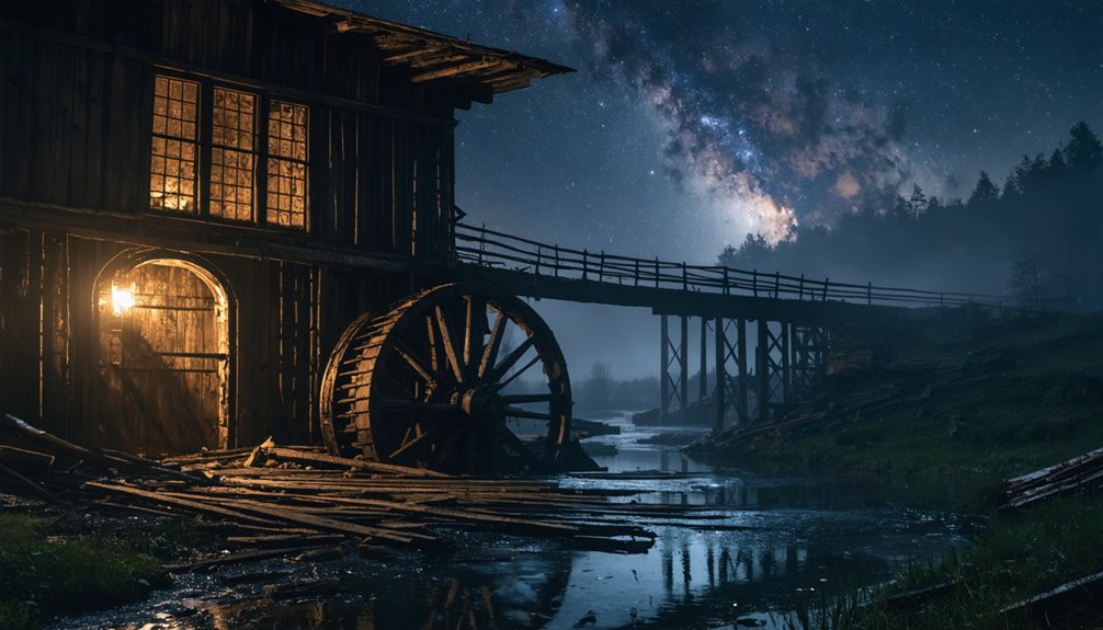
As twilight surrenders to darkness, Elkmont’s abandoned structures transform into ethereal canvases for the nocturnal photographer seeking to capture Appalachia’s spectral dimension.
This ghost town, accessible via Elkmont Road, offers 24-hour access with proper permits—ideal for those documenting its ghostly ambiance under starlit skies.
You’ll want to position near the Elkmont Nature Trail parking area, where most preserved cabins cluster. The absence of artificial light creates perfect conditions for astrophotography, while frequent fog enhances the haunting quality of your compositions.
For best night techniques, bring a tripod, set ISO between 800-1600, and experiment with 15-30 second exposures.
The Levi Trentham cabin and Daisy Town’s structures provide compelling focal points, especially when illuminated through light painting.
Don’t overlook the ethereal Troll Bridge or the whispered stories captured in remaining stone chimneys.
Markers of the Past: Finding Ellenton’s Nuclear Age Displacement Stories
While Elkmont’s ghostly cabins whisper tales of voluntary abandonment, Ellenton’s landscape bears witness to a more abrupt and government-mandated exodus. In 1950, the Truman administration seized 310 square miles for hydrogen bomb production, forcing 6,000 residents to surrender their homes to Cold War priorities.
Today, photographers seeking Ellenton memories find only fragments of a vanished community.
For compelling nuclear legacy documentation, visit:
- Highway 125’s weathered marker denoting “Site of Ellenton”
- SRS Museum’s “6,000 Stories” exhibit featuring firsthand accounts of displacement
- Former town roads where nature gradually reclaims contested ground
The haunting statistic that 50% of displaced residents over 50 died within a decade of evacuation speaks volumes about the human cost of national security decisions—a sobering counterpoint to triumphalist Cold War narratives.
Between Two States: The Moonshiner’s Paradise at Lost Cove’s Border
Nestled between North Carolina and Tennessee in the rugged Appalachian terrain, Lost Cove emerged as a moonshiner’s utopia where jurisdictional ambiguity became its most valuable resource.
When pursued by authorities, distillers exploited the border confusion, often escaping prosecution as courts struggled to determine which state held jurisdiction.
The settlement’s moonshining legacy began around 1898, flourishing in this liminal space where neither state could effectively enforce Prohibition laws.
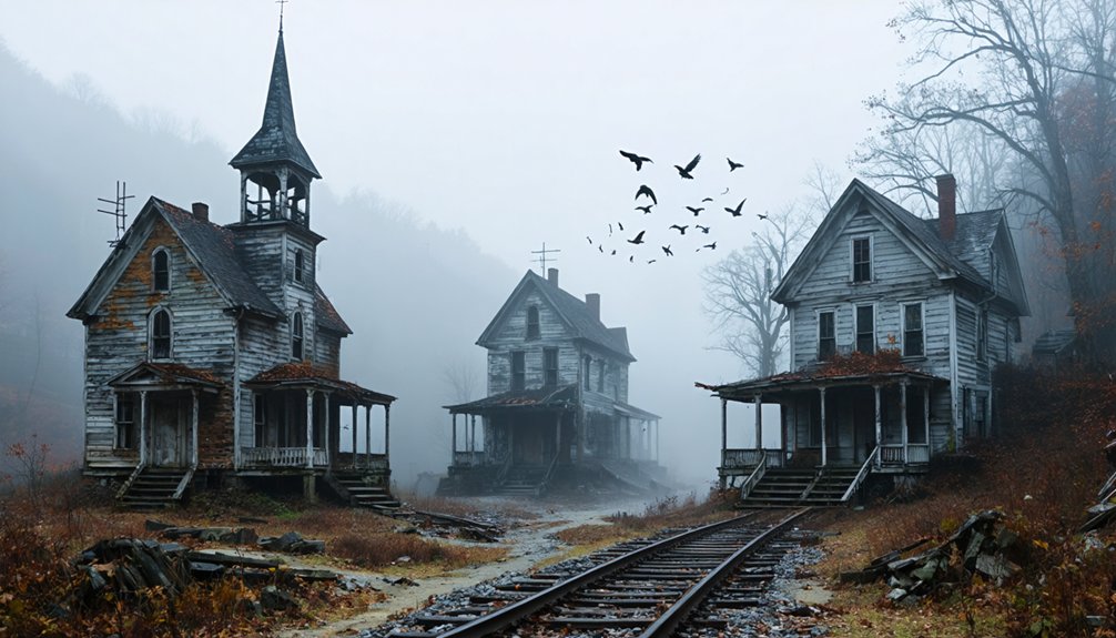
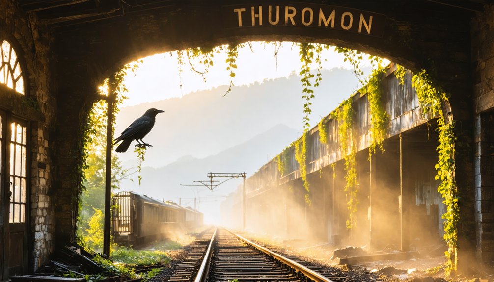
You’ll find the remains of this defiant community accessible only by foot—via a steep North Carolina trail or along Tennessee’s Nolichucky River railroad tracks.
Among moss-covered cabin ruins and stone foundations, you can trace border folklore through the physical remnants of this resistance economy.
Seasonal daffodils still mark homesteads of families who turned geographic isolation into calculated independence from government oversight.
Seasonal Hauntings: How Autumn Transforms Appalachia’s Abandoned Communities
The transformation of Appalachia’s abandoned settlements during autumn transcends mere seasonal change, creating a photographer’s dreamscape where natural decay harmonizes with structural collapse. As autumn chills sweep through hollow buildings, they carry what locals interpret as ghostly whispers—amplified by the season’s unique atmospheric conditions.
Autumn transforms Appalachia’s ruins into haunting galleries where decaying structures whisper stories through the golden light and morning mist.
This convergence of natural aesthetics and historical remnants offers distinct photographic opportunities:
- Morning fog enveloping coal town ruins creates ethereal compositions unavailable in other seasons.
- Golden hour light striking abandoned structures through crimson foliage produces dramatic contrast.
- Extended blue hour during fall enables longer exposure times for capturing spectral motion effects.
The seasonal intensification of purportedly paranormal phenomena coincides with pragmatic environmental factors—dimming daylight, increased atmospheric moisture, and wind patterns through deteriorating architecture—yet the resulting imagery remains hauntingly compelling regardless of one’s metaphysical stance.
Frequently Asked Questions
Are Permits Required for Ghost Town Photography?
You’ll need permits for commercial shoots, but personal photography is typically exempt. Historical preservation and photography ethics mandate respecting structures, even as you’re documenting these untethered relics of forgotten industrial prosperity.
What Camera Equipment Works Best in Low-Light Abandoned Structures?
Like teleporting through time, you’ll need full-frame cameras with wide aperture lenses (f/1.8-2.8). Use high ISO settings, stabilization, and a tripod for crisp images in these spectral domains.
How Safe Are These Locations During Winter Months?
Winter weather dramatically increases risks in these locations. You’ll face treacherous road conditions, unstable structures, and limited emergency access. Survival demands proper gear, communication plans, and safety precautions beyond casual exploration.
Can I Bring Home Artifacts I Find?
No, you shouldn’t. Removing artifacts violates preservation ethics and carries serious legal implications—from trespassing charges to federal penalties. Document your discoveries through photography instead, preserving history while respecting heritage protection laws.
Are Guided Photography Tours Available for These Locations?
Like whispers from the past, yes, guided tours exist but vary widely. You’ll find photography-focused excursions at Elkmont and Lost Cove, often requiring advance reservations. Photography tips accompany most historical walks.
References
- https://appalachian.org/lost-cove-ghost-town-in-the-national-forest/
- https://www.thewanderingappalachian.com/post/the-underwater-towns-of-appalachia
- https://www.blueridgeoutdoors.com/go-outside/southern-ghost-towns/
- https://www.appalachianhistory.net/2014/07/ghost-towns-cumberland-plateau.html
- https://dc.etsu.edu/etd/2147/
- https://thelaurelofasheville.com/lifestyle/history-feature-love-and-lawlessness/
- https://www.atlasobscura.com/places/lost-cove-settlement
- https://www.appalachianhistory.net/2021/04/the-vanished-community-of-lost-cove.html
- https://www.youtube.com/watch?v=3ACdfa_jQXc
- https://www.wanderingsmokymountains.com/proctor-north-carolina/