On June 25, 1788, Virginia was the 10th state to join the United States. The state was named after the Virgin Queen, Queen Elizabeth I.
There are 19 ghost towns in Virginia.
The first president of the United States, George Washington, was born in Westmoreland County, Virginia on February 22, 1732. Eight other presidents were also born in Virginia. Covering 42,769 square miles, Virginia is the 35th largest state.
At one time, West Virginia and Virginia were one state under Virginia’s name. During the Civil War, Virginia joined the Confederacy, but the western part of the state remained loyal to the Union and began the separation process that created West Virginia.
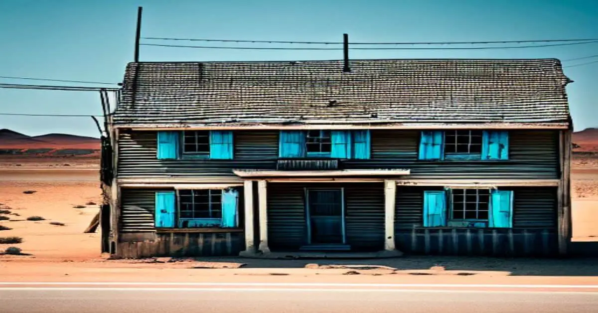
Ca Ira, Virginia
Ca Ira, Virginia, started as a small farming community, and the General Assembly formally established a town in 1796. Named after a popular French marching song, Ca Ira meant “the Revolution will triumph” and reflected the French Revolution happening in Virginia.
A milestone was reached around 1836 when the town was reported to have a population of 310, three mercantile stores, a tobacco warehouse, a merchant mill, two taverns, a non-denominational church, a masonic hall, and around 40 homes.
Other highlights of the time included mail delivery three times a week, and there were two blacksmiths, wheelwrights, plow manufacturers, and tailors. In 1825, the Willis River canal was completed and improved residents’ health and tobacco transporting and trading.
Before the canal was finished, the stagnant pond that was in its place was infamous for diseases and bacteria that caused fatal illnesses that nearly took everyone’s lives in the town not once but twice. As the town and all the surviving town members recovered from the diseases that had struck, Ca Ira had $40,000 worth of annual sales at the mercantile stores, ground nearly 30,000 bushels of wheat, and received an estimated 300 to 500 barrels of tobacco.
It was the 1850s when Ca Ira was operating at its highest and could add a bank to the list of town buildings and businesses. Unfortunately, following the Civil War, the town suffered from a decline in trade, and residents left, abandoning the town.
By 1906, a handful of houses were still standing, along with the post office, two stores, a warehouse, and the church. Today, the church is still there, and a few newer houses have been added to the area, but there is not much left to showcase the town that used to be.
Elko Tract, Virginia
Elko Tract, Virginia, is one of the most famous ghost towns in all of Virginia. Located just outside Richmond, Virginia, the town was a small farming community before World War II. When the U.S. military took over the land, an elaborate plan was formulated to create the ultimate battle scheme.
Elko Tract became a decoy city with roads, houses, businesses, and even a landing strip resembling Richmond’s layout. The town never had any residents since it was used to protect Richmond from German and Japanese air attacks.
Eastern Virginia would alert the Richmond area of night attacks from enemy bombers when they were spotted overhead. Richmond would then cut the power to residents and businesses, create a forced blackout, and then turn on power set up at Elko Tract to trick the bombers into bombing an uninhabited town instead of Richmond. Luckily, the war ended without Elko Tract being attacked, and the land was turned over to the Commonwealth of Virginia.
The next plan for Elko Tract involved a mental hospital meant to serve African American children and communities. Construction had begun on the treatment facility but did not get more than halfway completed before the government pulled funding for the project. A water tower and sewage treatment plant were completed, but that was as far as the project made it.
The site was open to the public in previous years. Visitors could walk through the town that looked like an eerie vacant movie set. Today, visiting the site may be harder since the road leading into the decoy town has been blocked and marked with No Trespassing signs. The water tower is visible and peeking through the trees if you can find a good spot to look from.
Lignite, Virginia
Lignite, Virginia, was an iron ore mining town founded the mid to late 1800s. The Allegheny Ore and Iron Company owned the town with the only purpose of mining the iron ore. Before being mostly abandoned in the 1920s, when higher-grade iron ore was found in the Great Lakes area, the town consisted of churches, a post office, a company store, and even a theater.
Some residents remained in Lignite until the 1950s. Today the town is part of the Jefferson National Forest. Remnants of the old mining town have since been reclaimed by nature.
Westham, Virginia
Westham, Virginia, was established in 1750 under the ownership of Beverley Randolph, who inherited the land from his father, William Randolph II, after his passing. Upon inheriting the family plantation and all the land associated with it, Beverley made plans to create the town of Westham and offer a location for trade transactions.
Unexpectedly, Beverley suffered from sudden death, leaving the land to his younger brother Peter. Peter continued the work his older brother had started before his death, and the town of Westham renamed Beverley in honor of his late brother, was completed.
Due to the James River location, it was the ideal spot to create a trading town. Richmond, Virginia, was built on the other side of a fall line along the river, which prevented river passage past Westham. Before canals and railways connected the two towns, Westham was the first and only stop along the trade route.
That worked out well for Westham, making it the first destination point for the iron used during the Revolutionary War.
During the Revolutionary War, a Virginia merchant bought Oxford Iron Works, which supplied iron to a Westham metal casting company. The company, known as a foundry, would melt the iron, pour the hot liquid into molds, and create various castings for use.
When word came in of a British raid to happen in Richmond, the iron supplier had to recall all the Westham supplies to avoid any loss. Thomas Jefferson, then governor, asked to rebuild the foundry, but the supplies were moved to reconstruct the Point of Fork Arsenal, which was destroyed in a raid on June 5, 1781.
In 1790, the entry point of the Kanawha Canal was built. The canal was used to transport boats around the fall line that prevented passage from Westham to Richmond. Three locks were used to connect parts of the river to the canal to ensure safe passage into Richmond. In 1851, a plank road was constructed to connect Richmond and Westham.
The road eventually became Cary Street, which is used today. In the 1880s, Westham station was established, and railroad tracks were laid along the James River and Kanawha Canal to further connect the towns. The Westham Bridge that crosses the James River was built in 1911.
Westham eventually became part of Richmond. A neighborhood was built on the site of the original Westham that goes by that same name. The area was established in the 1930s. One of Westham’s oldest homes is just outside the original town borders, built in 1827. The Westham station was relocated in 1961 to a park in Richmond.
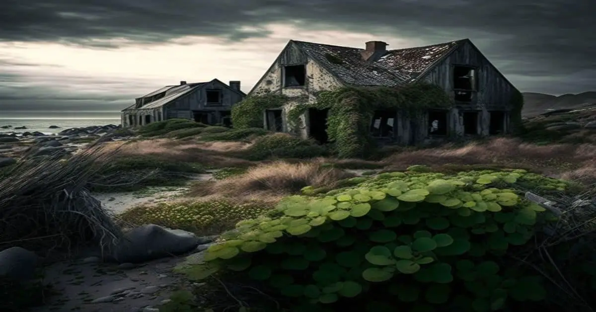
Other Ghost Town Areas of Interest In Virginia
In 1790, Matildaville, Virginia, served as the headquarters location for the future Potomac Canal. The canal was designed to go around the Virginia side of Great Falls, making Matildaville a commercial stop for passing ships.
The town consisted of multiple homes, taverns, a market, a sawmill, a grist mill, boarding houses, worker barracks, a foundry, an inn, and even an icehouse in its heyday. Dickey’s Tavern, built in 1797, was a frequent destination spot for tourists and local fishermen. It was the last remaining building of the town before it was destroyed in a fire in 1950.
The idea for the canal was brilliant. However, low water levels kept the canal from functioning as intended. The canal closed in 1828, and Matildaville saw a rapid decline in sustainability. In the mid-1800s, a Great Falls company tried to reinvent the town as a textile manufacturing community, but with no canal, that attempt failed too, and the residents relocated.
Now part of the Great Falls National Park, the once main road of Matildaville is used as a hiking trail to see what is left of the few remains of the old town.
In False Cape State Park, an old settlement is known as Wash Woods. The date of the first inhabitant or when the community was founded is unknown. It is estimated to have been during the 1600s or early 1700s.
Stories have been shared that the community started when sailors were shipwrecked off the coast and were forced to call the new land home. The sailors survived by fishing, growing crops, hunting, and living off the land. It has been said the small community once rose to the size of 300.
By the late 1800s, many men born and raised in the settlement served with the United States Life-Saving Service, now known as the Coast Guard. Remaining a strong community for hundreds of years, devastating storms in the 1920s and 1930s started the move away from Wash Woods.
A massive storm in 1962 known as The Ash Wednesday Storm was the final storm to drive out the last of the residents, leaving the town deserted. Today, remnants of the town include an overgrown cemetery and a church steeple.
A religious quest in the late 1800s is the background for Pocosin Mission. Frederick Neve, an Episcopal minister, believed the mountain folk of the Blue Ridge Mountains were in desperate need of saving. The minister vowed to build a mission every ten miles along the mountains. Pocosin was one of those missions Neve made. In 1902, two sisters known as the Towles sisters were assigned to Pocosin.
They lived in a small mission house and maintained the schoolhouse and chapel built on the mission site. The sisters ministered for years before leaving the mission, and the community thrived for twenty years after being forced out as the Shenandoah National Forest was developed.
Using a fire road and driving for one mile into the forest, a cemetery, old barns, and crumbling walls can be seen marking the Pocosin Mission’s location.
Castles, kings, knights, and even pirates once filled the Sherwood Forest area at the Virginia Renaissance Faire. The Faire did not last long, only operating from 1996 to 1999, but the deserted place and empty buildings offer quite an eerie experience.
The Renaissance Entertainment Corporation had an excellent idea offering a chance to travel back in time and walk among those from the past.
Still, the Fredericksburg, Virginia, location was ill-suited for success. Poor weather conditions and the swamp-like terrain that featured many unliked bugs kept ticket sales low. The Renaissance Entertainment Corporation could not maintain the property with more loss than profit, so they packed up everything but the empty buildings and moved to a new location in 2004.
As much fun as it would be to see this site, no trespassing signs are posted to keep unwanted visitors out.