Along America’s coastlines, you’ll find traces of lost communities beneath the waves – from submerged Indigenous settlements to colonial-era ports. Modern mapping reveals thousands of archaeological sites now underwater due to dam projects, rising seas, and coastal erosion. You can spot ancient shell mounds, remnants of fishing villages, and even entire towns that once thrived along these shores. These sunken settlements hold centuries of stories waiting to surface from America’s drowned heritage.
Key Takeaways
- Archaeological sites reveal submerged Native American settlements, including shell mounds and sacred locations along coastal shorelines.
- Advanced mapping technologies enable detailed documentation of underwater structures and artifacts from drowned coastal communities.
- Physical remnants of colonial ports and indigenous fishing sites persist but face threats from rising seas and coastal erosion.
- Over 5,700 archaeological sites are currently underwater, with nearly 20,000 more projected to vanish by 2100.
- Oral traditions and cultural memory preserve knowledge of submerged villages, including sacred sites and ancestral fishing grounds.
The Ancient Waters of Secotan Village
While the exact coordinates remain debated among scholars, Secotan village once thrived along the strategic waters of North Carolina’s Pamlico River, likely near present-day Bath Creek.
You’ll find this Algonquian settlement commanded a vast territory across the Albemarle Peninsula, where waterways shaped their daily lives and sustained their community until 1690.
The village’s location wasn’t chosen by chance. From this vantage point, Secotan agriculture flourished in fertile riverside soil, while waterborne trade routes connected them to neighboring communities.
Under Algonquian governance, the settlement operated without defensive walls – unusual for its time – suggesting peaceful relations with nearby groups. John White’s watercolor provides a detailed glimpse into their well-organized village structure and daily activities.
Their fields were abundant with tobacco and maize crops, which became central to both sustenance and trade.
The waters that once carried English explorers like Grenville and White to these shores also witnessed the rise and fall of this sophisticated maritime society.
Submerged Communities of America’s Reservoirs
A watery legacy lies beneath America’s reservoirs, where hundreds of communities disappeared beneath rising waters during the 20th century’s ambitious dam-building era.
You’ll find these displaced communities scattered across the nation’s waterways, from New England’s Quabbin Reservoir to Oregon’s Brownlee depths. Each reservoir holds stories of forced relocations and lost homelands.
The transformation was systematic and thorough. You can trace the patterns where federal agencies cleared entire valleys, demolished structures, and relocated cemeteries to higher ground. Families like McGraw’s received about $125 per acre through eminent domain for their submerged lands.
Indigenous peoples bore some of the heaviest losses – the flooding of Celilo Falls and Fort Berthold Reservation erased centuries of cultural heritage. When Lake Sakakawea formed in 1953, it displaced 325 families from their ancestral lands.
Today, these submerged towns exist only in memory, their streets and buildings preserved in the dark waters of progress, while their descendants carry the weight of reservoir history.
Ghost Villages of the Aleutian Chain
Located at the furthest reach of Alaska’s Aleutian archipelago, Attu Village stands as perhaps the most poignant of America’s lost coastal settlements.
In 1942, this remote Unangax̂ community of 44 souls faced an unprecedented invasion when Japanese forces seized their island home, forcing them into captivity in Japan where half would perish. By the war’s end, sixteen Attuans had died from starvation and tuberculosis in Japanese internment.
You won’t find the village there today. After U.S. forces retook Attu Island in a brutal 1943 battle, the settlement lay in ruins from bombing campaigns. The soldiers’ final stand resulted in 2,351 Japanese deaths, marking one of the Pacific theater’s deadliest engagements.
The battle for Attu Island left only ghosts and rubble where a thriving Native village once stood.
The survivors couldn’t return – their ancestral home was now off-limits. The old village site sits abandoned within the Alaska Maritime National Wildlife Refuge, its foundations slowly vanishing beneath wild growth.
It’s a stark reminder of how warfare and government policies can erase centuries of Unangax̂ heritage from the landscape.
Cape Romano’s Sinking Dome Legacy
Far from Alaska’s ghost settlements, Florida’s southwest coast tells its own tale of coastal abandonment through the haunting remains of Cape Romano’s Dome House.
You’ll find no better example of innovative dome architecture meeting nature’s raw power than this once-proud structure built by oil producer Bob Lee in the early 1980s.
Despite its environmental resilience design, featuring six interconnected spheres perched 20 feet above the waterline, the home couldn’t escape the Gulf’s relentless advance.
Hurricane Ian delivered the final blow, causing the remaining structures to collapse completely in 2022.
Today, with two domes collapsed into the sea, the structure stands as a stark reminder of nature’s unstoppable force.
Through decades of hurricanes and erosion, you’ve witnessed this marvel transform from a revolutionary beach dwelling to a partially submerged artificial reef.
Vanishing Outer Banks Settlements
While modern coastal erosion threatens today’s Outer Banks communities, perhaps no settlement disappearance has captured America’s imagination quite like the Lost Colony of Roanoke Island.
You’ll find several Roanoke mystery theories attempting to explain how 117 settlers vanished without a trace in 1587, leaving only the cryptic word “CROATOAN” carved into a palisade.
The most compelling evidence points to voluntary relocation rather than disaster – their dismantled homes suggest an organized departure.
A methodical deconstruction of dwellings hints at planned exodus rather than catastrophe befalling the lost Roanoke settlers.
Through Croatan tribe alliances, particularly with Chief Manteo’s people, many colonists likely found refuge on Hatteras Island.
Archaeological discoveries of 16th-century artifacts in Buxton and Frisco Woods support this migration theory.
Some settlers may have dispersed further, integrating with Native communities along Albemarle Sound and Chesapeake Bay.
Today, visitors can explore the Fort Raleigh Historic Site to learn about the colony’s mysterious fate.
When John White returned in 1590 to deliver supplies to the colony, he found the settlement completely abandoned with no signs of violence or conflict.
Medieval Towns Under Yorkshire’s Waves
The medieval port town of Ravenser Odd vanished beneath Yorkshire’s waves in ways that make Roanoke’s mystery seem tame by comparison.
You won’t find this once-thriving maritime hub on any modern map – it’s been swallowed by the relentless North Sea.
While Ravenser Odd flourished in the mid-1200s with around 100 families, medieval erosion proved an unstoppable force against its sandbank foundation.
Native Traditions Lost to Rising Waters

Beneath the waters of America’s dams and coastlines lie the submerged remains of countless Native American settlements, each holding centuries of cultural heritage and communal memory.
You’ll find evidence of these lost villages in the oral histories passed down through generations, telling of great floods and earthquakes that repeatedly struck Pacific Northwest communities. The Makah and Klallam people’s accounts align perfectly with geological proof of tsunamis that devastated their coastal homes.
But it’s not just natural disasters that claimed these settlements. You can trace the devastating impact of dam projects that deliberately flooded over 1.13 million acres of tribal lands, forcing entire communities from their ancestral homes.
When water levels drop in places like Lake Marion and Lake Oahe, you’ll glimpse the cultural significance of what lies beneath – ancient burial grounds, sacred sites, and the foundations of once-thriving villages.
Mapping America’s Drowned Heritage
Modern mapping of submerged archaeological sites demands sophisticated technologies and integrated data analysis to reveal America’s drowned heritage.
You’ll find that digital mapping now combines ancient shoreline data with cutting-edge bathymetry to locate settlements that disappeared beneath the waves up to 15,000 years ago.
Today’s underwater archaeology relies on an impressive arsenal of tools – from magnetometers detecting metal objects to side-scan sonar creating detailed seafloor images.
You can trace lost villages using NOAA’s advanced elevation models, which help identify submerged landforms where your ancestors might’ve lived.
These digital tools have revolutionized how we explore sites like the Pacific Northwest’s drowned peninsulas and headlands, reducing survey times dramatically while providing unprecedented accuracy.
What once took months of painstaking work now yields results in just a week.
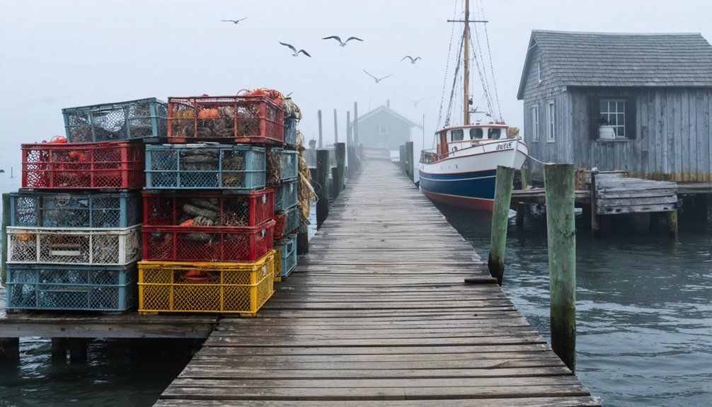
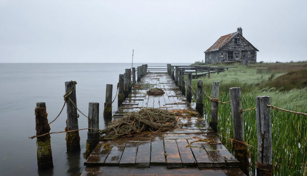
The Cultural Cost of Coastal Erosion
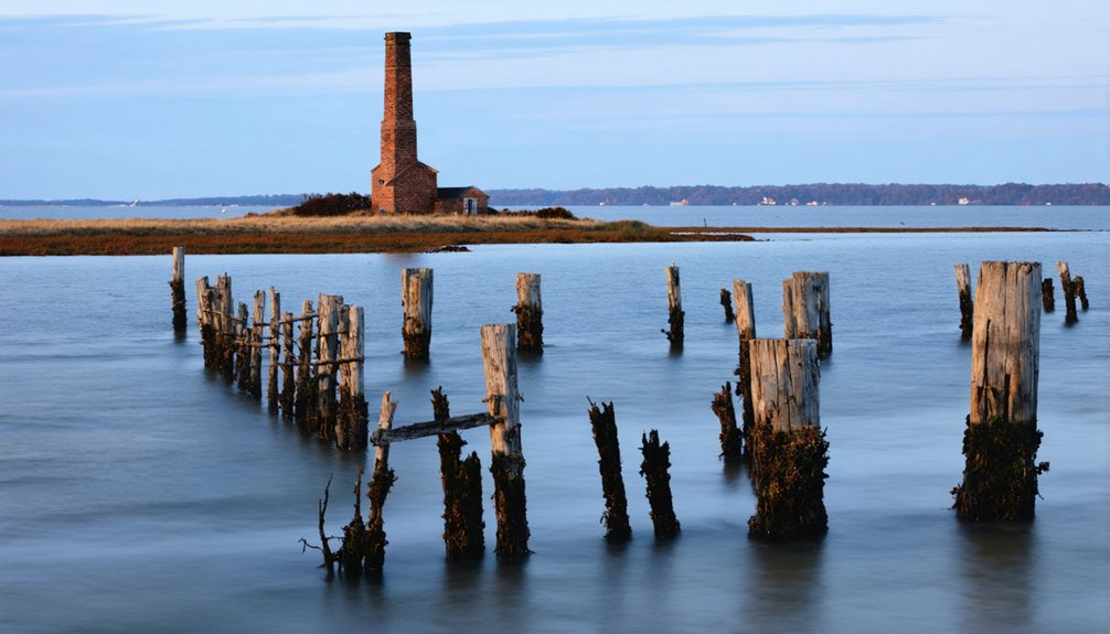
You’ll find once-thriving coastal communities now lying beneath the waves, their church steeples and chimney tops marking where generations of maritime families built their lives.
From Maine to Louisiana, rising seas and intensifying storms have forced entire villages to retreat inland, leaving behind centuries of cultural heritage etched into now-submerged landscapes.
The physical remnants of these lost settlements – from indigenous shell middens to colonial ports – tell a vital story of how coastal peoples adapted to changing shorelines throughout American history.
Vanishing Heritage Sites Underwater
Rising seas threaten an unprecedented number of coastal archaeological sites along America’s Atlantic and Gulf shores, with nearly 20,000 recorded locations projected to vanish beneath the waves by 2100.
You’ll find these submerged archaeology sites concentrated in vulnerable low-lying areas, particularly across the Mississippi River Delta where land subsidence accelerates their destruction.
What’s most alarming is that over 5,700 archaeological sites are already underwater, with thousands more teetering just above sea level.
Each passing storm and tide erases more of this underwater heritage – from indigenous monuments to historic maritime structures.
The situation grows dire in places like relict delta regions, where erosion runs unchecked without fresh sediment deposits to counter it.
These aren’t just statistics – they’re irreplaceable pieces of American coastal history slipping away forever.
Communities Lost to Time
Behind every submerged archaeological site lies a deeper human story of displaced communities and fractured cultural ties.
You’ll find Indigenous heritage woven through Louisiana’s coastline, where ancient shell mounds still protect shorelines today. These aren’t just historical artifacts – they’re living monuments of coastal resilience that continue to shape the landscape.
The stories of the people who once inhabited these areas are crucial to understanding the coastline’s past and its potential future. As restoration efforts in ghost towns gain momentum, communities are rediscovering their roots and rekindling pride in their unique histories. These revitalization projects not only breathe new life into the areas but also foster a deeper connection between residents and their heritage.
- The Chitimacha’s sacred Pond Lily site vanished, yet lives on through oral traditions
- Celilo Falls’ submersion ended centuries of Indigenous fishing practices
- Alaska Native villages watch their ancestral lands slip beneath rising waters
You’re witnessing the erasure of entire cultural landscapes as coastal erosion accelerates.
From the Mississippi Delta to the Beaufort Sea, these aren’t just places being lost – they’re the physical anchors of living traditions, spiritual practices, and community identities that have persisted for generations.
Cultural Memory and Preservation
While coastal communities have long adapted to environmental changes, the accelerating loss of cultural heritage sites presents an unprecedented crisis for maritime societies worldwide.
You’ll find ancient shell mounds, fishing sites, and submerged cities vanishing at alarming rates as rising seas and erosion erase these irreplaceable markers of cultural memory.
Cultural resilience faces its greatest test as communities struggle to preserve their heritage.
When storm surges wash away Native American middens or El Niño events damage stone geoglyphs, you’re not just losing artifacts – you’re losing centuries of traditional knowledge and ancestral connections.
Memory preservation has become a race against time, especially in vulnerable regions like Florida’s coast and China’s southern shores, where both tangible structures and intangible traditions face extinction without swift intervention and innovative protection strategies.
Frequently Asked Questions
How Do Archaeologists Locate and Study Underwater Ruins of Lost Coastal Villages?
You’ll find submerged settlements using underwater mapping tools like sonar and LiDAR, then carefully excavate using water dredges while documenting artifacts and structures through 3D modeling and precise spatial coordinates.
What Legal Processes Govern the Preservation of Submerged Historical Sites?
You’ll find federal legal frameworks like NHPA and ARPA govern offshore sites, while state preservation policies control waters up to 3-9 miles out, requiring permits for exploration and recovery.
Can Residents Receive Compensation When Their Coastal Communities Become Uninhabitable?
You’ll be eligible for compensation through FEMA buyouts and disaster recovery grants if your coastal community faces severe risks, but funding isn’t guaranteed and often depends on federal disaster declarations.
How Do Scientists Predict Which Current Coastal Communities Might Disappear Next?
Like watching dominoes fall, you’ll see vulnerable communities mapped through climate modeling and shoreline tracking. Scientists analyze erosion rates, sea-level rise, and population migration patterns to predict which coastal settlements face imminent threats.
What Modern Technologies Are Used to Reconstruct the Layout of Lost Villages?
You’ll find scientists using aerial surveys, LiDAR scans, and 3D modeling to map buried foundations, while GIS tools integrate historical maps and photos to recreate village layouts and settlement patterns.
References
- https://coastalreview.org/2020/07/lost-history-search-for-village-abandoned/
- https://www.neh.gov/article/atlas-drowned-towns
- https://www.nps.gov/aleu/learn/historyculture/lost-villages.htm
- https://www.idyllicpursuit.com/10-abandoned-american-seaside-towns-that-once-overflowed-with-tourists/
- https://www.caitlingreen.org/2016/02/ravenserodd-lost-towns-yorkshire-coast.html
- https://www.geotab.com/ghost-towns/
- https://www.legendsofamerica.com/lost-landmarks-vanished-sites/
- https://savingplaces.org/11most-past-listings
- https://www.atlasobscura.com/lists/americas-best-preserved-ghost-towns
- https://www.youtube.com/watch?v=uq5dxf2A9sA