Whiskeytown was a thriving California Gold Rush settlement that housed 1,000 miners by 1855, complete with saloons, a hotel, and essential services supporting the region’s placer and hydraulic mining operations. After gold deposits declined in the 1870s, the town gradually emptied. In 1963, the Bureau of Reclamation’s Central Valley Project sealed Whiskeytown’s fate—authorities purchased properties, relocated key buildings to nearby Shasta, and flooded the entire town beneath 241,100 acre-feet of water. The drowned settlement now rests 60 feet below Whiskeytown Lake‘s surface, where its structural outlines remain visible on clear days.
Key Takeaways
- Whiskeytown was a thriving Gold Rush settlement of 1,000 miners by 1855, featuring saloons, hotels, schools, and essential infrastructure.
- Mining decline began in the 1870s as gold deposits were exhausted, transforming the community into a ghost town.
- The town was physically erased in 1960 when Whiskeytown Dam construction submerged it beneath 241,100 acre-feet of water.
- Historic structures like the general store and schoolhouse were relocated to preserve fragments of the town’s 110-year history.
- The drowned settlement lies 60 feet underwater as California Historical Landmark 131, with visible structural outlines on clear days.
The Legend of Billie Peterson’s Spilled Whiskey
The most enduring origin story of Whiskeytown centers on a miner named Billie Peterson, who allegedly lost a barrel of whiskey in the early 1850s while hauling supplies back to his claim. According to folklore, his mule’s pack broke loose, sending the barrel tumbling down the hillside where it shattered on rocks below, spilling its contents into the creek.
You’ll find this tale repeated throughout local history, yet National Park Service documents acknowledge these dubious folklore origins—no verified records of Peterson exist. The legend persists because it captures the region’s Gold Rush character.
From Fur Trading Post to Gold Rush Settlement
Before gold fever swept through California, fur traders gathered annually at the site that would become Whiskeytown, conducting their rendezvous in the decades preceding 1848. The California fur trade, which began in 1778 and intensified through the 1830s, had nearly exhausted populations of beaver, otter, and muskrat by the time fashion trends and depleted stocks forced companies like Hudson’s Bay to abandon their operations.
When John Marshall discovered gold at Sutter’s Mill in 1848, former trappers who’d mapped California’s wilderness helped guide the flood of miners who established Whiskey Creek Diggings in 1849, transforming the remote trading site into a settlement of 1,000 prospectors by 1855.
Fur Traders’ Annual Rendezvous
Starting in 1825, fur traders and mountain men transformed remote wilderness locations across the Rocky Mountains into temporary commercial hubs through annual gatherings called rendezvous. William H. Ashley pioneered this system when his supply train reached southwestern Wyoming on July 1, 1825, establishing a practice that would continue until 1840.
The annual gathering rituals created temporary towns where trappers exchanged pelts for essential supplies, demonstrating the fur trade significance in opening western territories.
These wilderness meetings attracted diverse participants:
- Mountain men and fur trading companies conducting major business transactions
- Native Americans, who comprised the majority of attendees
- Merchants offering supplies and entertainment services
Before Whiskeytown became a mining settlement, the Clear Creek location hosted these annual rendezvous, serving as an established trading post that would later morph into the Gold Rush hub known as Whiskey Creek Diggings.
1852 Gold Rush Beginnings
On January 24, 1848, James Marshall’s gold discovery at Sutter’s Mill on the American River ignited a transformation that would reshape California’s wilderness trading posts into booming mining settlements. You’ll find that gold fever spread rapidly—by spring 1848, miners worked 150 miles along the Sierra Nevada’s western slope.
Northern California prospectors reached Clear Creek that same year, establishing Whiskeytown’s foundation. The settlement earned its name when a whiskey barrel tumbled from a pack mule into the creek during 1849. Initial mining techniques proved remarkably profitable: you’d average $50 daily using simple pan mining yields with picks, shovels, and gold pans. Prospectors discovered impressive nuggets, including a 56-ounce specimen in 1851. By 1855, roughly 1,000 miners populated this once-remote wilderness.
Boom Times: 1,000 Miners and a Thriving Community
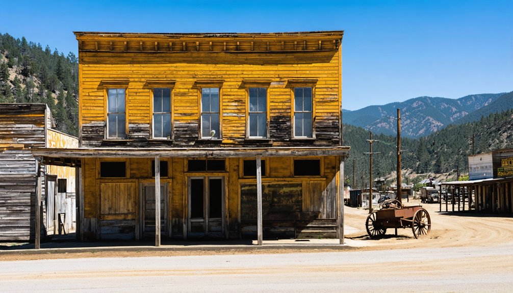
By 1855, you’d find yourself among roughly 1,000 residents who transformed Whiskeytown from a crude mining camp into a functioning frontier settlement complete with several saloons, a hotel, school, stable, and post office.
The town’s position along the main travel route to other mining districts made it a critical freight hub where stagecoaches and pack trains moved supplies and people through the Clear Creek drainage. This infrastructure supported an economy built on both placer operations in the creek beds and lode mining ventures like the Mt. Shasta Mine, which extracted $180,000 worth of gold from its quartz veins.
Peak Population of 1,000
During the mid-1850s, Whiskeytown’s population swelled to approximately 1,000 residents, transforming the settlement into one of the principal mining communities serving Shasta, Trinity, and Siskiyou counties. The mining demographics reflected typical gold rush patterns—predominantly white males pursuing independent fortune through placer operations.
You’ll find this peak coincided with the area’s most productive years, when the gold rush economy generated average daily earnings of $50 per miner.
The community’s composition included:
- Miners who panned, picked, and blasted for their livelihood
- Saloon operators and general store proprietors serving the workforce
- The first white woman, who arrived in 1852
Essential Infrastructure and Services
As Whiskeytown’s population approached 1,000 miners, the community’s survival depended on solving a critical challenge: water scarcity during California’s prolonged dry season. Early agricultural irrigation systems emerged in 1852 when Frank Vandeventer and Levi Tower constructed ditches for their crops and orchards.
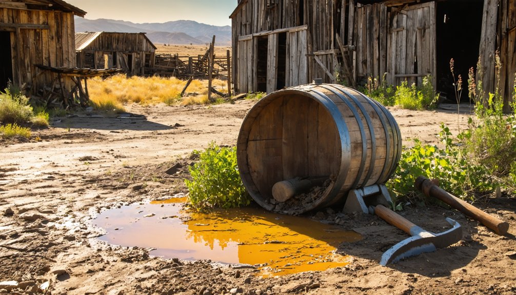
The Clear Creek Ditch Company transformed these modest efforts into pioneering public utilities, completing an 18-mile canal by June 1855 and extending the full 41-mile system to Horsetown by 1856. This infrastructure enabled year-round hydraulic mining operations, where high-pressure water moved tons of dirt and gravel.
You’ll find the community also established essential services: Benjamin Mix’s hotel, a schoolhouse, stable, and post office by 1855, creating a self-sufficient settlement that supported the booming mining economy.
Regional Freight Hub Operations
When Whiskeytown’s population swelled to approximately 1,000 residents during the 1850s gold rush, the settlement’s strategic location along the primary travel route connecting Shasta, Weaverville, and French Gulch transformed it into an essential freight hub. Prosperous freight and trade operations emerged as packed trains and stagecoaches transported supplies through town to regional mines, while efficient regional transportation routes enabled ore shipments from operations like Mount Shasta Mine to reach the Keswick smelter.
The hub facilitated critical commerce:
- Stage coaches delivered supplies to thousands of miners working Sierra Nevada and Klamath Mountain foothills
- Freight operations supported business owners, tradesmen, and railroad workers near Southern Pacific lines
- Ore transport sustained economic activity even after placer deposits declined in 1862
You’ll find this transportation network provided miners and travelers comfortable stopover accommodations while maintaining community prosperity.
Life in a Principal Mining Town of Shasta County
Gold seekers who arrived at Whiskey Creek Diggings in 1849 found themselves in one of Shasta County’s most productive mining districts, where daily earnings averaged $50 by the 1850s—equivalent to $2,039 in 2024 dollars.
By 1855, you’d encounter a thriving community of 1,000 residents supporting robust civic and social institutions including several saloons, a hotel, school, stable, and post office. The diversity of early population extended beyond miners to include ranchers, farmers, and service providers who capitalized on the town’s strategic position along routes to Shasta and Weaverville.
You’d witness pack trains and stagecoaches arriving regularly, while real estate values surged rapidly from 1852 onward. The 1851 discovery of a 56-ounce nugget confirmed the district’s exceptional mineral wealth.
The Decline of Gold and the Exodus of Miners
By the 1870s, miners had extracted the vast majority of gold deposits from the Whiskeytown area, marking the beginning of a prolonged decline that would span nearly a century. You’ll find that subsequent decades brought sporadic revivals—pocket miners in the mid-1920s produced between a few hundred and $15,000 annually, providing mere subsistence.
The 1930s price increase from $20.67 to $35.00 per ounce sparked brief renewed interest, though environmental damage from copper smelting operations scarred the region.
Key factors in Whiskeytown’s mining decline:
- The decline of small mining companies left only marginal operations by the 1920s
- World War II virtually halted gold production until mid-1945
- Post-1951 annual gold values fell below any year since 1880
The environmental impact of mining, particularly from smelter operations, compounded economic challenges facing independent prospectors.
Whiskeytown Dam: The Drowning of a Historic Town

The economic collapse of Whiskeytown’s mining industry would prove a prelude to the town’s physical erasure. You’ll find that the Central Valley Project’s expansion sealed Whiskeytown’s fate in 1960 when Gibbons and Reed Company commenced dam construction.
Engineering challenges included excavating foundations through Balaklala metarhyolite and Mule Mountain granite, creating a 282-foot structure spanning 4,000 feet. Community displacement began as authorities purchased properties and cleared vegetation, saving only the post office and schoolhouse while relocating the cemetery.
Salvaging History: Relocated Buildings and Structures
Before Whiskeytown disappeared beneath 241,100 acre-feet of water, salvage crews worked frantically to preserve fragments of the town’s 110-year history. You’ll find these historic structures relocated down the highway to Shasta, where they began new lives far from their original foundations.
The community preservation effort saved:
- General Store – Moved near Whiskey Creek Day Use Area, operating as gas station, store, and post office before eventual abandonment
- Whiskeytown School – Relocated to become part of a church on Red Bluff Road after receiving a 1930s New Deal facelift
- Post Office – Among the few buildings rescued from the 1962-1963 inundation, representing the town’s peak population of 1,000 residents
The Tower House District‘s Camden House and outbuildings remain at the recreation area’s western fringe—a fragile community of abandoned structures witnessing what governmental necessity couldn’t erase.
The Whiskeytown Cemetery Through Fire and Time
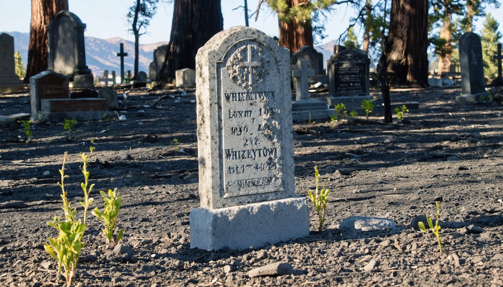
Among the few remnants of Whiskeytown’s gold rush legacy that survived the reservoir’s creation, the pioneer cemetery stands as a twice-moved record to preservation’s complexities. You’ll find graves dating to the 1850s, relocated in the early 1960s before Whiskeytown Dam’s flooding. Bodies from Whiskeytown and Oak Bottom Cemeteries were exhumed and reinterred at their current forested site within the national park.
The July 2018 Carr Fire decimated headstones and shifted ongoing volunteer efforts from cleanup to rebuilding. Despite destruction, an American flag survived, lowered to half-mast by firefighters honoring fallen comrades.
Today, the cemetery’s generational legacy of pioneers slowly returns to life, overseen by Shasta County Sheriff’s Office. Ranger-led tours continue, and burials persist, preserving this whimsical memorial to freedom-seeking settlers.
Beneath the Lake: What Remains of Old Whiskeytown
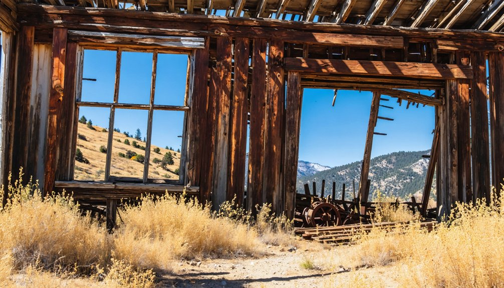
Sixty feet beneath Whiskeytown Lake’s surface lies a drowned frontier settlement, its buildings and mining camps submerged when the Whiskeytown Dam flooded the valley in 1962. On clear days, you’ll spot outlines of former structures resting on the lake bottom—a ghostly record to California’s Gold Rush era. Most town buildings vanished underwater, though the general store and post office were relocated above the full pool level near Whiskey Creek.
Historical mining infrastructure including old mines positioned above water level
Former water ditches—roughly 40 miles documented before the 2018 Carr Fire revealed dozens more
Few residences now occupied by National Recreation Area personnel
This underwater archaeology site remains California Historical Landmark 131, preserving 1849’s Whiskey Creek Diggings beneath recreational waters.
Frequently Asked Questions
Can You Still Find Gold at Whiskeytown Lake Today?
Yes, you’ll find gold through recreational panning at designated areas like Tower House Historic District and Clear Creek Picnic Area. From a prospector’s perspective, abandoned mining equipment marks historical sites where you can legally pan using simple tools with proper permits.
Is It Possible to Scuba Dive and See Submerged Buildings?
You can scuba dive at Whiskeytown Lake with diving conditions offering 15-20 feet underwater visibility, but you won’t see intact submerged buildings. Most structures were demolished before the 1963 flooding, leaving only occasional foundations visible during low water.
How Deep Is Whiskeytown Lake Where the Town Was Located?
The submerged town’s depth varies between 100-200 feet depending on lake depth fluctuations. You’ll find most structures lie around 150 feet deep. Underwater archaeological surveys haven’t precisely mapped all buildings, so exact locations remain partly unexplored and challenging to access.
Are There Any Descendants of Original Miners Still Living Nearby?
Yes, you’ll find descendants like historian Jeremy M. Tuggle, who traces lineage to eleven pioneer families through historic family records and local oral histories, actively preserving their ancestors’ mining heritage in Shasta County today.
What Happened to Residents Who Refused to Sell Their Property?
No records show residents refusing sales—the government’s systematic property acquisition left no paper trail of resistance. Without documented eminent domain cases or compulsory land acquisition battles, any potential holdouts apparently resolved through quiet negotiations before forced relocation of residents occurred.


