
You’ll find White Bead, Oklahoma along the Washita River, where a vibrant frontier town once flourished after its 1868 founding. Named for a respected Caddo woman leader, this settlement peaked when the Santa Fe Railroad arrived in 1906. While the post office closed in 1912 and residents gradually moved away, you can still visit the historic cemetery where local volunteers maintain the last physical connection to this fascinating ghost town’s Native American and settler heritage.
Key Takeaways
- White Bead, Oklahoma became a ghost town after its post office closed in 1912, marking a significant decline in population and community activity.
- The town reached its peak during the arrival of the Atchison, Topeka and Santa Fe Railroad in 1906 as a freight station.
- Originally founded in 1868 by W.G. Kimberlin, White Bead was named after an influential Caddo woman who oversaw trading post operations.
- The cemetery, established in the 1920s, remains the last physical landmark of the former settlement’s existence.
- Economic activities centered around ranching and trading, with the town’s first store and post office established in 1877.
The Rise and Fall of White Bead
When W.G. Kimberlin arrived in Indian Territory in 1868, he couldn’t have known he’d become part of a unique settlement’s story.
White Bead, named after a respected Caddo woman leader, emerged along the south side of the Washita River where Native American trade routes had long existed.
Like McGee, White Bead had a vibrant blacksmith shop that served the community’s early needs.
You’ll find the town’s peak coincided with the arrival of the Atchison, Topeka and Santa Fe Railroad in 1906, sparking local commerce and establishing a proper school district.
The first schoolhouse was constructed that same year as a one long room divided by a distinctive red flannel curtain.
Despite its promising start and community resilience, White Bead couldn’t withstand the economic shifts that swept through Oklahoma’s early settlements.
As transportation patterns changed and neighboring towns faced similar challenges, the population dwindled.
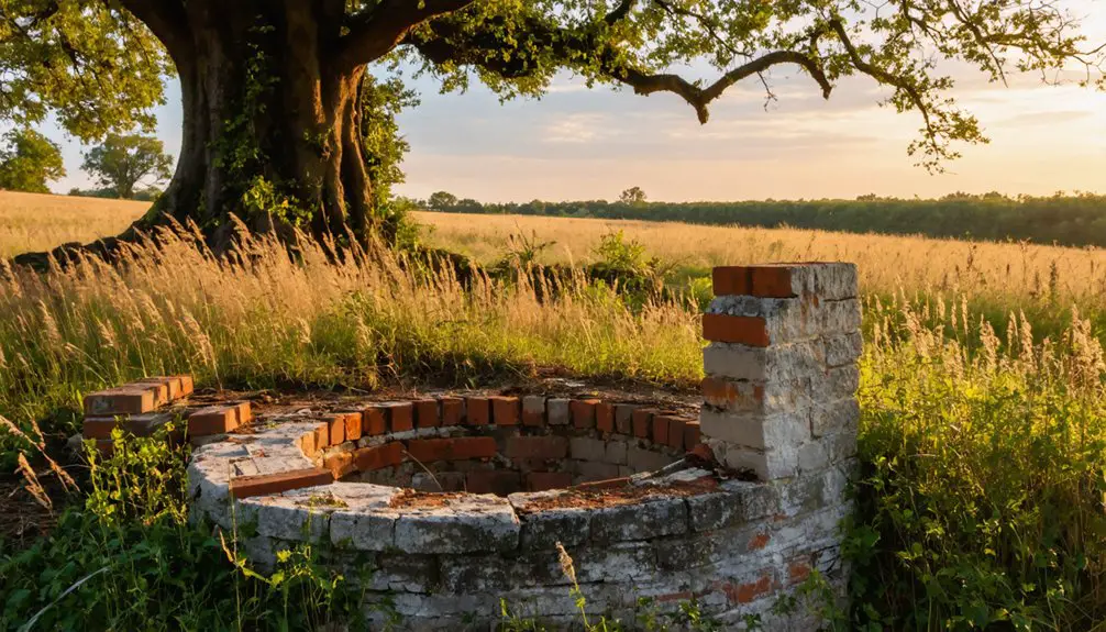
Today, you’ll only find scattered remnants and the old cemetery, silent witnesses to a settlement that once represented the delicate balance between Native American heritage and frontier development.
Native American Heritage and Settlement
Long before White Bead emerged as a frontier settlement, the land held deep significance for numerous Native American nations. The area’s rich tribal heritage reflected generations of cultural resilience through waves of migration, settlement, and change. Following the 1834 Trade Act, the region was legally designated as Indian country with strict prohibitions on white settlement. The tribes maintained sovereign authority over their territories through established governmental systems.
You’ll find these pivotal developments shaped the region’s Native American story:
- The Five Civilized Tribes established strong tribal governance systems, including the Choctaw who proposed naming the territory “Oklahoma.”
- Early Cherokee settlers moved westward by 1817, creating communities around missions and trading posts.
- The Medicine Lodge Treaties of 1867 redefined territorial boundaries for Plains tribes.
- The Dawes Act of 1887 drastically altered traditional communal land ownership, forcing individual allotments that undermined tribal authority and triggered White Bead’s eventual settlement pattern.
Historical Significance Along the Washita River
Nestled in the fertile Washita River valley at the base of a hill, White Bead‘s location proved indispensable to its historical significance in Indian Territory.
You’ll find this historical crossroads strategically positioned near two essential springs and a natural ford, making it perfect for early settlement and trade.
The river valley served as a critical lowland route westward, where cultural exchanges flourished between Native Americans and settlers.
You can trace White Bead’s importance to the government freight road connecting Fort Sill to Caddo, with stage stops and military activities centered around nearby Forts Washita and Arbuckle.
The Whitebead Caddos, named after an elder woman leader, found shelter in this region after their difficult 1840 journey across Indian Territory.
During the Civil War, the area’s significance peaked when Confederate forces used the region to gather Plains Indian support at Cherokee Town.
The Washita River’s role in shaping migration patterns and settlements can’t be understated.
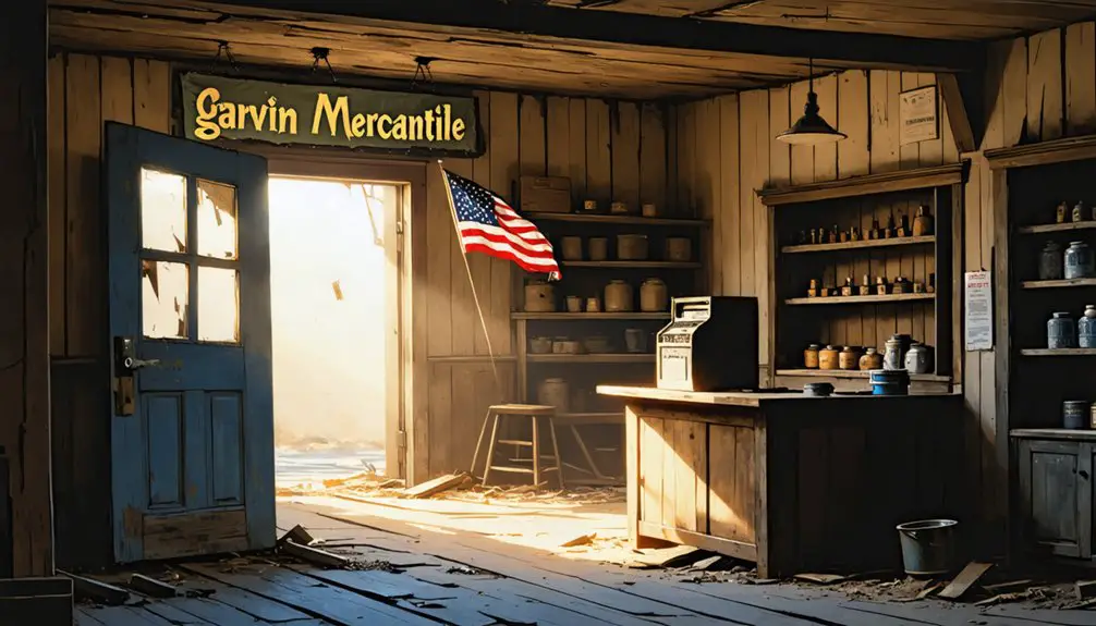
The village grew into a thriving community with James Rennie’s store becoming a cornerstone business worth approximately $40,000.
Railroad Impact and Community Changes
If you’d visited White Bead before the Missouri-Kansas-Texas Railroad arrived, you’d have found a simple stage stop and trading post where travelers could rest near fresh springs.
The arrival of the “Katy” line in the late 19th century changed White Bead into a bustling freight station, especially known for shipping livestock and serving as an essential transportation hub between Caddo and Fort Sill. The Missouri-Kansas-Texas Railroad continued to expand its influence in Oklahoma, managing construction and operations of the Oklahoma Belt Railroad in 1917.
Your visit after 1902 would have revealed a community in flux, as new branch lines through places like Pauls Valley began redirecting rail traffic and diminishing White Bead’s importance as a shipping center.
Railroad Growth Changes Everything
Once the railroads carved their iron paths through Indian Territory in the 1870s, White Bead’s destiny changed forever. The railroad expansion brought dramatic economic disruption to this once-bustling stage stop, as steel rails replaced dirt roads for moving goods and people.
You can trace White Bead’s transformation through these key developments:
- The Katy Railroad’s arrival in 1870 shifted trade routes away from traditional stops.
- White Bead’s crucial stage stop status diminished as rail stations drew commerce elsewhere.
- Local ranchers like Albert Rennie now shipped livestock by rail instead of driving them.
- The community’s post office closed in 1912, marking its decline as residents moved to railroad towns.
Like other railroad towns of the era that experienced major population swings, settlements could go from 2500 to 150 residents when local industries declined.
The iron horse had reshaped the land, and White Bead couldn’t compete with the whistle’s call.
Life Before Train Service
Before the iron horse charged through Indian Territory, White Bead thrived as a vibrant frontier community shaped by both Native American heritage and settler determination.
You’d find the community dynamics centered around Whitebead School District 16 and Kimberlin Chapel, where folks gathered to learn and worship by 1909.
Life revolved around agricultural practices, with settlers working the land and trading cattle along the old stage road to Fort Cobb.
You could spot modest homesteads dating back to the 1870s, built by land-rich but cash-poor pioneers.
The settlement’s heart traced back to Salvania, a Caddo woman whose white beads became a symbol of trade between tribes.
The Wichita tribe settlements in the area from 1250 to 1450 left behind numerous artifacts showing their transition from nomadic life to farming villages.
Stagecoach routes connected you to nearby forts and towns, while the Washita River ford served as an essential crossing point for travelers and traders.
Leading rancher William Grant Kimberlin ran up to 1,500 cattle on his expansive frontier holdings.
Archaeological Discoveries and Cultural Sites
You’ll find fascinating evidence of Native American life throughout Garvin County’s sixty-four Plains Village sites, which date from A.D. 1000 to 1500.
The Wichita tribe‘s shift from nomadic life to settled farming communities around A.D. 1250 left behind pottery fragments, stone tools, and remnants of permanent structures.
These archaeological treasures, scattered across the Washita River valley, show how Native peoples adapted to the land through hunting, farming, and establishing complex trading networks.
Native Settlement Patterns
Archaeological evidence reveals that the Whitebead Caddo settlement, named after a respected elder woman, established itself strategically along the Washita River near present-day Whitebead, Oklahoma. The location proved crucial for Caddo trade and intertribal relations, though tensions existed with the local Choctaw Nation.
You’ll find these key patterns in the Whitebead settlement:
- Village sites concentrated near springs and waterways for essential resources
- Settlements positioned along lowland routes connecting western territories
- Trading posts established near government freight roads and stage stands
- Strategic proximity to Fort Washita and Fort Arbuckle for protection and commerce
The archaeological record shows continuous adaptation as the Whitebead Caddos maintained their cultural identity while engaging in regional trade networks and steering complex relationships with neighboring tribes.
Early Plains Village Sites
Three distinct Plains Village sites near White Bead showcase a unique variant of indigenous culture that flourished from the late 1600s through mid-1700s.
You’ll find evidence of extensive cultural interactions through pottery fragments and traded goods, while the distinctive Plains Village architecture reveals both local adaptations and regional influences.
These settlements weren’t just temporary camps – you can still see remains of picket-post houses, trash mounds, and earthen fortifications that highlight the villagers’ permanent presence.
They mastered a free-ranging lifestyle that combined farming with bison hunting, as shown by their diverse tool assemblages.
What’s particularly fascinating is how they built defensive structures to protect their independence during a time of increasing pressure from European colonial powers and inter-tribal conflicts.
Life in Early White Bead Settlement
Life in early White Bead centered around two essential springs, where settlers established the first store and post office in 1877. You’d have found a bustling community engaged in cultural exchanges between settlers and Native Americans, particularly the Caddo tribe.
The settlement’s economic activities thrived through:
- A strategic stage stop on the government freight road to Fort Sill
- Ranching operations, including Albert Rennie’s impressive 660-hog drive to Lehigh
- Trading post transactions overseen by the influential Caddo woman wearing white beads
- Commercial connections via the Santa Fe and Katy railroad lines
You’d have met folks like Whit Hyden, Bryant Mitchell, and Clayton Blackburn going about their daily business, while Miss Berta Johnson taught at the local school.
The community’s spirit lived on through its cemetery, established in the early 1920s.
The Legacy of Samuel J. Garvin
Among the notable figures who shaped White Bead‘s early days, Samuel J. Garvin stands out as a true frontier success story.
After settling near White Bead in 1870, he’d build an empire through marriage, business savvy, and hard work. You’ll find Garvin’s businesses stretched across the region, from his main store at White Bead Hill to branches in Paoli and Beef Creek.
His cattle operations were impressive – he ran about 2,500 head at their peak, while managing 2,000 acres of farmland with 45 renters.
By marrying Susan Muncrief, daughter of a prominent Choctaw cattleman, he’d secured his place in both settler and Native American societies.
His influence was so significant that when Oklahoma’s counties were mapped out, they named one after him – Garvin County, where his legacy lives on today.
Cemetery Records and Family Histories
When you explore the records of Whitebead Cemetery in Pauls Valley, Oklahoma, you’ll discover nearly 1,200 memorial stones that tell the area’s rich family histories.
Cemetery preservation efforts have made it possible for you to trace your family genealogy through these carefully documented records spanning from the late 19th to 20th centuries.
Notable family histories include:
- The Brinley family legacy, featuring WWI Sergeant Ray A. Brinley and several generations
- Multiple Cox family members, including WWII Navy Seaman Ace Cox
- The Cowley family’s multi-generational presence, from young Raymond Lee to William S.
- Military service records that connect local families to America’s major conflicts
You’ll find these stories preserved through online databases like Find A Grave and the Oklahoma Gravestones Project, making family research accessible to everyone seeking their roots.
Preservation Efforts and Historical Landmarks
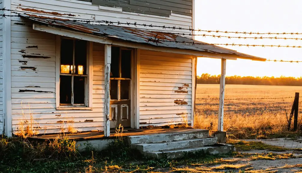
Despite White Bead’s rich history as a Methodist education center, only the cemetery remains as a physical memorial to this once-thriving community.
You’ll find preservation challenges abound, as windstorms and time have erased most physical structures, including the renowned Pierce Institute that once taught advanced subjects like Hebrew and trigonometry.
While you won’t see many original buildings, historical markers help keep White Bead’s legacy alive. Nearby Cherokee Town’s marker commemorates its role as a Confederate Indian meeting site and stagecoach stop.
The White Bead cemetery serves as the last tangible link to the past, maintained by dedicated local volunteers. It’s a declaration of the town’s educational and cultural significance within the Chickasaw Nation, even though limited funding and formal preservation efforts make protecting this heritage an ongoing struggle.
Frequently Asked Questions
What Was the Origin of the Name “White Bead”?
You’ll find the name’s historical significance comes from Salvania, a Caddo Indian leader who wore white beads. Her cultural heritage as “White Bead” influenced trading relations and tribal authority.
Were There Any Notable Conflicts Between Settlers and Native Americans?
You’ll find the area was marked by settler resistance and native displacement, as tribes were pushed west into Indian Territory while white settlers established new communities throughout the region.
What Natural Resources or Industries Sustained White Bead’s Early Economy?
Like a taproot anchoring a mighty oak, you’ll find White Bead’s prosperity grew from its Washita Valley springs, agricultural practices along fertile riverlands, and its position as an essential transportation hub.
How Many People Lived in White Bead at Its Peak?
You’ll find that 695 folks called this place home at its peak in 1930, before population decline set in. Now it’s mostly empty buildings and ghost stories where those settlers once lived.
Did Any Famous Outlaws or Lawmen Pass Through White Bead?
Truth is stranger than fiction, but you won’t find any documented outlaw encounters or lawman legends in White Bead’s history. Historical records focus on Native American heritage rather than famous frontier figures.
References
- http://genealogytrails.com/oka/garvin/towns.html
- https://www.okhistory.org/publications/enc/entry?entry=GA017
- https://okgenweb.net/~okgarvin/towns/schools/whitebeadschool.html
- https://kids.kiddle.co/List_of_ghost_towns_in_Oklahoma
- https://freepages.rootsweb.com/~gtusa/history/usa/ok.htm
- https://www.okhistory.org/publications/enc/entry?entry=IN018
- https://en.wikipedia.org/wiki/Indian_Territory
- https://www.okhistory.org/publications/enc/entry?entry=AM010
- https://www.okcps.org/cms/lib/OK01913268/Centricity/Domain/130/OK History Booklet 2019 From Trails to Truths.pdf
- https://www.familysearch.org/en/wiki/Indigenous_Tribes_of_Oklahoma


