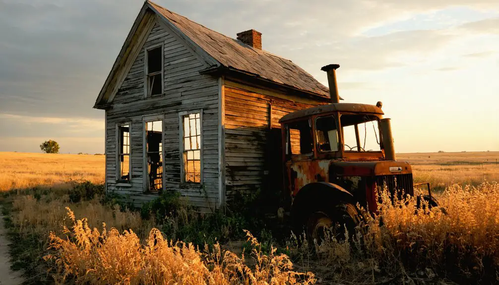
You’ll find White Rock’s remnants along White Rock Creek in Republic County, Kansas, where a vibrant frontier town once flourished in the 1870s. After its establishment in 1866, the settlement grew to nearly 400 residents with three general stores, mills, and a hotel. When voters rejected railroad bonds in 1878, the Union Pacific bypassed the town, leading to its decline. By 1912, only 30 residents remained. The limestone bluffs still guard stories of Native American raids, pioneer resilience, and fateful decisions.
Throughout the state, many ghost towns in Kansas history serve as reminders of similar stories where once-thriving communities faded into the landscape. These abandoned places often feature crumbling buildings and overgrown streets, echoing the past glories and hardships faced by their inhabitants. Each ghost town carries a unique history, inviting curiosity about the lives that once filled their spaces.
The tale of White Rock is just one of many ghost towns in Kansas history that highlight the fleeting nature of frontier life. Each abandoned structure whispers tales of hope, ambition, and ultimate loss as communities once vibrant disappeared from the map. Exploring these remnants not only uncovers the past but also reflects the broader struggles faced by settlements across the state.
Key Takeaways
- White Rock was established in 1866 and grew into a vibrant trade center with nearly 400 residents by 1873.
- The town’s rejection of railroad bonds in 1878 led to its bypass by the Central Branch Union Pacific Railroad.
- Without rail access, transportation costs increased significantly, causing businesses to fail and residents to leave.
- By 1912, White Rock’s population had dwindled to just 30 people, marking its decline into ghost town status.
- Today, only a memorial marker remains where this once-thriving Kansas settlement stood along White Rock Creek.
The Birth of a Frontier Settlement
While several attempts to settle the area had failed, White Rock’s permanent establishment finally took root in 1866 when Thomas Lovewell chose this promising location west of the Republican River. The settlement strategies proved successful as the area’s rich soil and position along a major emigrant route from Nebraska attracted determined pioneers.
You’ll find that community leadership emerged quickly when the Morlan Brothers, Lovewell, Laney, Babcock, and Reynolds formed a town company in 1871. They laid out the settlement, with Lovewell and Babcock donating land for development. A post office opened in July 1870 with Chester Babcock serving as the first postmaster.
Though initially proposed as “Pinhook,” they named it “White Rock” after the distinctive local bluffs and creek. Despite earlier Indian hostilities that had delayed settlement, the White Rock Valley’s favorable terrain and strategic location made it the most desirable area in Republic and Jewell Counties. This naming choice would later require a disambiguation page to distinguish it from other locations sharing the “White Rock” name.
Early Growth and Economic Prosperity
Although White Rock began as a modest frontier settlement, it rapidly evolved into Republic County’s most vibrant trade center by 1873.
From humble frontier beginnings, White Rock transformed into a bustling commercial hub that dominated Republic County’s trade landscape by 1873.
You would’ve found a bustling town of economic diversity, with three general stores, a sawmill, a corn mill, and a hotel serving nearly 400 residents and surrounding farmers.
The town’s carefully planned streets, officially platted in 1876, showcased the community’s resilience and forward-thinking approach to development.
As the first settlement west of the Republican River, White Rock capitalized on its strategic location along key emigrant routes from Nebraska.
The rich farmland surrounding the township attracted homesteaders, while the town’s commercial infrastructure processed and traded their agricultural products, creating a self-sustaining economic ecosystem that defined White Rock’s golden age.
The local Round Mound limestone proved valuable for construction, providing building materials that helped establish the town’s permanent structures.
Natural Features and Geographic Significance
When you visit the former townsite of White Rock, you’ll see the dramatic limestone bluffs overlooking the Republican River that gave the settlement its name.
White Rock Creek winds through the fertile valley, where early settlers harnessed its flow for mills and agriculture.
The area’s abundant limestone deposits provided sturdy building material for the town’s structures, many of which stood until the community’s eventual decline.
Bluffs and River Landscapes
Two dramatic limestone bluffs tower over White Rock, Kansas, forming a distinctive natural boundary along the Republican River.
These bluff formations, sculpted by centuries of river erosion, showcase the region’s rugged Fencepost limestone and Fort Hays limestone layers.
You’ll find a landscape where steep cliffs meet fertile floodplains, creating a striking contrast to the surrounding Great Plains.
Similar to the stunning vistas at Four State Lookout, these elevated points provide breathtaking panoramic views of the surrounding countryside.
Discover these natural wonders:
- Strategic vantage points that once served early settlers and travelers
- Diverse ecological zones where xeric prairie plants thrive on dry slopes
- Natural corridors supporting wildlife migration through the Great Plains
- Unique watershed dynamics where limestone-filtered waters shape the Republican River’s course
The bluffs’ dramatic presence has left an indelible mark on the region’s identity, even inspiring the town’s name.
White Rock Creek Setting
White Rock Creek winds eastward through northern Kansas, originating in Smith County before cutting across Jewell County as an essential tributary of the Republican River.
You’ll find a diverse river ecology shaped by ancient glacial processes, where loess canyons and limestone outcrops create dramatic views along the northern margins. These historical landscapes tell a story of geological change, with high terraces rising 50 to 65 feet above the floodplain, carved by centuries of flowing water.
The creek’s valley features thick Peoria loess deposits reaching depths of 75 feet near the Republican River, while Illinoian age sand and gravel deposits line the creek bed. During the Illinoian time period, White Rock Creek extended its valley significantly westward. As the most prominent small stream in the region, White Rock Creek maintains consistent flow patterns throughout most of the year.
The surrounding terrain includes deeply dissected ravines that once provided natural shelter during frontier conflicts, marking this waterway’s significance in regional history.
Limestone Building Resources
Limestone’s abundance throughout the White Rock region provided settlers with essential building materials that shaped the area’s architectural heritage.
You’ll find this durable stone was particularly valued for its resilience and versatility in construction. The region’s limestone quarries yielded high-quality Fencepost limestone, known for its weather-resistant properties and distinctive iron oxide streaks. Community blacksmiths crafted tools specifically designed for quarrying and shaping the stone. The stone’s primary component of calcium carbonate minerals made it ideal for long-lasting structures.
- The crystalline calcite matrix made the stone exceptionally durable for building projects.
- Natural bedding seams allowed for easy splitting into manageable construction slabs.
- Varied coloring from white to rust-red created unique architectural aesthetics.
- Extensive quarrying operations left hundreds of abandoned sites, evidence of the stone’s widespread use.
The limestone’s availability near river systems and natural outcrops made it readily accessible, influencing settlement patterns and local building traditions across Kansas.
Native American Conflicts and Settlement Challenges
If you’d ventured near White Rock Creek in 1869, you’d have faced deadly raids from Cheyenne Dog Soldiers, who killed six buffalo hunters that May and forced the Excelsior Colony to abandon their settlement.
The persistent Native American attacks made White Rock’s early settlement particularly treacherous, with mounted warriors striking frequently at homesteaders attempting to establish farms along the creek and Republican River. Gordon Winbigler met a tragic end when Indians overtook him while retrieving his hat near the Republican River. The conflicts were part of a larger pattern of displacement, as Kanza people controlled vast territories in Kansas before being forced to relocate to Oklahoma in 1873.
You can trace the impact of these conflicts through the evacuation patterns of 1869-1870, when many settlers fled the region’s rich valley lands due to the ongoing violence.
Early Settlement Raids
During the tumultuous period of frontier settlement in the late 1860s and 1870s, the White Rock Creek area became a focal point of violent clashes between Native American tribes and pioneer settlers. The raids revealed both calculated raid strategies and settler resilience in the face of constant danger.
- In April 1867, nine Sioux warriors killed four settlers and kidnapped Mary Ward, demonstrating the vulnerability of isolated homesteads.
- The Cheyenne employed deceptive tactics, posing as friendly Otoe to gain entry before attacking the Ward family.
- By May 1869, coordinated raids forced settlers to retreat to Lake Sibley, with six men killed and multiple captives taken.
- The August 1878 attacks showed sophisticated planning, with simultaneous strikes along the frontier from Saline to Republican River, claiming 40 settler lives.
Defensive Settlement Patterns
As settler communities faced persistent Native American raids along White Rock Creek, they developed sophisticated defensive strategies that shaped settlement patterns throughout the region.
You’d find homes clustered together near natural barriers like White Rock Bluffs and the Republican River, maximizing both protection and visibility against surprise attacks. Settlers strategically positioned their dwellings to maintain access to water while using the terrain as a defensive advantage.
Community cohesion became essential for survival, with settlers organizing vigilance committees and coordinating defense efforts.
They’d establish shared patrols, watch shifts, and communication systems like signal fires. Land claims were often chosen more for their defensibility than agricultural potential, and communities built defensive trenches, fences, and stockades during periods of heightened conflict.
The Railroad Decision That Changed Everything
While White Rock stood as one of Republic County’s most prosperous towns in the early 1880s, a single decision sealed its fate. In 1878, voters rejected $130,000 in railroad funding bonds, with White Rock township voting 95-2 against.
You’ll understand how this fateful choice redirected the town’s destiny through these key events:
- The Central Branch Union Pacific Railroad bypassed White Rock, choosing the Republican River’s east side instead.
- Town leaders’ confidence that the railroad would come without bonds proved catastrophically wrong.
- Transportation costs soared as businesses struggled without rail access.
- By 1912, White Rock’s population plummeted to just 30 residents.
This stark voter sentiment against railroad funding transformed a thriving commercial center into a ghost town, proving that sometimes the price of saying “no” is the future itself.
Daily Life in White Rock’s Heyday
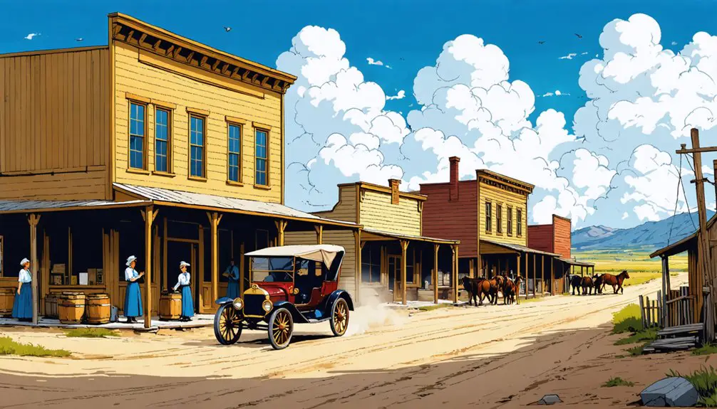
Life in White Rock buzzed with energy in the 1870s, when its 400 residents built a thriving community around three general stores, two mills, and a hotel near White Rock Creek.
You’d find the streets filled with farmers bringing their corn to the mill or travelers stopping at the hotel to rest and share news from distant settlements.
Your daily routines would’ve centered on agriculture and trade, with the fertile White Rock Valley providing ideal conditions for farming.
Community gatherings often took place at the general stores, where you’d catch up with neighbors while purchasing supplies.
The hotel served as another social hub, where you’d meet emigrants passing through on their westward journey.
The town’s strategic location and organized layout made it a natural center for commerce and social life in Republic County.
The Gradual Decline of a Once-Thriving Town
The pivotal failure to secure railroad access in 1878 marked the beginning of White Rock’s steady decline.
Despite early settler cooperation that had established a promising community with mills, stores, and a hotel, the town’s economic isolation proved insurmountable after voters rejected the Kansas Pacific Railway bond by 95-2.
You’ll find these stark realities shaped White Rock’s fate:
- By 1912, all businesses had shuttered their doors
- Population dwindled to just 30 residents
- Nearby towns with rail connections drew away commerce and settlers
- Agricultural mechanization reduced the need for rural workers
Without rail transportation, White Rock couldn’t maintain its economic diversity or attract new settlers.
The town that once showed such promise as the first settlement west of the Republican River in Republic County gradually faded into Kansas history.
Legacy of White Rock in Republic County
White Rock’s enduring legacy in Republic County extends far beyond its brief existence as a commercial hub. You’ll find its influence embedded in the region’s settlement patterns, as it served as a vital waypoint on the emigrant route from Nebraska, facilitating westward expansion into Kansas Territory.
The town exemplified community cooperation through its founding members’ land contributions and early emphasis on education.
Though the physical town has vanished, White Rock’s story illuminates important historical themes: the risks early settlers took in establishing communities despite Indian conflicts, the significant role of railroad access in determining a town’s fate, and the spirit of frontier entrepreneurship.
The town’s connection to natural landmarks like White Rock Creek and the Bluffs continues to shape the region’s geographical identity.
What Remains: Modern-Day White Rock
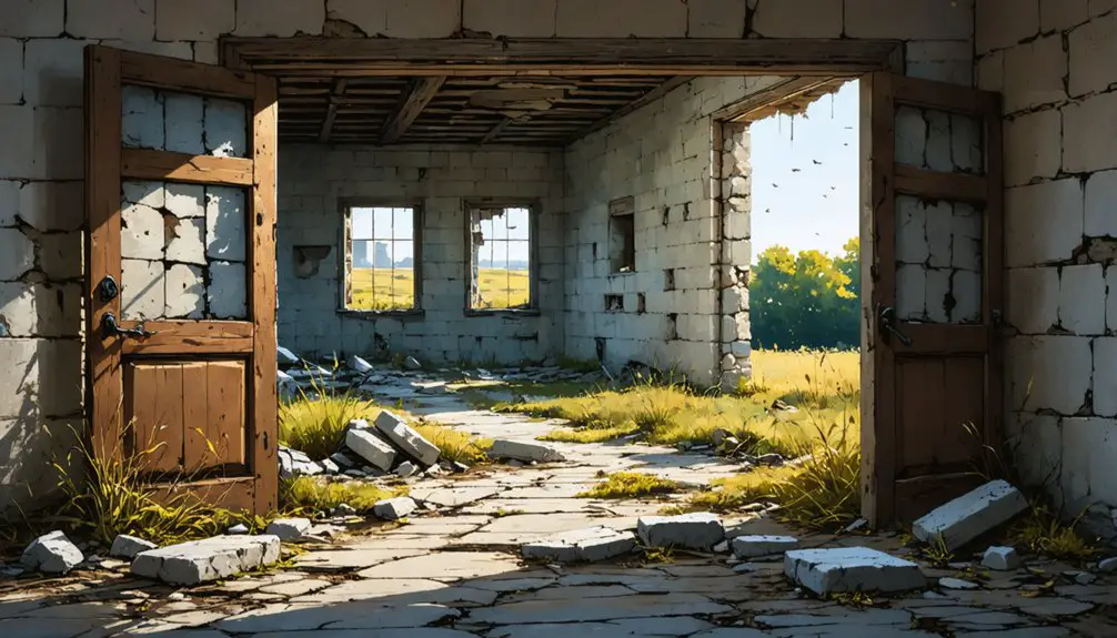
Modern visitors to the former site of White Rock will find little evidence that a bustling frontier town once stood there.
Today, this ghost town has completely merged with the surrounding rural landscape, transformed into productive farmland that stretches across Republic County’s gentle terrain.
- You’ll find a solitary memorial marker carved from native white rock, standing as the only physical reminder of the town’s existence.
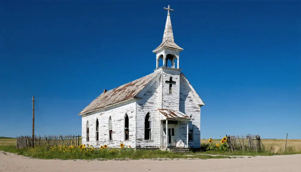
- The last remaining structure, a rock schoolhouse, vanished in 1926.
- You can reach the site via local roads near Courtland, though you won’t see any directional signs.
- The location sits quietly 14 miles northwest of Belleville, where agricultural fields have reclaimed all traces of streets and buildings.
Frequently Asked Questions
What Was the Highest Recorded Population of White Rock During Its Peak?
While direct census records don’t exist, you’ll find White Rock’s highest population reached an estimated 100-200 residents during its peak years of the 1870s, when three stores, two mills, and a hotel thrived.
Were There Any Major Fires or Natural Disasters in White Rock?
You won’t find any documented fire incidents or natural disasters in the historical records. All evidence points to economic and social challenges, not environmental catastrophes, as the key factors affecting the town.
What Happened to the Buildings and Materials After Residents Left?
Imagine weathered timbers and crumbling stone – you’d find the abandoned structures fell into decay while resourceful settlers salvaged usable materials, taking wood, metal, and stone to build anew in neighboring towns.
Did Any Notable Historical Figures Ever Visit White Rock?
You won’t find any records of famous visitors in White Rock’s history. While the town experienced significant historical events like Indian raids, no notable national or international figures ever visited this settlement.
What Were the Typical Land Prices in White Rock During Settlement?
You’d think a town with “White Rock” in its name would command premium prices, but land values during settlement followed typical frontier trends: business lots sold between $500-$1,250, mirroring other Kansas boom towns.
References
- https://en.wikipedia.org/wiki/White_Rock
- https://legendsofkansas.com/white-rock-kansas/
- http://www.lovewellhistory.com/maps-etc/maps-etc.html
- http://www.lovewellhistory.com/blog/towns-with-twins.html
- https://lostkansas.ccrsdigitalprojects.com/sites/lostkansas/files/private_static/2022-12/LT_RP_WhiteRockTownshipAndWhiteRockCity_Clark.pdf
- https://fhsuguides.fhsu.edu/kansasheritage/lanecounty
- https://www.youtube.com/watch?v=OyBXD18P_j4
- https://freepages.rootsweb.com/~gtusa/history/usa/ks.htm
- https://www.wikiwand.com/en/articles/White_Rock
- https://dianastaresinicdeane.wordpress.com/2012/01/29/columbia-a-kansas-ghost-town-story/


