
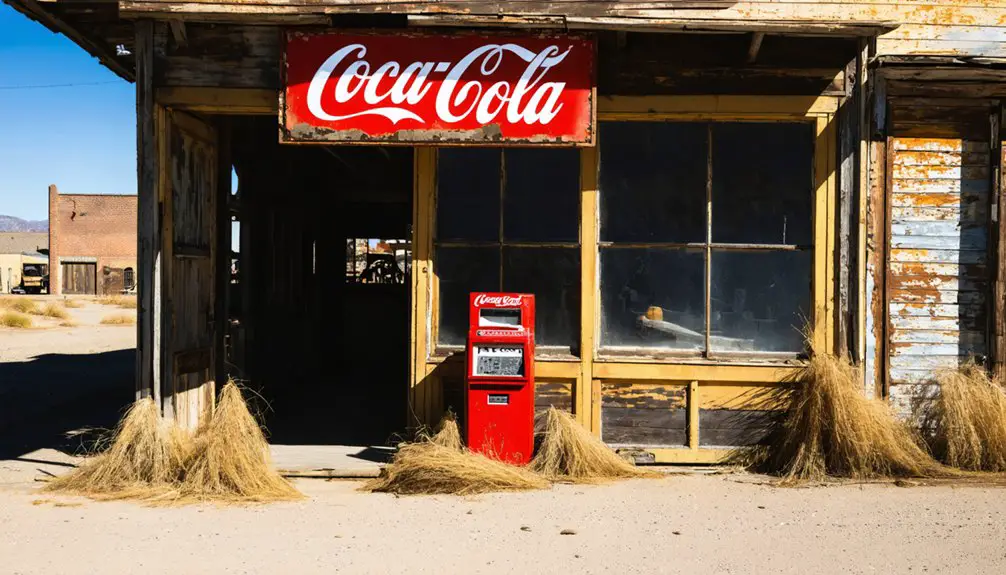
You’ll find Yonkers beneath the waters of Fort Gibson Lake in eastern Oklahoma, where this bustling railroad town once thrived from 1912 to 1933. Named after Yonkers, New York, it served as an essential agricultural hub and trading post along the Grand River, supporting farmers through ferry crossings and railroad shipping. The town met its fate during the Fort Gibson Dam Project, and its submerged foundations now tell fascinating tales of pioneer life and community sacrifice.
Key Takeaways
- Yonkers, Oklahoma was established in 1912 as a railroad town and agricultural hub before being abandoned due to flooding in 1933.
- The town now lies submerged beneath Fort Gibson Lake, with remnants visible during low water periods.
- Fort Gibson Dam’s construction in the 1940s permanently flooded the town site as part of a larger flood control project.
- Physical artifacts, including stone ruins and barbed wire fences, remain underwater as evidence of the former farming community.
- The ghost town represents one of Oklahoma’s 2,000 abandoned communities, specifically those sacrificed for water management development.
The Birth of a Railroad Town
When the Kansas, Oklahoma & Gulf Railroad arrived in 1912, it birthed the town of Yonkers in what would later become Wagoner County, Oklahoma.
You’ll find this settlement’s origins tied directly to railroad expansion across Indian Territory, as William Kenefic named it after its New York counterpart during the development of the rail line.
The town quickly emerged as an essential hub serving farming communities east of the Grand River, where you’d reach it by ferry and wagon roads.
Railroad expansion transformed this once-isolated prairie into a bustling center of commerce, following patterns you’d see across the region, similar to how cattle and lumber loading created Wagoner Switch.
Like many frontier settlements, Yonkers’ town development centered around its depot, with the railroad providing significant links for shipping agricultural products and timber to distant markets.
The community established a post office in 1913 to serve the growing population of settlers and Cherokee residents.
Life Along the Grand River
If you’d traveled to Yonkers in its heyday, you’d have found a bustling riverside community where farmers regularly crossed the Grand River by ferry to trade their goods.
The town’s position along the Grand River made it a natural gathering point for agricultural commerce, with crops and livestock moving both by water and eventually by rail. The region’s rich bottomlands soil supported diverse farming operations typical of the Red River Valley area.
The fertile riverside lands supported numerous farming families who relied on Yonkers as their primary trading hub, creating a web of economic and social connections that defined life in this now-submerged settlement. The area experienced dramatic population growth similar to other Oklahoma settlements after the Land Rush of 1889.
River Transportation Routes
As the lifeblood of northeastern Oklahoma’s early development, the Grand River served as an essential transportation corridor before the era of widespread roads and bridges.
You’ll find evidence of this significant river navigation system throughout the region, where communities like Grove and Wyandotte once depended entirely on waterborne transport.
Key aspects of Grand River transportation that shaped the area:
- Ferry crossings provided critical links between settlements until bridges were constructed in the 1930s and 40s.
- Local merchants relied on river routes to move goods and supplies to market.
- Early residents used the natural waterway for personal travel between riverside communities.
- River transport remained dominant until dam construction and road development transformed the landscape.
Henry Holderman witnessed this transformation when the Pensacola Dam completion in 1940 forever changed these historic transportation patterns, creating Grand Lake and new infrastructure challenges.
The Cherokee National Council established strict licensing requirements and taxes for ferry operations along the river in 1849, ensuring regulated transport services for both tribal members and travelers.
Farming Community Interactions
Life along the Grand River near Yonkers revolved around tight-knit farming communities where families worked together to survive and thrive.
You’d find farmers sharing equipment, seeds, and labor during essential planting and harvest seasons, creating a robust network of community support that defined daily life.
Your success as a farmer depended on maintaining strong relationships with neighbors.
Like many farming towns of the era, Yonkers faced challenges from economic booms and busts that affected agricultural markets.
During barn raisings and harvest festivals, you’d trade surplus crops, share agricultural knowledge, and strengthen social bonds.
These gatherings weren’t just social events – they were critical for economic resilience.
Extended family networks helped manage risks from crop failures and market fluctuations, while shared resources meant everyone could access tools and equipment they couldn’t afford alone.
This interdependence proved especially important given Yonkers’ isolated location east of the Grand River.
Like many of Oklahoma’s estimated two thousand ghost towns, Yonkers’ community spirit wasn’t enough to prevent its eventual decline and abandonment.
Riverside Trading Activities
Trading along the Grand River near Yonkers emerged as an essential economic force during the 1830s, when prominent merchants like Auguste P. Chouteau established trading posts near abandoned military sites. French explorers who ventured into the region during the early 1600s laid the groundwork for future trading activities.
You’ll find the rich history of trading post interactions reflected in the exchange of beaver, deer, and bison pelts for manufactured goods from Illinois and New Orleans. This tradition of commerce continued well into the modern era, with River City Trading opening in 1994 as a vintage and antique mall.
- Spring and fall seasons provided ideal conditions for pirogue navigation
- Trading posts served as critical hubs for Cherokee and Osage commerce
- European goods transformed indigenous economies along the waterway
- Control of river routes determined trading success and expansion
The river’s strategic importance, first noted by Meriwether Lewis in 1806, shaped settlement patterns and created lasting economic networks that would define the region’s development through its early Oklahoma history.
From Cherokee to Wagoner County
When Oklahoma achieved statehood in 1907, Yonkers initially fell within Cherokee County‘s boundaries. You’ll find this detail significant because the town’s county governance shifted dramatically in 1923 when state officials redrew boundary lines, transferring Yonkers to Wagoner County.
This administrative change created interesting challenges for historical documentation, as you’ll discover some records listing Yonkers in Cherokee County while others place it in Wagoner County.
The shift wasn’t just bureaucratic – it affected how the community received public services and infrastructure funding. Located on the Grand River’s east side, north and east of Wagoner, the town’s repositioning likely reflected Oklahoma’s broader efforts to organize governance around natural features like rivers and watersheds.
Economic Boom and Daily Life
Through the bustling Kansas, Oklahoma & Gulf Railroad line established in 1912, Yonkers emerged as an essential agricultural hub serving farms along the Grand River’s east side.
Despite economic challenges like limited road access and river crossings, the town’s community resilience shone through as residents adapted to their relative isolation.
Here’s what made Yonkers thrive during its peak:
- Railroad commerce drove the movement of agricultural goods and supplies
- Mixed Cherokee and white student population attended the local school, fostering cultural integration
- Ferry service across Grand River connected traders and farmers to crucial markets
- Local businesses, including general stores and farm suppliers, supported the agricultural economy
You’d have found a tight-knit community here, where daily life centered around farming, education, and railroad activities until flooding from Fort Gibson Lake led to the town’s eventual abandonment.
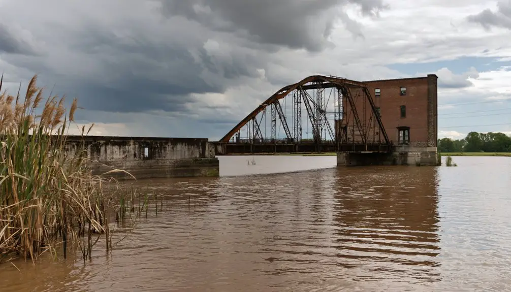
The Fort Gibson Dam Project
As part of the Arkansas River Basin’s extensive flood control plan, the Fort Gibson Dam project launched in 1942 under the Tulsa District Corps of Engineers’ supervision.
World War II briefly halted dam construction until 1946, but crews completed the embankment by June 1949. You’ll find this concrete gravity dam stretching 2,850 feet with an impressive 90-foot height, utilizing over 461,300 cubic yards of concrete.
Despite wartime delays, Fort Gibson Dam emerged as a massive concrete structure, stretching nearly 3,000 feet across the Arkansas River Basin.
The dam’s strategic location manages runoff from a vast 12,615-square-mile watershed, protecting roughly 3,000 acres in the Grand River Valley from flooding.
Working alongside Pensacola and Markham Ferry reservoirs, it’s played a significant role in the region’s post-war development. By September 1953, all four generators were operational, marking the completion of this $42.5 million project that’s transformed the area’s flood control and power generation capabilities.
Legacy Beneath the Waters

You’ll find more than just water when you look down into Fort Gibson Lake, where the submerged foundations of Yonkers tell stories of Oklahoma pioneers and their vanished community.
The town’s physical remnants, from scattered stone ruins to old barbed wire emerging from trees along the shoreline, stand as silent witnesses to the farming families who once called this place home.
While the waters may have claimed the buildings in 1933, Yonkers lives on through local folklore, historical photographs, and the memories of those who understand what lies beneath the surface.
Underwater History Lives On
The underwater legacy of Yonkers, Oklahoma lives on in three distinct ways: its physical remnants beneath Lake Fort Gibson, its cultural memory in local folklore, and its role in Oklahoma’s broader narrative of sacrificed communities.
You’ll find this submerged heritage revealed through:
- Stone foundations and infrastructure that emerge during low water levels
- Local poetry and photographs documenting the town’s underwater archaeology
- Artifacts like barbed wire fences that tell stories of agricultural life
- The one-room schoolhouse foundation where Cherokee and white students once learned together
When you explore Lake Fort Gibson’s shores during water drawdowns, you’re witnessing more than just a drowned town – you’re connecting with a community that gave way to progress, leaving behind physical traces that continue to surface and remind us of Oklahoma’s complex past.
Lost Community Still Remembered
Modern-day visitors to Lake Fort Gibson‘s shores stand where Yonkers once thrived, a community sacrificed in 1933 for Oklahoma’s growing water needs. Below the water’s surface, you’ll find tangible remnants of this lost town – submerged artifacts like building foundations, fallen stones, and barbed wire that tell stories of earlier times.
While the physical town lies underwater, community memories live on through local histories, photographs, and poetry. The one-room schoolhouse‘s skeletal remains serve as a poignant reminder of when Cherokee and white children learned side by side.
You’re witnessing more than just another flooded town; Yonkers represents countless small Oklahoma communities that gave way to 20th-century reservoir projects. Its legacy endures as an archeological treasure and a symbol of rural sacrifice for regional progress.
Waters Hide Pioneer Stories
Beneath Fort Gibson Lake‘s placid surface, pioneer stories linger in the submerged remnants of Yonkers, Oklahoma.
You’ll find traces of pioneer resilience in fallen stones and twisted barbwire, while tree growth patterns mark where a vibrant community once stood. The waters now hide what was once a groundbreaking integrated schoolhouse where Cherokee and white students learned side by side.
- Foundation ruins peek through scrub oaks during low water
- One-room schoolhouse skeleton tells of educational progress
- Barbwire fragments mark old property lines
- Natural markers reveal former homestead locations
These submerged stories aren’t lost – they’re preserved in local memory and photographs, reminding you of the sacrifices made as progress reshaped the landscape.
While Fort Gibson Lake claimed the physical town, it couldn’t erase the legacy of those who called Yonkers home.
Oklahoma’s Submerged History
Across Oklahoma’s vast reservoirs lie the remnants of once-thriving communities, silently preserving stories of displacement and progress. You’ll find nearly 2,000 ghost towns scattered throughout the state, with several, like Yonkers, hidden beneath the waters of man-made lakes.
This submerged heritage tells a unique story of sacrifice for development. When the Fort Gibson Dam project began in 1933, entire communities faced deliberate flooding for the greater good of water management and power generation.
Unlike ghost towns abandoned due to economic decline or resource depletion, these underwater settlements were forcibly surrendered to progress. Today, foundations and artifacts rest peacefully below the surface, while photographs and local archives keep their memories alive, reminding you of Oklahoma’s complex relationship with development and preservation.
Frequently Asked Questions
Were Any Artifacts Recovered From Yonkers Before the Flooding?
You won’t find official records of artifact recovery before flooding, though it’s likely informal discoveries occurred. The artifact significance and recovery methods weren’t documented during that vital pre-flood period.
Did Any Original Yonkers Buildings Survive Relocation to Higher Ground?
You won’t find any confirmed records of building preservation from Yonkers. Despite the historical significance of the town, there’s no evidence that any original structures survived relocation before the flooding occurred.
What Happened to the Railroad Tracks After the Town’s Submergence?
You’ll find no track preservation here – the railroad history ended when Fort Gibson Lake submerged the Kansas, Oklahoma & Gulf Railroad tracks completely. They weren’t relocated, just abandoned beneath the waters.
How Deep Underwater Is the Former Town Site Today?
You’d need a submarine to reach this slice of town history, as it rests under dozens of feet of Fort Gibson Lake’s waters, with exact underwater exploration depths varying by seasonal levels.
Are There Any Surviving Photographs of Yonkers Before Its Flooding?
You won’t find many surviving pre-flood photos of the town, despite its historical significance. While local ghost stories keep its memory alive, documented images are limited to ruins exposed during low water levels.
References
- https://www.okgenweb.net/~okwagone/roundup.html
- https://en.wikipedia.org/wiki/List_of_ghost_towns_in_Oklahoma
- https://www.ghosttowns.com/states/ok/yonkers.html
- https://kids.kiddle.co/List_of_ghost_towns_in_Oklahoma
- https://www.okhistory.org/publications/enc/entry?entry=WA003
- https://www.oml.org/municipal-messenger/2020/7/23/from-historical-prominence-the-wagoner-depot-has-returned-home
- https://oklahomarailwaymuseum.org/wp-content/uploads/2023/03/A-Brief-History-Of-Oklahoma-Railroads.pdf
- https://yonkerstimes.com/on-this-day-in-yonkers-history-173/
- https://www.okhistory.org/publications/enc/entry?entry=WA002
- https://www.nps.gov/jeff/planyourvisit/settlement-of-the-southern-plains.htm


