You’ll find Beaver’s haunting story in Minnesota’s Whitewater River Valley, where settlers established a thriving farming community in the mid-1800s. Poor agricultural practices, including deep plowing and vegetation removal, triggered devastating soil erosion. By the 1920s, the town faced up to 28 floods annually, burying croplands under sand and silt. After the Dust Bowl’s final blow in the 1930s, Beaver vanished by 1940, leaving only its cemetery to tell a cautionary environmental tale.
Key Takeaways
- Beaver was a thriving settlement in Minnesota’s Whitewater River Valley during the mid-1800s before environmental disasters led to its abandonment.
- Severe flooding with up to 28 events annually in the 1930s devastated farmland and ultimately contributed to the town’s demise.
- The Dust Bowl buried portions of Beaver in topsoil, while unsustainable farming practices caused severe erosion throughout the region.
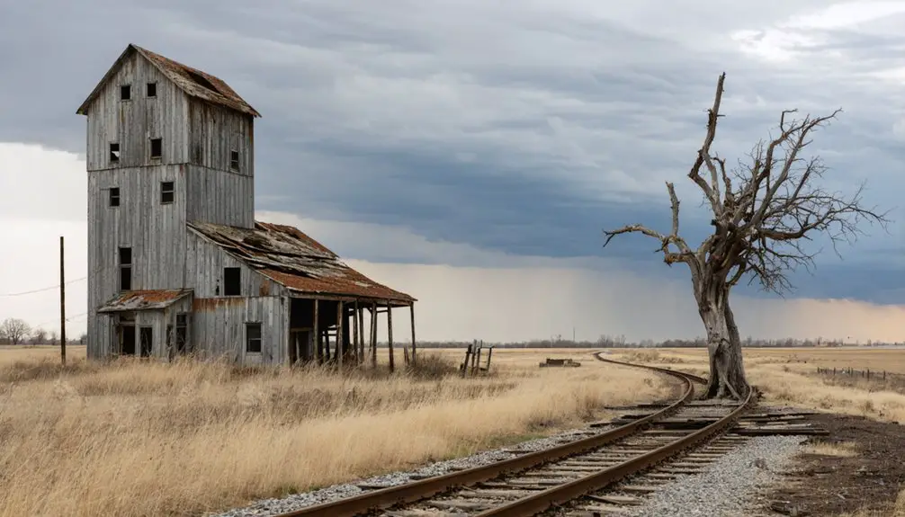
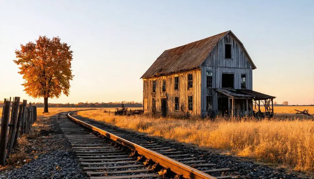
- No buildings remain at the former town site, which lies buried beneath layers of silt, with only the cemetery surviving.
- The ghost town’s story serves as a cautionary tale about environmental mismanagement and the consequences of unsustainable agricultural practices.
The Rise of a Farming Community
As the Whitewater River Valley beckoned settlers in the mid-1800s, farming took root on the steep slopes and floodplains near Beaver, Minnesota. You’d have found early farmers struggling with rudimentary farming techniques, unaware of the environmental impact their methods would have on the soil. Before agriculture dominated the region, fur trading posts had been established throughout Minnesota by French settlers.
The community growth centered around wheat production, making southeastern Minnesota counties the region’s leading producers. Without access to modern conservation methods, farmers in the area experienced up to 20 floods annually during the 1920s.
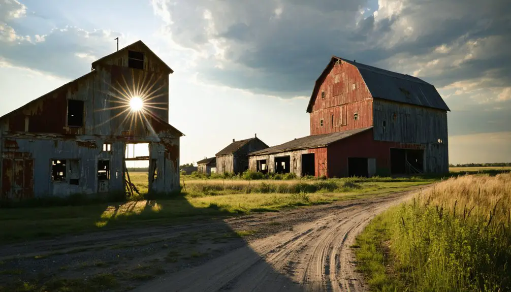
You’ll notice the landscape dotted with threshing barns built between the 1850s and 1870s – massive timber-framed structures that became the heart of farm operations. These three-bay buildings housed livestock below while storing hay and feed above.
Environmental Warning Signs
You’ll notice the first major environmental warning signs in Beaver during the 1930s Dust Bowl, when wind erosion buried portions of the town in silty topsoil from nearby fields.
Deep plowing practices left farmers vulnerable to devastating soil loss, with high winds carrying away precious topsoil and depositing it in Beaver Creek valley.
When intense rains hit these eroded and deposited soils, they created destructive muddy torrents that damaged both local streams and agricultural fields.
Like many ghost town remains across America, the environmental devastation permanently altered the landscape and contributed to the town’s abandonment.
The erosion was so severe that soil from the area traveled as far as Washington D.C. during peak wind events.
Soil Erosion Warning Signs
Recognizing soil erosion warning signs can help prevent devastating property damage and environmental deterioration in Beaver’s ghost town landscape.
You’ll want to look for exposed tree roots, uneven ground formations, and persistent water pooling as primary indicators that soil’s being washed away. Through regular soil monitoring, you can spot developing cracks and rills before they evolve into dangerous gullies. Wind erosion in arid areas can rapidly sweep away precious topsoil.
Watch for tilting fences, foundation cracks, and undermined sidewalks that signal serious structural threats. Regular drain cleaning will help maintain proper stormwater management and prevent flooding issues. If you notice sediment-laden runoff or debris accumulation near water paths, it’s time to implement erosion control measures.
Pay special attention to steep slopes and areas where vegetation’s been removed, as these conditions accelerate soil loss. Early detection through systematic property inspection helps you maintain your land’s integrity and avoid costly environmental damage.
Heavy Rain Danger Signals
While soil erosion poses significant risks to Beaver’s landscape, heavy rainfall presents its own set of distinct warning signals that demand attention.
You’ll notice the first signs when dark, dense clouds gather overhead, often accompanied by unusually white, ice-like formations that signal approaching storms. Your heavy rain preparedness should intensify when westward winds pick up, especially during periods of high heat. When rainfall reaches 50 millimeters within twelve hours, immediate precautionary measures are necessary. Official warning systems operate continuously to monitor and alert residents about dangerous weather conditions.
For precise rainfall measurement, you can rely on both traditional and modern tools. Local rain gauges provide exact readings, while radar systems track broader storm patterns.
When you observe rapid wind shifts combined with rising humidity, it’s time to act. Watch for these indicators carefully – they’re your key to protecting yourself and your property from Beaver’s potentially dangerous rainfall events.
The Devastating Impact of Poor Agricultural Practices
As Beaver’s settlers expanded their agricultural operations in the late 1800s, a series of devastating farming practices set in motion the town’s eventual downfall.
Without considering agricultural sustainability, farmers stripped native vegetation from steep slopes and floodplains, triggering massive soil erosion. You’ll find they practiced continuous wheat monoculture, depleting soil nutrients by the mid-1870s and forcing expansion into new prairie lands. Similar to Minnesota’s recent troubles, farmers saw income drop dramatically as poor practices caught up with them.
These short-sighted farming innovations backfired spectacularly. The altered landscape couldn’t retain water, leading to severe flooding – up to 28 floods in 1938 alone. Floods deposited 15-foot sediment layers, burying crops and homes. By 1932, many farmers faced financial ruin as corn prices plummeted to just 28 cents per bushel.
Life in the Whitewater Valley
The Whitewater Valley‘s story begins long before Beaver’s agricultural decline, back when Dakota people called the river “Minneiska” for its milky-white appearance during spring thaws.
By the 1870s, settlement patterns had shifted dramatically as pioneers like Emanuel Hessig established homesteads in what was once pristine wilderness.
You’d have found about 100 farms dotting the landscape by 1900, transforming native prairie into a patchwork of wheat and corn fields.
Community dynamics centered around small-town life, with villages like Beaver and Whitewater Falls springing up along the river’s course.
The valley’s rich, fertile soil supported a thriving agricultural economy where farmers worked the land their families called home.
The river’s steady flow of 133 cubic feet per second sustained the region’s growing population.
The Path to Abandonment

You’ll find that Beaver’s decline began with deep plowing practices that stripped protective soil layers, leaving farmland vulnerable to devastating wind erosion during the Dust Bowl era.
The exposed fields suffered severe degradation as winds carried away precious topsoil, while intense rainstorms created muddy torrents that repeatedly flooded the valley below.
Erosion Destabilizes Farm Life
During the early 1900s, intensive farming practices in Beaver triggered a devastating chain of environmental consequences that would ultimately lead to the town’s abandonment.
Without erosion control measures, deep plowing destroyed native prairie root systems, leaving loose topsoil vulnerable to wind and water erosion. You’d have witnessed the devastating results as eroded soil washed into valleys, clogging streams and creating unstable, muddy torrents.
The lack of sustainable farming practices led to catastrophic flooding, with Beaver experiencing 20-28 flood events annually during the 1920s and 1930s.
These floods buried cropland under feet of sand and silt, making agriculture impossible. As streambank erosion claimed roughly 80 acres of farmland yearly in the watershed, repeated evacuations and crop failures forced many to abandon their lands, contributing to Beaver’s eventual demise by 1940.
Floods Force Final Exodus
As erosion devastated Beaver’s farmland, catastrophic flooding delivered the final blow to this once-thriving community.
Throughout the 1920s, you’d have witnessed up to 20 floods annually, testing community resilience as waters repeatedly destroyed crops and homes.
The situation worsened until 1938’s peak of 28 floods, when sediment-laden waters buried structures under 15 feet of mud.
What Remains Today
The former site of Beaver, Minnesota lies buried beneath layers of silty topsoil, a consequence of severe wind erosion during the Dust Bowl era. You won’t find any standing structures in this ghost town today – natural forces have erased visible traces of human habitation.
The most tangible connection to the past is the cemetery, where you’ll discover graves of former residents during cemetery visits. It’s become a focal point for descendants researching their family histories.
Archaeological challenges make exploring the original town site difficult without specialized equipment. If you’re hoping to uncover artifacts, you’ll need more than surface-level observation – deep soil probes have revealed thick deposits where buildings once stood.
Metal detecting enthusiasts occasionally search the area, though most historical remnants remain buried in the heavily altered landscape.
Legacy in Minnesota’s History
Once the most populous settlement in the Whitewater River Valley, Beaver’s legacy endures as a stark reminder of environmental mismanagement and rural resilience in Minnesota’s history.
Through deep plowing and poor land management, settlers inadvertently triggered devastating soil erosion that, combined with the Dust Bowl era, sealed the town’s fate. You’ll find Beaver’s cultural memory preserved primarily through oral histories and the haunting presence of its cemetery, where local folklore speaks of a cursed ring of trees.
Today, preservation efforts have transformed Beaver’s cautionary tale into valuable lessons about sustainable farming practices. The town’s history lives on through “The Beaver Story” and other documented accounts, while descendants maintain connections through genealogical research, ensuring this chapter of Minnesota’s rural past won’t be forgotten.
Frequently Asked Questions
Were Any Efforts Made to Save Beaver Before Its Complete Abandonment?
You won’t find records of any community preservation attempts or recognition of Beaver’s historical significance. Environmental disasters struck too quickly, and neither government nor locals mounted organized rescue efforts.
What Happened to the Buildings and Structures After Residents Left?
You’d be amazed how quickly Mother Nature reclaims her turf! Buildings decayed naturally from weather exposure, while salvagers stripped valuable materials. Without historical preservation efforts, structures rotted, collapsed, and vanished beneath soil deposits.
Did Any Families Choose to Stay Despite the Environmental Challenges?
You’ll find remarkable family resilience in the Wichmann, Ahrens, and Schaefer families, who adapted to stay despite environmental challenges, though they represented a tiny fraction of Beaver’s original population.
Are There Any Surviving Photographs of Beaver During Its Prime Years?
You won’t find widely available historical archives with photographs of Beaver during its prime. While some photographic documentation may exist in private collections, public records don’t contain verified images of the town’s peak years.
What Was the Peak Population of Beaver Before Its Decline?
Like a whisper lost to time, you’ll find Beaver’s exact peak population isn’t documented, but historical records suggest it likely housed fewer than 200 residents before environmental disasters triggered its population decline.
References
- https://freshwater.org/2020/02/12/a-minnesota-ghost-story/
- https://www.minnesotahistory.org/post/a-complete-guide-to-the-ghost-towns-of-hennepin-county
- https://www.treasurenet.com/threads/ghost-town-of-beaver-minnesota.326391/
- https://kroc.com/9-strange-ghost-towns-within-100-miles-of-rochester-minnesota/
- https://friendsofwhitewater.weebly.com/resources.html
- https://openrivers.lib.umn.edu/article/whitewater-valley/
- https://mntrappers.org/history-2/
- https://www.dot.state.mn.us/culturalresources/docs/crunit/elementstw.pdf
- http://joshkwinkler.com/blog/2020/6/24/connection-to-minnesotas-forests-past-present-and-future-2-a-deeper-look-at-land-near-home
- https://twin-cities.umn.edu/news-events/beavers-support-freshwater-conservation-and-ecosystem-stability