You’ll find exceptional drone photography opportunities at Missouri’s ghost towns like Allenton, Times Beach, and Indian Ridge Resort. These locations offer diverse structural subjects, from abandoned mills to modern development ruins, with varied landscapes that create natural framing. You’ll need FAA certifications, local permits, and proper gear including a lightweight drone and ND filters. Early morning or late afternoon shoots yield the most dramatic results, though each site holds unique preservation stories waiting to be discovered through your lens.
Key Takeaways
- Times Beach offers exceptional drone photography opportunities with its iconic Warren truss bridge and historic Bridgehead Inn ruins.
- Allenton’s grid layout provides unique aerial perspectives of abandoned streets and nature reclaiming urban spaces.
- Indian Ridge Resort features modern ruins with striking geometric patterns formed by unfinished duplexes and road networks.
- Moselle’s location in Franklin County’s Ozark terrain creates dramatic landscapes perfect for aerial photography during golden hour.
- Historic mill sites like Missouri Mines and Hodgson Mill offer compelling industrial subjects with excellent natural lighting conditions.
Why Missouri’s Ghost Towns Are Perfect for Drone Photography
While many states offer abandoned locations for aerial photography, Missouri’s ghost towns present an unparalleled combination of features that make them ideal for drone work.
You’ll find diverse structural subjects from abandoned mills to resort ruins, creating compelling geometric patterns perfect for urban exploration through your lens. The state’s varied landscapes provide natural frames, while seasonal changes offer distinct photographic techniques throughout the year. The one-lane bridge access to sites like Allenton creates unique perspectives for aerial shots. Late day shoots often produce stunning footage, though photographers should note that lighting conditions may appear washed out.
The accessibility of these sites along major routes like I-44 and Route 66 means you can maximize your shooting time.
Many locations feature multiple vantage points, from wide architectural remains to intimate foundation details. With golden hour light painting dramatic shadows across decaying structures and fog rolling through river valleys, you’ll capture the haunting beauty of Missouri’s forgotten places from perspectives few have seen.
Essential Gear and Equipment for Ghost Town Aerial Shoots
Successful ghost town drone photography requires a carefully curated collection of specialized equipment beyond just the drone itself.
Capturing abandoned places from above demands more than a drone – it requires strategic gear selection and technical preparation.
You’ll need a lightweight camera drone like the Mavic Mini series for maneuvering tight spaces between deteriorating structures, along with at least three batteries to maximize your shooting time at remote Missouri locations.
Pack essential drone maintenance items including spare propellers, ND filters, and a landing pad to protect your gear from rough terrain.
For image processing flexibility, shoot in RAW format and use exposure bracketing to capture the full dynamic range of shadowy interiors and sun-bleached exteriors.
Don’t forget safety gear – bring protective eyewear, dust masks, and a laser rangefinder to assess structural hazards before flight.
A portable charging station will keep you powered through long days documenting these historic sites.
Consider bringing a sturdy tripod for supplementary ground-based shots during your aerial photography sessions.
When scouting locations, maintain a safe distance from any parked vehicles that could indicate security presence on site.
Understanding Local Drone Laws and Permissions
Before launching your drone over Missouri’s historic ghost towns, you’ll need to navigate a complex web of federal, state, and local regulations that govern aerial photography.
Make sure you’ve obtained your FAA Remote Pilot Certificate for commercial shoots or completed TRUST certification for recreational flights. Your drone must comply with Remote ID requirements and stay below 400 feet. Sound levels must remain under 98 decibels when measured from 50 feet away.
Check county and municipal ordinances for specific drone regulations and secure necessary permits before filming. The City of Columbia restricts drone operations to designated areas in public parks.
Many ghost towns sit on public lands or near historic sites, requiring additional permissions from local authorities. You’ll need liability insurance in certain jurisdictions, like Jackson County, where specific coverage requirements apply.
Exploring ghost towns in Missouri cinema history can reveal fascinating insights into how these locations have been portrayed in various films. Many filmmakers have chosen these abandoned sites for their eerie charm and unique backdrops, adding to the allure of Missouri’s cinematic legacy. As you delve into the stories behind the films, you’ll discover how these ghost towns contribute to the region’s cultural identity.
For those seeking adventure, ghost towns near Missouri’s Ozarks offer an intriguing glimpse into the past. Wander through their crumbling structures and uncover the rich history that makes each location unique. Whether you’re a history buff or simply looking for an unusual destination, these towns promise an experience filled with mystery and exploration.
Remember that while ghost towns may appear abandoned, they’re often protected historic sites with unique preservation rules that affect drone operations.
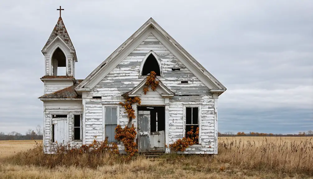
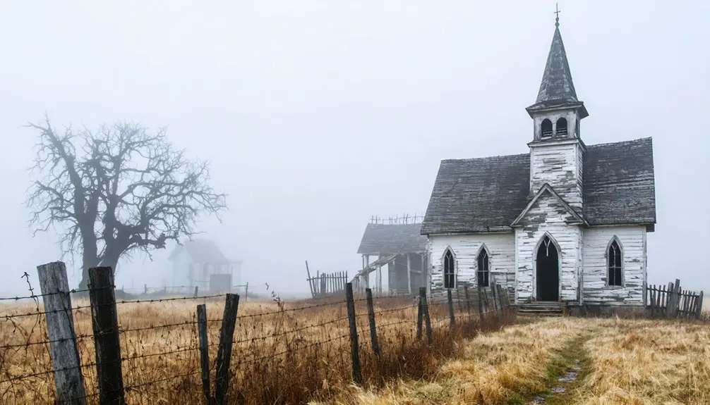
The Historic Allenton Settlement From Above
From above, you’ll discover Allenton’s grid-like ruins showcase the stark geometry of abandoned streets against encroaching vegetation near the Missouri Pacific Railroad line.
You must obtain proper clearance to fly your drone here, as the settlement borders active railroad property and the remaining stone structure sits within restricted airspace.
Your aerial footage can help document the town’s physical transformation since its 1985 disincorporation, capturing the contrast between overgrown pathways and surviving architectural fragments. The area once contained forty-five houses before becoming completely vacant by 2006.
The historic settlement’s remains have been steadily reclaimed by rough cut stone, with one surviving building standing as testament to its architectural past.
Aerial Ruins Showcase Patterns
While nature slowly reclaims Allenton’s abandoned streets, the ghost town’s underlying grid pattern creates a striking aerial canvas for drone photographers.
You’ll capture remarkable aerial patterns where overgrown vegetation interweaves with the remnants of civilization, showcasing nature’s gradual urban reclamation of this once-bustling railroad community.
From above, you can document the contrast between the linear railroad viaduct and the meandering Meramec floodplain.
The historic stone building stands as a solitary sentinel among the wilderness, while Lost Hill’s farm structures provide compelling elevated reference points.
The controversial imminent domain removal in 2006 left an eerie vacancy that your drone footage will reveal as the horseshoe bend’s eroded landforms intersect with the geometric precision of abandoned streets, creating a unique tapestry that tells Allenton’s story of transformation from thriving town to atmospheric ruin.
The town’s Route 66 alignment from 1932 to 1977 remains visible from above as a ghostly reminder of America’s historic highway system.
To safely capture aerial images of Allenton’s historic ruins, you’ll need to understand the complex property boundaries governing railroad infrastructure in the area.
Even abandoned-looking tracks may remain private property under railroad control, requiring explicit permission for drone flights. Don’t assume unused corridors are public spaces – Missouri trespass laws apply.
Before launching your drone, verify track status through Surface Transportation Board records and county plat maps. Railroad easements often remain active despite minimal train traffic.
While FAA regulations permit certain airspace access, they don’t override property rights for low-altitude operations. Check with Missouri Pacific’s successors and local recorders to confirm ownership.
This due diligence protects both your legal interests and the historic site’s preservation while allowing you to document Allenton’s vanishing railroad heritage.
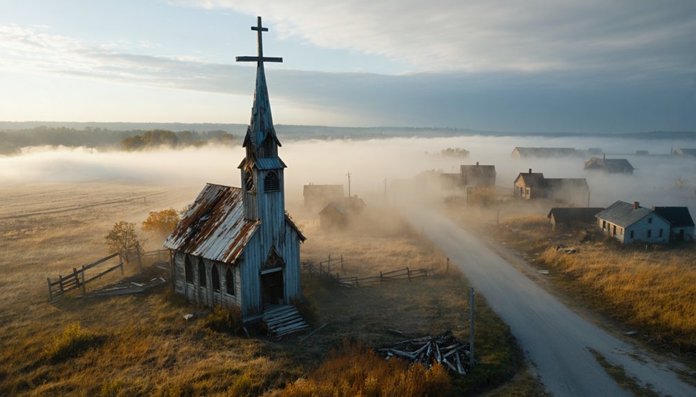
Capturing Route 66’s Abandoned Legacy at Times Beach
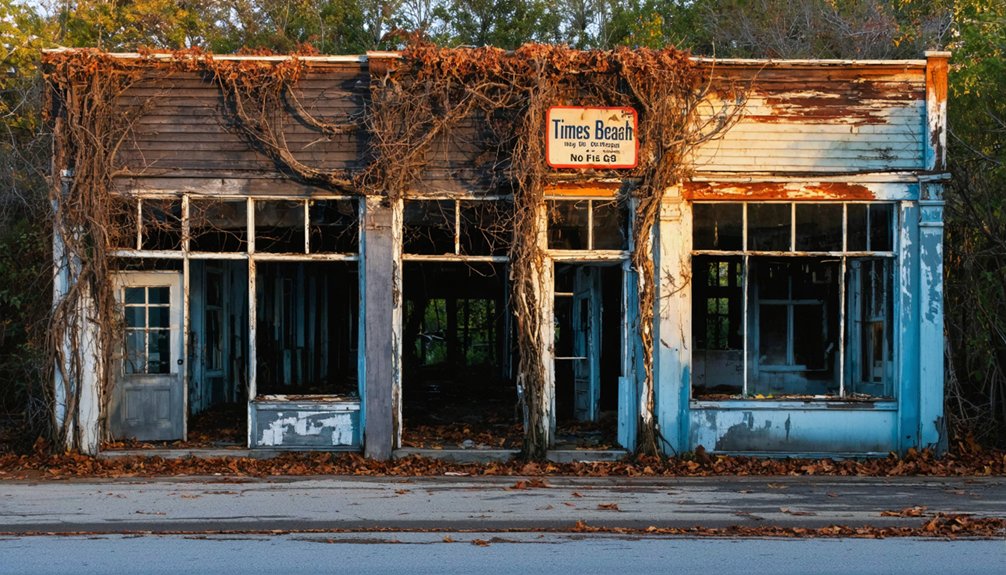
Once a thriving Route 66 resort town turned environmental disaster site, Times Beach now offers drone photographers a unique opportunity to document America’s abandoned roadside heritage.
From a drone perspective, you’ll capture compelling evidence of this location’s complex history while respecting current park boundaries.
Key aerial shots to evaluate:
- The rusted 1932 Warren truss bridge spanning the Meramec River, showcasing classic Route 66 engineering
- Subtle ground patterns revealing former street grids beneath the park’s grassy terrain
- The historic Bridgehead Inn, now serving as the visitor center, with its distinctive 1930s architecture
- Dramatic river overlooks contrasting with I-44’s modern bypass, highlighting Times Beach’s isolation
Remember to maintain safe distances from structures while documenting this transformed landscape that’s finally healed after decades of environmental recovery.
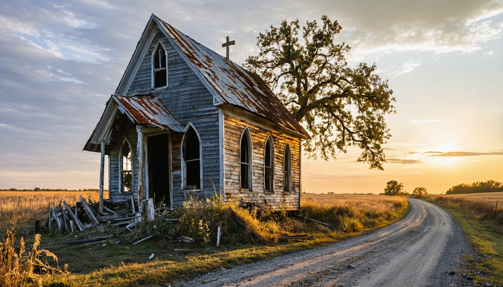
Hidden Gems in the Ozark Mountains: Moselle and Beyond
Deep in Franklin County’s Ozark terrain, Moselle stands as a photographer’s paradise of industrial decay and forgotten history.
You’ll find hollow homes and abandoned streets that tell the tale of a once-thriving mining community that produced 10,000 tons of iron ore during the 1870s. The site’s mining legacy continues to intrigue visitors, with remnants of railroad ties and equipment scattered throughout.
Your drone can capture stunning aerial perspectives of the flooded mine pit, where a 1953 mystery remains unsolved – three men allegedly disposed of an unknown object in its murky waters.
The surrounding Ozark Mountains create a dramatic backdrop as you document the ghost town’s haunting beauty. From above, you’ll reveal Moselle’s industrial past while preserving its visual story for future generations.
Indian Ridge Resort: A Modern Ghost Town Paradise
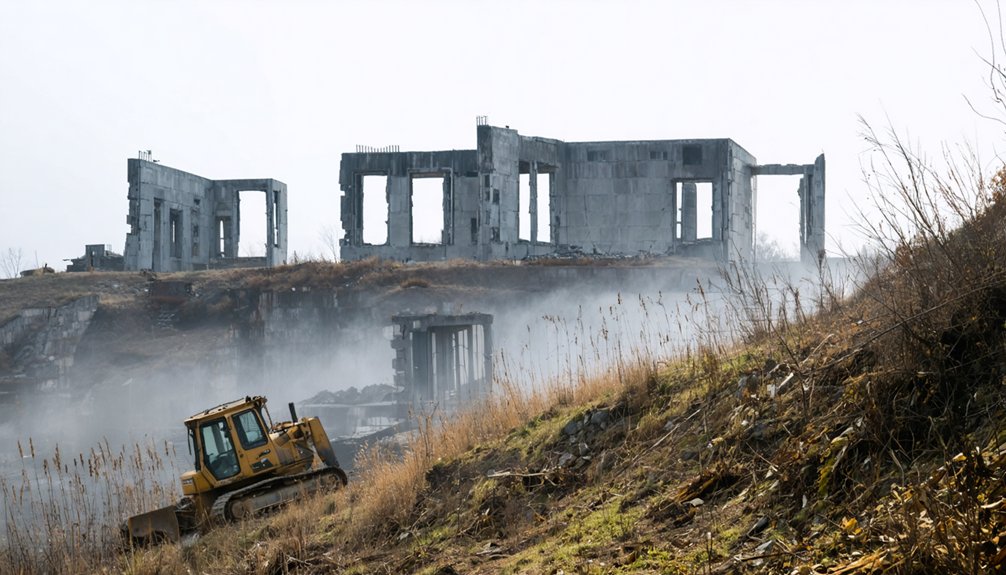
While modern ghost towns rarely match the mystique of century-old ruins, Indian Ridge Resort near Branson, Missouri stands as a haunting reminder to the 2008 financial crisis.
You’ll find this 900-acre monument to failed ambition stretching from Table Rock Lake to Highways 13 and 76, visible from Silver Dollar City’s exit.
For drone photographers seeking unique aerial compositions, Indian Ridge offers:
- Stripped-out duplex shells resembling dystopian McMansions
- Abandoned roads creating geometric patterns against untamed nature
- Lake-to-highway panoramic sweeps capturing the full scope of decay
- Textured contrasts between crumbling infrastructure and encroaching wilderness
While urban exploration of these abandoned structures remains restricted, the site’s ongoing demolition marks the final chapter of this $1.6 billion development’s cautionary tale.
Exploring Historic Mill Sites Through Your Drone’s Lens
Historic mill sites across the Ozarks region present exceptional opportunities for aerial photography, with structures like Missouri Mines State Historic Site and Hodgson Mill offering unique perspectives on America’s industrial heritage.
You’ll find prime drone photography techniques include capturing the interplay of natural springs and weathered foundations against rugged landscapes.
At Missouri Mines, your DJI Mavic Pro can document the preserved powerhouse and processing facilities, while Hodgson Mill rewards pilots with compositions featuring its spring-fed pond setting.
For ideal mill site history documentation, explore the granite shut-ins near Millstream Gardens, where eroded potholes and historic structures merge.
Focus your aerial work during golden hour to highlight the textural details of abandoned timberworks and grist operations, capturing these preservation-worthy landmarks before they succumb to time.
Best Times and Weather Conditions for Ghost Town Photography
Three prime conditions define successful ghost town drone photography: golden hour lighting, stable winds under 10 mph, and clear visibility.
In Missouri’s ghost towns, you’ll find ideal timings during sunrise and sunset when warm tones illuminate abandoned structures and create dramatic shadows. Weather impacts can make or break your shoot, so timing is vital.
- Plan flights during golden hours (30 minutes after sunrise or before sunset) to capture long shadows across deteriorating mill foundations.
- Use overcast conditions to highlight textural details in limestone ruins and weathered wood.
- Monitor wind patterns through drone apps – Missouri’s spring mornings typically offer the calmest conditions.
- Schedule twilight shoots 10 minutes after sunset when ambient light balances with any remaining artificial illumination.
Consider carrying backup batteries in temperature-controlled cases, as Missouri’s humidity can affect performance.
Planning Your Ghost Town Drone Photography Adventure
Before you launch your drone at any ghost town site, thoroughly research legal permissions, verify site ownership, and obtain necessary permits to avoid trespassing violations or disrupting historically protected areas.
You’ll need to conduct a detailed site assessment, including identifying hazards like unstable structures, mapping safe launch zones away from obstacles, and checking airspace restrictions through FAA resources.
Your essential gear should include not just your drone and backup equipment, but also protective gear for ground operations and detailed maps marking emergency landing zones and evacuation routes.
Scout First, Shoot Later
When planning a ghost town drone photography expedition in Missouri, thorough scouting becomes essential for capturing compelling aerial footage. Your pre-shoot reconnaissance will determine ideal flight paths and lighting conditions while ensuring respectful documentation of these historic sites.
Additionally, exploring astrophotography spots in Missouri can enhance your creative portfolio, providing stunning night sky backdrops to your drone footage. When scouting these locations, it’s crucial to consider factors like light pollution and seasonal meteor activity to maximize your captures. Engaging with local astronomy clubs may also yield valuable insights on the best times and techniques for photographing celestial events.
- Start with satellite imagery analysis using Google Earth’s historical views, particularly useful for locations like Allenton where structural changes occurred between 1990-2013.
- Visit during different seasons to assess lighting – Turkey Hollow’s timber density appears best in fall, while Hodgson Mill creates dramatic winter compositions.
- Map multiple access points, noting that Allenton requires specific crossing paths near I-44.
- Document seasonal variations through ground-level scouting before launching your drone, as sites like Indian Ridge Resort display distinct characteristics throughout the year.
These scouting techniques will maximize your shooting strategies while preserving these forgotten places through your lens.
Safety and Legal Prep
Proper safety protocols and legal compliance form the bedrock of successful ghost town drone photography in Missouri.
You’ll need to register your drone with the FAA if it’s over 0.55 pounds and obtain your TRUST certificate before launching at any abandoned site. Keep your drone under 400 feet and maintain visual contact throughout your flight.
For ghost towns like Allenton or Times Beach, verify public access rights and watch for hazards like unstable structures and wildlife.
You’re responsible for following state restrictions near critical infrastructure, especially around I-44. Respect private property boundaries and secure permission when required.
Pack emergency supplies, check weather conditions, and guarantee cell coverage for remote locations. Notify local authorities of your planned activities, particularly in St. Louis County where additional permits may apply.
Essential Gear Checklist
When photographing Missouri’s historic architecture from aerial perspectives, your gear setup makes or breaks the shoot.
Pack these essential items to capture these preserved places effectively:
- Primary flight gear including your drone body with gimbal, controller, minimum three extra batteries, and charging equipment for extended sessions documenting multiple structures.
- High-speed 128GB microSD cards from reliable brands, plus backups to guarantee you never lose irreplaceable footage of these vanishing sites.
- ND filters and polarizers to handle harsh midday sun reflecting off weathered metal roofs and aged glass windows.
- Anti-collision lights rated for 3-mile visibility and proper strobe lighting if shooting during golden hour or dusk, when ghost towns take on an especially atmospheric quality.
Always bring a landing pad to protect your gear from the dusty, uneven terrain typical of abandoned sites.
Frequently Asked Questions
How Do I Protect My Drone From Wildlife Encounters in Abandoned Areas?
You’ll prevent wildlife encounters by flying above 200ft, using protective cages, conducting site scans for nests, avoiding dawn/dusk flights, and maintaining drone safety with quick ascent capabilities when threatened.
What Backup Power Options Exist When Shooting in Remote Ghost Towns?
Like a power oasis in the desert, you’ll want portable generators and solar chargers to keep your drone flying. Pack high-capacity power banks and car inverters for reliable backup when exploring remote ruins.
Are There Seasonal Changes That Affect Ghost Town Drone Photography Quality?
You’ll get ideal footage during autumn’s leaf-off period with stable weather conditions and warm directional lighting. Winter offers high contrast but shorter days, while summer’s dense foliage reduces structural visibility.
How Can I Safely Photograph Partially Collapsed Structures Without Risking Damage?
90% of structure collapses occur without warning. You’ll need to maintain 50+ feet distance, use your drone’s zoom capabilities, and verify structural integrity before approaching any unstable ghost town buildings.
Which Drone Filters Work Best for Capturing Weathered Textures and Details?
You’ll get the best texture detail using polarizing filters to cut glare on weathered surfaces, while ND filters help control exposure for rich shadows and highlights in historic materials.
References
- https://www.youtube.com/watch?v=PbcXSyYHQDw
- https://www.youtube.com/watch?v=GHc0hzMIhW4
- https://www.onlyinyourstate.com/stays/missouri/indian-ridge-resort-mo
- https://www.youtube.com/watch?v=3HrCTAG7t1U
- https://www.youtube.com/watch?v=jJlHdFomYdc
- https://101theeagle.com/take-a-lonely-walk-thru-missouri-ghost-towns-lost-in-the-past/
- https://www.youtube.com/watch?v=DV62UyUMNBg
- https://store.bandccamera.com/blogs/how-to/photographing-ghost-towns
- https://www.youtube.com/watch?v=Ec72UKlZy6Y
- https://petapixel.com/2022/07/15/spectacular-drone-footage-of-an-8th-century-italian-ghost-town/