You’ll find Alaska’s most photogenic ghost towns at Kennecott Mill, with its iconic 14-story red concentration mill, and Treadwell Ruins, where gold mining structures meet tidal waters. For ideal drone shots, visit between June and August when you’ll get 20+ hours of daylight and stable weather conditions. Target early mornings for calm conditions and golden hour lighting at sites like Dyea’s lost port and the Fortymile District. These historic locations reveal deeper stories through their aerial perspectives.
Key Takeaways
- Kennecott Mill offers stunning drone shots of its 14-story concentration mill and aerial tramway lines against mountain backdrops.
- Treadwell Ruins provides exceptional aerial photography of crumbling mill foundations and geometric concrete structures along tidal waters.
- Dyea’s abandoned port features dramatic tidal flats and hidden foundations beneath forest canopy, ideal for historical perspective shots.
- The Fortymile District showcases extensive gold mining remnants at Bonanza Bar and Franklin Creek with well-preserved claim sites.
- Coastal cannery ruins, particularly at Funter Bay and Taku Harbor, present unique aerial perspectives of collapsed tanks and historic pilings.
Planning Your Ghost Town Drone Adventure
When planning a drone photography expedition to Alaska’s ghost towns, you’ll need to carefully consider access routes, seasonal conditions, and permit requirements for each location.
Ghost town accessibility varies greatly: Kennicott requires a high-clearance vehicle or shuttle after a 5-mile bike ride, while Taku Harbor demands boat access 20 miles from Juneau. The abandoned town of Sulzer is accessible only by boat as well.
Reaching Alaska’s haunting ghost towns demands persistence – from rugged mountain roads to remote waterways, each site presents its own access challenges.
For the best drone shots, time your visits strategically. Summer offers the best conditions at Unga Island and Pilgrim Hot Springs, while Forty Mile’s dramatic weather creates stunning opportunities until the September 25th border closure. High winds and icy rain can make summit filming particularly challenging.
Check specific photography regulations before launch – the National Park Service oversees drone operations at Kennicott’s historic structures, and you’ll need to respect preservation work.
Each location presents unique challenges, from Dyea’s Klondike-era trails to Hyder’s bear viewing platforms.
Essential Equipment and Safety Guidelines
Selecting the right drone equipment proves critical for capturing Alaska’s remote ghost towns effectively.
For enthusiasts looking for adventure, ghost towns explored by atv offer a unique glimpse into the past. These desolate locations, often tucked away in the wilderness, provide thrilling experiences for those willing to venture off the beaten path. Capturing their haunting beauty with drone equipment enhances the exploration, allowing for stunning aerial views that showcase both the rugged landscape and the remnants of history.
The DJI Mavic 3 CINE excels at capturing intricate architectural details in wide, sweeping shots of abandoned structures.
You’ll want a drone with integrated obstacle sensing and at least a 1-inch sensor for detailed architectural shots. Pack multiple batteries that’ll give you 30-40 minutes of total flight time, considering the cold weather’s impact on battery life. Consider getting a Two-Way Charging Hub for simultaneous charging of three batteries in the field.
For equipment selection, prioritize travel-ready drones under 250g to minimize regulatory hurdles.
Don’t forget essential ND filters for harsh Alaskan light and high-capacity microSD cards for RAW files. Your drone safety kit should include a satellite communicator, bright landing pad, and first-aid supplies. Keep spare props and tools handy for field repairs.
Remember to maintain conservative distance from unstable structures and always calibrate your compass before flights in these remote locations.
Weather Windows and Seasonal Considerations
You’ll find Alaska’s ideal drone photography window during the summer months of June through August, when daylight stretches up to 24 hours above the Arctic Circle and weather conditions stabilize across most ghost town locations.
Your flight planning must account for regional variations, from Southeast Alaska’s frequent rain patterns to the Aleutians’ persistent high winds, with early mornings typically offering the calmest conditions for aerial work. The steep cliffs of abandoned Ukivok village present particularly challenging wind conditions for drone operators. Taku Harbor ruins provide excellent aerial subjects with their remaining pilings and dock structures gradually being reclaimed by nature.
For ghost towns like Kennicott and Treadwell, you’re best targeting the peak season of late June through early September, when clear skies and stable conditions maximize your chances of capturing high-quality aerial footage before winter weather systems move in.
Peak Seasonal Light Windows
To capture Alaska’s ghost towns through drone photography, understanding the state’s unique seasonal light patterns proves essential across its diverse regions.
Among the best ghost towns in Alaska, each location tells a story of exploration and abandonment that captures the imagination. The interplay of light and shadow across these historic sites offers stunning visuals, perfect for showcasing the allure of the Alaskan wilderness. As the seasons change, so too does the character of these towns, providing endless opportunities for captivating photography.
Filming locations in ghost towns often reveal haunting remnants of the past, allowing photographers to capture the juxtaposition of nature reclaiming man-made structures. As abandoned buildings stand against the breathtaking backdrop of the Alaskan landscape, each click of the camera preserves a moment in time. This unique exploration not only enhances the artistic endeavor but also deepens the connection to the history embedded within these silent towns.
You’ll find peak light opportunities in Southeast Alaska from May through September, with places like Dyea and Treadwell Ruins offering exceptional drone conditions during shoulder seasons.
In Southcentral, Kennicott Ghost Town delivers stunning 20+ hour daylight windows in June-July, while Western Alaska’s Ukivok demands quick action during brief summer openings. The historic Copper River Railway route provides dramatic aerial perspectives along the 60-mile journey to the site.
The Interior’s Forty Mile shines brightest in late September when dynamic weather creates ideal HDR conditions.
For best results, time your shoots around the midnight sun period between May 10 and July 31, when extended daylight maximizes your shooting windows.
Avoid winter months when limited light restricts drone operations.
Weather Pattern Safety Tips
While exploring Alaska’s ghost towns by drone, understanding critical weather patterns can mean the difference between successful shots and equipment loss.
You’ll need robust weather prediction skills to navigate the region’s challenging conditions, especially near glaciers where winds can suddenly intensify and sweep away smaller drones. The DJI Mavic Pro has proven reliable against strong glacier winds.
Monitor temperatures ranging from 0°F to 70°F, as these extremes affect battery performance and flight duration. To maintain optimal control, check the aurora forecast regularly as northern lights activity can impact visibility and shooting conditions.
You’ll face rapid weather shifts – from clear skies to rain or snow – demanding constant wind management and equipment adaptation.
When shooting aurora time-lapses, expect variable cloud cover and shifting winds.
Before launching your drone, establish safety windows by pre-marking locations and testing angles.
Keep flights brief on unstable glacial terrain, and always prioritize leave-no-trace practices to protect these remote historical sites.
Timing Your Drone Operations
Successful drone photography in Alaska’s ghost towns demands strategic timing across dramatically different seasons.
You’ll find ideal conditions during shoulder seasons – late spring and early autumn – when moderate temperatures maximize your battery life while providing excellent light quality.
Winter operations require careful battery management, with flight times reduced 20-50% in extreme cold.
Plan your flights during mid-day solar peaks to leverage limited daylight.
Summer’s midnight sun offers extended shooting windows but watch for sensor overheating and low-angle glare.
Stay within drone regulations by monitoring wind conditions – cease operations when sustained winds exceed 20-25 mph.
For the best results, schedule flights during golden hours within 60 minutes of sunrise or sunset.
On overcast days, take advantage of diffuse midday light to capture high-contrast details in ruins.
Kennecott’s Red Mill: Capturing Mining History
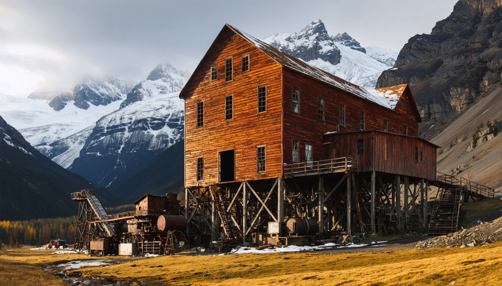
You’ll want to position your drone on the western side of the mill to capture the iconic red structure against the Kennicott Glacier backdrop during golden hour lighting.
The massive mill processed over 1.3 billion pounds of copper during its operating years, making it one of the richest copper strikes in history.
For ideal flight paths, trace the aerial tramway lines from north to south, using the remaining cables and towers as leading lines toward the 14-story concentration mill.
Consider timing your shots for late afternoon when the sun’s position creates dramatic shadows across the mill’s western facade while illuminating the ruby-red color that makes this historic landmark so photogenic.
Optimal Drone Flight Paths
Before launching your drone at the historic Kennecott Mill site, you’ll need to map out precise flight paths that maximize compositional opportunities while adhering to National Park Service regulations.
Start with wide establishing shots from the McCarthy Road approach, positioning your drone high enough to capture the mill against Bonanza Ridge’s dramatic backdrop.
For architectural detail work, program waypoints for smooth lateral passes along the mill’s façade, maintaining safe distances from the historic structures.
You’ll get your best shots by following the ore flow story – start at the tramway remains, sweep down to the 14-story mill, then pan across to the glacier.
Remember to factor in the site’s remote location when planning battery changes, and always keep your drone within visual line of sight while respecting wildlife buffer zones and NPS flight corridors.
Golden Hour Lighting Tips
Once your drone flight paths are mapped, mastering golden-hour photography at Kennecott demands precise timing and technical finesse.
You’ll find ideal lighting conditions 30-60 minutes before sunset and after sunrise, with extended twilight periods during mid-summer months. The warm rays during golden hour perfectly highlight the red mill’s weathered textures, creating dramatic architectural portraits at color temperatures between 3000-4500K.
For the best shots, time your flights when broken clouds create soft, diffused warmth across the mill’s facade.
Watch for Root Glacier’s cool blue reflections, which can neutralize warm tones. You’ll need to bracket exposures or use GND filters to handle the extreme dynamic range between bright glaciers and shadowed mill faces.
Capture in RAW to preserve those rich golden-hour gradations for post-processing flexibility.
Treadwell Ruins: Gold Mining Meets Coastal Beauty
Located across the Gastineau Channel from Juneau, the historic Treadwell Mine ruins stand as a monument to Alaska’s first large-scale gold mining operation. From 1882 until its dramatic 1917 collapse, this industrial powerhouse extracted over $66 million in gold through its network of four interconnected mines.
You’ll find compelling drone shots where crumbling mill foundations meet tidal waters, creating stark contrasts between industrial remnants and coastal beauty.
The site’s geometric concrete structures, overgrown by vegetation, offer perfect subjects for aerial photography, especially during golden hour when side-lighting accentuates their textures.
Position your drone for high oblique angles to capture both the ruins and Gastineau Channel, showcasing the mine’s strategic coastal location.
Remember to maintain safe distances from unstable structures while documenting this remarkable piece of Alaskan mining heritage.
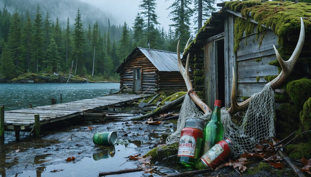
Dyea’s Lost Port: Tidal Flats and Forest Remains
The historic port of Dyea stands as a tribute to Alaska’s dramatic gold rush era, where nature has steadily reclaimed what was once a bustling boomtown of 8,000 residents.
You’ll find prime drone photography opportunities across the tidal flats where ships once anchored, now offering sweeping aerial views of the Taiya River’s transformed coastline.
The site’s historical significance emerges through your lens as you capture the remaining foundations beneath the forest canopy.
The environmental impact of time and elements creates compelling contrasts – from relocated cemetery headstones to the granite monument honoring Native peoples.
Position your drone to document the ghost town’s layout, where the shifting river has eroded half the former downtown, while forest growth frames the remnants of Alaska’s gold rush legacy.
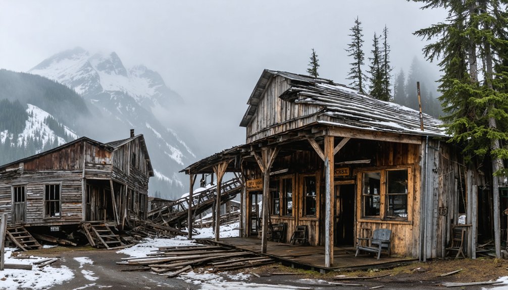
Fortymile District: Remote Mining Heritage
Pioneering prospector Howard Franklin’s 1886 gold discovery along the Fortymile River bars sparked Alaska’s first major gold rush, yielding 14,000 ounces from just 115 miners in its initial year.
You’ll find extensive evidence of mining techniques across this remote district, from hand-dug shafts to mechanical dredge remnants that ripped through valley bottoms.
- Bonanza Bar and Franklin Creek sites showcase early mining methods with visible hand-stacked tailings
- Walker Fork’s preserved claim sites offer drone views of historic placer operations
- Wade Creek demonstrates both mining’s impact and modern reclamation efforts
- Mosquito and Dennison Forks contain the district’s largest gold-bearing formations
The district’s 568,000-ounce legacy lives on in these remote locations, where you’ll discover untold stories of Alaska’s earliest interior gold rush preserved in the wilderness.
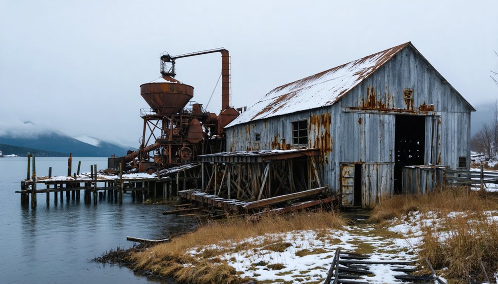
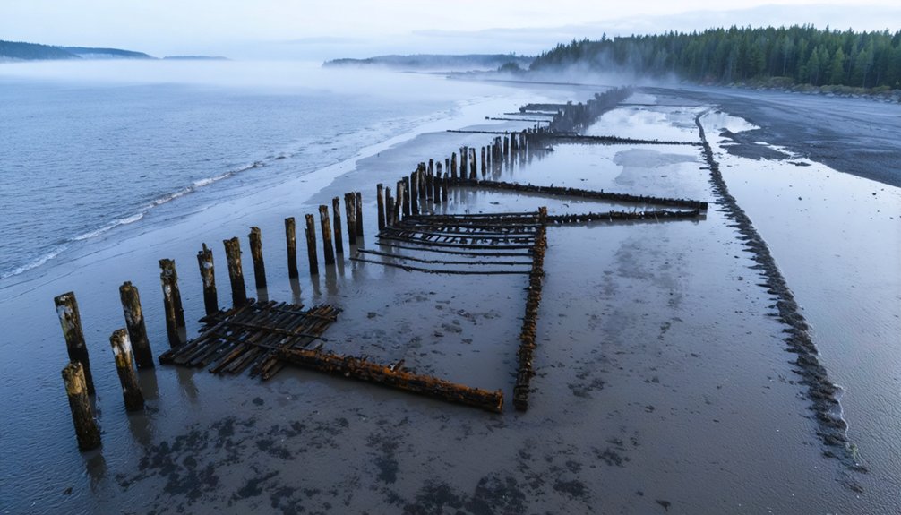
Coastal Cannery Ruins of Southeast Alaska
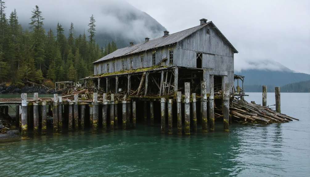
While gold rushes transformed Alaska’s interior, a different industrial heritage dots the Alexander Archipelago’s shorelines. Over 150 historic canneries once operated along Southeast Alaska’s protected bays and inlets, leaving behind distinctive ruins perfect for drone photography.
You’ll find collapsed wood-stave tanks, degraded pilings, and processing sheds that create compelling aerial compositions.
Prime shooting locations include Funter Bay’s bunkhouse ruins on Admiralty Island, where cannery architecture meets forested clearings, and Taku Harbor’s atmospheric combination of marine hardware and sheltered bay reflections.
For historical significance and visual drama, explore Dundas Bay’s remaining structure near Glacier Bay.
Before launching your drone, check land management rules – many sites lie within federal jurisdictions where specific flight restrictions apply.
Military Ghosts: The Buckner Building Legacy
Standing like a concrete titan against Whittier’s mountainous backdrop, the Buckner Building represents one of Alaska’s most impressive Cold War relics for drone photographers. This six-story behemoth spans 500 feet with a fascinating Buckner history as a self-contained military city housing 1,000 soldiers during the height of Soviet tensions.
- Capture sweeping aerial shots of the 275,000-square-foot concrete fortress designed to withstand bombs
- Frame dramatic perspectives of the northeast-southwest orientation against mountain slopes
- Document the stark military abandonment through shots of broken windows and weathered exterior
- Scout unique angles of the building’s connection to Whittier’s tunnel system
You’ll find this deteriorating giant particularly photogenic during golden hour, when shadows play across its imposing facade.
Remember that ground access is prohibited, making drone photography your best option for documenting this haunting Cold War sentinel.
Frequently Asked Questions
How Do You Handle Curious Bears While Flying Drones in Ghost Towns?
Like texting your bestie mid-flight, stay alert for bears. For bear safety, immediately stop your drone, back away slowly maintaining visual contact, and keep bear spray ready while retreating.
Can Drone Batteries Perform Reliably in Alaska’s Extreme Temperatures?
You’ll face significant battery performance challenges in Alaska’s cold. Preheating your LiPo batteries and keeping spares insulated is essential. Expect 30-50% shorter flight times due to temperature effects.
Are There Indigenous Cultural Sites That Should Be Avoided?
Like a respectful traveler in someone’s home, you’ll need to obtain site permissions before flying near any Alaska Native sites. Cultural sensitivity means avoiding heritage centers and sacred grounds.
Which Ghost Towns Offer Cellphone Coverage for Drone GPS Connectivity?
You’ll find reliable cell service for drone GPS at Treadwell Ruins near Juneau and Kennicott through NPS zones. Dyea gets coverage from Skagway towers, while Forty Mile’s border location guarantees connectivity.
How Do You Deal With Sudden Coastal Fog During Drone Flights?
When coastal visibility challenges arise, immediately reduce speed, maintain VLOS, and execute pre-planned foggy flight strategies. If you lose visual contact, activate RTH and land in your designated safe zone.
References
- https://thealaskafrontier.com/ghost-towns-in-alaska/
- https://www.atlasobscura.com/things-to-do/alaska/ghost-towns
- https://explorenorthblog.com/forty-mile-ghost-town-wild-weather-top-of-the-world-highway/
- https://www.youtube.com/watch?v=AtwCPa7jiNc
- https://www.youtube.com/watch?v=SbIdJihcAwE
- https://www.youtube.com/watch?v=xCm_fA54E2g
- https://www.youtube.com/watch?v=3dyjGZxA7pc
- https://www.marysmark.com/blog/2021/4/10/3-places-for-drone-photography-in-juneau-alaska
- https://alaskaphototreks.com/treks/alaska-drone-photo-tour/
- https://www.seneca-photography.com/blog/gear-list