You’ll find Maine’s most photogenic ghost towns at Fort William Henry’s coastal ruins and Flagstaff Lake’s submerged foundations. The abandoned Perkins Township on Swan Island offers dramatic river views, while Davidson’s industrial remnants showcase geometric patterns ideal for aerial shots. For forest-reclaimed sites, target Askwith Settlement between Greenville and Rockwood. Each location requires specific permits and seasonal timing to capture their historic essence through your drone’s lens.
Key Takeaways
- Fort William Henry offers dramatic coastal views and colonial military architecture, with optimal golden hour shots of stone walls from above.
- Perkins Township on Swan Island features five historic 18th-century structures, including ice houses and a cemetery, perfect for aerial documentation.
- Flagstaff Lake reveals submerged village foundations during late summer, creating unique geometric patterns visible through clear water at dawn.
- Davidson’s Industrial Ruins provides compelling symmetrical compositions of factory remains with natural leading lines from logging paths.
- Askwith Settlement between Greenville and Rockwood offers stunning autumn foliage contrasts and historical rail remnants for wide-angle aerial shots.
Why Maine’s Ghost Towns Are Perfect for Aerial Photography
While many states boast ghost towns worth photographing, Maine’s abandoned settlements offer a compelling mix of geographic and historical elements that make them ideal for drone photography.
Maine’s ghost towns blend history and landscape into perfect compositions, making them uniquely suited for capturing haunting aerial imagery.
You’ll find submerged foundations at Flagstaff Lake creating geometric patterns visible only from above, while abandoned mill sites along rivers provide strong aerial composition opportunities through reflections and carved valley floors. The state’s low population density around these sites simplifies long-exposure shots and low-altitude flights. Sites like Fort William Henry in Bristol provide dramatic coastal backdrops for aerial photography.
These locations tell powerful historical narratives through their industrial remnants – from lumber mill foundations to railway grades – which read clearly in aerial frames. The region of Perkins Township features five historic homes that create striking visual markers against Swan Island’s natural landscape.
The seasonal transformations of surrounding forests add dramatic color shifts, while coastal ghost sites juxtapose built ruins against dynamic tidal patterns, offering fresh perspectives with each visit.
Essential Drone Equipment for Ghost Town Photography
To capture Maine’s ghost towns from above, you’ll need specific drone equipment that meets the unique challenges of aerial heritage photography.
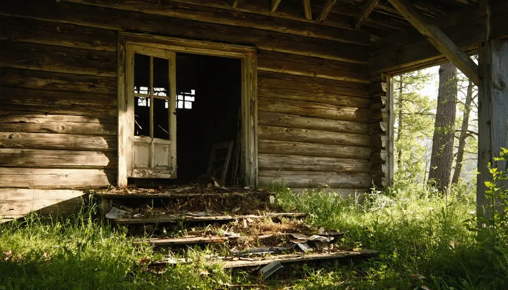
Exploring ghost towns in northern Maine reveals remnants of the past, with abandoned buildings that whisper stories of the communities that once thrived there. Each site presents an opportunity to document the interplay of nature reclaiming human structures, showcasing the beauty of decay. As you navigate these atmospheric locales, the stunning vistas from above will provide a striking contrast to the desolation on the ground.
The DJI Phantom 4 Pro V2.0‘s 20MP sensor delivers the detail needed for documenting historic structures, while the DJI Air 2S offers compact mobility for maneuvering tight spaces between abandoned buildings. Regular equipment maintenance ensures optimal performance during remote location shoots.
For stabilization in Maine’s coastal winds, a three-axis gimbal is essential. The DJI DL mount lenses provide exceptional image quality while maintaining a lightweight profile that won’t overburden your drone.
Pair your drone with ND filters to manage harsh sunlight and create atmospheric long exposures of weathered architecture.
Pack multiple high-capacity batteries and fast microSD cards for extended shoots in remote locations.
Don’t forget propeller guards when flying near deteriorating structures, and bring a protective case to shield your equipment from Maine’s unpredictable weather conditions.
Seasonal Considerations for Ghost Town Shoots
Since each Maine season presents distinct photographic opportunities and challenges, planning your ghost town drone shoots requires careful timing throughout the year.
One of the most intriguing aspects of exploring the best ghost towns in Maine is the rich history they embody, providing a unique backdrop for captivating images. From crumbling buildings to overgrown landscapes, each location tells a story waiting to be captured. Additionally, the changing seasons offer a stunning transformation of these abandoned sites, making them a photographer’s dream throughout the year.
The allure of ghost towns in Maine film history extends beyond their visual appeal; they also serve as tangible reminders of the past, evoking a sense of nostalgia and curiosity. Filmmakers often venture into these forgotten places to capture both their haunting beauty and the compelling stories they hold. This blend of photography and storytelling makes each visit an opportunity to delve deeper into Maine’s cultural heritage.
Winter shooting at Freeman and Perkins offers stark, snow-covered compositions, but you’ll face limited daylight and access issues on unplowed roads. The stunning European-inspired architecture of the chalet creates dramatic contrasts against snowy landscapes, making winter an excellent time to capture its unique design elements. Experienced drone pilots recommend warming batteries beforehand to ensure optimal performance in cold conditions.
Winter’s stark beauty awaits drone photographers at ghost towns, but short days and snow-blocked roads demand strategic planning.
Spring accessibility becomes tricky as melting snow creates muddy conditions near Kennebec River sites, though exposed foundations emerge for unique shots.
Summer visibility suffers at Davidson and Riceville where dense foliage conceals ruins, but extended daylight maximizes shooting windows.
Fall colors peak in early October, making it prime time to capture sites like Houlton’s abandoned chalet, though you’ll need to work around hunting season restrictions and unpredictable leaf-peeping weather patterns.
Capturing Fort William Henry’s Strategic Hilltop Views
Fort William Henry’s commanding position atop Pemaquid Point provides drone photographers with exceptional opportunities for capturing Maine’s coastal heritage.
You’ll find the fortress aesthetics particularly striking from 29 feet above the bastion roof, where converging lines create powerful compositions against the harbor backdrop. The stone walls and exposed bedrock offer compelling foreground elements for your wide-angle coastal panoramas.
Originally constructed in 1692 as the largest New England fort, this historic site offers a fascinating glimpse into colonial military architecture. The fort was built using 2,000 cartloads of stone to create its imposing structure.
For ideal results, shoot during golden hour when the sun casts dramatic shadows across the 10-22 foot walls.
The site’s elevation exposes your drone to coastal winds, so maintain higher gimbal stabilization. Consider sunrise for illuminating the harbor’s eastern exposure, or sunset for warm western light against the stone textures.
Just remember to secure proper permits before flying over this historic site.
Exploring Perkins: The Abandoned Island Paradise
Ever wondered what a perfectly preserved 18th-century ghost town looks like from above? You’ll find your answer on Swan Island, where the abandoned Perkins Township offers unparalleled drone photography opportunities.
The island’s rich history dates back to Abenaki settlements, followed by colonial-era development under Dr. Silvester Gardiner in the 1750s.
Your drone can capture five historic structures that have survived since the 1700s, including three distinctive ice houses and a preserved town cemetery. The four-mile-long island’s strategic position in the Kennebec River provides dramatic aerial perspectives of this former shipbuilding community. The area is now designated as the Steve Powell Wildlife Management Area, ensuring protection of these historic treasures.
You’ll need to launch from Richmond, Maine, and remember that access requires advance reservations between May and October. The abandoned buildings, untouched fields, and miles of trails create compelling compositional elements for aerial photography. The island has remained uninhabited since 1940s, creating a perfect time capsule for photographers to document.
Freeman’s Rural Remnants From Above
Deep in Franklin County, Maine, Freeman Township offers a stark contrast to Swan Island’s coastal isolation.
Nestled in Maine’s rugged interior, Freeman Township stands worlds apart from the state’s wave-swept islands and maritime settlements.
You’ll discover a forgotten world at 1,300 feet elevation, where aerial perspectives reveal the township’s haunting Freeman history through dense forest canopies and hidden clearings.
Your drone can capture the ghostly remnants of 19th-century life from 200+ feet: collapsed barns near Route 16, the moss-covered stones of old logging camps, and the weathered Freeman Ridge Cemetery with headstones dating back to 1820.
Morning light reflects off rusted metal roofs near Freeman Pond, while fall foliage creates dramatic contrasts against decaying wooden structures.
Operating under FAA Part 107 regulations, you’re free to explore this 40-square-mile area where the population plummeted from 500 to nearly zero after the lumber industry’s collapse in the early 1900s.
Askwith’s Hidden Forest Secrets
While most ghost towns leave obvious ruins, Askwith’s ethereal presence in Piscataquis County manifests primarily through subtle traces of its railroad logging past.
You’ll find this vanished settlement between Greenville and Rockwood, where dense mixed forest has reclaimed the logging heritage of Maine’s industrial era.
For the best drone photography, you’ll want to visit during autumn when the foliage creates stunning contrast with old rail remnants.
Launch your UAV in the late afternoon to capture compelling shadows across former clearings and rail grades.
Focus on wide-angle passes to document the linear corridors where trains once hauled timber, and use nadir shots to map foundation stones beneath the canopy.
Remember to maintain line-of-sight operations and secure necessary permissions before exploring this forgotten piece of Maine’s past.
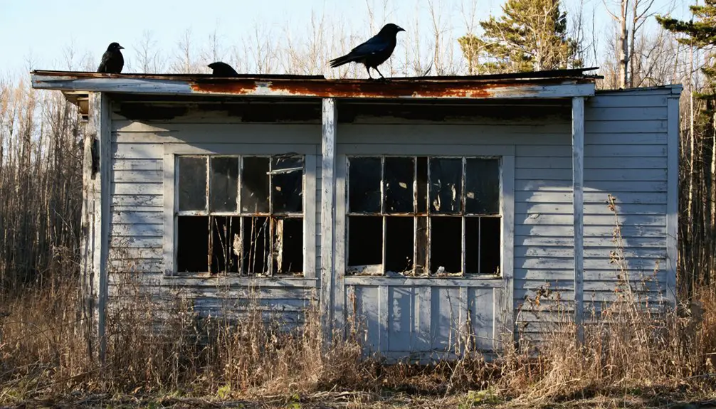
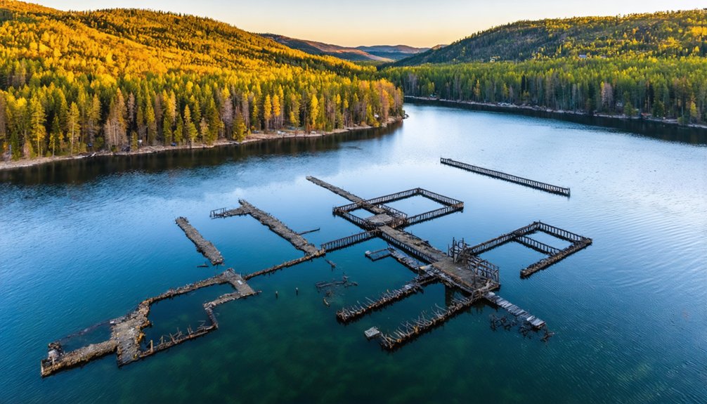
Davidson’s Industrial Ruins Through the Lens
The industrial remnants of Davidson stand as striking monuments to Maine’s manufacturing past, offering drone photographers a rare glimpse into early 20th-century industrial architecture.
You’ll find compelling aerial symmetry in the clothespin factory’s multi-bay layout, where geometric lines create dramatic patterns from above. The adjacent sawmill and boiler room, documented in 1908 photographs, provide rich opportunities for capturing industrial decay through your drone’s lens.
Position your drone to leverage the site’s natural leading lines – from old logging paths to rail routes – while framing the structural remains against the rural Penobscot County landscape.
Focus on the textural contrasts between weathered wood, rusted metal, and aged masonry, but remember to secure landowner permission before launching your aerial survey of this historic manufacturing complex.
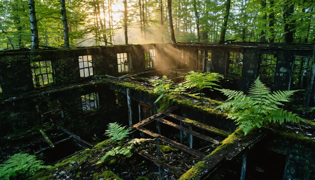
Uncovering Flagstaff Lake’s Submerged History
Beneath Flagstaff Lake’s expansive waters lies a compelling photographic subject – an entire submerged village sacrificed for hydroelectric progress in 1950.
You’ll find prime drone photography conditions during late summer when water levels drop, revealing submerged artifacts from Flagstaff Village and Dead River Plantation.
For the sharpest historical narratives, focus your lens on the lake’s northwestern sector where Flagstaff Village once stood. The foundations of razed buildings emerge during clear conditions, offering striking aerial compositions.
Target dawn shoots when the water’s surface is calmest, maximizing visibility of underwater structures. To capture the full scope of this drowned community, position your drone above the original township boundaries, where Long Falls Dam‘s construction forever altered Maine’s landscape.
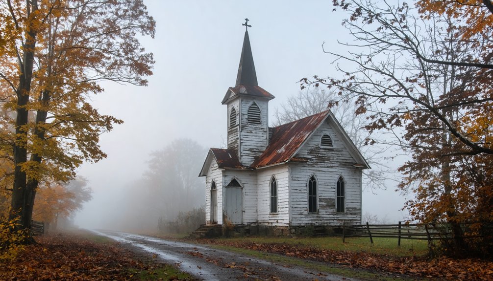
Consider including the relocated Flagstaff Memorial Chapel in your shots for contextual depth.
Drone Photography Tips and Permits for Maine Ghost Towns
Before launching your drone at Flagstaff Lake or any Maine ghost town, you’ll need to secure proper permits and understand specific regulations.
Obtain your FAA Remote Pilot Certificate for commercial shoots or complete TRUST certification for recreational flights. Your drone must have Remote ID capability unless operating in an FAA-recognized area.
FAA certification is mandatory – get your Remote Pilot Certificate for commercial work or TRUST for recreational drone flights.
For ghost town photography around Flagstaff Lake’s historic sites, you’ll need a Special Activity Permit from Maine’s Bureau of Parks and Lands. Plan several weeks ahead for approval.
Keep your drone below 400 feet and maintain visual line of sight unless you’ve secured specific waivers. Avoid capturing audio or private property without consent.
When photographing archaeological sites, consult site managers about specific restrictions to protect fragile structures. Document all authorizations in writing and keep them readily available during your flight operations.
Frequently Asked Questions
Are There Any Dangerous Wildlife Encounters When Filming Ghost Towns by Drone?
You’ll risk bears charging your crew while retrieving downed drones near carcasses, plus moose collisions on access roads. Take wildlife safety measures: secure food, maintain safe altitudes, and follow filming precautions.
Which Ghost Towns Allow Night Drone Photography for Capturing Spooky Atmospheres?
You’ll need permits for night photography at Swan Island and Flagstaff Lake. For spooky atmospheres, target Ligonia Village’s cemetery edges before sunset, as most locations restrict after-dark drone operations.
How Do Local Residents Feel About Drone Photographers Visiting Nearby Ruins?
You’ll find strong local opinions about privacy, safety, and site preservation. Many residents express community concerns over low flights, trespassing, and disruption unless you’ve coordinated permissions and flight plans beforehand.
Can Drones Detect Underwater Structures in Flagstaff Lake During Winter Freeze?
You’ll discover specialized underwater exploration drones can penetrate Flagstaff Lake’s winter ice using sonar or ROV technology, though thick ice coverage and 50-foot depths limit standard drone technology’s effectiveness.
What Are the Best Angles for Capturing Stone Foundations Without Trees Blocking?
You’ll get ideal shooting angles at 10-20° camera tilt during golden hour, maintaining 5-10m distance parallel to walls. Execute foundation framing through diagonal sweeps where tree gaps exceed 10m clearance.
References
- https://www.mooseriverlookout.com/post/ghost-towns-in-maine-9-fascinating-places-that-rose-fell
- https://www.hotels.com/go/usa/ghost-towns-maine
- https://www.youtube.com/watch?v=z8hfTT78SjM
- http://www.onlyinyourstate.com/state-pride/maine/creepy-ghost-town-me-2
- https://wblm.com/here-are-some-of-the-coolest-drone-photos-of-portland/
- https://www.youtube.com/watch?v=M7EEe0a0pAs
- http://freepages.rootsweb.com/~gtusa/history/usa/me.htm
- https://www.youtube.com/watch?v=cRKJfT3NoB4
- https://www.maineterrain.com/drones-down-east/
- https://www.samys.com/c/Drone-Accessories/3/380.html