You’ll find exceptional drone photography opportunities across Minnesota’s Iron Range ghost towns, including Taconite Harbor’s geometric streets, Elcor’s mining ruins, and the historic sites of Manganese and Sparta. Plan your shoots during late September for peak fall colors, or capitalize on extended summer daylight hours from June through August. Always verify airspace restrictions, obtain necessary permits, and maintain visual line-of-sight during flights. Mastering the technical aspects of ghost town aerial photography opens up a world of haunting industrial landscapes.
Key Takeaways
- Taconite Harbor offers grid-like streets and industrial ruins, making it ideal for aerial photography with clear structural compositions.
- Elcor’s mining ruins provide dramatic landscapes and historical remnants that photograph exceptionally well from drone perspectives.
- Finland features stunning fall colors from September through October, with abandoned structures contrasting beautifully against seasonal foliage.
- Forestville presents well-preserved buildings and extended summer lighting windows of up to 15 hours during June-August.
- Grey Cloud Island showcases unique spring contrasts between fresh growth and weathered structures during April-May.
Capturing Minnesota’s Abandoned Mining Heritage From Above
While Minnesota’s Iron Range once bustled with dozens of company mining towns, today’s drone photographers can capture haunting aerial perspectives of these abandoned settlements.
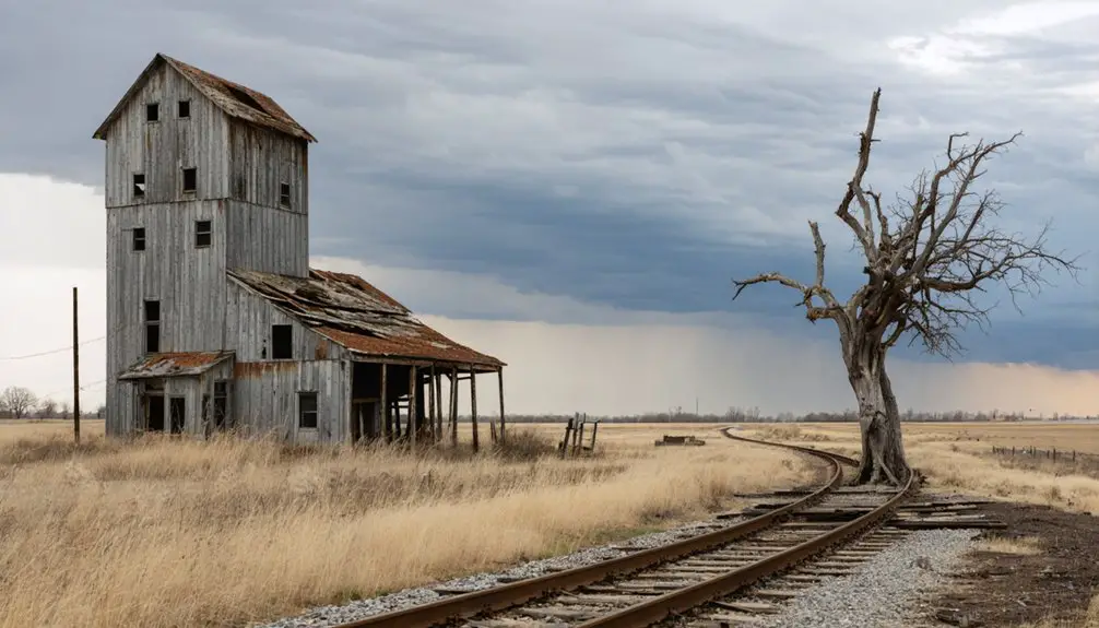
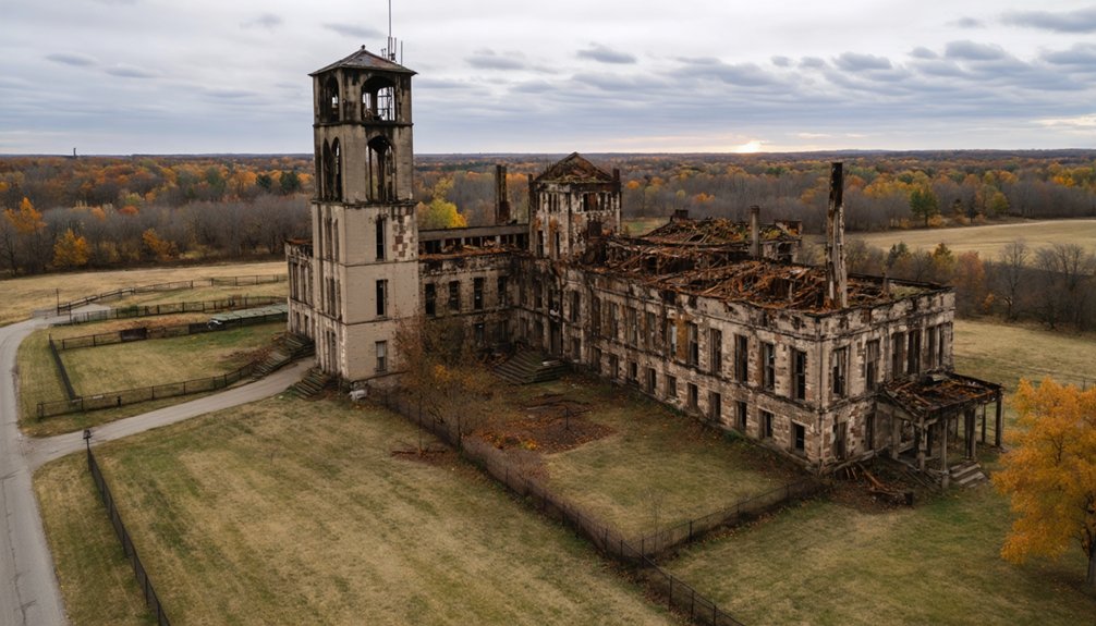
From your vantage point above, you’ll discover the geometric patterns of Taconite Harbor‘s grid-like streets and the scattered foundations of Elcor’s mining ruins. Look for compelling compositions in the decaying industrial equipment and structural remnants that dot these sites.
Stark geometric grids and crumbling foundations tell silent stories of Minnesota’s abandoned mining towns through haunting aerial perspectives.
These once thriving mining communities now serve as time capsules of Minnesota’s early industrial era.
For the best abandoned architecture shots, explore the forgotten landscapes of Manganese and Sparta, where mining history reveals itself through weathered foundations and subtle earthworks. Remember to obtain proper permissions first before launching your drone, as some ghost towns are located on private property.
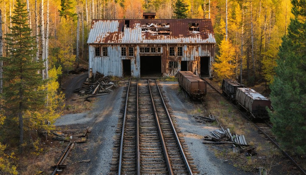
You’ll find rich documentary opportunities at sites like Cooley and Penobscot, where careful drone work can highlight the transient nature of these company-built communities through their ghostly outlines and remaining infrastructure.
Essential Drone Equipment for Ghost Town Photography
You’ll need a rugged, weather-resistant carrying case with customizable foam inserts to protect your drone and accessories while hiking through Minnesota’s remote ghost towns.
Consider using the Hoodman Aviator Hood when reviewing your footage outdoors, as it helps reduce glare on your tablet screen during bright Minnesota days.
To maximize your flight time at these historic sites, carry 3-5 spare batteries and a portable charging station for extended shooting sessions.
Your drone must be equipped with a reliable 3-axis gimbal to guarantee steady footage when maneuvering around deteriorating structures, especially during Minnesota’s notoriously gusty conditions.
A Part 107 certification is required before conducting any commercial drone photography at Minnesota ghost towns, ensuring legal compliance and demonstrating your expertise to potential clients.
Protective Drone Storage Solutions
When venturing out to photograph Minnesota’s ghost towns with drones, protecting your equipment becomes paramount with specialized storage solutions.
You’ll want to invest in aluminum cases with IP67-rated protection that shield your gear from dust, rain, and harsh field conditions common in abandoned locations.
Choose cases with custom-cut foam inserts specifically designed for your drone model, ensuring your equipment stays firmly in place during transport across rough terrain.
For ideal drone security, look for cases featuring keyed locks, bolted tie-down rings, and sturdy latches that prevent unauthorized access and theft.
Your storage solution should accommodate all essential gear – multiple batteries, props, filters, and tools – while maintaining organization through precision-cut compartments.
Consider cases with pressure equalization valves if you’re traveling between locations at different altitudes.
Our recommended K 470 Universal Box offers 600 × 400 × 340 mm dimensions to fit most standard drone setups.
Professional drone operators can benefit from storage boxes with slide-out trays that provide quick access to equipment while in the field.
Flight Time Battery Management
Effective battery management stands as the cornerstone of successful ghost town drone photography in Minnesota. You’ll need to plan for 3-4 batteries per hour of flight time, considering the state’s unpredictable weather conditions.
Your charging strategy should include at least two multi-port chargers to maintain continuous operations while exploring abandoned locations. Utilizing modular battery packs connected in series can significantly extend your flight sessions.
To maximize your battery capacity in Minnesota’s varying temperatures, especially during colder months, pack 20-50% more batteries than your calculated minimum. A reliable battery management system monitors temperature and discharge rates to prevent mid-flight power loss.
Implement a rotation system where you’re charging one battery, cooling another, and flying with a third. Keep your flight segments to 8-12 minutes, maintaining a 30% reserve for safe return-to-home capability.
Monitor battery temperatures during charging and never compromise on cooling time between flights – your ghost town documentation depends on reliable power management.
Camera Stabilization Gear
Professional ghost town photography relies heavily on a robust camera stabilization system, particularly a 3-axis gimbal that counteracts pitch, roll, and yaw movements during flight.
When exploring Minnesota’s abandoned settlements, you’ll need reliable stabilization techniques to capture those haunting shots with crystal clarity. Hands-on experience through extensive practice is essential for achieving professional-level drone footage in these challenging environments.
Regular maintenance with dust removal techniques helps ensure optimal gimbal performance in debris-filled ghost town environments.
- Choose a 3-axis gimbal system that matches your camera’s payload capacity – exceeding weight limits will compromise your footage quality.
- Ascertain your gimbal’s brushless motors and shock absorbers are properly calibrated for ghost town conditions.
- Verify your IMU sensors are functioning correctly to handle unexpected wind gusts around old structures.
- Consider professional options like the DJI Ronin series for advanced features like ActiveTrack 6.0.
Different gimbal types offer varying levels of stability, but investing in professional-grade equipment will greatly enhance your ghost town documentation capabilities.
Weather and Seasonal Considerations for Aerial Ghost Town Shots
You’ll find Minnesota’s ghost towns most photogenic from late May through early October, when reduced cloud cover and extended daylight hours maximize your aerial shooting opportunities.
During these peak months, you can take advantage of stable thermals for smoother footage and dramatic golden-hour lighting that enhances architectural details.
Winter shoots require careful planning around shorter days, reduced battery performance in cold temperatures, and challenging light conditions that can flatten your compositions.
Peak Season Shooting Windows
When planning drone photography expeditions to Minnesota’s ghost towns, timing your shoots around the state’s distinct seasonal windows can dramatically enhance your aerial compositions.
You’ll find prime conditions across several peak periods that maximize both safety and creative potential.
- Late September through October delivers stunning fall color palettes in northern sites like Finland, with stable 50-60°F temperatures perfect for drone handling.
- June through August offers extended summer lighting windows up to 15 hours, ideal for southern locations like Forestville.
- April-May presents unique contrasts between fresh spring growth and weathered structures, particularly visible at Grey Cloud Island.
- Civil twilight periods provide 30-40 minutes of soft, directional light that reveals intricate textures while minimizing harsh shadows across elevated ruins.
Winter Lighting Challenges
Despite winter’s dramatic visual potential, Minnesota’s ghost town drone photography faces significant lighting hurdles that demand careful technical preparation.
You’ll need to adapt your lighting techniques to combat shortened daylight hours and manage snow glare effectively. Use circular polarizing filters matched to your drone’s camera and adjust your ISO settings when overcast conditions threaten to underexpose your shots.
Watch your drone’s battery performance closely in cold conditions – store spare batteries warm and monitor voltage levels through your flight app.
Slow your flight speed to 2 mph during low-light situations and make exposure adjustments to maintain image clarity. The low winter sun creates compelling shadows, but you’ll need precise timing to capitalize on the limited daylight.
Always check multiple weather forecasts and plan your shoots around the most stable conditions.
Legal Guidelines for Ghost Town Drone Operations
Operating drones at Minnesota ghost towns requires careful adherence to both state and federal regulations. Before launching your drone for that perfect abandoned town shot, you’ll need proper registration and licensing through both MnDOT and the FAA, depending on whether you’re flying commercially or recreationally.
Exploring ghost towns around Minnesota can reveal fascinating glimpses into the state’s history and the stories of its past inhabitants. It’s important to be aware of the unique challenges these locations present, such as accessibility and safety concerns in abandoned structures. Moreover, local wildlife and environmental regulations should always be considered to minimize impact while enjoying these intriguing sites.
To guarantee your ghost town photography follows drone regulations and photography ethics, remember these essential requirements:
Stay legal and ethical while capturing Minnesota’s ghost towns by following essential drone photography requirements and regulations.
- Register your drone with MnDOT for commercial use or with the FAA for recreational flights over 0.55 lbs.
- Maintain visual line-of-sight and stay under 400 feet unless specifically authorized.
- Check airspace restrictions near Minnesota’s 375+ airports before each flight.
- Respect private property rights and obtain permits for state-owned ghost town lands.
While there’s no explicit law requiring landowner permission for overflight, it’s recommended to prevent potential privacy disputes.
Best Times of Day for Haunting Aerial Imagery
To capture the most haunting aerial imagery of Minnesota’s ghost towns, timing your drone flights during golden and blue hours will dramatically enhance your results.
You’ll find the warm, low-angle light of golden hour creates long shadows that emphasize structural decay, while morning fog in valley locations adds mysterious atmospheric layers to your compositions.
Blue hour offers a unique window for balanced exposures, letting you blend the cool ambient light with any remaining artificial illumination.
You’ll need to work quickly during these brief periods – typically 30-60 minutes for golden hour and 15-30 minutes for blue hour.
For detailed documentation, consider mid-morning or mid-afternoon flights when even lighting reveals intricate textures.
In Minnesota’s challenging climate, watch for calm, clear conditions, especially during winter months when shorter days require precise timing.
Planning Your Ghost Town Drone Photography Route
Mapping an efficient ghost town photography route across Minnesota lets you maximize your limited golden and blue hour shooting windows. For ideal aerial composition and ghost town exploration coverage, plan your journey starting south and heading north.
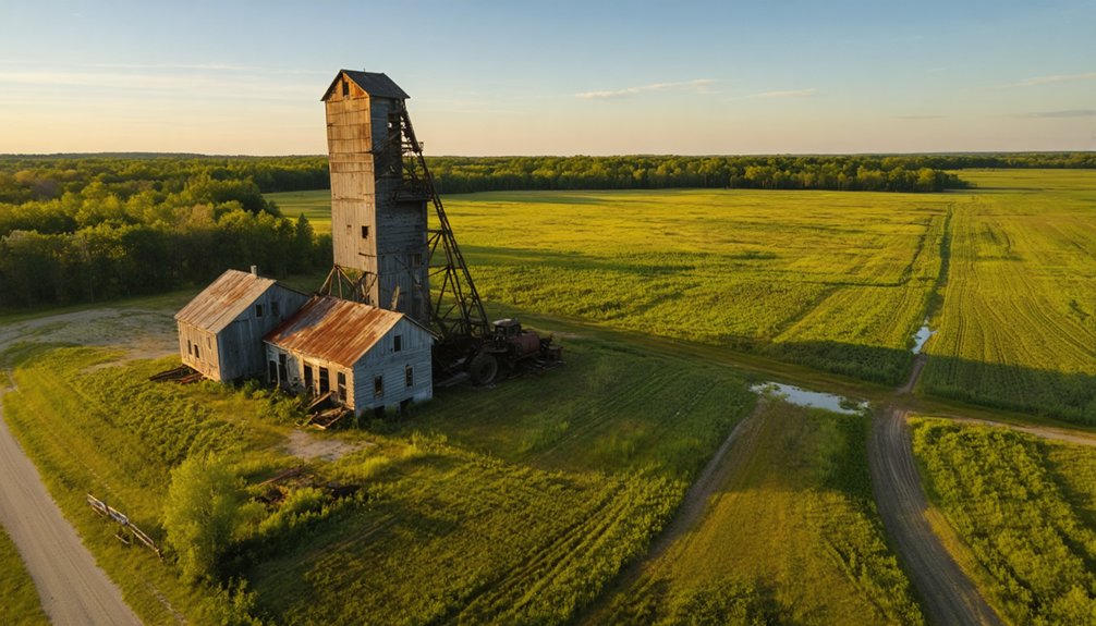
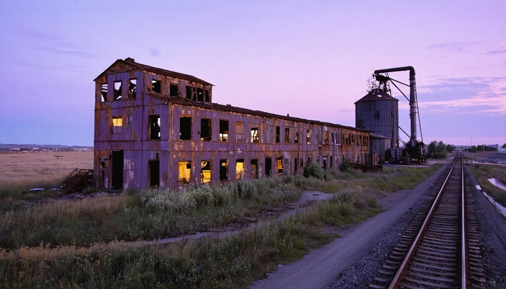
As you traverse the state, make sure to include stops at the best ghost towns in Minnesota, each offering unique stories and stunning backdrops for your photography. Exploring these forgotten places not only enhances your portfolio but also provides insight into the rich history and landscapes of the area. From the remnants of old mining towns to once-thriving railroad hubs, each location invites you to capture the beauty of decay and nostalgia.
- Begin at Forestville’s preserved buildings in Fillmore County, catching morning light on the local brick structures and vacant streets that showcase the town’s 1852 origins.
- Head to Finland’s apocalyptic landscape, where peeling paint and mysterious houses create compelling drone perspectives against evergreen backdrops.
- Capture Taconite Harbor’s abandoned industrial remnants in Cook County during mid-afternoon light.
- End at Grand Portage’s fire tower after a 1.5-mile hike, positioning your drone for sunset shots over the expansive forest canopy.
Remember to respect private property boundaries and maintain safe distances from structures while shooting.
Advanced Techniques for Documenting Historic Ruins
Modern photogrammetry techniques have revolutionized how we document historic ruins through drone photography.
Aerial photogrammetry and drone technology have transformed our ability to preserve and study architectural heritage in unprecedented detail.
You’ll want to leverage high-resolution 4K HDR cameras with 21MP sensors for capturing both nadir and oblique perspectives of Minnesota’s abandoned structures.
For ideal results, program your drone to fly circular tiers at varying heights – typically 50m and 30m – ensuring thorough coverage while avoiding obstacles.
The DJI Phantom 4 RTK excels at aerial surveying these sites, while thermal imaging can reveal hidden foundations and pathways through heat signatures.
Process your captures through PIX4D or DJI 4.0 software to generate detailed 3D models.
Remember to incorporate ground control points for enhanced precision and consider combining both automated flight paths with manual controls when documenting intricate architectural features.
Top Vantage Points for Dramatic Aerial Compositions

Minnesota’s ghost towns offer spectacular aerial vantage points that’ll transform your drone photography portfolio. Your aerial perspectives will capture haunting scenes of abandonment while maintaining respectful distances from these historic sites.
- Position your drone at Forestville Bridge for sweeping valley shots that showcase the restored 1890s architecture against natural contours.
- Capture the stark isolation of the abandoned fire tower north of Grand Portage by orbiting its rusted framework piercing through dense forest canopy.
- Frame Finland’s decaying structures from the fire tower vantage point, emphasizing the eerie contrast between vibrant autumn trees and abandoned homes.
- Set up at Grey Cloud Island’s bluffs for dramatic drone compositions of the lone kiln standing sentinel over the Mississippi River’s changing shoreline.
Remember to maintain safe flight paths and respect private property boundaries while documenting these atmospheric locations.
Safety Measures When Flying Over Abandoned Structures
Before flying your drone near abandoned buildings, you’ll need to carefully assess the structural integrity through recent site photos and inspection reports to identify hazards like unstable roofs or loose materials.
You should program conservative geofencing boundaries and altitude limits to maintain safe distances from compromised structures while still capturing compelling angles.
Keep your equipment well-maintained with updated firmware and fully-charged batteries, and always bring backup gear including a first-aid kit and emergency retrieval tools.
Pre-Flight Structure Assessment
When photographing abandoned structures with drones, a thorough pre-flight structural assessment is essential to guarantee both operator safety and equipment preservation.
Before launching your drone, you’ll need to implement critical safety protocols that protect both you and your equipment from potential hazards.
- Scan the roof structure for unstable spans, sagging areas, and missing support members – these indicate high collapse risk zones you’ll need to avoid.
- Look for exterior wall cracks wider than 1/4 inch, as they signal structural distress and potential debris hazards.
- Check for water damage signs like vegetation growth or rot that could mean hidden structural voids.
- Establish a minimum 50-150 foot standoff distance based on observed instability level and mark clear visual-observer positions outside debris fall zones.
Equipment Safety Protocols
Operating drones safely around abandoned structures requires implementing thorough equipment protocols to protect both your gear and the historic sites.
You’ll need a drone with obstacle avoidance sensors and reliable GPS positioning to steer through deteriorating buildings safely. Always carry backup batteries and establish emergency procedures for unexpected failures.
Before launch, verify your drone insurance covers flights over abandoned properties and maintain proper registration documentation.
Position your landing pad away from unstable surfaces, and use a tethered system when flying near collapsing walls or loose debris.
Keep your movements conservative with reduced speeds and minimal control inputs when maneuvering through confined spaces.
Work with a dedicated visual observer who can maintain line-of-sight while you focus on capturing your shots, using clear communication protocols between team members.
Editing Tips to Enhance Ghost Town Drone Footage
Four key post-processing techniques can transform your ghost town drone footage from raw captures into compelling cinematic narratives.
Master the art of color grading with teal-orange profiles to enhance weathered textures while preserving natural midtones. Apply precise motion refinement to maintain stable footage without sacrificing the authentic feel of your aerial exploration.
Thoughtful color grading elevates drone footage, using teal-orange profiles to highlight aging textures while keeping movement natural and authentic.
- Utilize exposure blending to recover detail in both shadowy doorways and bright Minnesota skies.
- Apply selective HSL adjustments to emphasize rustic reds while taming distracting foliage.
- Implement gentle warp stabilization at 85-90% to preserve architectural lines.
- Create seamless narrative flow by cutting on motion peaks and matching color profiles between clips.
Keep your edits subtle yet impactful, letting the haunting beauty of these abandoned structures tell their own story through thoughtfully processed footage.
Frequently Asked Questions
Are There Any Ghost Towns With Underground Tunnels Suitable for Indoor Drone Exploration?
You shouldn’t attempt underground exploration in Minnesota’s ghost town tunnels – they’re hazardous, often illegal to access, and present severe risks to drone operations through signal loss and structural instability.
Which Ghost Towns Have Reported Paranormal Activity During Aerial Photography Sessions?
You’ll find reported ghost sightings and aerial anomalies at Finland’s mining ruins, Grey Cloud Island’s kilns, Taconite Harbor’s structures, Forestville’s historic buildings, and the Elcor mining complex during drone flights.
How Do Local Residents Feel About Drone Photographers Visiting These Sites?
You’ll face mixed local opinions – residents often worry about privacy, safety and trespassing. Address community concerns by seeking permits, providing flight plans, and coordinating with property owners before launching your drone.
What Wildlife Encounters Should Drone Pilots Prepare for at These Locations?
You’ll need to watch for deer, bears, moose, and aggressive birds, especially raptors. Follow drone regulations for wildlife buffers, secure your gear from scavengers, and carry animal deterrents.
Can I Sell Prints or Footage Captured at These Ghost Towns?
You’ll need permits to sell prints from state parks like Forestville, while private locations require property releases. Always verify copyright considerations and obtain proper commercial permissions before monetizing any footage.
References
- https://www.youtube.com/watch?v=-eAg5yc3kkg
- https://thievesriver.com/blogs/articles/ghost-towns-in-minnesota
- https://www.youtube.com/watch?v=Tp1sKG_5yZc
- https://quickcountry.com/minnesotas-abandoned-ghost-towns/
- https://www.youtube.com/watch?v=mopglvvpzvg
- https://mnprairieroots.com/2021/11/16/along-goodhue-county-road-8-past-fields-farms-ghost-towns/
- https://bringmethenews.com/minnesota-lifestyle/places-to-visit-in-minnesota-the-eerie-ghost-town-of-north-hibbing
- https://www.minnesotamonthly.com/travel-recreation/snapshot-abandoned-fire-tower/
- https://therockofrochester.com/minnesota-ghost-towns/
- https://pbsnorth.org/show/minnesotas-lost-mining-towns/