You’ll find exceptional drone photography opportunities at five distinct South Carolina ghost towns. Colonial Dorchester offers a dramatic 1751 bell tower against the Ashley River, while Glenn Springs features 23 National Register structures perfect for aerial capture. Don’t miss Ella’s Grove’s antebellum ruins, Pinckneyville’s 162-year-old jail remnants, or Hamburg’s historic depot. Each location demands specific gear like the DJI Mavic 4 Pro and proper FAA permits. These abandoned sites hold countless untold stories waiting for your lens to discover.
Key Takeaways
- Colonial Dorchester offers stunning drone shots of its 1751 brick bell tower and tabby fort walls along the Ashley River.
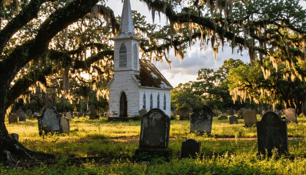
- Glenn Springs features 23 National Register structures and an abandoned Presbyterian church amid the Blue Ridge Mountains.
- Ella’s Grove presents excellent aerial photography opportunities of antebellum structures and dramatic tree canopy patterns.
- Pinckneyville’s 1.75-acre site showcases brick ruins of a historic jail and store, though requiring private property access permission.
- Hamburg’s abandoned port town provides compelling views of the historic depot and original street grid patterns from above.
What Makes South Carolina Ghost Towns Unique
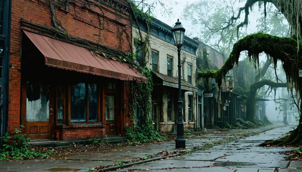
While many states boast abandoned settlements, South Carolina’s ghost towns tell a distinctive story through their diverse origins as trading posts, plantation centers, and railroad hubs.
The arrival of European settlers in the 1700s established the foundation for many of these historic sites across the Williamsburg District and beyond.
Changes in transportation routes and the departure of major industries have contributed significantly to these towns’ abandonment.
You’ll discover sites shaped by dramatic historical narratives – from British destruction during the Revolutionary War to Sherman’s March devastation, and from agricultural decline to intentional flooding for modern infrastructure.
These locations offer unique drone photography opportunities due to their cultural significance and varied architectural remnants.
Ghost towns showcase their forgotten stories through aerial views, revealing cultural treasures and architectural echoes of South Carolina’s past.
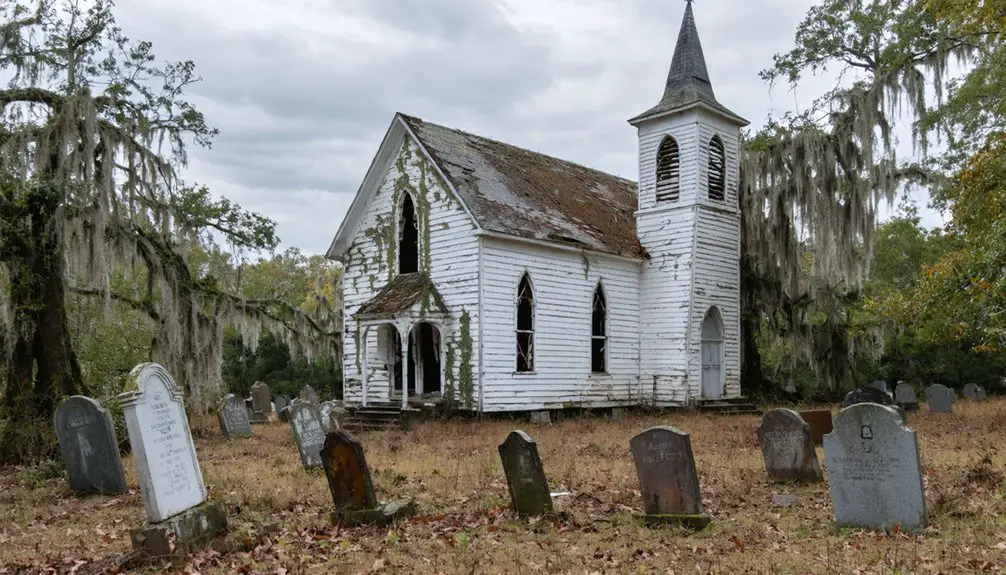
You can capture 1850s railroad depots, Gothic-style bridges from 1820, and preserved church structures that stand as solitary witnesses to vanished communities.
Whether you’re hovering over Colonial Dorchester‘s trading post ruins or documenting the haunting remains of Old Sheldon Church, you’ll find compelling compositions that showcase South Carolina’s complex past through an aerial perspective.
Essential Drone Photography Equipment and Permits
You’ll need professional-grade drone equipment to capture South Carolina’s ghost towns effectively, including a camera drone with at least a 1-inch sensor, reliable obstacle avoidance, and a complete kit of ND filters and cleaning supplies. A compact Lowepro DroneGuard backpack offers secure transportation while exploring abandoned locations. Carrying a backup drone is essential to prevent shoot disruptions due to equipment failure.
Before launching your first flight, you must secure written permissions from private property owners and check local historic preservation regulations that may affect drone operations.
Your pre-flight checklist should include current FAA registration, Remote ID compliance, and liability insurance coverage specific to drone photography in historically sensitive areas.
Required Gear List
A successful ghost town drone photography expedition requires specific gear that balances image quality, safety, and portability.
You’ll need a capable camera drone like the DJI Mini 2 or FPV 4K for capturing detailed architectural shots. The new DJI Mavic 4 Pro offers a revolutionary triple-camera system perfect for capturing ghost towns from multiple perspectives. Pack ND filters to maintain proper exposure in bright conditions and polarizing filters to enhance the rich textures of weathered buildings.
Don’t forget your LiPo safety bags for spare batteries and a landing pad for safe takeoffs from uneven terrain. Consider bringing a RGB LED light to illuminate dark interior spaces during twilight shoots.
Your controller setup should include a sunshade to combat glare while framing shots. Bring microfiber cloths and a cleaning kit to keep your lens pristine in dusty environments.
For protection during transport and organization in the field, invest in a dedicated carrying case.
Remember your pre-flight checklist to guarantee legal compliance at each location.
Permit Application Process
Before heading to ghost towns with your drone, securing proper permits and certifications is essential for legal operation.
You’ll need to register any drone over 0.55 lbs with the FAA for $5, valid for three years. For recreational flights, complete the free TRUST test online and keep your certificate handy during operations.
If you’re planning commercial ghost town photography, you’ll need a Part 107 Remote Pilot Certificate through an FAA knowledge test. Government employees operating drones can work under either Part 107 or obtain a Certificate of Authorization.
Don’t forget Remote ID compliance is now mandatory. For flights near restricted areas or controlled airspace, obtain LAANC authorization through the FAA.
When filming ghost towns for commercial purposes, contact the SC Film Commission for additional permits.
Exploring ghost towns in South Carolina can reveal fascinating historical insights and unique landscapes. Many of these towns offer stunning backdrops for filmmakers, capturing the essence of faded glory and abandoned beauty. To ensure a smooth filming process, it’s essential to research each location’s specific regulations and history.
Remember to check local drone regulations, as some towns require specific certifications beyond federal requirements. The B4UFLY mobile app can help you verify any airspace restrictions in ghost town areas.
Capturing Colonial Dorchester’s Historical Ruins
Your drone’s lens can reveal centuries of colonial history at Colonial Dorchester State Historic Site, where the red brick bell tower and tabby fort walls stand as prime subjects against the Ashley River backdrop.
Park Manager Noah Letter oversees the preservation of these remarkable ruins while working to uncover more of the site’s colonial past.
The site’s extensive archaeological excavations have yielded over 6,500 artifacts from a single lot, providing glimpses into colonial life that can be documented from above.
You’ll find rich opportunities for capturing the site’s eight newly discovered geophysical anomalies, including a potential Revolutionary War trench system that’s invisible at ground level.
Ground-penetrating radar surveys have opened up exciting possibilities for aerial documentation of unexcavated structures across the 325-acre park, where only 10 of 119 original quarter-acre lots have been explored.
Preserved Walls Tell Stories
Three distinct structural elements make Colonial Dorchester an exceptional drone photography site: the iconic 1751 brick bell tower, weathered tabby fort walls, and remnants of an 18th-century log wharf.
You’ll find ghostly narratives etched into every surface, from the tower’s weathered brick and seismic repair straps to the fort’s coarse oyster-shell concrete walls.
For the most compelling architectural whispers, position your drone during golden hour when raking light accentuates the tabby’s rich textures and the tower casts dramatic shadows.
Winter’s leaf-off period reveals hidden foundation lines and cemetery markers perfect for pattern-recognition shots.
Time your flights with low tide to capture the exposed wharf timbers along the Ashley River, where wood grain patterns create striking compositions against the water’s reflective surface.
Aerial Archaeological Discoveries
While Colonial Dorchester‘s 325-acre expanse harbors remarkable archaeological treasures, capturing them from above requires strategic flight planning and specialized gear.
You’ll gain unprecedented historical insights by flying your drone over the tabby fort’s powder magazine and St. George’s Anglican Church tower, both visible against the vibrant landscape.
For ideal aerial archaeology shots, launch your quad-copter near the Ashley River during low tide to document the colonial-era log shipping wharves.
You’ll need park manager approval and a $2.00 daily permit, but you’ll have access to sweeping views of burial grounds and archaeological excavation sites.
Position your drone to capture the interplay between Mary Wightman’s ongoing dig sites and the towering trees that frame these well-preserved colonial ruins.
Exploring the Abandoned Elegance of Glenn Springs
Hidden within the foothills of South Carolina’s Blue Ridge Mountains lies Glenn Springs, a once-thriving resort destination transformed into an atmospheric ghost town ripe for aerial photography.
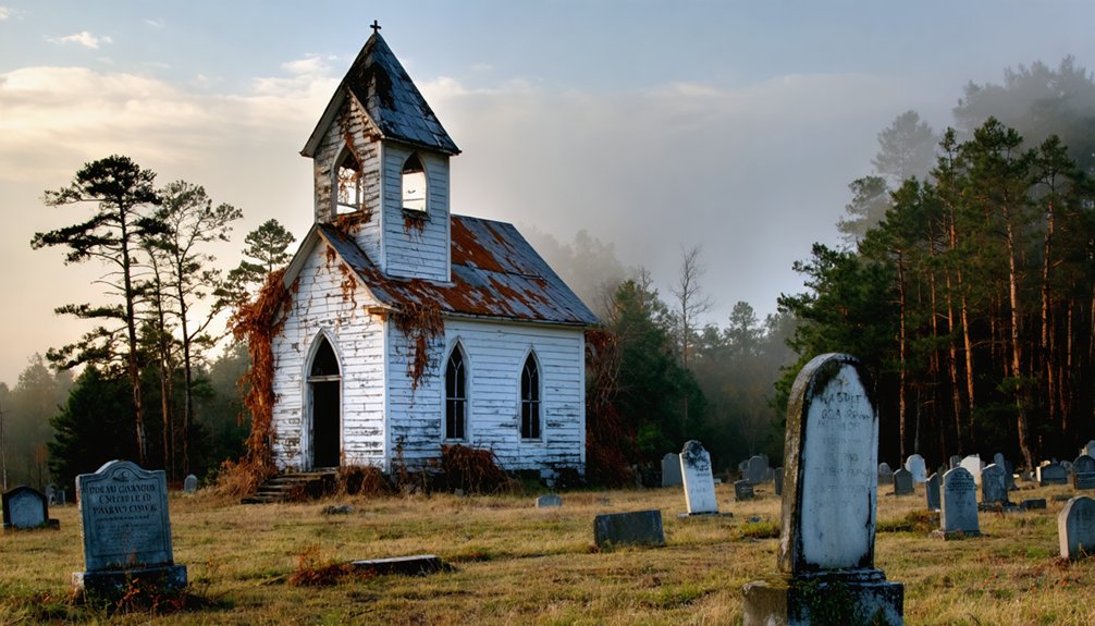
You’ll discover 23 National Register structures perfect for your drone’s lens, including the haunting Presbyterian church, abandoned since 1961, and the deteriorating Cates Store.
The site where the grand hotel stood until its 1941 fire offers compelling angles for capturing abandoned elegance, while the historic mineral spring’s wooden kiosk adds context to your footage.
For the best shots, position your drone to capture the historical significance of Camp Hill, where British forces once encamped, and the restored McIlwaine Cabin.
The Glenn Springs Historic District’s layout presents unique opportunities for sweeping aerial sequences that’ll document this preserved slice of resort-era Americana.
Hidden Gems at Ella’s Grove and Palmer Cemetery
Nestled between the Big and Little Pee Dee Rivers in Marion County, Ella’s Grove and Palmer Cemetery offer drone pilots exceptional opportunities for capturing South Carolina’s antebellum past.
Your aerial shots can showcase the historic Davis plantation store, relocated brick buildings, and the remaining old house that once sheltered a family of eleven.
Soar above the storied Davis plantation, where crumbling brick walls and an old house whisper tales of bygone Southern life.
You’ll find prime shooting conditions where overgrown trees, once hosting 1930s proms, now create dramatic canopy patterns perfect for overhead compositions.
The riverside location provides stunning contrasts between water features and abandoned structures.
For the most compelling footage, position your drone to capture the isolated rural setting of Palmer Cemetery alongside Ella’s Grove’s architectural remnants.
The site’s minimal modern development guarantees authentic historical perspectives in your aerial photography.
Discovering Pinckneyville’s Stone Foundations
Deep in Union County’s backcountry, Pinckneyville’s stone foundations tell a haunting story of a failed Charleston replica.
You’ll find prime aerial exploration opportunities at the 1.75-acre National Register site, where brick ruins of a 162-year-old jail and store building await your drone’s lens.
For the most compelling shots, position your drone to capture the intact dungeon walls, period-specific wainscoting, and scattered brick foundations topped with weathered tin roofs.
The solitary chimney north of the road offers dramatic aerial perspectives against the surrounding woodland. Frame your composition around Thomas C. Taylor’s rusty-fenced grave and the confluence of the Broad and Pacolet rivers.
Just remember, while the Pinckneyville ruins present incredible photography potential, this privately-owned site requires permission for access.
Aerial Views of Hamburg’s Trading Post Past
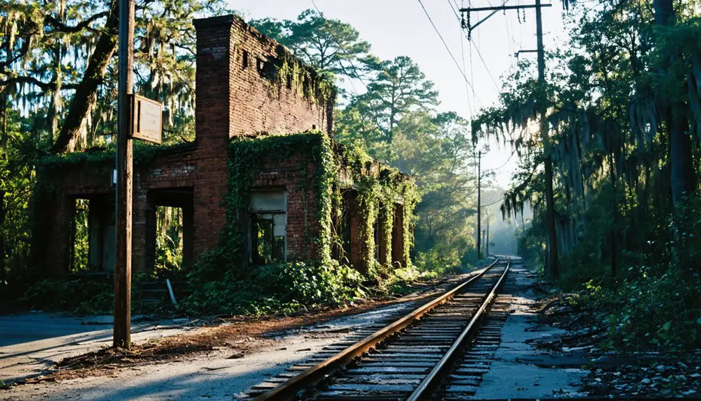
Along the western edge of South Carolina, the abandoned port town of Hamburg presents drone photographers with compelling aerial opportunities to document its 19th-century trading legacy.
You’ll capture stunning views of the dilapidated Hamburg Depot, where rail travelers once disembarked during the town’s heyday as a major cotton trading hub.
Your drone footage will reveal the ghost town’s strategic position along the Savannah River, where merchant ships once loaded cotton bound for Charleston and Savannah.
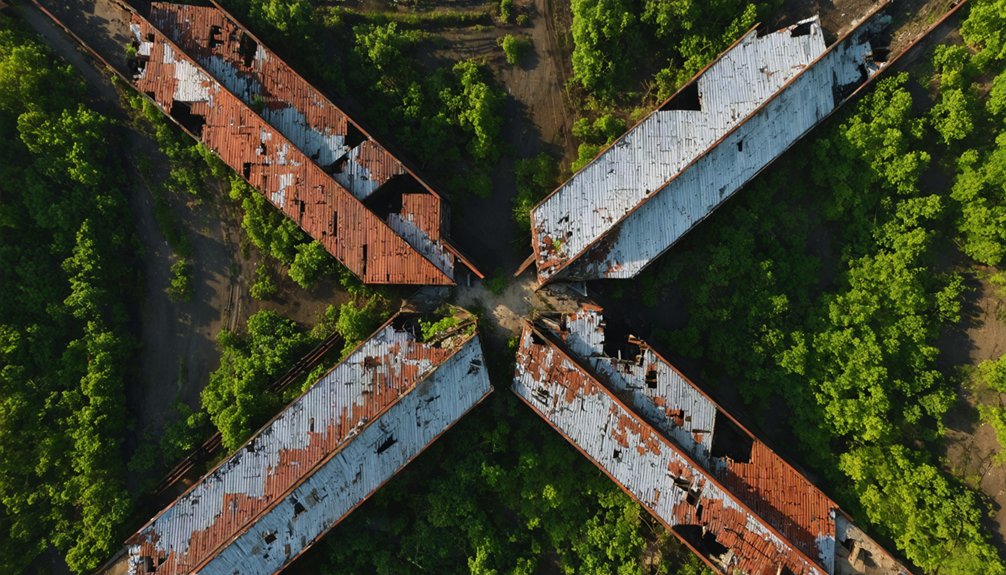
From above, you can trace the remnants of street grids, bridge foundations, and flood plains that tell the story of Hamburg’s rise and fall.
The overgrown ruins offer unique perspectives of this former inland port, established in 1821, where nature has reclaimed what was once South Carolina’s bustling western gateway to commerce.
Best Times and Weather for Ghost Town Drone Shots
Three key factors determine the perfect drone photography conditions at ghost towns: seasonal timing, weather patterns, and daylight angles.
You’ll get your clearest structural shots during late autumn when foliage thins out, revealing hidden foundations and architectural details. For ideal results, plan your flights during calm winds under 15 mph and low humidity conditions.
Follow drone regulations by scheduling shoots during daylight hours and obtaining necessary permits. Early morning and late afternoon sessions help you avoid peak visitor times while capturing dramatic lighting.
You’ll find the best seasonal trends in February through early March for aerial mapping, and October through November for atmospheric golden-hour shots.
When shooting in partly cloudy conditions, you’ll capture dynamic light that adds depth to your ghost town documentation.
Preserving History Through Aerial Documentation
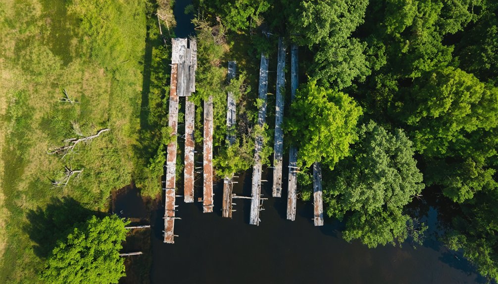
Modern drone photography serves as an important tool for preserving South Carolina’s vanishing ghost towns, from the stone foundations of Pinckneyville to the submerged ruins of Ferguson beneath Lake Marion.
Exploring the best ghost towns in South Carolina allows visitors to step back in time and appreciate the rich history that these areas once held. Each town, with its unique stories and remnants, offers a glimpse into the past that can be captured beautifully through modern photography. As preservation efforts continue, these sites may very well become significant cultural landmarks for future generations.
Your aerial preservation efforts can capture inaccessible structures, rusty water towers, and overgrown buildings that ground-level documentation can’t reach.
Through historical documentation, you’ll reveal the hidden textures of abandoned Midlands communities and expose underwater outlines of towns that Lake Marion claimed.
Your drone can access remote locations like Church Island Cemetery, where you’ll gather significant visual data of deteriorating sites.
While some locations require permits or face privacy restrictions, you’re contributing to an essential archive of South Carolina’s disappearing history with each flight, supplementing traditional archaeological work at sites like Colonial Dorchester.
Frequently Asked Questions
Are There Any Paranormal Investigation Restrictions When Flying Drones at Night?
You’ll need to follow standard FAA nighttime regulations and maintain drone safety protocols – anti-collision lights, visual line-of-sight, and remote pilot certification – regardless of your paranormal investigation objectives.
Which Ghost Towns Require Special Permission From Private Landowners?
You’ll need landowner agreements for Pinckneyville’s foundations, Glenn Springs’ former resort, Ella’s Grove’s commercial buildings, and Lake Marion’s shoreline ruins. Private property restrictions also affect Colonial Dorchester’s peripheral zones.
How Dangerous Are Collapsing Structures When Launching Drones Nearby?
You’re risking severe injury from sudden structural collapses when launching drones near unstable buildings. Keep at least 50 feet away, as falling masonry and debris clouds can damage both you and your equipment.
Can Metal From Old Ruins Interfere With Drone Compass Calibration?
You’ll experience significant drone interference at ruins, as buried metal and debris can disrupt compass accuracy. Always calibrate at least 30 feet away from structures to maintain reliable magnetic readings.
Are There Seasonal Wildlife Considerations Affecting Drone Flights in These Areas?
Like clockwork, you’ll need to dodge wildlife migration September-November in Pee Dee swamps and respect seasonal nesting March-May near Pinckneyville. Winter waterfowl congregate at Lake Hartwell’s Andersonville ruins.
References
- https://www.randomconnections.com/ghost-towns-of-the-pee-dee-part-1-ellas-grove-and-palmer/
- https://www.onlyinyourstate.com/trip-ideas/south-carolina/haunted-road-trip-sc-ghost-towns
- https://en.wikipedia.org/wiki/List_of_ghost_towns_in_South_Carolina
- https://www.randomconnections.com/the-ghost-towns-of-lake-marion/
- https://www.youtube.com/watch?v=uwrzp6d3EU0
- https://www.youtube.com/watch?v=KQOA3Q1z0Nc
- https://www.atlasobscura.com/places/dorchester-south-carolina-s-abandoned-town
- https://theforgottensouth.com/salters-depot/
- https://www.randomconnections.com/ghost-towns-of-south-carolina/
- https://www.blueridgeoutdoors.com/go-outside/southern-ghost-towns/